Acura CSX 2011 Navigation Manual
Manufacturer: ACURA, Model Year: 2011, Model line: CSX, Model: Acura CSX 2011Pages: 145, PDF Size: 4.11 MB
Page 111 of 145
Navigation System111Coverage Areas
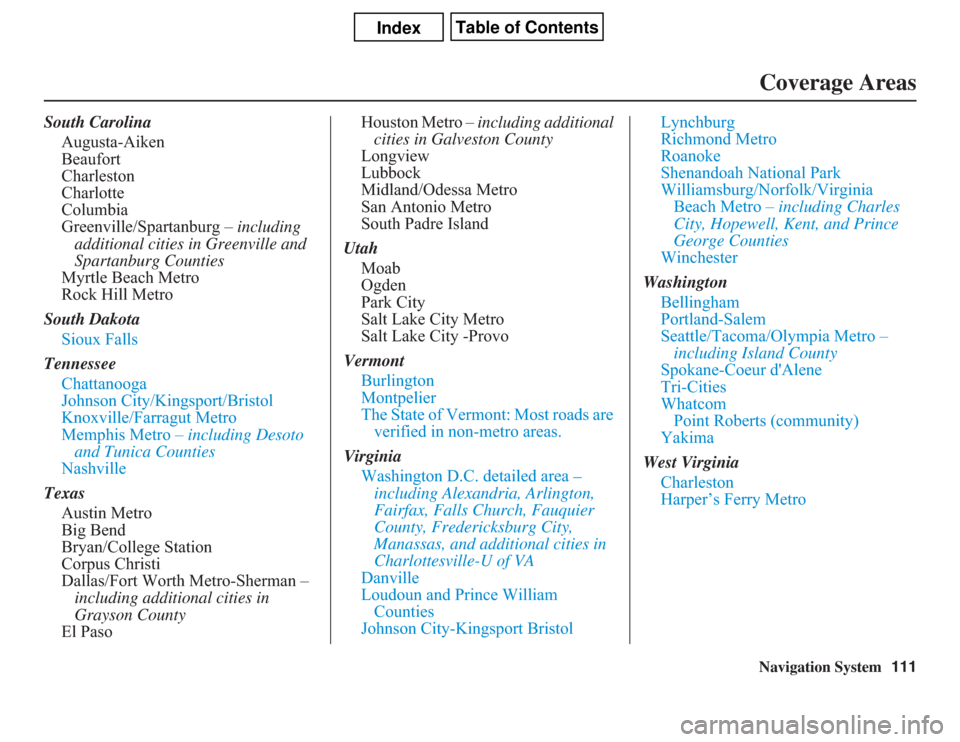
South Carolina
Augusta-Aiken
Beaufort
Charleston
Charlotte
Columbia
Greenville/Spartanburg – including
additional cities in Greenville and
Spartanburg Counties
Myrtle Beach Metro
Rock Hill Metro
South Dakota
Sioux Falls
Tennessee
Chattanooga
Johnson City/Kingsport/Bristol
Knoxville/Farragut Metro
Memphis Metro – including Desoto
and Tunica Counties
Nashville
Texas
Austin Metro
Big Bend
Bryan/College Station
Corpus Christi
Dallas/Fort Worth Metro-Sherman –
including additional cities in
Grayson County
El PasoHouston Metro – including additional
cities in Galveston County
Longview
Lubbock
Midland/Odessa Metro
San Antonio Metro
South Padre Island
Utah
Moab
Ogden
Park City
Salt Lake City Metro
Salt Lake City -Provo
Vermont
Burlington
Montpelier
The State of Vermont: Most roads are
verified in non-metro areas.
Virginia
Washington D.C. detailed area –
including Alexandria, Arlington,
Fairfax, Falls Church, Fauquier
County, Fredericksburg City,
Manassas, and additional cities in
Charlottesville-U of VA
Danville
Loudoun and Prince William
Counties
Johnson City-Kingsport BristolLynchburg
Richmond Metro
Roanoke
Shenandoah National Park
Williamsburg/Norfolk/Virginia
Beach Metro – including Charles
City, Hopewell, Kent, and Prince
George Counties
Winchester
Washington
Bellingham
Portland-Salem
Seattle/Tacoma/Olympia Metro –
including Island County
Spokane-Coeur d'Alene
Tri-Cities
Whatcom
Point Roberts (community)
Yakima
West Virginia
Charleston
Harper’s Ferry Metro
Page 112 of 145
112
Navigation System
Coverage AreasWisconsin
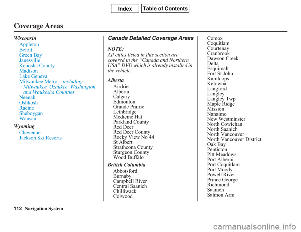
Appleton
Beloit
Green Bay
Janesville
Kenosha County
Madison
Lake Geneva
Milwaukee Metro – including
Milwaukee, Ozaukee, Washington,
and Waukesha Counties
Neenah
Oshkosh
Racine
Sheboygan
Wausau
Wyoming
Cheyenne
Jackson Ski Resorts
Canada Detailed Coverage AreasNOTE:
All cities listed in this section are
covered in the “Canada and Northern
USA” DVD which is already installed in
the vehicle.
Alberta
Airdrie
Alberta
Calgary
Edmonton
Grande Prairie
Lethbridge
Medicine Hat
Parkland County
Red Deer
Red Deer County
Rocky View No 44
St Albert
Strathcona County
Sturgeon County
Wood Buffalo
British Columbia
Abbotsford
Burnaby
Campbell River
Central Saanich
Chilliwack
ColwoodComox
Coquitlam
Courtenay
Cranbrook
Dawson Creek
Delta
Esquimalt
Fort St John
Kamloops
Kelowna
Langford
Langley
Langley Twp
Maple Ridge
Mission
Nanaimo
New Westminster
North Cowichan
North Saanich
North Vancouver
North Vancouver District
Oak Bay
Penticton
Pitt Meadows
Port Alberni
Port Coquitlam
Port Moody
Powell River
Prince George
Richmond
Saanich
Salmon Arm
Page 113 of 145
Navigation System113Coverage Areas
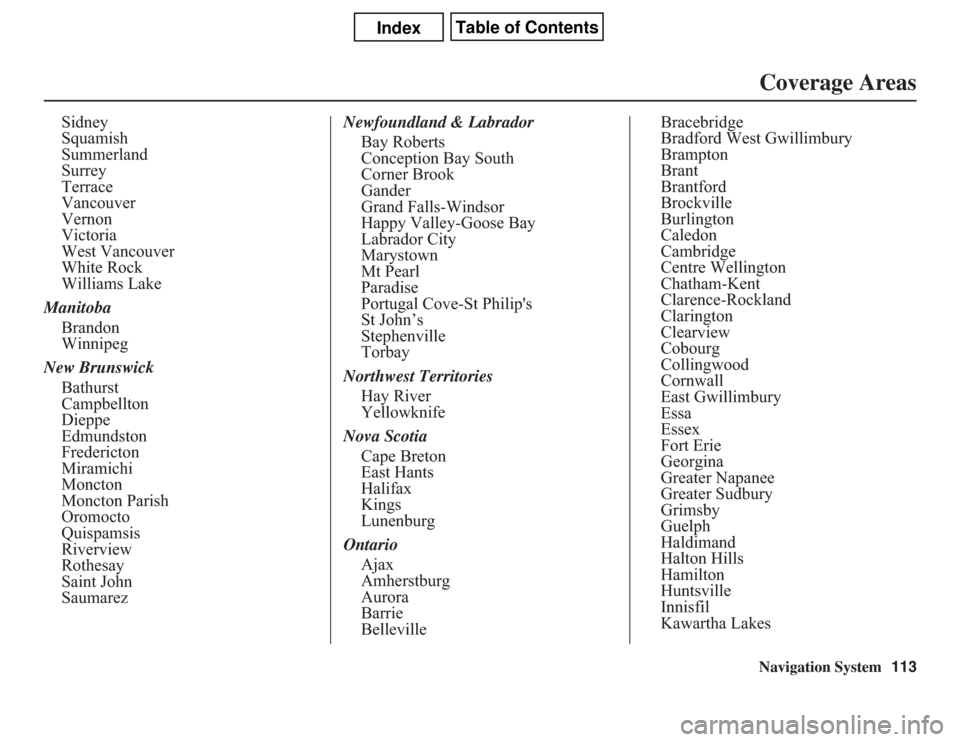
Sidney
Squamish
Summerland
Surrey
Terrace
Vancouver
Vernon
Victoria
West Vancouver
White Rock
Williams Lake
Manitoba
Brandon
Winnipeg
New Brunswick
Bathurst
Campbellton
Dieppe
Edmundston
Fredericton
Miramichi
Moncton
Moncton Parish
Oromocto
Quispamsis
Riverview
Rothesay
Saint John
SaumarezNewfoundland & Labrador
Bay Roberts
Conception Bay South
Corner Brook
Gander
Grand Falls-Windsor
Happy Valley-Goose Bay
Labrador City
Marystown
Mt Pearl
Paradise
Portugal Cove-St Philip's
St John’s
Stephenville
Torbay
Northwest Territories
Hay River
Yellowknife
Nova Scotia
Cape Breton
East Hants
Halifax
Kings
Lunenburg
Ontario
Ajax
Amherstburg
Aurora
Barrie
BellevilleBracebridge
Bradford West Gwillimbury
Brampton
Brant
Brantford
Brockville
Burlington
Caledon
Cambridge
Centre Wellington
Chatham-Kent
Clarence-Rockland
Clarington
Clearview
Cobourg
Collingwood
Cornwall
East Gwillimbury
Essa
Essex
Fort Erie
Georgina
Greater Napanee
Greater Sudbury
Grimsby
Guelph
Haldimand
Halton Hills
Hamilton
Huntsville
Innisfil
Kawartha Lakes
Page 114 of 145
114
Navigation System
Coverage Areas
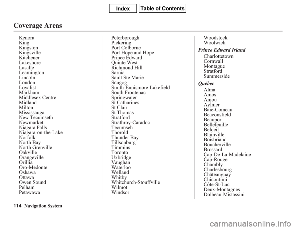
Kenora
King
Kingston
Kingsville
Kitchener
Lakeshore
Lasalle
Leamington
Lincoln
London
Loyalist
Markham
Middlesex Centre
Midland
Milton
Mississauga
New Tecumseth
Newmarket
Niagara Falls
Niagara-on-the-Lake
Norfolk
North Bay
North Grenville
Oakville
Orangeville
Orillia
Oro-Medonte
Oshawa
Ottawa
Owen Sound
Pelham
PetawawaPeterborough
Pickering
Port Colborne
Port Hope and Hope
Prince Edward
Quinte West
Richmond Hill
Sarnia
Sault Ste Marie
Scugog
Smith-Ennismore-Lakefield
South Frontenac
Springwater
St Catharines
St Clair
St Thomas
Stratford
Strathroy-Caradoc
Tecumseh
Thorold
Thunder Bay
Tillsonburg
Timmins
Toronto
Uxbridge
Vaughan
Waterloo
Welland
Whitby
Whitchurch-Stouffville
Wilmot
WindsorWoodstock
Woolwich
Prince Edward Island
Charlottetown
Cornwall
Montague
Stratford
Summerside
Québec
Alma
Amos
Anjou
Aylmer
Baie-Comeau
Beaconsfield
Beauport
Bellefeuille
Beloeil
Blainville
Boisbriand
Boucherville
Brossard
Cap-De-La-Madelaine
Cap-Rouge
Chambly
Charlesbourg
Châteauguay
Chicoutimi
Côte-St-Luc
Deux-Montagnes
Dolbeau-Mistassini
Page 115 of 145
Navigation System115
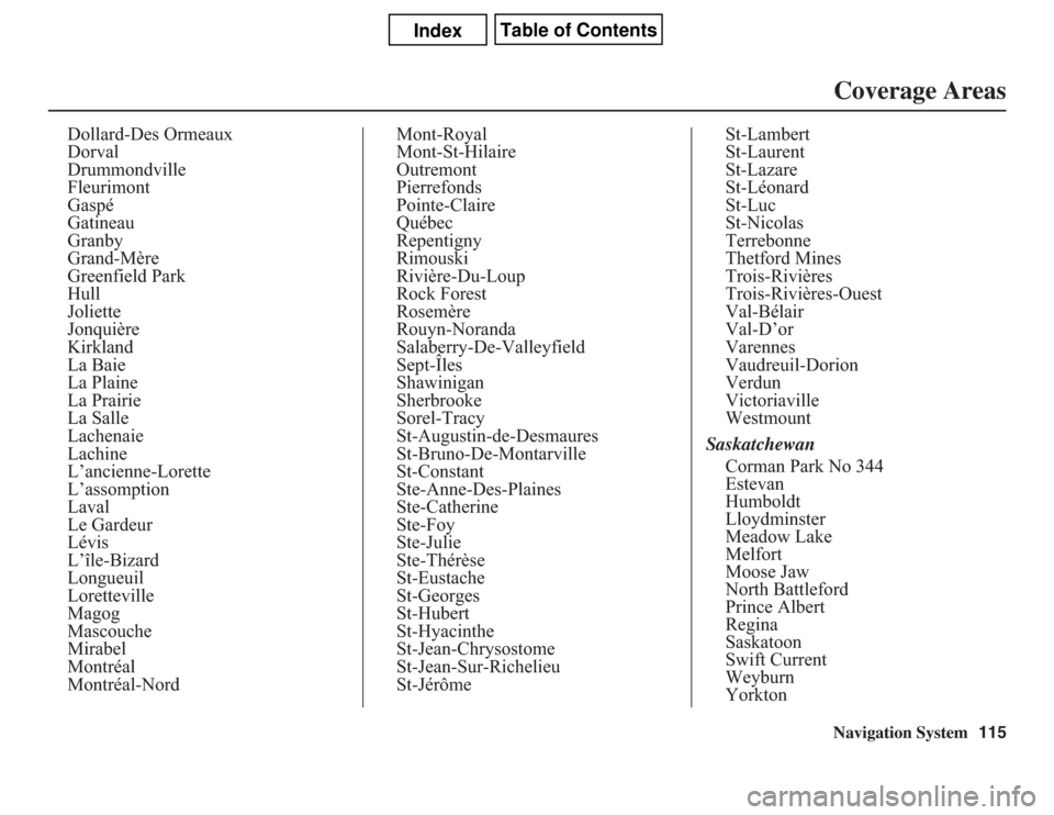
Dollard-Des Ormeaux
Dorval
Drummondville
Fleurimont
Gaspé
Gatineau
Granby
Grand-Mère
Greenfield Park
Hull
Joliette
Jonquière
Kirkland
La Baie
La Plaine
La Prairie
La Salle
Lachenaie
Lachine
L’ancienne-Lorette
L’assomption
Laval
Le Gardeur
Lévis
L’île-Bizard
Longueuil
Loretteville
Magog
Mascouche
Mirabel
Montréal
Montréal-NordMont-Royal
Mont-St-Hilaire
Outremont
Pierrefonds
Pointe-Claire
Québec
Repentigny
Rimouski
Rivière-Du-Loup
Rock Forest
Rosemère
Rouyn-Noranda
Salaberry-De-Valleyfield
Sept-Îles
Shawinigan
Sherbrooke
Sorel-Tracy
St-Augustin-de-Desmaures
St-Bruno-De-Montarville
St-Constant
Ste-Anne-Des-Plaines
Ste-Catherine
Ste-Foy
Ste-Julie
Ste-Thérèse
St-Eustache
St-Georges
St-Hubert
St-Hyacinthe
St-Jean-Chrysostome
St-Jean-Sur-Richelieu
St-JérômeSt-Lambert
St-Laurent
St-Lazare
St-Léonard
St-Luc
St-Nicolas
Terrebonne
Thetford Mines
Trois-Rivières
Trois-Rivières-Ouest
Val-Bélair
Val-D’or
Varennes
Vaudreuil-Dorion
Verdun
Victoriaville
Westmount
Saskatchewan
Corman Park No 344
Estevan
Humboldt
Lloydminster
Meadow Lake
Melfort
Moose Jaw
North Battleford
Prince Albert
Regina
Saskatoon
Swift Current
Weyburn
Yorkton
Coverage Areas
Page 116 of 145
116
Navigation System
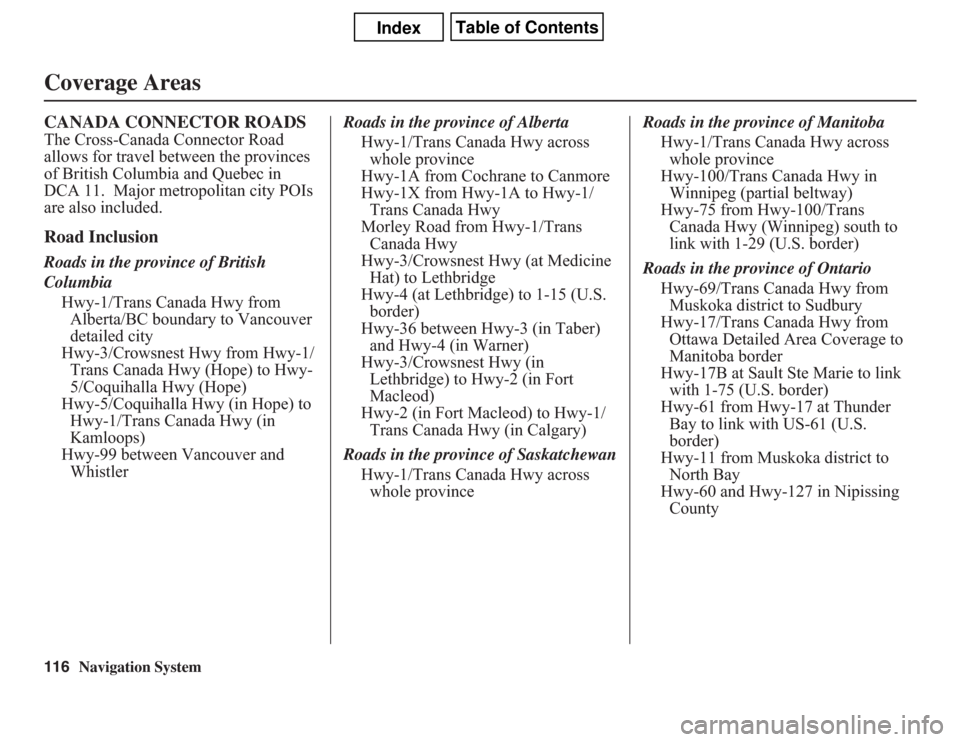
CANADA CONNECTOR ROADSThe Cross-Canada Connector Road
allows for travel between the provinces
of British Columbia and Quebec in
DCA 11. Major metropolitan city POIs
are also included.Road InclusionRoads in the province of British
Columbia
Hwy-1/Trans Canada Hwy from
Alberta/BC boundary to Vancouver
detailed city
Hwy-3/Crowsnest Hwy from Hwy-1/
Trans Canada Hwy (Hope) to Hwy-
5/Coquihalla Hwy (Hope)
Hwy-5/Coquihalla Hwy (in Hope) to
Hwy-1/Trans Canada Hwy (in
Kamloops)
Hwy-99 between Vancouver and
WhistlerRoads in the province of Alberta
Hwy-1/Trans Canada Hwy across
whole province
Hwy-1A from Cochrane to Canmore
Hwy-1X from Hwy-1A to Hwy-1/
Trans Canada Hwy
Morley Road from Hwy-1/Trans
Canada Hwy
Hwy-3/Crowsnest Hwy (at Medicine
Hat) to Lethbridge
Hwy-4 (at Lethbridge) to 1-15 (U.S.
border)
Hwy-36 between Hwy-3 (in Taber)
and Hwy-4 (in Warner)
Hwy-3/Crowsnest Hwy (in
Lethbridge) to Hwy-2 (in Fort
Macleod)
Hwy-2 (in Fort Macleod) to Hwy-1/
Trans Canada Hwy (in Calgary)
Roads in the province of Saskatchewan
Hwy-1/Trans Canada Hwy across
whole provinceRoads in the province of Manitoba
Hwy-1/Trans Canada Hwy across
whole province
Hwy-100/Trans Canada Hwy in
Winnipeg (partial beltway)
Hwy-75 from Hwy-100/Trans
Canada Hwy (Winnipeg) south to
link with 1-29 (U.S. border)
Roads in the province of Ontario
Hwy-69/Trans Canada Hwy from
Muskoka district to Sudbury
Hwy-17/Trans Canada Hwy from
Ottawa Detailed Area Coverage to
Manitoba border
Hwy-17B at Sault Ste Marie to link
with 1-75 (U.S. border)
Hwy-61 from Hwy-17 at Thunder
Bay to link with US-61 (U.S.
border)
Hwy-11 from Muskoka district to
North Bay
Hwy-60 and Hwy-127 in Nipissing
CountyCoverage Areas
Page 117 of 145
Navigation System117
Frequently Asked Questions
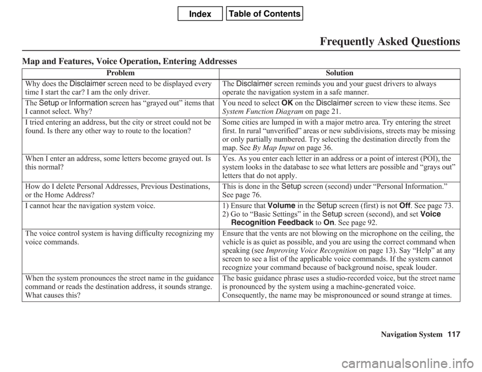
Map and Features, Voice Operation, Entering Addresses
Problem Solution
Why does the Disclaimer screen need to be displayed every
time I start the car? I am the only driver.The Disclaimer screen reminds you and your guest drivers to always
operate the navigation system in a safe manner.
The Setup or Information screen has “grayed out” items that
I cannot select. Why?You need to select OK on the Disclaimer screen to view these items. See
System Function Diagram on page 21.
I tried entering an address, but the city or street could not be
found. Is there any other way to route to the location?Some cities are lumped in with a major metro area. Try entering the street
first. In rural “unverified” areas or new subdivisions, streets may be missing
or only partially numbered. Try selecting the destination directly from the
map. See By Map Input on page 36.
When I enter an address, some letters become grayed out. Is
this normal?Yes. As you enter each letter in an address or a point of interest (POI), the
system looks in the database to see what letters are possible and “grays out”
letters that do not apply.
How do I delete Personal Addresses, Previous Destinations,
or the Home Address?This is done in the Setup screen (second) under “Personal Information.”
See page 76.
I cannot hear the navigation system voice. 1) Ensure that Volume in the Setup screen (first) is not Off. See page 73.
2) Go to “Basic Settings” in the Setup screen (second), and set Voice
Recognition Feedback to On. See page 92.
The voice control system is having difficulty recognizing my
voice commands.Ensure that the vents are not blowing on the microphone on the ceiling, the
vehicle is as quiet as possible, and you are using the correct command when
speaking (see Improving Voice Recognition on page 13). Say “Help” at any
screen to see a list of the applicable voice commands. If the system cannot
recognize your command because of background noise, speak louder.
When the system pronounces the street name in the guidance
command or reads the destination address, it sounds strange.
What causes this?The basic guidance phrase uses a studio-recorded voice, but the street name
is pronounced by the system using a machine-generated voice.
Consequently, the name may be mispronounced or sound strange at times.
Page 118 of 145
118
Navigation System
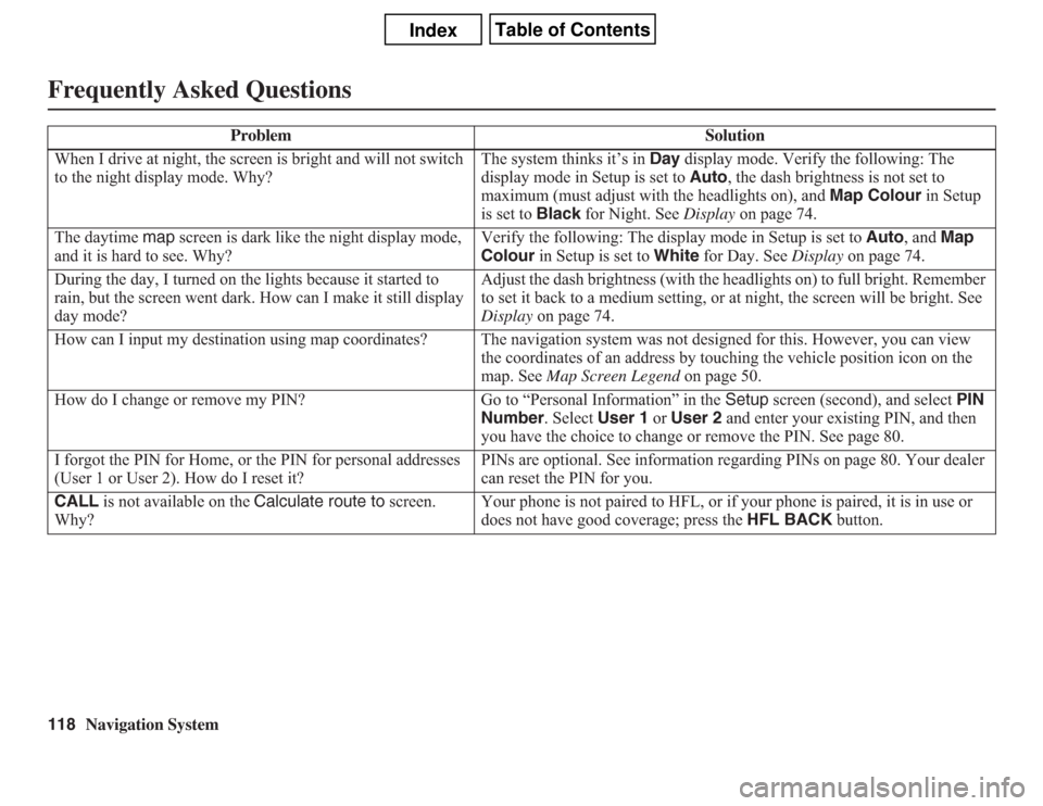
Frequently Asked QuestionsWhen I drive at night, the screen is bright and will not switch
to the night display mode. Why?The system thinks it’s in Day display mode. Verify the following: The
display mode in Setup is set to Auto, the dash brightness is not set to
maximum (must adjust with the headlights on), and Map Colour in Setup
is set to Black for Night. See Display on page 74.
The daytime map screen is dark like the night display mode,
and it is hard to see. Why?Verify the following: The display mode in Setup is set to Auto, and Map
Colour in Setup is set to White for Day. See Display on page 74.
During the day, I turned on the lights because it started to
rain, but the screen went dark. How can I make it still display
day mode?Adjust the dash brightness (with the headlights on) to full bright. Remember
to set it back to a medium setting, or at night, the screen will be bright. See
Display on page 74.
How can I input my destination using map coordinates? The navigation system was not designed for this. However, you can view
the coordinates of an address by touching the vehicle position icon on the
map. See Map Screen Legend on page 50.
How do I change or remove my PIN? Go to “Personal Information” in the Setup screen (second), and select PIN
Number. Select User 1 or User 2 and enter your existing PIN, and then
you have the choice to change or remove the PIN. See page 80.
I forgot the PIN for Home, or the PIN for personal addresses
(User 1 or User 2). How do I reset it?PINs are optional. See information regarding PINs on page 80. Your dealer
can reset the PIN for you.
CALL is not available on the Calculate route to screen.
Why?Your phone is not paired to HFL, or if your phone is paired, it is in use or
does not have good coverage; press the HFL BACK button. Problem Solution
Page 119 of 145
Navigation System119
Frequently Asked Questions
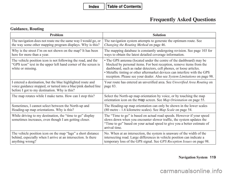
Guidance, Routing
Problem Solution
The navigation does not route me the same way I would go, or
the way some other mapping program displays. Why is this?The navigation system attempts to generate the optimum route. See
Changing the Routing Method on page 46.
Why is the street I’m on not shown on the map? It has been
here for more than a year.The mapping database is constantly undergoing revision. See page 103 for
ways to obtain the latest detailed coverage information.
The vehicle position icon is not following the road, and the
“GPS icon” text in the upper left hand corner of the screen is
white or missing.• The GPS antenna (located under the centre of the dashboard) may be
blocked by personal items. For best reception, remove items from the
dashboard, such as radar detectors, cell phones, or loose articles.
• Metallic tinting or other aftermarket devices can interfere with the GPS
reception. Please see your dealer. Also see System Limitations on page 98.
I entered a destination, but the blue highlighted route and
voice guidance stopped, or turned into a blue/pink dashed line
before I got to my destination. Why is this?Your route has entered an unverified area. See Unverified Area Routing on
page 83.
The map rotates while I make turns. How can I stop this? Select the North-up map orientation by voice, or by touching the map
orientation icon on the map screen. See Map Orientation on page 55.
Sometimes, I cannot select between the North-up and
Heading-up map orientations. Why is this?The Heading-up map orientation can only be shown in the lower scales
(80 metre - 1.6 kilometre scales). See Map Scale on page 54.
While driving to my destination, the “time to go” display
sometimes increases, even though I am getting closer.The “Time to go” is based on actual road speeds. However if your speed
slows down when you encounter slower traffic, the system updates the
“Time to go” based on your actual speed to give you a better estimate of
arrival time.
The vehicle position icon on the map “lags” a short distance
behind, especially when I arrive at an intersection. Is there
anything wrong?No. When at an intersection, the system is unaware of the width of the
intersecting road. Large differences in vehicle position can indicate a
temporary loss of the GPS signal. See GPS Reception Issues on page 98.
Page 120 of 145
120
Navigation System
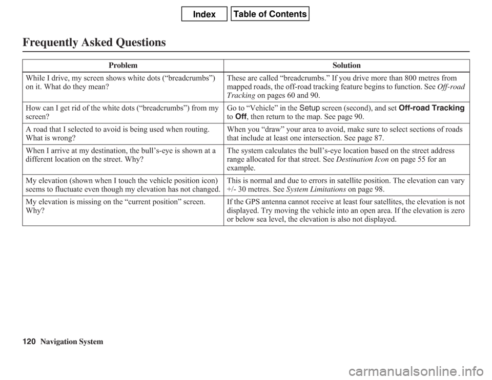
Frequently Asked QuestionsWhile I drive, my screen shows white dots (“breadcrumbs”)
on it. What do they mean?These are called “breadcrumbs.” If you drive more than 800 metres from
mapped roads, the off-road tracking feature begins to function. See Off-road
Tracking on pages 60 and 90.
How can I get rid of the white dots (“breadcrumbs”) from my
screen?Go to “Vehicle” in the Setup screen (second), and set Off-road Tracking
to Off, then return to the map. See page 90.
A road that I selected to avoid is being used when routing.
What is wrong?When you “draw” your area to avoid, make sure to select sections of roads
that include at least one intersection. See page 87.
When I arrive at my destination, the bull’s-eye is shown at a
different location on the street. Why?The system calculates the bull’s-eye location based on the street address
range allocated for that street. See Destination Icon on page 55 for an
example.
My elevation (shown when I touch the vehicle position icon)
seems to fluctuate even though my elevation has not changed.This is normal and due to errors in satellite position. The elevation can vary
+/- 30 metres. See System Limitations on page 98.
My elevation is missing on the “current position” screen.
Why?If the GPS antenna cannot receive at least four satellites, the elevation is not
displayed. Try moving the vehicle into an open area. If the elevation is zero
or below sea level, the elevation is also not displayed. Problem Solution