navigation system HONDA ACCORD 2017 9.G Navigation Manual
[x] Cancel search | Manufacturer: HONDA, Model Year: 2017, Model line: ACCORD, Model: HONDA ACCORD 2017 9.GPages: 145, PDF Size: 24.13 MB
Page 75 of 145
74
uuCalculating the Route uViewing the Destination Map
Navigation
Viewing the Destination Map
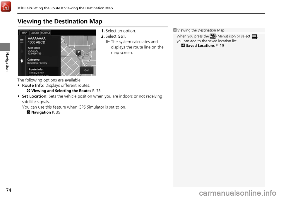
1. Select an option.
2. Select Go!.
u The system calculates and
displays the route line on the
map screen.
The following options are available:
• Route Info : Displays different routes.
2Viewing and Selecting the Routes P. 73
•Set Location : Sets the vehicle position when you are indoors or not receiving
satellite signals.
You can use this feature when GPS Simulator is set to on.
2Navigation P. 35
1Viewing the Destination Map
When you press the (Menu) icon or select ,
you can add to the saved location list. 2 Saved Locations P. 19
Page 76 of 145
75Continued
Navigation
Driving to Your Destination
Viewing the Route
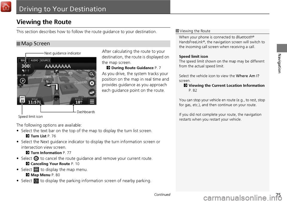
This section describes how to follow the route guidance to your destination.After calculating the route to your
destination, the route is displayed on
the map screen.
2During Route Guidance P. 7
As you drive, the system tracks your
position on the map in real time and
provides guidance as you approach
each guidance point on the route.
The following options are available:
• Select the text bar on the top of the map to display the turn list screen.
2Turn List P. 76
• Select the Next guidance indicator to di splay the turn information screen or
intersection view screen.
2 Turn Information P. 77
• Select to cancel the route guidance and remove your current route.
2Canceling Your Route P. 10
• Select to display the map menu.
2Map Menu P. 80
• Select to display the parking info rmation screen of nearby parking.
■Map Screen
1
Viewing the Route
When your phone is connected to Bluetooth®
HandsFreeLink ®, the navigation screen will switch to
the incoming call screen when receiving a call.
Speed limit icon
The speed limit shown on th e map may be different
from the actual speed limit.
Select the vehicle icon to view the Where Am I?
screen. 2 Viewing the Current Location Information
P. 82
You can stop your vehicle en route (e.g., to rest, stop
for gas, etc.), and then continue on your route.
If you did not complete y our route, the navigation
restarts when you re start your vehicle.
Next guidance indicator
Speed limit icon Dashboards
Page 77 of 145
uuDriving to Your Destination uViewing the Route
76
Navigation
• Select the map dashboards when you want to change the information that is
displayed. Select the following options:
Arrival Time , Distance , Time to Destination , Via Arrival , Distance to Via ,
Time to Via , Direction of Travel , Elevation.
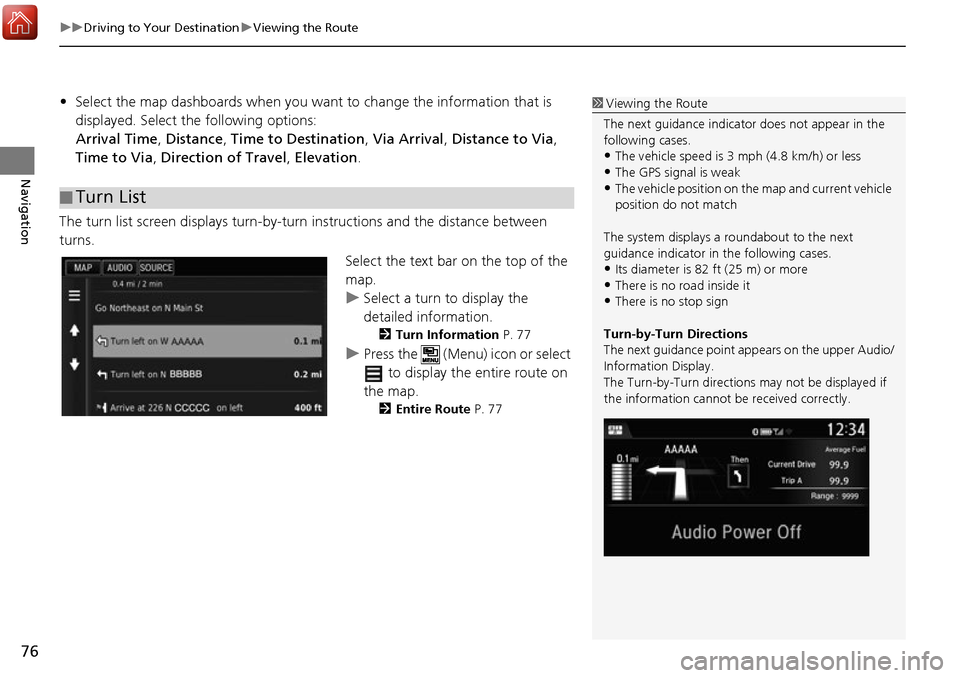
The turn list screen displays turn-by-turn instructions and the distance between
turns.
Select the text bar on the top of the
map.
uSelect a turn to display the
detailed information.
2Turn Information P. 77
uPress the (Menu) icon or select
to display the entire route on
the map.
2 Entire Route P. 77
■Turn List
1
Viewing the Route
The next guidance indicator does not appear in the
following cases.
•The vehicle speed is 3 mph (4.8 km/h) or less
•The GPS signal is weak•The vehicle position on the map and current vehicle
position do not match
The system displays a roundabout to the next
guidance indicator in the following cases.
•Its diameter is 82 ft (25 m) or more•There is no road inside it
•There is no stop sign
Turn-by-Turn Directions
The next guidance point ap pears on the upper Audio/
Information Display.
The Turn-by-Turn directions may not be displayed if
the information cannot be received correctly.
Page 79 of 145
uuDriving to Your Destination uViewing the Route
78
Navigation
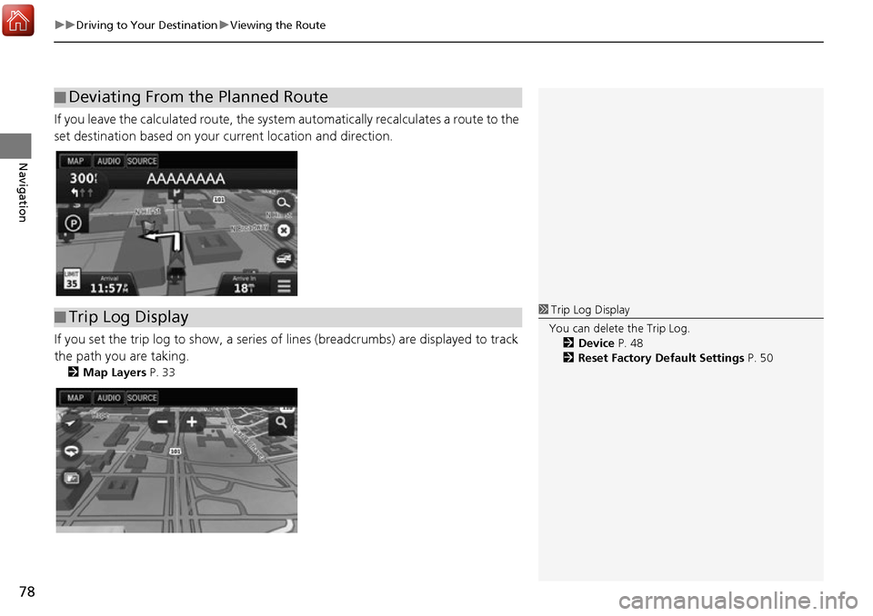
If you leave the calculated route, the system automatically recalculates a route to the
set destination based on your current location and direction.
If you set the trip log to show, a series of lines (breadcrumbs) are displayed to track
the path you are taking.
2 Map Layers P. 33
■Deviating From the Planned Route
■Trip Log Display1
Trip Log Display
You can delete the Trip Log. 2 Device P. 48
2 Reset Factory Default Settings P. 50
Page 81 of 145
80
uuMap Operation uMap Menu
Navigation
Map Menu
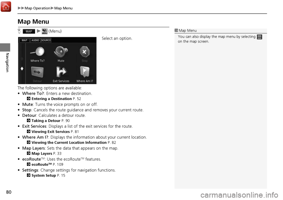
H u (Menu)
Select an option.
The following options are available:
• Where To? : Enters a new destination.
2Entering a Destination P. 52
•Mute : Turns the voice prompts on or off.
• Stop : Cancels the route guidance an d removes your current route.
• Detour : Calculates a detour route.
2Taking a Detour P. 90
•Exit Services : Displays a list of the exit services for the route.
2Viewing Exit Services P. 81
•Where Am I? : Displays the info rmation about your current location.
2Viewing the Current Lo cation Information P. 82
•Map Layers : Sets the data that appears on the map.
2Map Layers P. 33
•ecoRouteTM: Uses the ecoRouteTM features.
2 ecoRouteTM P. 109
•Settings : Change settings for navigation functions.
2System Setup P. 15
1Map Menu
You can also display the map menu by selecting
on the map screen.
Page 85 of 145
84
uuMap Operation uTraffic Information
Navigation
Traffic Information
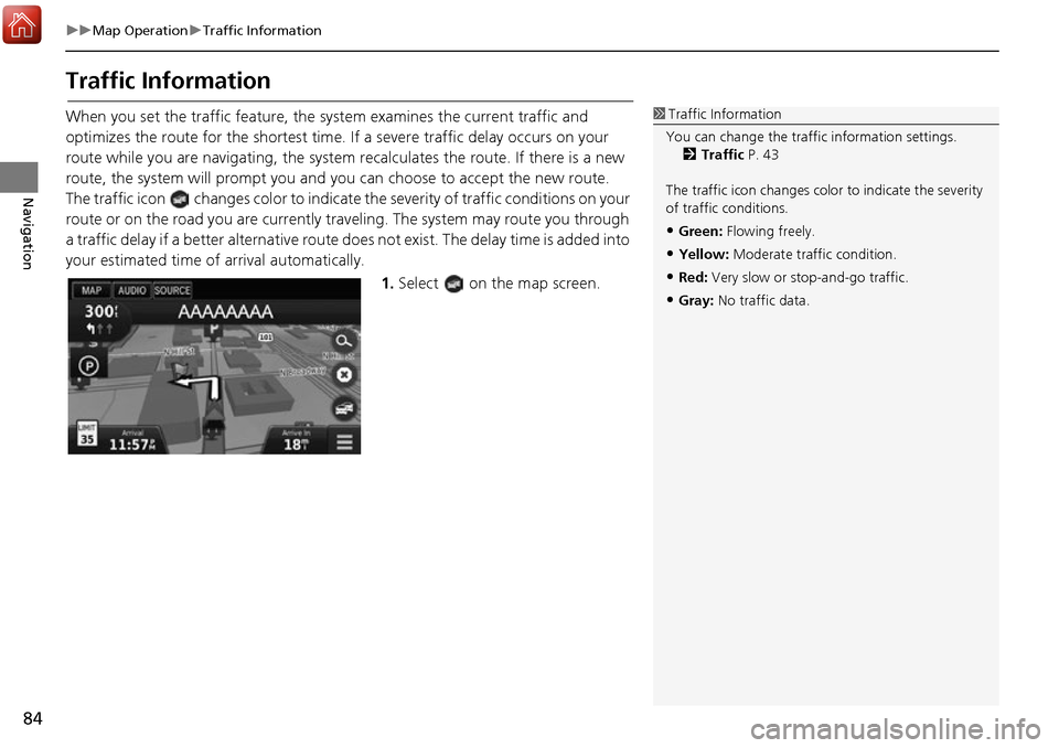
When you set the traffic feature, the system examines the current traffic and
optimizes the route for the shortest time. If a severe traffic delay occurs on your
route while you are navigating, the system re calculates the route. If there is a new
route, the system will prompt you and you can choose to accept the new route.
The traffic icon changes color to indicate the severity of traffic conditions on your
route or on the road you are currently tra veling. The system may route you through
a traffic delay if a better alternative route do es not exist. The delay time is added into
your estimated time of arrival automatically.
1.Select on the map screen.1Traffic Information
You can change the traffic information settings. 2 Traffic P. 43
The traffic icon changes color to indicate the severity
of traffic conditions.
•Green: Flowing freely.
•Yellow: Moderate traf fic condition.
•Red: Very slow or st op-and-go traffic.
•Gray: No traffic data.
Page 89 of 145
88
uuMap Operation uTraffic Information
Navigation
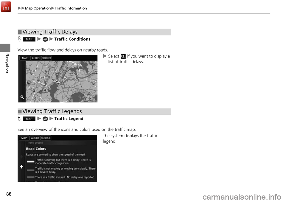
H uuTraffic Conditions
View the traffic flow a nd delays on nearby roads.
uSelect if you want to display a
list of traffic delays.
H uuTraffic Legend
See an overview of the icons and colors used on the traffic map.
The system displays the traffic
legend.
■Viewing Traffic Delays
■Viewing Traffic Legends
Page 91 of 145
90
uuChanging Your Route uTaking a Detour
Navigation
Taking a Detour
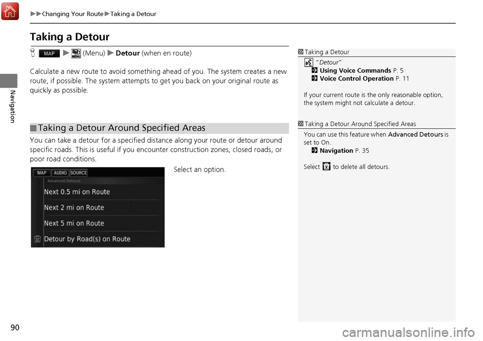
H u (Menu) uDetour (when en route)
Calculate a new route to avoid something ahead of you. The system creates a new
route, if possible. Th e system attempts to get you ba ck on your original route as
quickly as possible.
You can take a detour for a specified distan ce along your route or detour around
specific roads. This is useful if you enco unter construction zones, closed roads, or
poor road conditions.
Select an option.
■Taking a Detour Around Specified Areas
1
Taking a Detour
“Detour ”
2 Using Voice Commands P. 5
2 Voice Control Operation P. 11
If your current route is the only reasonable option,
the system might not calculate a detour.
1 Taking a Detour Ar ound Specified Areas
You can use this feature when Advanced Detours is
set to On. 2 Navigation P. 35
Select to delete all detours.
Page 93 of 145
92
uuChanging Your Route uAdding Waypoints
Navigation
Adding Waypoints
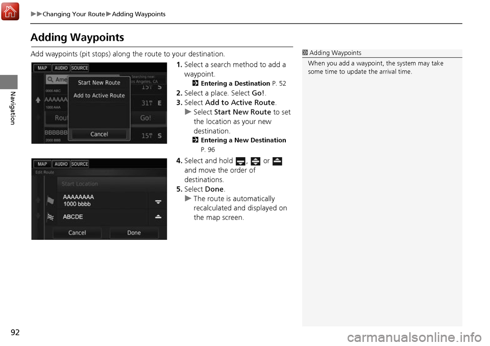
Add waypoints (pit stops) along the route to your destination.
1.Select a search method to add a
waypoint.
2 Entering a Destination P. 52
2.Select a place. Select Go!.
3. Select Add to Active Route .
u Select Start New Route to set
the location as your new
destination.
2 Entering a New Destination
P. 96
4. Select and hold , or
and move the order of
destinations.
5. Select Done.
u The route is automatically
recalculated and displayed on
the map screen.
1Adding Waypoints
When you add a waypoint, the system may take
some time to update the arrival time.
Page 109 of 145
108
Other Features
About Apps Menu
Hu (Back) uApps
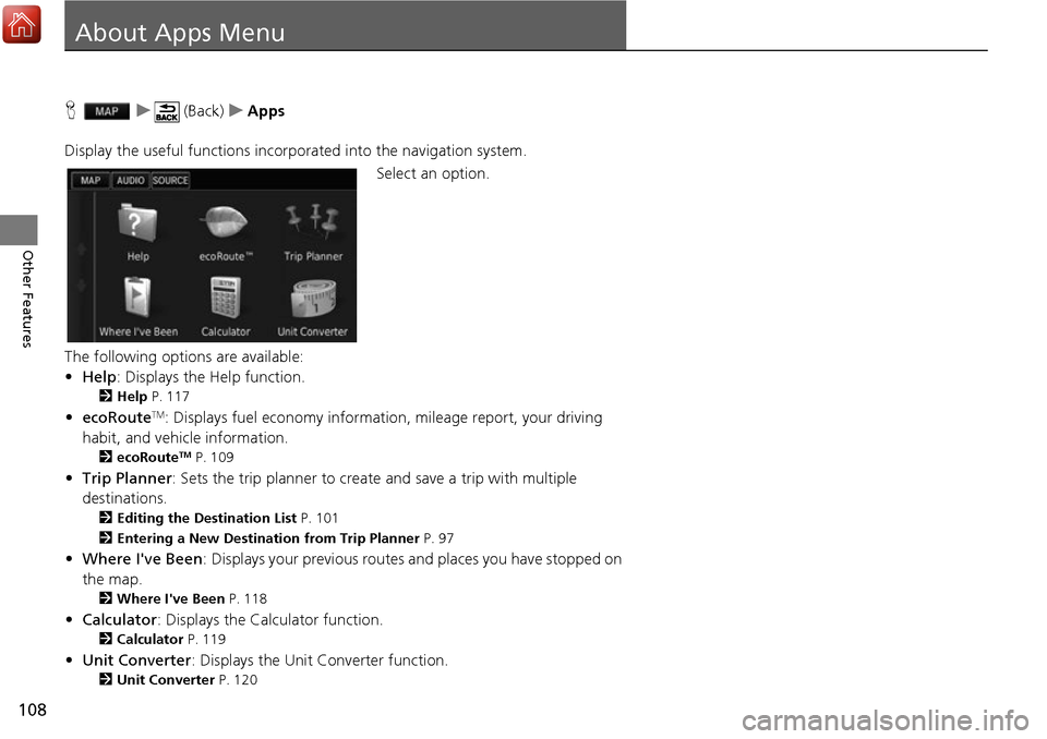
Display the useful functions incorpor ated into the navigation system.
Select an option.
The following options are available:
• Help : Displays the Help function.
2Help P. 117
•ecoRouteTM: Displays fuel economy informati on, mileage report, your driving
habit, and vehicle information.
2 ecoRouteTM P. 109
•Trip Planner : Sets the trip planner to create and save a trip with multiple
destinations.
2 Editing the Destination List P. 101
2 Entering a New Destination from Trip Planner P. 97
•Where I've Been : Displays your previous routes and places you have stopped on
the map.
2 Where I've Been P. 118
•Calculator : Displays the Calculator function.
2Calculator P. 119
•Unit Converter : Displays the Unit Converter function.
2Unit Converter P. 120