navigation system Lexus IS250 2014 Navigation Manual
[x] Cancel search | Manufacturer: LEXUS, Model Year: 2014, Model line: IS250, Model: Lexus IS250 2014Pages: 404, PDF Size: 35.2 MB
Page 93 of 404

93
1. BASIC OPERATION
IS300h/250_Navi_EE
NAVIGATION SYSTEM
3
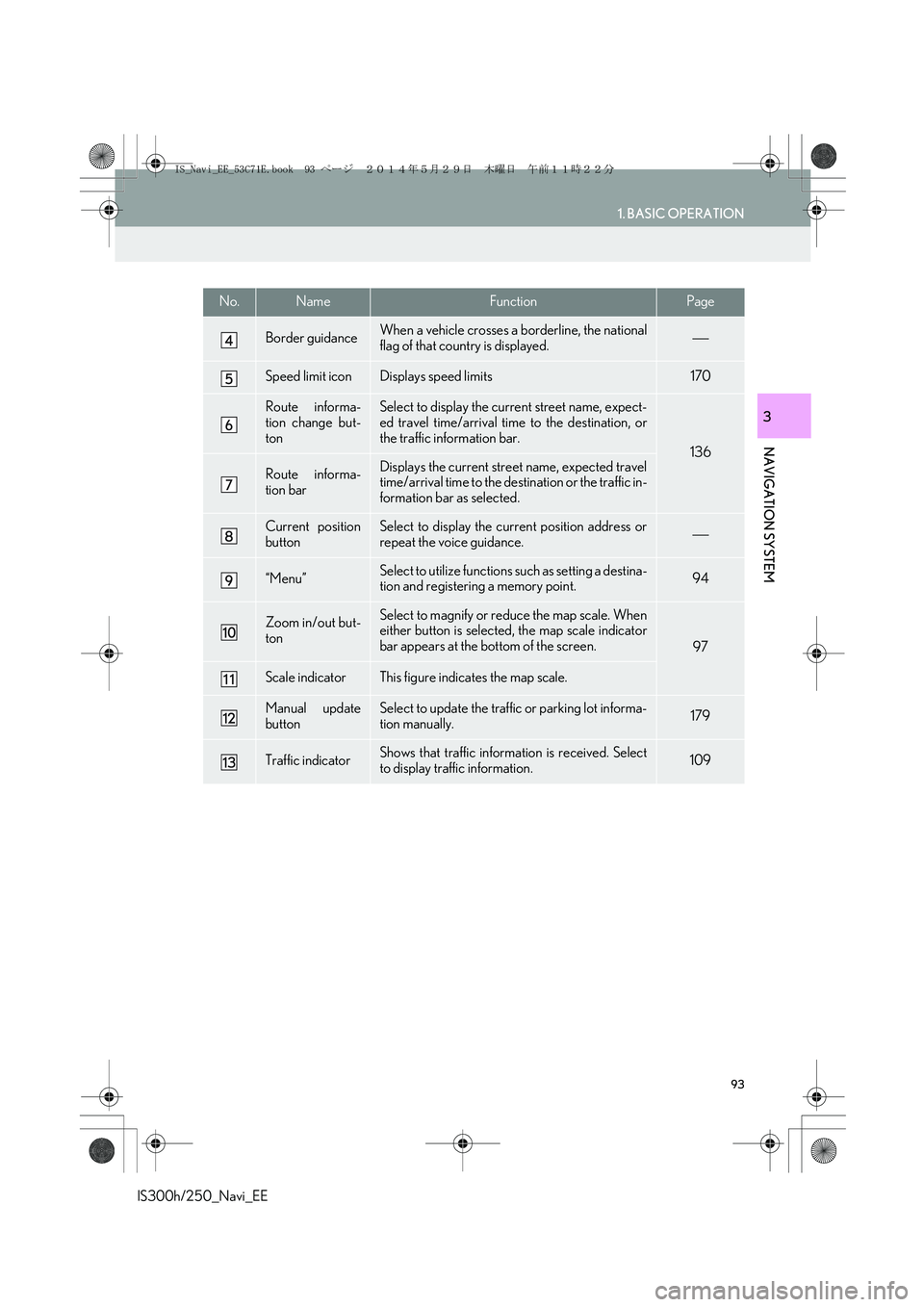
Border guidanceWhen a vehicle crosses a borderline, the national
flag of that country is displayed.
Speed limit iconDisplays speed limits170
Route informa-
tion change but-
tonSelect to display the current street name, expect-
ed travel time/arrival time to the destination, or
the traffic information bar.
136
Route informa-
tion barDisplays the current street name, expected travel
time/arrival time to the destination or the traffic in-
formation bar as selected.
Current position
buttonSelect to display the current position address or
repeat the voice guidance.
“Menu”Select to utilize functions such as setting a destina-
tion and registering a memory point.94
Zoom in/out but-
tonSelect to magnify or reduce the map scale. When
either button is selected, the map scale indicator
bar appears at the bottom of the screen.
97
Scale indicatorThis figure indicates the map scale.
Manual update
buttonSelect to update the traffic or parking lot informa-
tion manually. 179
Traffic indicatorShows that traffic information is received. Select
to display traffic information.109
No.NameFunctionPage
IS_Navi_EE_53C71E.book 93 ページ 2014年5月29日 木曜日 午前11時22分
Page 95 of 404

95
1. BASIC OPERATION
IS300h/250_Navi_EE
NAVIGATION SYSTEM
3
No.FunctionPage
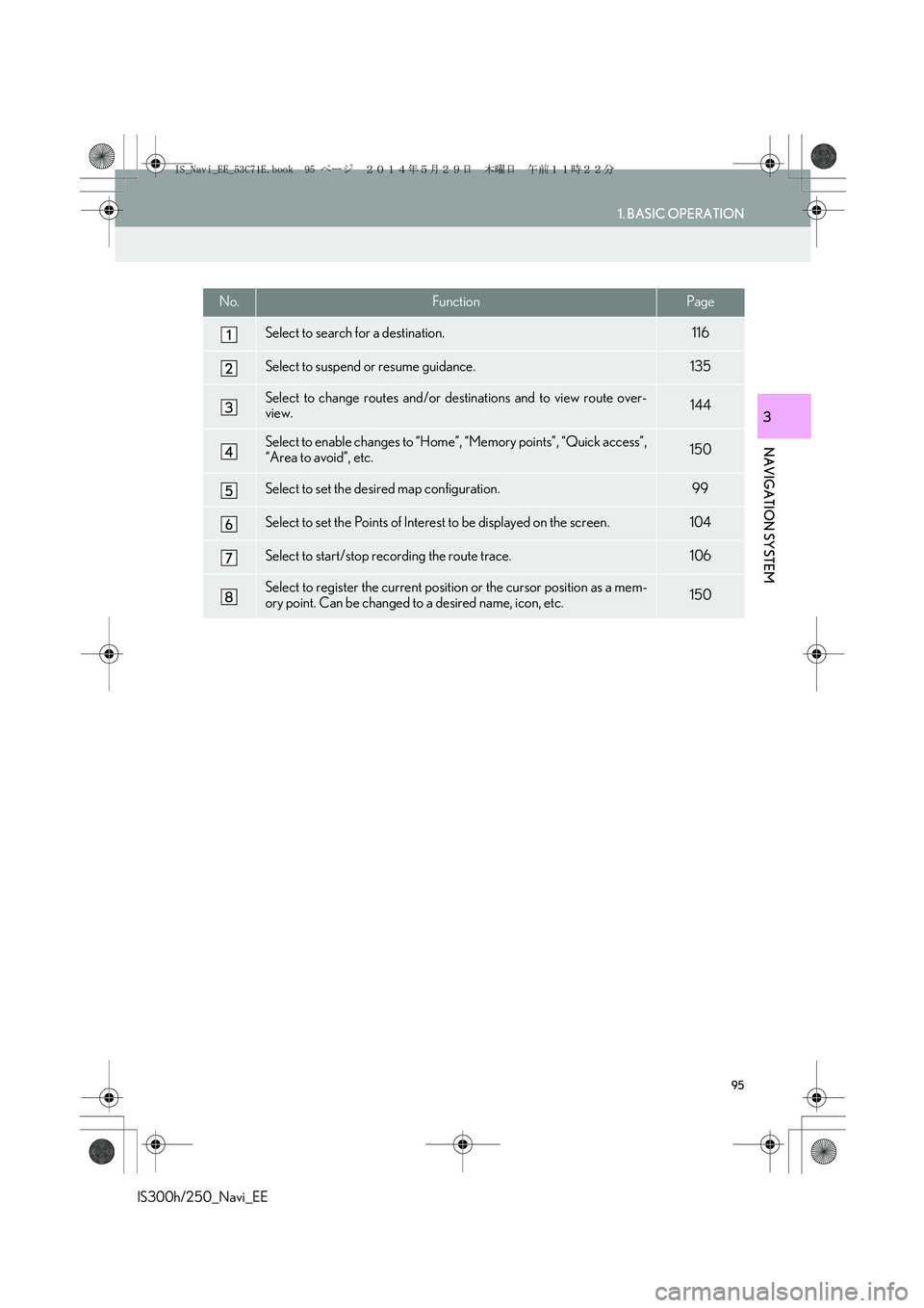
Select to search for a destination.116
Select to suspend or resume guidance.135
Select to change routes and/or destinations and to view route over-
view.144
Select to enable changes to “Home”, “Memory points”, “Quick access”,
“Area to avoid”, etc.150
Select to set the desired map configuration.99
Select to set the Points of Interest to be displayed on the screen.104
Select to start/stop recording the route trace.106
Select to register the current position or the cursor position as a mem-
ory point. Can be changed to a desired name, icon, etc.150
IS_Navi_EE_53C71E.book 95 ページ 2014年5月29日 木曜日 午前11時22分
Page 96 of 404

96
1. BASIC OPERATION
IS300h/250_Navi_EE
2. MAP SCREEN OPERATION
1Press the “MENU” button on the
Remote Touch.
2Select “Nav”.
3Check that the current position map is
displayed.
�zSelect if the navigation menu
screen is displayed.
CURRENT POSITION DISPLAY
�zTo correct the current position manually:
→P.1 7 3
INFORMATION
●
While driving, the current position mark
is fixed on the screen and the map moves.
●The current position is automatically set
as the vehicle receives signals from the
GPS (Global Positioning System). If the
current position is not correct, it is auto-
matically corrected after the vehicle
receives signals from the GPS.
●After 12-volt battery disconnection, or on
a new vehicle, the current position may
not be correct. As soon as the system
receives signals from the GPS, the cor-
rect current position is displayed.
IS_Navi_EE_53C71E.book 96 ページ 2014年5月29日 木曜日 午前11時22分
Page 97 of 404

97
1. BASIC OPERATION
IS300h/250_Navi_EE
NAVIGATION SYSTEM
3
1Select or to change the
scale of the map screen.
�zThe scale indicator bar appears at the bot-
tom of the screen.
�zSelect and hold or to continue
changing the scale of the map screen.
�zThe scale of the map screen can also be
changed by selecting the scale bar directly.
: Select to display the entire route, if
the destination has been set.
1Select to display the city map.
�zTo return to the normal map display, select
.
MAP SCALE
INFORMATION
●
Press the “” button on the Remote
Touch to zoom in on the map screen and
the “” button to zoom out.
●When the map scale is at the minimum
range, a one way street is displayed by
.
CITY MAP
The city map is available for some major
cities. When a map scale of 50 yd. (50
m) is selected, the map display will
change to the city map in either 2D or
3D.
IS_Navi_EE_53C71E.book 97 ページ 2014年5月29日 木曜日 午前11時22分
Page 99 of 404

99
1. BASIC OPERATION
IS300h/250_Navi_EE
NAVIGATION SYSTEM
3
1Select “Menu” on the map screen.
2Select “Map Configuration”.
3Select the desired item.
�zDepending on the conditions, certain con-
figuration screen buttons cannot be
selected.
SWITCHING MAP
CONFIGURATIONSNo.FunctionPage
Select to display the single
map screen.100
Select to display the dual
map screen.100
Select to display the com-
pass mode screen.101
Select to display the turn list
screen.142
Select to display the arrow
screen.142
Select to display the motor-
way information screen.140
Select to display the inter-
section guidance screen or
the guidance screen on the
motorway.
141
IS_Navi_EE_53C71E.book 99 ページ 2014年5月29日 木曜日 午前11時22分
Page 101 of 404

101
1. BASIC OPERATION
IS300h/250_Navi_EE
NAVIGATION SYSTEM
3
■COMPASS
�zTo scroll over the map, place the cursor
mark in the desired position and then press
and hold the Remote Touch knob. The map
will continue scrolling in that direction until
the knob is released.
Information about the destination, cur-
rent position and a compass is displayed
on the screen.
INFORMATION
●
The destination mark is displayed in the
direction of the destination. When driv-
ing, refer to the longitude and latitude
coordinates, and the compass, to make
sure that the vehicle is headed in the
direction of the destination.
●When the vehicle travels out of the cover-
age area, the guidance screen changes to
the compass mode screen.
SCREEN SCROLL
OPERATION
Use the scroll feature to move the de-
sired point to the centre of the screen for
looking at a point on the map screen that
is different from the current position.
No.Information/FunctionPage
Cursor mark
Select to register the cursor
location as area to avoid.102
Select to return to the cur-
rent position.
Select to register as a mem-
ory point. To change the
icon, name, etc.: →P.156
Select to set as a destina-
tion.131
Distance from the current
position to the cursor mark
IS_Navi_EE_53C71E.book 101 ページ 2014年5月29日 木曜日 午前11時22分
Page 103 of 404

103
1. BASIC OPERATION
IS300h/250_Navi_EE
NAVIGATION SYSTEM
31Select one of the 8 directional arrows to
move the cursor to the desired point.
ADJUSTING LOCATION IN
SMALL INCREMENTS
The exact target location can be adjust-
ed in small increments by selecting one
of the 8 directional arrows.
IS_Navi_EE_53C71E.book 103 ページ 2014年5月29日 木曜日 午前11時22分
Page 105 of 404

105
1. BASIC OPERATION
IS300h/250_Navi_EE
NAVIGATION SYSTEM
3
■SELECTING OTHER POI ICONS
TO BE DISPLAYED
1Select “Other POI’s”.
2Select the desired POI categories and
select “OK”.
“List all categories”: Select to display all
POI categories. To add more POI catego-
ries, select “More”.
■DISPLAYING THE LOCAL POI
LIST
1Select “List nearest POI’s”.
2Select the desired POI.
“On this route”: Select to search for POIs
along the route. When set to on, the indica-
tor will illuminate.
3Check that the selected POI is dis-
played on the map screen. (→P.101)
POIs that are within 20 miles (30 km) of
the current position will be listed from
among the selected categories.
IS_Navi_EE_53C71E.book 105 ページ 2014年5月29日 木曜日 午前11時22分
Page 107 of 404

107
1. BASIC OPERATION
IS300h/250_Navi_EE
NAVIGATION SYSTEM
3
1 Place the cursor over an icon.
2Select “Info”.
�XPOI information�XMemory point information
�XDestination information
�XTraffic information
�XParking information
DISPLAYING INFORMATION
ABOUT THE ICON WHERE
THE CURSOR IS SET
When the cursor is placed over an icon
on the map screen, the name bar is dis-
played on the upper part of the screen. If
“Info” appears on the right side of the
name bar, the detailed information can
be displayed.
IS_Navi_EE_53C71E.book 107 ページ 2014年5月29日 木曜日 午前11時22分
Page 109 of 404

109
1. BASIC OPERATION
IS300h/250_Navi_EE
NAVIGATION SYSTEM
3
4. TRAFFIC AND PARKING INFORMATION
*: Can only be used when receiving RDS-TMC
or TPEG (Transport Protocol Experts Group)
information. Depending on the country or ar-
ea, receiving RDS-TMC and TPEG informa-
tion may not be possible.
1Press the “MENU” button on the
Remote Touch.
2Select “Info”.
Traffic information, traffic prediction in-
formation and parking lot information
can be viewed.
�zThe following 3 methods are available to
receive the above information:
• R D S -T M C * ( R a d i o D a t a S y s t e m -Tr a f f i c
Message Channel) using FM signals
• TPEG*-TEC (Traffic Event Compact),
TPEG*-TFP (Traffic Flow Prediction)
and TPEG*-PKI (Live Parking Informa-
tion) using DAB
• TPEG*-TEC, TPEG*-TEP and TPEG*-
PKI via the internet by using Wi-Fi
® or a
cellular phone
For detailed information about connec-
tion methods for a Wi-Fi® device or cel-
lular phone: →P.50, 69
�zReceiving information using a cellular
phone
• In order to use this service, a
Bluetooth
® DUN/PAN compatible cel-
lular phone with sufficient network cov-
erage and a SIM card with a contract
that allows access to the internet are
required.
• When using this service, depending on
your telephone subscription, some
related fees might apply.
• When a cellular phone is used in a
roaming situation (when outside the
geographical coverage area of mobile
network provider) connection fees will
be more expensive.
DISPLAYING TRAFFIC AND
TRAFFIC PREDICTION
INFORMATION
IS_Navi_EE_53C71E.book 109 ページ 2014年5月29日 木曜日 午前11時22分