navigation system MAZDA MODEL CX-3 2016 Navigation Manual (in English)
[x] Cancel search | Manufacturer: MAZDA, Model Year: 2016, Model line: MODEL CX-3, Model: MAZDA MODEL CX-3 2016Pages: 90, PDF Size: 5.47 MB
Page 2 of 90

2
1 Warnings and Safety information ................................. 4
2 Getting
started ............................................................... 6
2.1 Before using the navigation system .................................................. 6
2.2 Navigation
menu ............................................................................... 8
2.3
Buttons
and other controls on the screen ...................................... 10
2.3.1 Using keyboards .................................................................................. 10
2.3.2
Press and Hold ...................................................................................... 11
2.4 Map screen ...................................................................................... 12
2.4.1 Navigating on the map ........................................................................ 12
2.4.2
Position markers ................................................................................. 13
2.4.2.1
Selected map location (Cursor) and selected map object ...... 13
2.4.3
Objects on the map ............................................................................. 13
2.4.3.1
Streets and roads .................................................................... 13
2.4.3.2
Turn preview and Next street ................................................. 14
2.4.3.3
Lane information and Signposts ............................................ 16
2.4.3.4
Junction view .......................................................................... 17
2.4.3.5
Highway/Freeway exit services ............................................. 17
2.4.3.6
Elements of the active route ................................................... 19
2.4.4
Manipulating the map .......................................................................... 20
2.4.5
Checking the details of the current position (Where
Am I?)
.............. 23
3 On-road navigation ...................................................... 24
3.1 Selecting the destination of a route ............................................... 24
3.1.1 Entering an address or a part of the address ........................................ 25
3.1.1.1
Entering an address ................................................................ 25
3.1.1.2
Entering the midpoint of a street as the destination ............... 30
3.1.1.3
Selecting an intersection as the destination ............................ 33
3.1.1.4
Selecting a city center as the destination ............................... 36
3.1.2
Selecting the destination from the POI (point of interest) ................... 38
3.1.2.1
Quick search for a POI (point of interest) ............................... 38
3.1.2.2
Searching for Help nearby ..................................................... 41
3.1.2.3
Searching for a POI (point of interest) by category ................ 44
3.1.2.4
Searching for a POI (point of interest) by name ..................... 48
3.1.3
Searching for a Place using Local Search (Only some coun
tries and
regions)
................................................................................................ 52
3.1.4
Selecting a map location as the destination ........................................ 54
3.1.5
Selecting the destination from your Favorites .................................... 56
Table of contents
NAV-12AVUAE.indb 22015/02/20 15:09:05
Page 4 of 90

4
1 Warnings and Safety information
The navigation system guides you to your destination using the GPS receiver. The
navigation system does not transmit your GPS position and you cannot be tracked.
It is important that you look at the display only when it is safe to do so.
If you are the driver of the vehicle, we recommend that you operate the
navigation system before you start your journey. Plan the route before
your departure and stop if you need to change the route.
Drive the vehicle according to the road signs and the road shape. If you deviate from
the recommended route, the navigation system changes the instructions accordingly .
For more information, consult the End-User Terms (page 86).
NAV-12AVUAE.indb 42015/02/20 15:09:05
Page 5 of 90

5
1
2
3
4
5
6
1 Warnings and Safety information
The navigation system guides you to your destination using the GPS receiver. The
navigation system does not transmit your GPS position and you cannot be tracked.
It is important that you look at the display only when it is safe to do so.
If you are the driver of the vehicle, we recommend that you operate the
navigation system before you start your journey. Plan the route before
your departure and stop if you need to change the route.
Drive the vehicle according to the road signs and the road shape. If you deviate from
the recommended route, the navigation system changes the instructions accordingly .
For more information, consult the End-User Terms (page 86).
Memo
NAV-12AVUAE.indb 52015/02/20 15:09:05
Page 6 of 90
6
2 Getting started
2.1 Before using the navigation system
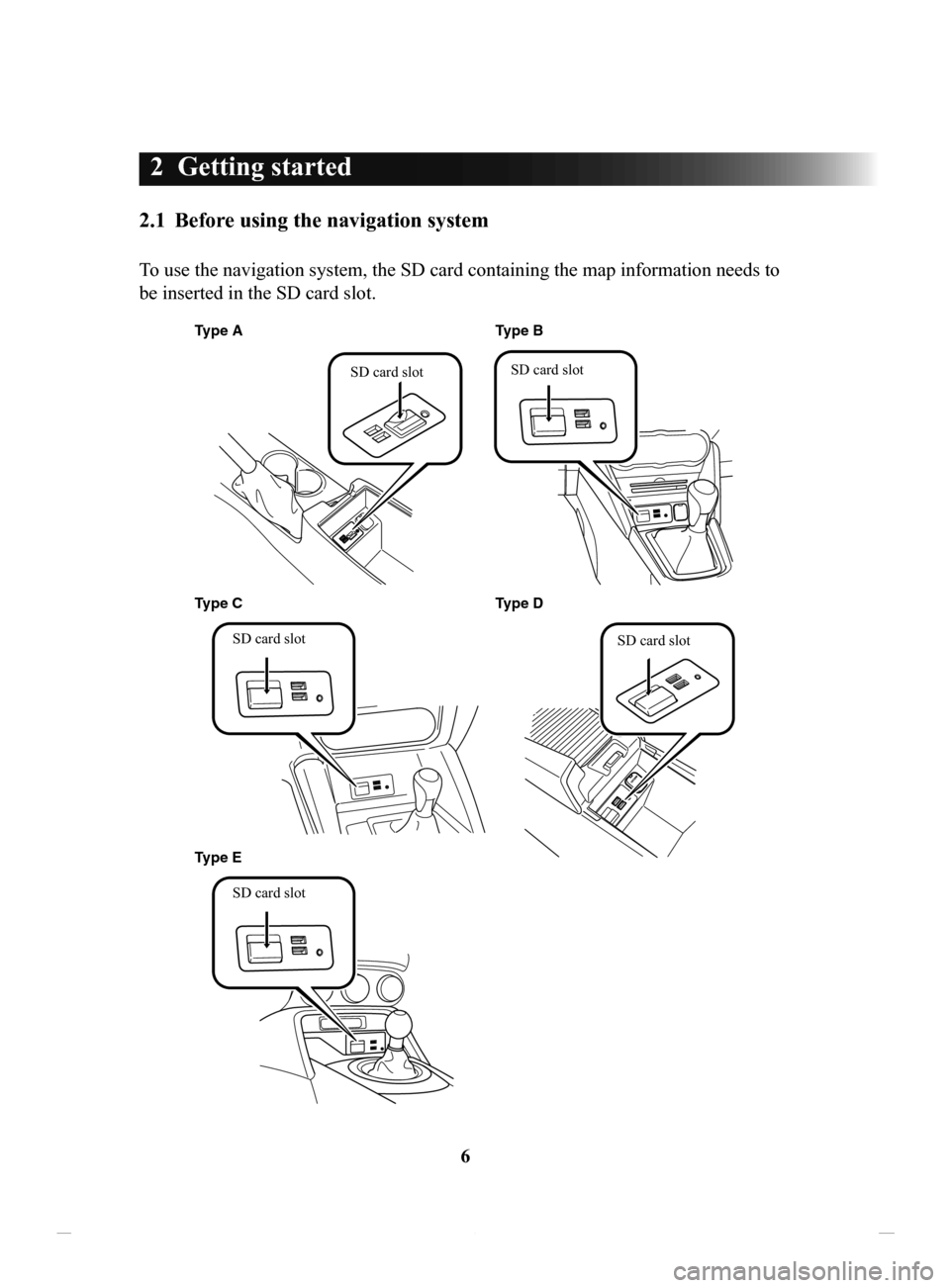
To use the navigation system, the SD card containing the map information needs to
be inserted in the SD card slot.
Type AType D
Type C Type B
SD card slot
SD card slot
Type E SD card slot SD card slot
SD card slot
NAV-12AVUAE.indb 62015/02/20 15:09:06
Page 7 of 90
7
1
2
3
4
5
6
2 Getting started
2.1 Before using the navigation system
To use the navigation system, the SD card containing the map information needs to
be inserted in the SD card slot.
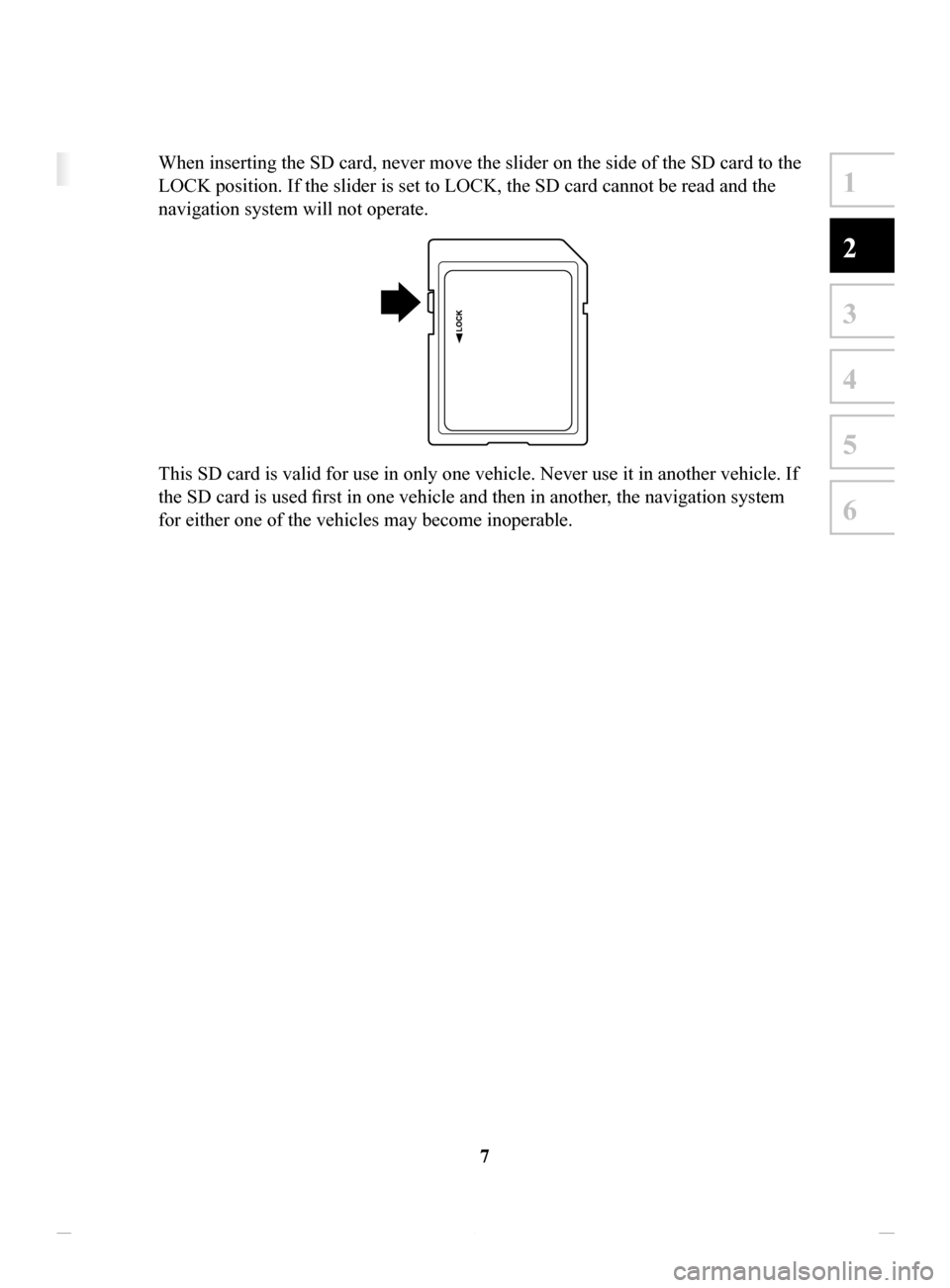
When inserting the SD card, never move the slider on the side of the SD card to the
LOCK position. If the slider is set to LOCK, the SD card cannot be read and the
navigation system will not operate.
This SD card is valid for use in only one vehicle. Never use it in another vehicle. If
the SD card is used first in one vehicle and then in another, the navigation system
for either one of the vehicles may become inoperable.
NAV-12AVUAE.indb 72015/02/20 15:09:06
Page 8 of 90
8
2.2 Navigation menu
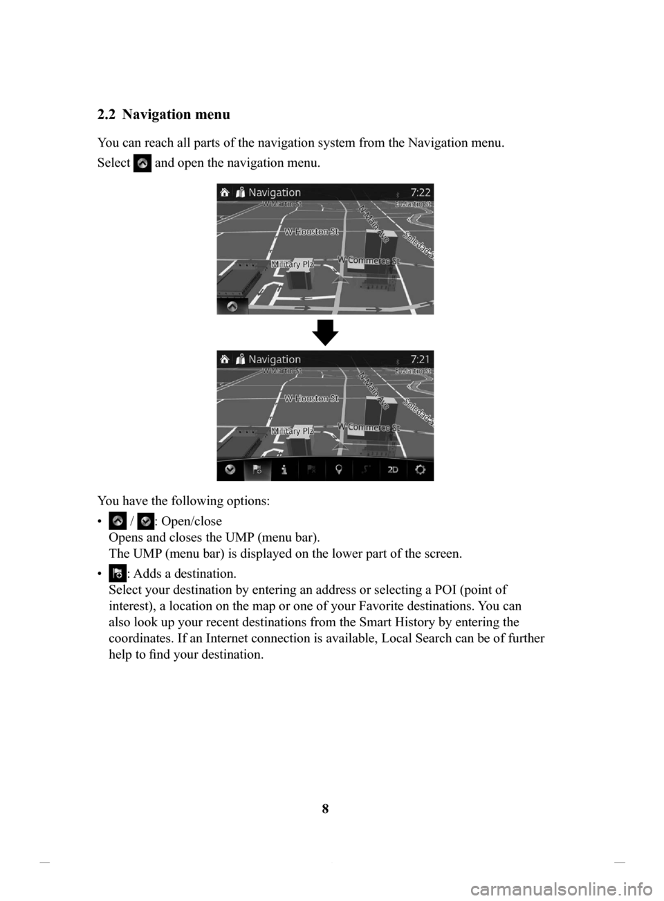
You can reach all parts of the navigation system from the Navigation menu.
Select
and open the navigation menu.
You have the following options:
•
/ : Open/close
Opens and closes the UMP (menu bar).
The UMP (menu bar) is displayed on the lower part of the screen.
•
: Adds a destination.
Select your destination by entering an address or selecting a POI (point of
interest), a location on the map or one of your Favorite destinations. You can
also look up your recent destinations from the Smart History by entering the
coordinates. If an Internet connection is available, Local Search can be of further
help to find your destination.
NAV-12AVUAE.indb 82015/02/20 15:09:06
Page 12 of 90
12
2.4 Map screen
2.4.1 Navigating on the map
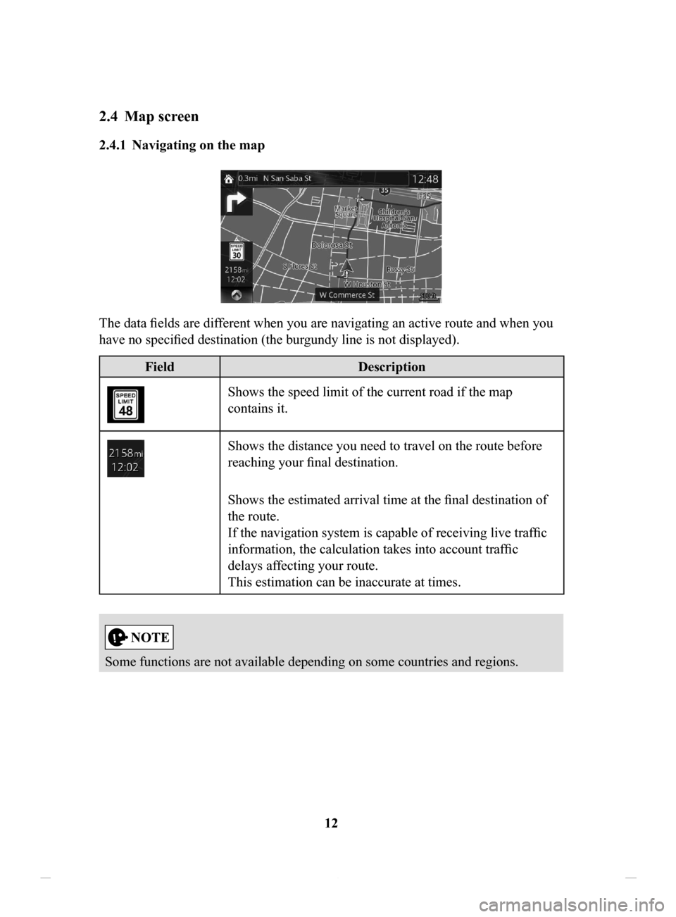
The data fields are different when you are navigating an active route and when you
have no specified destination (the burgundy line is not displayed).
FieldDescription
Shows the speed limit of the current road if the map
contains it.
Shows the distance you need to travel on the route before
reaching your final destination.
Shows the estimated arrival time at the final destination of
the route.
If the navigation system is capable of receiving live traffic
information, the calculation takes into account traffic
delays affecting your route.
This estimation can be inaccurate at times.
Some functions are not available depending on some countries and regions.
NAV-12AVUAE.indb 122015/02/20 15:09:07
Page 13 of 90
13
1
2
3
4
5
6
2.4.2 Position markers
2.4.2.1 Selected map location (Cursor) and selected map object
You can mark a map location in the following ways:
•
Select the map during route guidance.
•
Select the map when asked so that the destination can be confirmed after the
search is completed.
•
Select the destination from the map. (page 54)
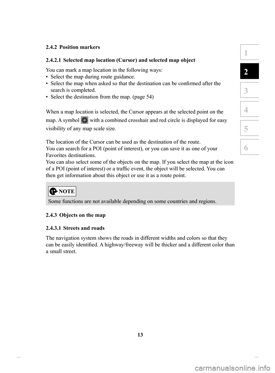
When a map location is selected, the Cursor appears at the selected point on the
map. A symbol
with a combined crosshair and red circle is displayed for easy
visibility of any map scale size.
The location of the Cursor can be used as the destination of the route.
You can search for a POI (point of interest), or you can save it as one of your
Favorites destinations.
You can also select some of the objects on the map. If you select the map at the icon
of a POI (point of interest) or a traffic event, the object will be selected. You can
then get information about this object or use it as a route point.
Some functions are not available depending on some countries and regions.
2.4.3 Objects
on the map
2.4.3.1 Streets and roads
The navigation system shows the roads in different widths and colors so that they
can be easily identified. A
highway/freeway will be thicker and a different color than
a small street.
NAV-12AVUAE.indb 132015/02/20 15:09:07
Page 16 of 90
16
2.4.3.3 Lane
information and Signposts
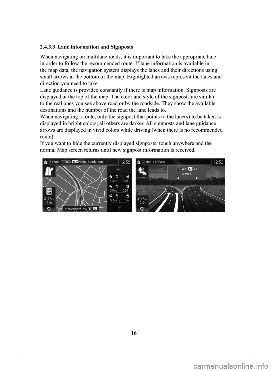
When navigating on multilane roads, it is important to take the appropriate lane
in order to follow the recommended route. If lane information is available in
the map data, the navigation system displays the lanes and their directions using
small arrows at the bottom of the map. Highlighted arrows represent the lanes and
direction you need to take.
Lane guidance is provided constantly if there is map information. Signposts are
displayed at the top of the map. The color and style of the signposts are similar
to the real ones you see above road or by the roadside. They show the available
destinations and the number of the road the lane leads to.
When navigating a route, only the signpost that points to the lane(s) to be taken is
displayed in bright colors; all others are darker
. All signposts and lane guidance
arrows are displayed in vivid colors while driving (when there is no recommended
route).
If you want to hide the currently displayed signposts, touch anywhere and the
normal Map screen returns until new signpost information is received.
NAV-12AVUAE.indb 162015/02/20 15:09:07
Page 19 of 90
19
1
2
3
4
5
6
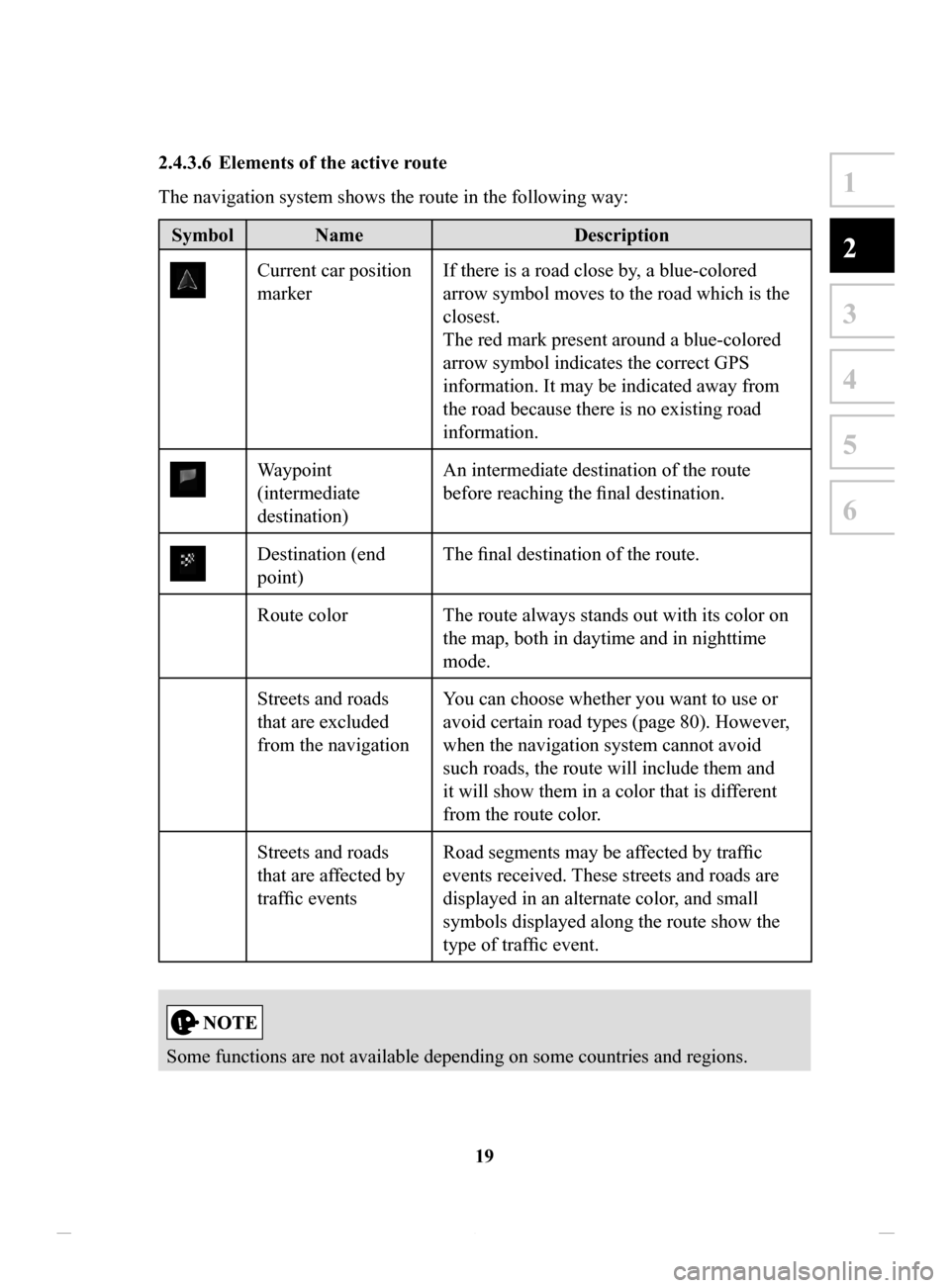
2.4.3.6 Elements of the active route
The navigation system shows the route in the following way:
Symbol NameDescription
Current car position
markerIf there is a road close by, a blue-colored
arrow symbol moves to the road which is the
closest.
The red mark present around a blue-colored
arrow symbol indicates the correct GPS
information. It may be indicated away from
the road because there is no existing road
information.
Waypoint
(intermediate
destination) An intermediate destination of the route
before reaching the final destination.
Destination (end
point)
The final destination of the route.
Route color The route always stands out with its color on the map, both in daytime and in nighttime
mode.
Streets and roads
that are excluded
from the navigation You can choose whether you want to use or
avoid certain road types (page 80). However,
when the navigation system cannot avoid
such roads, the route will include them and
it will show them in a color that is different
from the route color.
Streets and roads
that are affected by
traffic events Road segments may be affected by traffic
events received. These streets and roads are
displayed in an alternate color, and small
symbols displayed along the route show the
type of traffic event.
Some functions are not available depending on some countries and regions.
NAV-12AVUAE.indb 192015/02/20 15:09:07