display MERCEDES-BENZ CL-Class 2002 C215 Comand Manual
[x] Cancel search | Manufacturer: MERCEDES-BENZ, Model Year: 2002, Model line: CL-Class, Model: MERCEDES-BENZ CL-Class 2002 C215Pages: 251
Page 144 of 251

142
Destination input
Audio TelephoneNavigation
Index Info Services and
system settings Introduction
NavigationContents – Navigation ................... 143
Notes ................................................ 144
Before you use
the navigation system ................ 144
Navigation ....................................... 146
Quick reference – Navigation .... 146
Switching the navigation
system on ...................................... 148
Changing the Navigation CD ..... 149
Destination entry ........................... 150
Menu overview –
Destination entry ........................ 150
Entering destination address .... 152
Continue destination input ........ 160
Selecting a destination
via the map ................................... 163Destination entry via
coordinates ................................... 167
Entering points of interest ......... 169
Selecting the last destinations .. 174
Selecting the route
calculation mode and
calculating the route ................... 175
Route guidance ............................... 178
The principle
of route guidance ......................... 178
Requesting destination and
route information ........................ 181
Beginning route guidance .......... 189
Turning onto a street .................. 191
Following the course
of the road .................................... 193Driving through
an intersection ............................. 194
Changing to map display
during route guidance ................ 195
Route guidance with a mixture
of map and symbol display ........ 196
Altering the map scale ............... 197
Selecting map orientation .......... 198
Marking a way point ................... 199
Selecting a detour during
route guidance ............................. 202
Resetting functions during
route guidance ............................. 206
Deviating from the
calculated route ........................... 206
Driving on a non-digitized
road ................................................ 207
Contents – Navigation09-NAVI1-25-US.pm509.07.2004, 14:25 Uhr 142
Page 146 of 251
144
Destination input
Audio TelephoneNavigation
Index Info Services and
system settings Introduction
Notes
Before you use the navigation system
The route calculated by COMAND is a recommendation
on how to best reach your selected destination.
Warning!
During route guidance, you will not receive any
information on traffic lights, stop or yield signs,
no parking or no stopping zones, one-way streets,
narrow bridges and similar traffic regulation data.
Please always strictly observe traffic regulations
while driving. Traffic regulations always have
priority over any route recommendations given.
Study manual and select route before driving, – do
not watch display screen or operate buttons while
the vehicle is in motion – let voice instructions
guide you. – Stop at a safe location before using
buttons or making corrections. Drive carefully and
always obey traffic laws and road signs even if
they contradict system instructions.
For safety’s sake you should only enter destina-
tions when the vehicle is stationary. When the
vehicle is in motion, a passenger should enter the
destination.
Warning!
The CD reader contains a Class 1 laser product.
There is a danger of invisible laser radiation if the
cover is opened or damaged.
Do not remove the cover. The CD reader does not
contain any parts which can be serviced by the
user. For safety reasons, have any service work
which may be necessary performed only by
qualified personnel.Caution!
The data stored on the original navigation CD is used
for route calculation. Using other navigation CDs might
lead to malfunctions.
Because of changes in local traffic patterns and/or
incomplete data, errors in calculation may occur.
The recommended trip may deviate in this case from
the available traffic pattern, because the data material
stored on the CD represent the local conditions at the
time the CD was produced.
09-NAVI1-25-US.pm509.07.2004, 14:25 Uhr 144
Page 147 of 251
145 Destination input
Introduction
Audio
Telephone
Navigation
Index Info Services and
system settings
NotesThe current vehicle position cannot be displayed
exactly in every case. Satellite reception conditions,
road conditions, the condition of the vehicle, etc. could
cause deviations from the actual situation. In this case
enter the current vehicle position manually, page 220.
When the vehicle has been transported by a car train or
a ferry, COMAND will require some time to find its
exact position. In these cases it is often sufficient to
move the vehicle a few yards to receive a complete
route recommendation.
The reception of GPS signals can be unreliable or at
times even impossible:
• When driving between tall buildings, in parking
garages or tunnels, when obstructed by large
vehicles and similar structures
• During electrical storms or very heavy rains
• Satellites may be switched off for checking or repairChanging tires:
We recommend that you have any tire changes done by
a Mercedes-Benz Center. Because COMAND operates
using measurements taken by wheel revolutions, the
tire new size must be entered when the tires are
changed, see calibration on page 221.
Travelling abroad:
If you intend to travel through different regions or
abroad you will need the respective CD. Contact your
Mercedes-Benz Center or the Client Assistance Center
at 1-800-FOR-MERCedes (1-800-367-6372) for the
available CDs.
Remove the actual Navigation CD when you leave a
region or cross the border and insert the Navigation CD
for the region or country you are now in.09-NAVI1-25-US.pm509.07.2004, 14:25 Uhr 145
Page 149 of 251
147 Destination input
Introduction
Audio
Telephone
Navigation
Index Info Services and
system settings
Navigation1Selecting a detour during route guidance, page 202
2Switching the navigation system on, after which
either the main destination input menu, the symbol
display or the map will appear
3Repeats the current (last) voice instruction
4Selecting a destination via the map, page 163
5During map display:
Press
once – the scale bar appears,
page 166 and 197
Press again – selects a more detailed map
scale
If a list is displayed: Removes the window for
Number 6 below
6During map display:
Press once – the scale bar appears,
page 166 and 197
Press again – selects a less detailed map scale
If a list is displayed:
Press once – a long entry will display in full in
a window, page 170
Press again – removes the window7Raising
or lowering
the volume of the
voice output during route instruction
8Return to the previous menu
9Turn: Highlight a menu field, list entry or symbol
Altering the map scale, page 166 and 197
Press: Confirm an entry/selection, start a function
or activate a submenu
Activate the map scale bar, page 166 and 197
10Switching the COMAND system on and off, page 13
11Press
briefly:
The current route instruction is muted, page 190
Press longer than 2 seconds:
The voice output is switched off for the duration
of the current route guidance, page 190
12Color screen with map display
13CD slot for navigation CD
Note:
Do not insert radio CD’s in this slot.
14Ejects navigation CD
09-NAVI1-25-US.pm509.07.2004, 14:25 Uhr 147
Page 150 of 251

148
Destination input
Audio TelephoneNavigation
Index Info Services and
system settings Introduction
Navigation
Switching the navigation system on
Press
.
The following message will appear when COMAND is
preparing for navigation startup: “Activating
Navigation. Please obey all traffic rules”.One of four displays will appear:
• the main destination input menu, for active destina-
tion entry (illustrated above)
• the map display, page 178
when route guidance and the map were previously
active and route was not completed
• the symbol display indicating turns, page 178
when route guidance and the symbol display were
previously active and route was not completed.
• the location map, page 184
P82.85-6097-26
P82.85-6098-26
09-NAVI1-25-US.pm509.07.2004, 14:25 Uhr 148
Page 151 of 251
149 Destination input
Introduction
Audio
Telephone
Navigation
Index Info Services and
system settings
NavigationNote:
When navigation is preparing for operation, various
error messages may appear:
• “Navigation cannot be activated. An error has
occurred.”
• “CD-Reading error. Please change CD” – remove the
current CD and insert the Navigation CD.
• “No CD. Please insert NAVI-CD type DX only” – you
did not insert a CD, insert the Navigation CD type
DX. Please use only a current navigation CD. A
navigation CD from an older model may not be
compatible and may cause an error message to be
displayed.
When the error has been corrected COMAND shows the
message “Activating Navigation. Please obey all traffic
rules”.
To change over to another system press the
corresponding key, e.g.
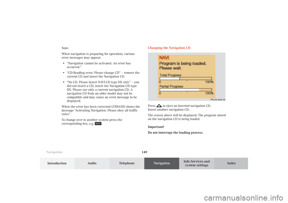
.Changing the Navigation CD
Press
to eject an inserted navigation CD.
Insert another navigation CD.
The screen above will be displayed. The program stored
on the navigation CD is being loaded.
Important!
Do not interrupt the loading process.
P82.85-6094-26
09-NAVI1-25-US.pm509.07.2004, 14:25 Uhr 149
Page 157 of 251

155 Destination input
Introduction
Audio
Telephone
Navigation
Index Info Services and
system settings
P82.85-2597-26
1312
11
To access the list of places:
Press the rotary/pushbutton
for longer than
2 seconds or highlight and confirm menu field (10).
11Selected City/Suburb, already highlighted
12Display to previous page
13Display to next pageThe next/previous page can be reached by turning the
rotary/pushbutton
past the last/first entry.
Turn the rotary/pushbutton
to highlight the desired
destination and press it to confirm.
09-NAVI1-25-US.pm509.07.2004, 14:26 Uhr 155
Page 168 of 251
166
Destination input
Audio TelephoneNavigation
Index Info Services and
system settings Introduction
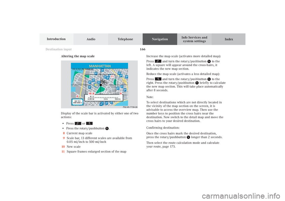
Altering the map scale
Display of the scale bar is activated by either one of two
actions:
• Press
or
• Press the rotary/pushbutton
.
8Current map scale
9Scale bar, 13 different scales are available from
0.05 mi/inch to 500 mi/inch
10New scale
11Square frames enlarged section of the mapIncrease the map scale (activates more detailed map):
Press
and turn the rotary/pushbutton
to the
left. A square will appear around the cross-hairs, it
indicates the new map section.
Reduce the map scale (activates a less detailed map):
Press
and turn the rotary/pushbutton
to the
right. Press the rotary/pushbutton
briefly to calculate
the new map section. This will take place automatically
after 8 seconds.
Note:
To select destinations which are not directly located in
the vicinity of the map section on the screen, it is
advisable to access the overview map. Then use the
number keys to position the cross hairs near the
destination. Now switch to the detail map and move the
cross hairs to your desired destination.
Confirming destination:
Once the cross hairs mark the desired destination,
press the rotary/pushbutton
longer than 2 seconds.
Then select the route calculation mode and calculate
your route, page 175.
P82.85-7739-26
11
10
8
8
9
09-NAVI1-25-US.pm509.07.2004, 14:27 Uhr 166
Page 172 of 251
170
Destination input
Audio TelephoneNavigation
Index Info Services and
system settings Introduction
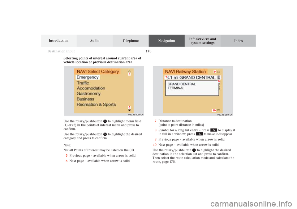
Selecting points of interest around current area of
vehicle location or previous destination area
Use the rotary/pushbutton
to highlight menu field
(1) or (2) in the points of interest menu and press to
confirm.
Use the rotary/pushbutton to highlight the desired
category and press to confirm.
Note:
Not all Points of Interest may be listed on the CD.
5Previous page – available when arrow is solid
6Next page – available when arrow is solid
P82.85-2615-26
10
8
7
9
7Distance to destination
(point to point distance in miles)
8Symbol for a long list entry – press
to display it
in full in a window, press
to make it disappear
9Previous page – available when arrow is solid
10Next page – available when arrow is solid
Use the rotary/pushbutton
to highlight the desired
destination in the selection list and press to confirm.
Then select the route calculation mode and calculate the
route, page 175.
P82.85-6099-2665
09-NAVI1-25-US.pm509.07.2004, 14:27 Uhr 170
Page 176 of 251
174
Destination input
Audio TelephoneNavigation
Index Info Services and
system settings Introduction
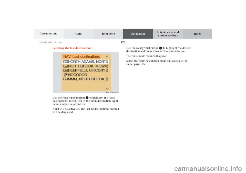
Selecting the last destinations
Use the rotary/pushbutton
to highlight the “Last
destinations” menu field in the main destination input
menu and press to confirm.
A list will be activated. The last 12 destinations entered
will be displayed.Use the rotary/pushbutton
to highlight the desired
destination and press it to confirm your selection.
The route mode menu will appear.
Select the route calculation mode and calculate the
route, page 175.
P82.85-6102-26
09-NAVI1-25-US.pm509.07.2004, 14:28 Uhr 174