ESP MERCEDES-BENZ CL CLASS 2010 Owner's Manual
[x] Cancel search | Manufacturer: MERCEDES-BENZ, Model Year: 2010, Model line: CL CLASS, Model: MERCEDES-BENZ CL CLASS 2010Pages: 500, PDF Size: 9.32 MB
Page 74 of 500
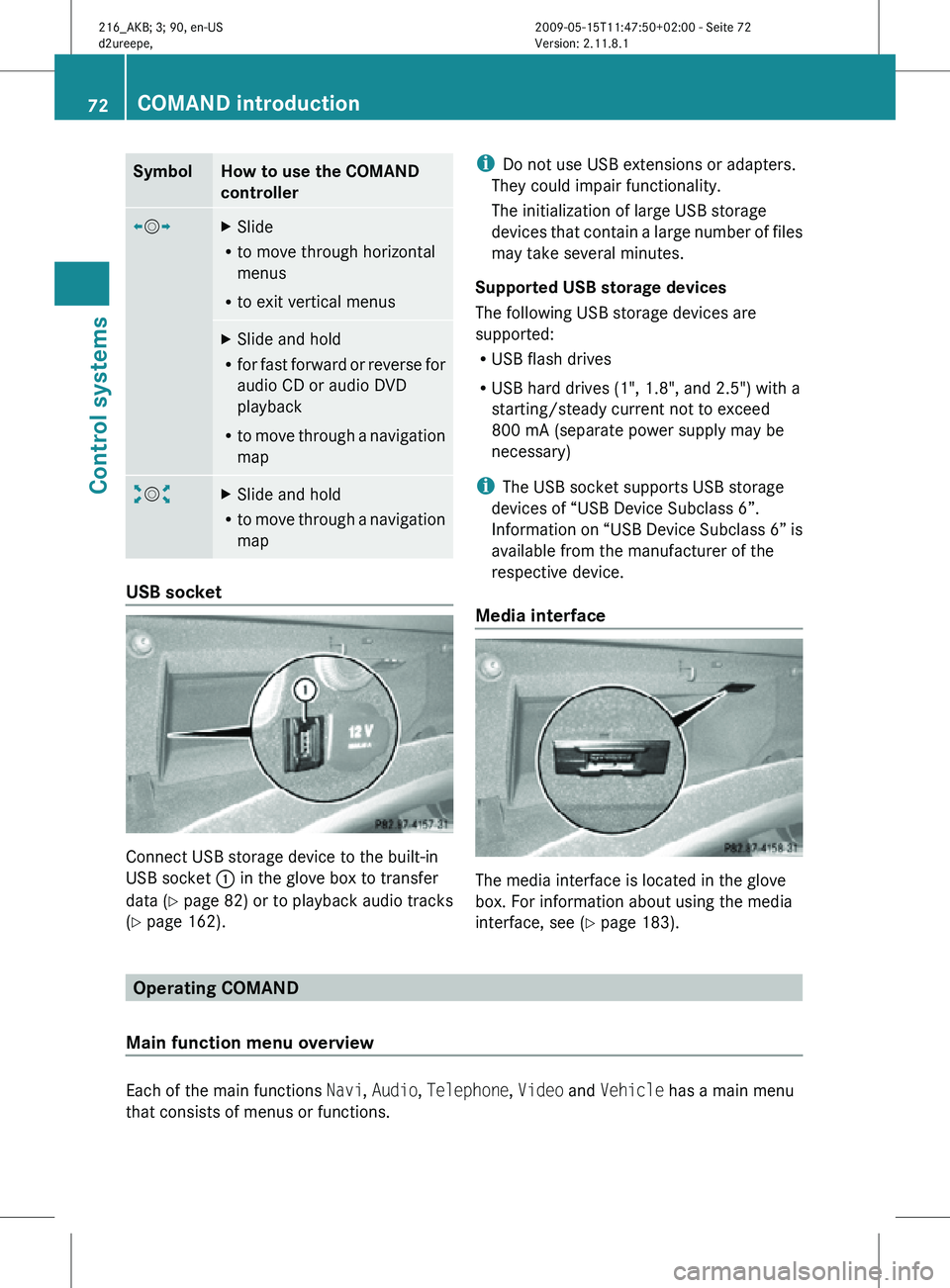
Symbol How to use the COMAND
controller
XVY
X
Slide
R to move through horizontal
menus
R to exit vertical menus X
Slide and hold
R for fast forward or reverse for
audio CD or audio DVD
playback
R to move through a navigation
map aVb
X
Slide and hold
R to move through a navigation
map USB socket
Connect USB storage device to the built-in
USB socket
: in the glove box to transfer
data ( Y page 82) or to playback audio tracks
(Y page 162). i
Do not use USB extensions or adapters.
They could impair functionality.
The initialization of large USB storage
devices that contain a large number of files
may take several minutes.
Supported USB storage devices
The following USB storage devices are
supported:
R USB flash drives
R USB hard drives (1", 1.8", and 2.5") with a
starting/steady current not to exceed
800 mA (separate power supply may be
necessary)
i The USB socket supports USB storage
devices of “USB Device Subclass 6”.
Information on “USB Device Subclass 6” is
available from the manufacturer of the
respective device.
Media interface The media interface is located in the glove
box. For information about using the media
interface, see (Y page 183).
Operating COMAND
Main function menu overview Each of the main functions
Navi, Audio, Telephone, Video and Vehicle has a main menu
that consists of menus or functions. 72
COMAND introductionControl systems
216_AKB; 3; 90, en-US
d2ureepe,
Version: 2.11.8.1 2009-05-15T11:47:50+02:00 - Seite 72
Page 78 of 500
X
Switching to the next higher menu:
Press back button % briefly.
COMAND switches to the next higher menu
level within the currently active operating
mode.
X Switching to the main menu: Press and
hold back button %.
COMAND switches to the main menu of the
currently active operating mode. Basic functions
i The components and operating principles
of COMAND can be found on ( Y page 68).
Sound X
Muting: Press button 8 on the
multifunction steering wheel
(Y page 202).
The sound of the current audio source is
switched on or is muted.
i When the sound is muted, symbol 8
appears in the status line. When you
change the audio source, the sound is
switched on automatically. Navigation
announcements will be audible even when
the sound is muted.
Switching navigation announcements off
X Press button 8 on the multifunction
steering wheel during an announcement.
i The announcements remain switched off
even when you start a new route guidance
or switch COMAND off/on with the u
button. When you switch COMAND off by
removing the SmartKey from the starter
switch and then switch the ignition back on
after more than 3 minutes, the
announcements are switched back on
automatically.
X Switching navigation announcements
back on manually: Select Navi Q RPT
(Y page 122). Adjusting volume
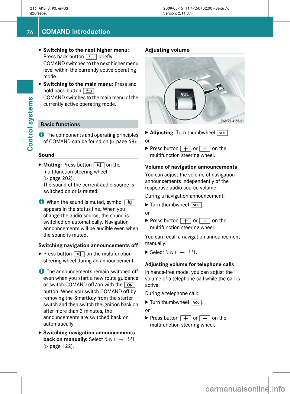
X
Adjusting: Turn thumbwheel H.
or
X Press button W or X on the
multifunction steering wheel.
Volume of navigation announcements
You can adjust the volume of navigation
announcements independently of the
respective audio source volume.
During a navigation announcement:
X Turn thumbwheel H.
or
X Press button W or X on the
multifunction steering wheel.
You can recall a navigation announcement
manually.
X Select Navi Q RPT.
Adjusting volume for telephone calls
In hands-free mode, you can adjust the
volume of a telephone call while the call is
active.
During a telephone call:
X Turn thumbwheel H.
or
X Press button W or X on the
multifunction steering wheel. 76
COMAND introductionControl systems
216_AKB; 3; 90, en-US
d2ureepe,
Version: 2.11.8.1 2009-05-15T11:47:50+02:00 - Seite 76
Page 79 of 500
Selecting sound settings
You can select different bass and treble
settings for the individual audio and video
sources. The respective sound menu can be
found via the submenu for which you wish to
make settings.
Example:
Audio Q FM/AM Radio Q Sound
Adjusting treble or bass
X Select Sound Q Treble or Bass.
The setting last selected is indicated by an
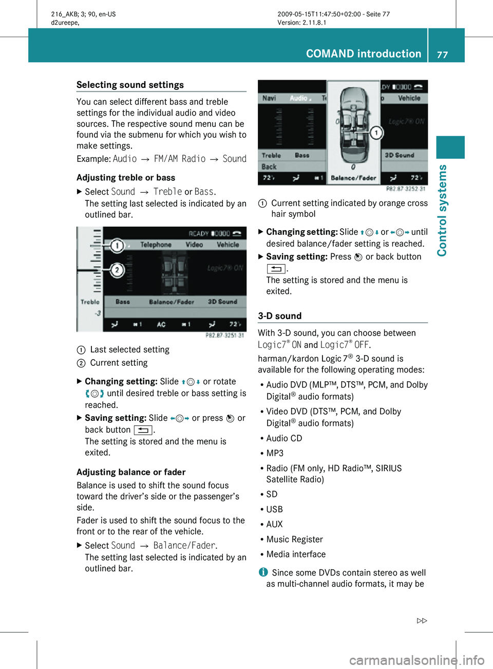
outlined bar. :
Last selected setting
; Current setting
X Changing setting: Slide ZVÆ or rotate
cVd until desired treble or bass setting is
reached.
X Saving setting: Slide XVY or press W or
back button %.
The setting is stored and the menu is
exited.
Adjusting balance or fader
Balance is used to shift the sound focus
toward the driver’s side or the passenger’s
side.
Fader is used to shift the sound focus to the
front or to the rear of the vehicle.
X Select Sound Q Balance/Fader.
The setting last selected is indicated by an
outlined bar. :
Current setting indicated by orange cross
hair symbol
X Changing setting: Slide ZVÆ or XVY until
desired balance/fader setting is reached.
X Saving setting: Press W or back button
%.
The setting is stored and the menu is
exited.
3-D sound With 3-D sound, you can choose between
Logic7
®
ON and Logic7 ®
OFF.
harman/kardon Logic 7®
3-D sound is
available for the following operating modes:
R Audio DVD (MLP™, DTS™, PCM, and Dolby
Digital ®
audio formats)
R Video DVD (DTS™, PCM, and Dolby
Digital ®
audio formats)
R Audio CD
R MP3
R Radio (FM only, HD Radio™, SIRIUS
Satellite Radio)
R SD
R USB
R AUX
R Music Register
R Media interface
i Since some DVDs contain stereo as well
as multi-channel audio formats, it may be COMAND introduction
77Control systems
216_AKB; 3; 90, en-US
d2ureepe, Version: 2.11.8.1 2009-05-15T11:47:50+02:00 - Seite 77 Z
Page 85 of 500
COMAND navigation (introduction)
Safety notes
G
Warning!
For safety reasons, only enter a destination
when the vehicle is stationary. When the
vehicle is
in motion, a passenger should enter
the destination. Study manual and select
route before driving.
Bear in mind that at a speed of just 30 mph
(approximately 50 km/h), your vehicle is
covering a distance of 44 feet (approximately
14 m) every second.
COMAND calculates the route to the
destination without taking account of the
following, for example:
R Traffic lights
R Stop and right-of-way signs
R Parking or stopping in prohibited areas
R Lane merging
R Other road and traffic rules and regulations
R Narrow bridges
COMAND may give incorrect navigation
commands if the data in the digital map does
not correspond with the actual road or traffic
situation. Maps do not cover all areas nor all
routes within an area. For example, if the
traffic routing has been changed or the
direction of a one-way road has been
reversed.
For this reason, you must always observe
applicable road and traffic rules and
regulations during your journey. Road and
traffic rules and regulations always have
priority over the navigation commands
generated by the system. G
Warning!
Navigation announcements are intended to
direct you
while driving without diverting your
attention from the road and driving.
Please always use navigation announcements
instead of consulting the map display for
directions. Consulting the symbols or map display for directions may cause you to divert
your
attention
from driving and increase your
risk of an accident. Map software
The digital maps generated by the map
software become outdated in the same way
as conventional road maps. Optimum route
guidance can only be provided by the
navigation system in conjunction with the
latest map software. Information about new
map software versions can be obtained from
an authorized Mercedes-Benz Center.
Displaying installed map version X
Navi Q Map Version
The installed map version is displayed.
For information on installing new map
software see ( Y page 83). Installing the map software
Your vehicle is factory-equipped with map
software for the USA (including Alaska and
Hawaii), Canada, the U.S. Virgin Islands, and
Puerto Rico.
You can
install new map software from one or
more DVDs, depending on the size of the map
software.
Copy protection of map software COMAND map software is subject to charges.
The map software requires an activation
code. The map software can be used for one
individual vehicle only and is
non-transferrable. The six-digit activation
code
is
available at any authorized Mercedes-
Benz Center. Contact an authorized
Mercedes-Benz Center in case you have lost
your activation code or when the COMAND
system does not accept the activation code
you have received. COMAND navigation (introduction)
83
Control systems
216_AKB; 3; 90, en-US
d2ureepe, Version: 2.11.8.1 2009-05-15T11:47:50+02:00 - Seite 83 Z
Page 86 of 500
When reinstalling a map software that has
been installed in that vehicle already, an
activation code is not required.
Installation process
i
The installation process can take
between 10 and 120 minutes, depending
on the
size of the map software. If the radio
is switched on when you start the
installation process, you can still adjust the
volume. During the installation process,
some COMAND functions are suspended.
Still available are the COMAND functions
for automatic air conditioning operation
and canceling the installation process.
If possible, carry out the installation when
the vehicle is stationary. When the vehicle
is stationary, the reading rate of the DVD
drive is higher than in a moving vehicle and
the installation process requires less time. G
Observe Safety notes, see page 68.
i COMAND may switch off during the
installation process automatically in order
to protect the battery. This may happen
when the engine is switched off and the
vehicle battery has insufficient power. If
this occurs,
restart the installation with the
engine running. Similarly, if the SmartKey
position is unintentionally switched to 0,
restart the installation. G
Warning!
Inhalation of exhaust gas is hazardous to your
health. All exhaust gas contains carbon
monoxide (CO), and inhaling it can cause
unconsciousness and lead to death. Do not
run the engine in confined areas (such as a
garage) which are not properly ventilated. Installing
Notes about handling DVDs (Y page 165). X
Load the map software DVD into the DVD
changer (Y page 165).
The COMAND
system verifies the DVD and
a respective message appears in the
COMAND display.
Map software incompatible with
navigation system A message indicates that installation of the
map software is not possible.
X
Confirming message: Press W.
The DVD is ejected.
X Remove the DVD from the slot.
X Insert a DVD that is compatible with the
navigation system of the vehicle.
Map software incompatible with the
current system software A message indicates that the system
software and the map software are
incompatible.
X
Confirming message: Press W.
The DVD is ejected.
X Remove the DVD from the slot.
X Have the system software updated at an
authorized Mercedes-Benz Center.
The system software must be updated before
you can install the map software.
Map software compatible with
navigation software and current
system software The COMAND system verifies whether the
map data on the DVD have been installed
already.
Map data installed already
A message that indicates that the map data
have been installed already appears. Also,
you
are
being asked if you would like to install
the map software anyhow. 84
COMAND navigation (introduction)
Control systems
216_AKB; 3; 90, en-US
d2ureepe,
Version: 2.11.8.1 2009-05-15T11:47:50+02:00 - Seite 84
Page 87 of 500

X
Select Yes or No.
When you select Yes, the current map data
will be overwritten.
When you select No, the DVD will be ejected
automatically and the installation process
is cancelled.
X Remove the DVD from the slot.
Map data not installed yet The versions of the map software on the DVD
and of the installed map software appear in
the COMAND display. You are then asked if
you want to install the map software.
X
Select Yes or No.
When you select Yes, the map data will be
installed.
When you select No, the DVD will be ejected
automatically and the installation process
is cancelled.
X Remove the DVD from the slot.
When an activation code is required, you will
be prompted to enter it. X
Enter the activation code and confirm by
pressing !.
Installation of the map software starts.
When you enter an invalid activation code,
you are prompted to reenter the activation
code. After entering an invalid activation code
for the third time, the prompt for reentering
the activation code will be delayed. The delay
increases by 5 minutes each time an invalid
activation code is entered to a maximum
delay of 5 hours. Map software installation Immediately before installation, the
COMAND system reboots.
A corresponding message and a progress bar
appear during the installation process.
X
Canceling installation on the DVD
changer: Press the respective magazine
tray button.
X Remove the DVD from the slot.
i When you cancel the installation, the
navigation system will be inoperative. You
can resume a canceled installation at a
later time.
X Installation of multiple DVD map
software: After installation of the first
DVD, a message appears that prompts you
to insert the next DVD. Follow the
instructions on the COMAND display.
X Continue installation without
canceling: Let the installation continue
without pressing any buttons.
When the installation has been completed,
a corresponding message appears.
X Confirming message: Press W.
The DVD is ejected.
X Remove the DVD from the slot.
The installation is finished.
When the installation has been completed
successfully, a corresponding message
appears.
X Confirming message: Press W.
The DVD is ejected.
X Remove the DVD from the slot.
If the installation was unsuccessful:
R The DVD is dirty or scratched.
XClean the DVD (Y page 165).
X Start the installation of the map
software once more.
R The system may be overheated due to
excessive temperature in the vehicle
interior. COMAND navigation (introduction)
85Control systems
216_AKB; 3; 90, en-US
d2ureepe, Version: 2.11.8.1 2009-05-15T11:47:50+02:00 - Seite 85 Z
Page 93 of 500
R
Bird’s-eye View:
Map display : is oriented
in the direction into which you are heading;
the orange tip of the symbol points to the
North.
R 3-D Map: Certain buildings in selected
cities are displayed in detail as a 3-D (three-
dimensional) model. The map displays
mountains and valleys three-
dimensionally. The 3-D map is country-
specific and is connected with the function
City (3D) ( Y page 92).
X Selecting map orientation: Select Navi
Q Map Orientation.
The list of available map orientations
appears. The
dot # indicates the currently
selected map orientation.
X Select North Up, Heading Up, Bird's-
eye View, or 3-D Map and press W.
X Exiting menu: Slide XVY.
Setting POI symbols You can set which points of interest (POIs)
should be displayed as symbols in the map.
POIs
are
parking facilities, hotels, restaurants
or movie theaters, for example.
i Depending on the map scale, POI symbols
may not be visible although their display is
activated. In addition, POI symbols may be
covered by other POIs or names displayed
on the map.
The following settings are possible:
R Standard symbols (factory setting)
R Personal symbols (you can select the
desired POIs)
R No symbols X
Adjusting: Select
Navi
Q POI Symbols
on Map.
The map display list appears. A dot #
indicates the current setting.
X Select Standard symbols, Personal
symbols or No symbols.
If you
select Personal symbols , the list of
POIs appears.
X Switching POI symbol display on or
off: Select the desired POI.
The corresponding symbol displays are
switched on or off, depending on the
previous status. A checkmark indicates
which status is active. You can switch on
the symbol
displays for more than one POI.
i The list shows all symbols that are
contained in the digital map across all
states (USA) and provinces (Canada). Not
all POIs
in all states (USA) or in all provinces
(Canada) are available, however. Certain
POI symbols may not be displayed on the
map, even if the symbol display is switched
on. You can use this list as a map legend.
The map legend also contains, in addition
to the POI symbols, the names of the POI
categories.
X Exiting menu: Slide XVY or press back
button % in the center console
(Y page 75).
Selecting traffic symbols on the map You can select what kind of traffic information
is displayed on the map
(Y
page 126).
Selecting text information on the map COMAND can display various text
information below the map:
R
Time of arrival and distance to destination
R Current street
R Geo coordinates
R None COMAND navigation (introduction)
91
Control systems
216_AKB; 3; 90, en-US
d2ureepe, Version: 2.11.8.1 2009-05-15T11:47:50+02:00 - Seite 91 Z
Page 101 of 500
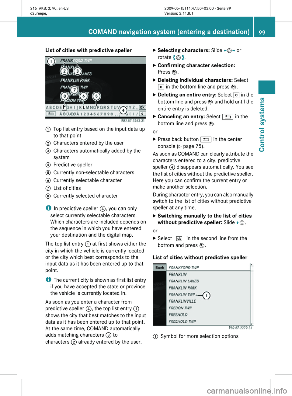
List of cities with predictive speller
:
Top list entry based on the input data up
to that point
; Characters entered by the user
= Characters automatically added by the
system
? Predictive speller
A Currently non-selectable characters
B Currently selectable character
C List of cities
D Currently selected character
i In predictive speller ?, you can only
select currently selectable characters.
Which characters are included depends on
the sequence in which you have entered
your destination and the digital map.
The top list entry : at first shows either the
city in which the vehicle is currently located
or the city which best corresponds to the
input data as it has been entered up to that
point.
i The current city is shown as first list entry
if you have accepted the state or province
the vehicle is currently located in.
As soon as you enter a character from
predictive speller ?, the top list entry :
shows the city that best matches to the input
data as it has been entered up to that point.
At the same time, COMAND automatically
adds matching characters = to
characters ; already entered by the user. X
Selecting characters: Slide XVY or
rotate cVd.
X Confirming character selection:
Press W.
X Deleting individual characters: Select
F in the bottom line and press W.
X Deleting an entire entry: Select F in the
bottom line and press W and hold until the
entire entry is deleted.
X Canceling an entry: Select % in the
bottom line and press W.
or
X Press back button % in the center
console (Y page 75).
As soon as COMAND can clearly attribute the
characters entered to a city, predictive
speller ? disappears automatically. You see
the list of cities without the predictive speller.
Here you can confirm the current entry or
make another selection.
During character entry, you can also manually
switch to the list of cities without predictive
speller at any time.
X Switching manually to the list of cities
without predictive speller: Slide ZV.
or
X Select ¬ in the second line from the
bottom and press W.
List of cities without predictive speller :
Symbol for more selection options COMAND navigation system (entering a destination)
99Control systems
216_AKB; 3; 90, en-US
d2ureepe,Version: 2.11.8.1 2009-05-15T11:47:50+02:00 - Seite 99 Z
Page 103 of 500
Entering a street
i
It is not possible to enter a street if you
have already entered a city center.
i You can only enter streets which are
available on the digital map.
If you have not entered a city before
entering the street, only those streets
within the state (USA) or province (Canada)
previously entered are available. If you have
already entered a city, streets within that
city are available.
If you have entered a zip code before
entering the street, only those streets
within the zip code area are available.
X In the address input menu, select Street.
The list of streets appears either with or
without the predictive speller
(Y page 102). Whether or not the
predictive speller appears depends on how
many streets are available for the selected
city.
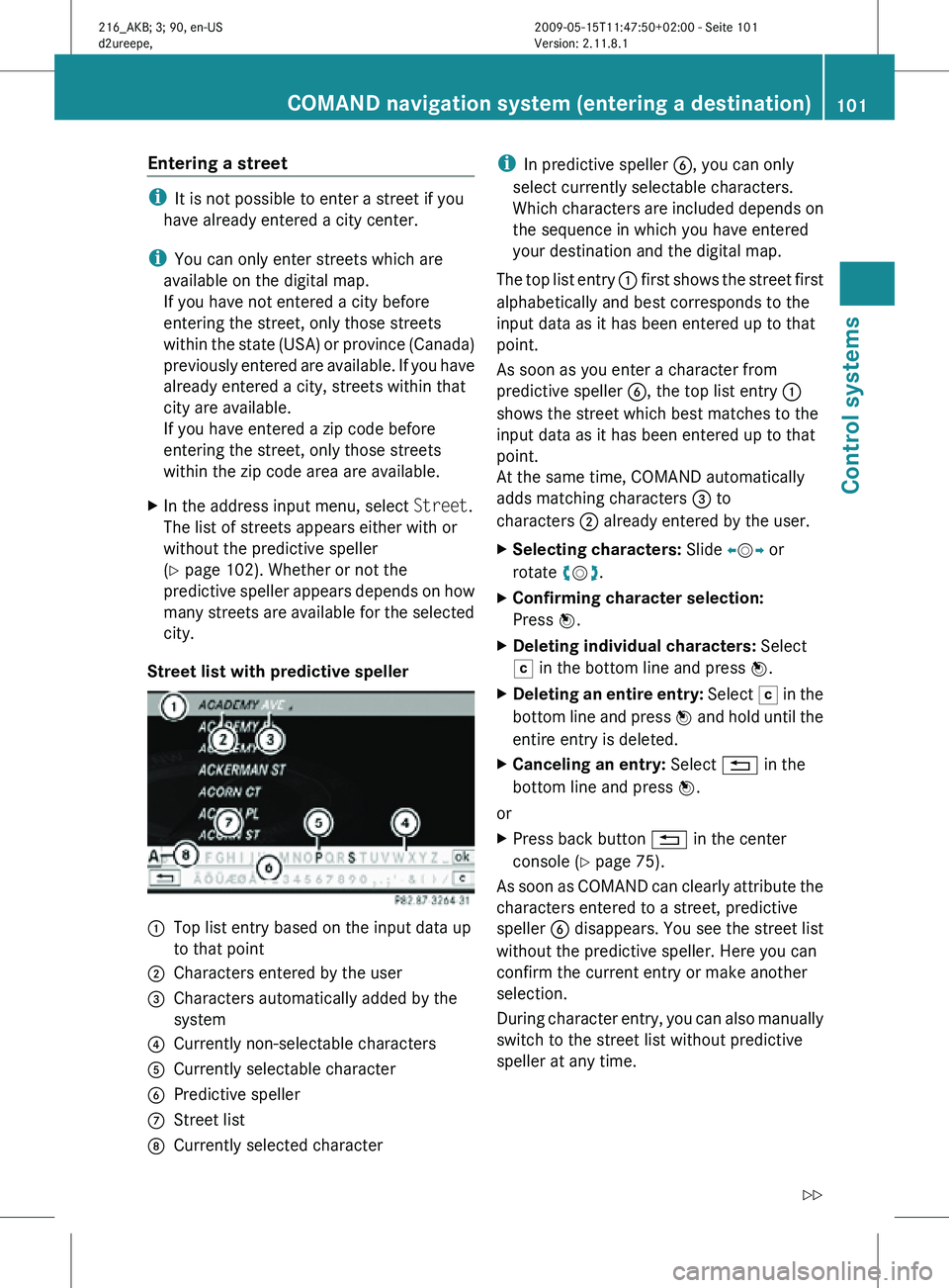
Street list with predictive speller :
Top list entry based on the input data up
to that point
; Characters entered by the user
= Characters automatically added by the
system
? Currently non-selectable characters
A Currently selectable character
B Predictive speller
C Street list
D Currently selected character i
In predictive speller B, you can only
select currently selectable characters.
Which characters are included depends on
the sequence in which you have entered
your destination and the digital map.
The top list entry : first shows the street first
alphabetically and best corresponds to the
input data as it has been entered up to that
point.
As soon as you enter a character from
predictive speller B, the top list entry :
shows the street which best matches to the
input data as it has been entered up to that
point.
At the same time, COMAND automatically
adds matching characters = to
characters ; already entered by the user.
X Selecting characters: Slide XVY or
rotate cVd.
X Confirming character selection:
Press W.
X Deleting individual characters: Select
F in the bottom line and press W.
X Deleting an entire entry: Select F in the
bottom line and press W and hold until the
entire entry is deleted.
X Canceling an entry: Select % in the
bottom line and press W.
or
X Press back button % in the center
console (Y page 75).
As soon as COMAND can clearly attribute the
characters entered to a street, predictive
speller B disappears. You see the street list
without the predictive speller. Here you can
confirm the current entry or make another
selection.
During character entry, you can also manually
switch to the street list without predictive
speller at any time. COMAND navigation system (entering a destination)
101Control systems
216_AKB; 3; 90, en-US
d2ureepe,Version: 2.11.8.1 2009-05-15T11:47:50+02:00 - Seite 101 Z
Page 104 of 500
X
Switching manually to the street list
without predictive speller: Slide ZV.
or
X Select ¬ in the second line from the
bottom and press W.
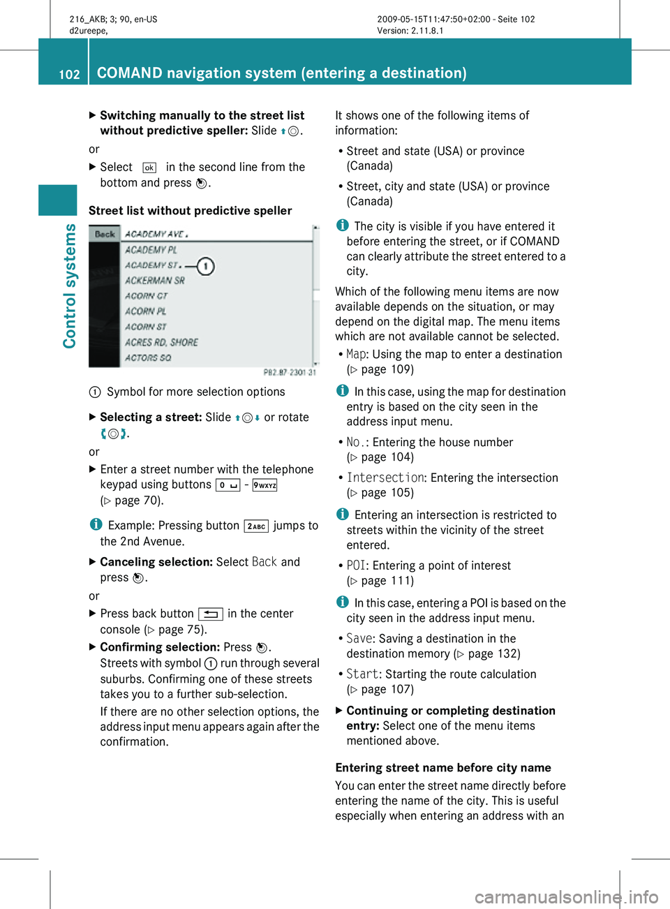
Street list without predictive speller :
Symbol for more selection options
X Selecting a street: Slide ZVÆ or rotate
cVd.
or
X Enter a street number with the telephone
keypad using buttons Å - Ã
(Y page 70).
i Example: Pressing button · jumps to
the 2nd Avenue.
X Canceling selection: Select Back and
press W.
or
X Press back button % in the center
console (Y page 75).
X Confirming selection: Press W.
Streets with symbol : run through several
suburbs. Confirming one of these streets
takes you to a further sub-selection.
If there are no other selection options, the
address input menu appears again after the
confirmation. It shows one of the following items of
information:
R
Street and state (USA) or province
(Canada)
R Street, city and state (USA) or province
(Canada)
i The city is visible if you have entered it
before entering the street, or if COMAND
can clearly attribute the street entered to a
city.
Which of the following menu items are now
available depends on the situation, or may
depend on the digital map. The menu items
which are not available cannot be selected.
R Map: Using the map to enter a destination
(Y page 109)
i In this case, using the map for destination
entry is based on the city seen in the
address input menu.
R No.: Entering the house number
(Y page 104)
R Intersection: Entering the intersection
(Y page 105)
i Entering an intersection is restricted to
streets within the vicinity of the street
entered.
R POI: Entering a point of interest
(Y page 111)
i In this case, entering a POI is based on the
city seen in the address input menu.
R Save: Saving a destination in the
destination memory (Y page 132)
R Start: Starting the route calculation
(Y page 107)
X Continuing or completing destination
entry: Select one of the menu items
mentioned above.
Entering street name before city name
You can enter the street name directly before
entering the name of the city. This is useful
especially when entering an address with an 102
COMAND navigation system (entering a destination)Control systems
216_AKB; 3; 90, en-US
d2ureepe,
Version: 2.11.8.1 2009-05-15T11:47:50+02:00 - Seite 102