navigation system MERCEDES-BENZ CL CLASS 2010 Workshop Manual
[x] Cancel search | Manufacturer: MERCEDES-BENZ, Model Year: 2010, Model line: CL CLASS, Model: MERCEDES-BENZ CL CLASS 2010Pages: 500, PDF Size: 9.32 MB
Page 119 of 500
Examples of displays and
announcements for a driving
maneuver
Driving maneuvers have three phases:
R Preparation phase
R Announcement phase
R Maneuver phase
Preparation phase COMAND prepares you for the upcoming
driving maneuver. Based on the example
display below, the driving maneuver is
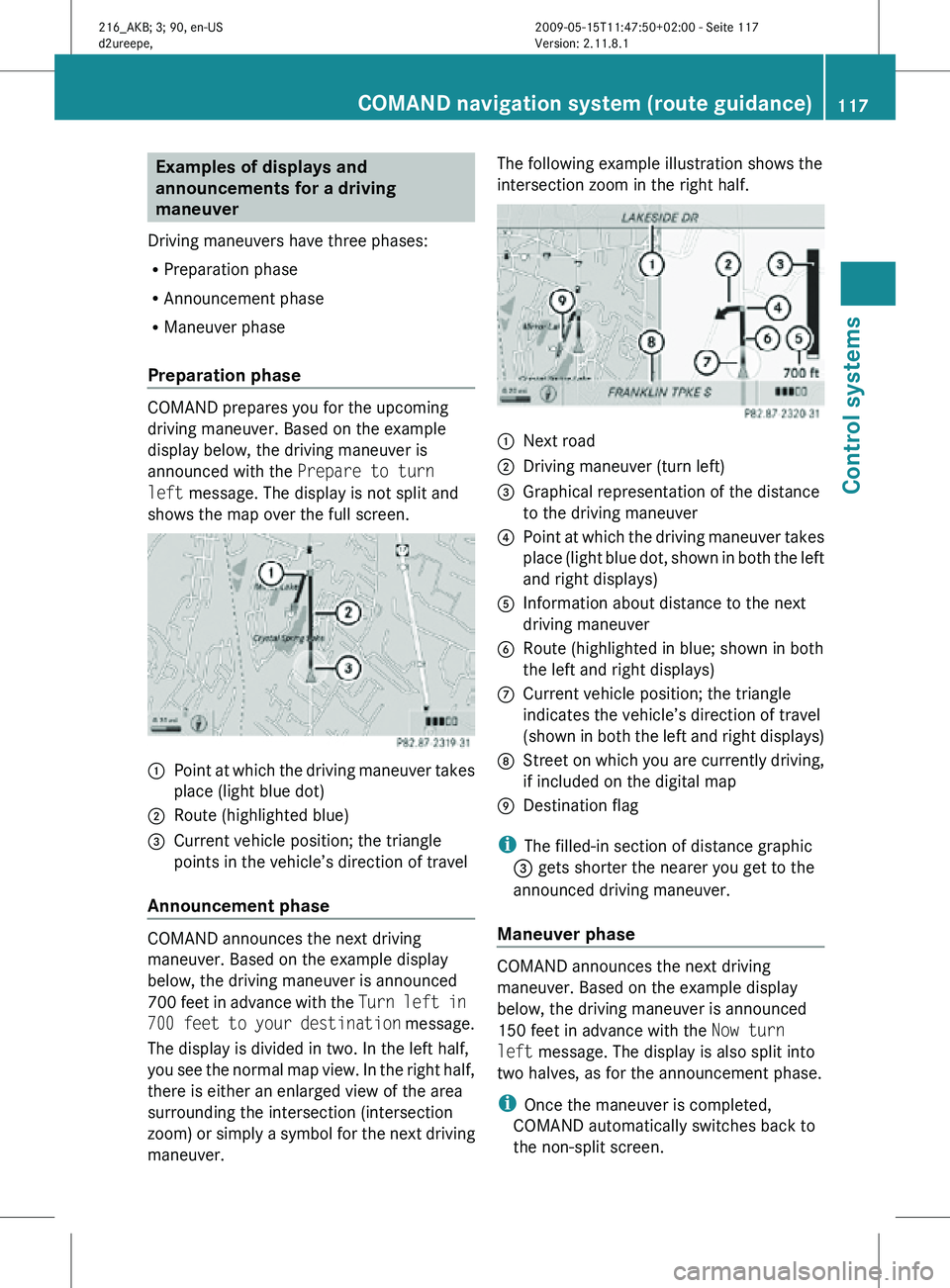
announced with the Prepare to turn
left message. The display is not split and
shows the map over the full screen.
:
Point at which the driving maneuver takes
place (light blue dot)
; Route (highlighted blue)
= Current vehicle position; the triangle
points in the vehicle’s direction of travel
Announcement phase COMAND announces the next driving
maneuver. Based on the example display
below, the driving maneuver is announced
700 feet in advance with the
Turn left in
700 feet to your destination message.
The display is divided in two. In the left half,
you see the normal map view. In the right half,
there is either an enlarged view of the area
surrounding the intersection (intersection
zoom) or simply a symbol for the next driving
maneuver. The following example illustration shows the
intersection zoom in the right half.
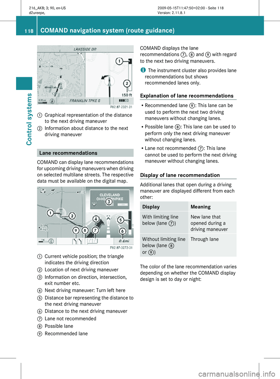
:
Next road
; Driving maneuver (turn left)
= Graphical representation of the distance
to the driving maneuver
? Point at which the driving maneuver takes
place (light blue dot, shown in both the left
and right displays)
A Information about distance to the next
driving maneuver
B Route (highlighted in blue; shown in both
the left and right displays)
C Current vehicle position; the triangle
indicates the vehicle’s direction of travel
(shown in both the left and right displays)
D Street on which you are currently driving,
if included on the digital map
E Destination flag
i The filled-in section of distance graphic
= gets shorter the nearer you get to the
announced driving maneuver.
Maneuver phase COMAND announces the next driving
maneuver. Based on the example display
below, the driving maneuver is announced
150 feet in advance with the
Now turn
left message. The display is also split into
two halves, as for the announcement phase.
i Once the maneuver is completed,
COMAND automatically switches back to
the non-split screen. COMAND navigation system (route guidance)
117Control systems
216_AKB; 3; 90, en-US
d2ureepe,Version: 2.11.8.1 2009-05-15T11:47:50+02:00 - Seite 117 Z
Page 120 of 500
:
Graphical representation of the distance
to the next driving maneuver
; Information about distance to the next
driving maneuver Lane recommendations
COMAND can display lane recommendations
for upcoming driving maneuvers when driving
on selected multilane streets. The respective
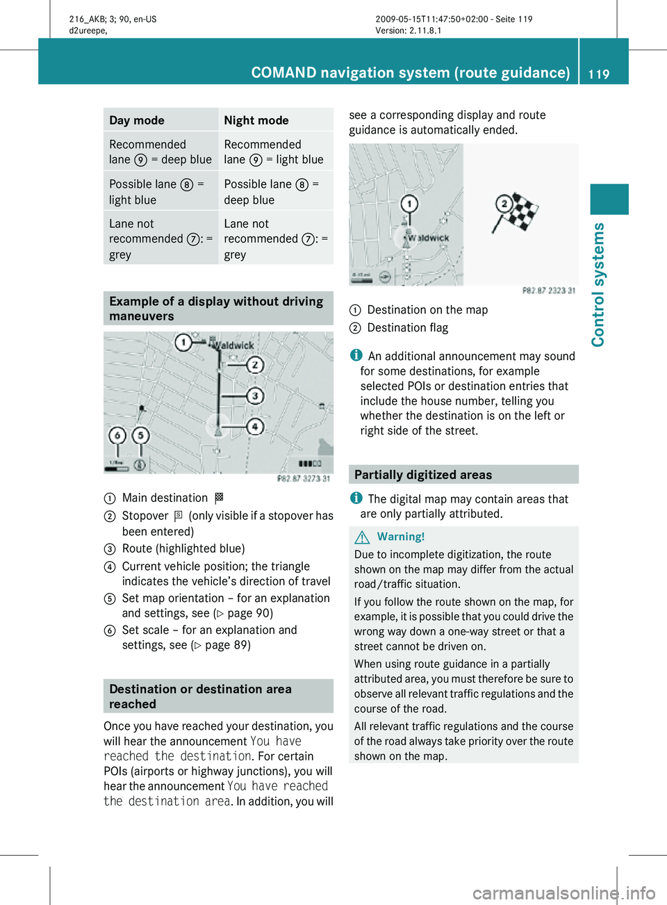
data must be available on the digital map. :
Current vehicle position; the triangle
indicates the driving direction
; Location of next driving maneuver
= Information on direction, intersection,
exit number etc.
? Next driving maneuver: Turn left here
A Distance bar representing the distance to
the next driving maneuver
B Distance to the next driving maneuver
C Lane not recommended
D Possible lane
E Recommended lane COMAND displays the lane
recommendations
C, D and E with regard
to the next two driving maneuvers.
i The instrument cluster also provides lane
recommendations but shows
recommended lanes only.
Explanation of lane recommendations R
Recommended lane E: This lane can be
used to perform the next two driving
maneuvers without changing lanes.
R Possible lane D: This lane can be used to
perform only the next driving maneuver
without changing lanes.
R Lane not recommended C: This lane
cannot be used to perform the next driving
maneuver without changing lanes.
Display of lane recommendation Additional lanes that open during a driving
maneuver are displayed different from each
other:
Display Meaning
With limiting line
below (lane
C) New lane that
opened during a
driving maneuver
Without limiting line
below (lane
D
or E) Through lane
The color of the lane recommendation varies
depending on whether the COMAND display
design is set to day or night:118
COMAND navigation system (route guidance)Control systems
216_AKB; 3; 90, en-US
d2ureepe,
Version: 2.11.8.1 2009-05-15T11:47:50+02:00 - Seite 118
Page 121 of 500
Day mode Night mode
Recommended
lane E = deep blue Recommended
lane E = light blue
Possible lane
D =
light blue Possible lane
D =
deep blue Lane not
recommended
C: =
grey Lane not
recommended
C: =
grey Example of a display without driving
maneuvers
:
Main destination O
; Stopover P (only visible if a stopover has
been entered)
= Route (highlighted blue)
? Current vehicle position; the triangle
indicates the vehicle’s direction of travel
A Set map orientation – for an explanation
and settings, see (Y page 90)
B Set scale – for an explanation and
settings, see (Y page 89) Destination or destination area
reached
Once you have reached your destination, you
will hear the announcement You have
reached the destination. For certain
POIs (airports or highway junctions), you will
hear the announcement You have reached
the destination area . In addition, you willsee a corresponding display and route
guidance is automatically ended.
:
Destination on the map
; Destination flag
i An additional announcement may sound
for some destinations, for example
selected POIs or destination entries that
include the house number, telling you
whether the destination is on the left or
right side of the street. Partially digitized areas
i The digital map may contain areas that
are only partially attributed. G
Warning!
Due to incomplete digitization, the route
shown on the map may differ from the actual
road/traffic situation.
If you follow the route shown on the map, for
example, it is possible that you could drive the
wrong way down a one-way street or that a
street cannot be driven on.
When using route guidance in a partially
attributed area, you must therefore be sure to
observe all relevant traffic regulations and the
course of the road.
All relevant traffic regulations and the course
of the road always take priority over the route
shown on the map. COMAND navigation system (route guidance)
119Control systems
216_AKB; 3; 90, en-US
d2ureepe,Version: 2.11.8.1 2009-05-15T11:47:50+02:00 - Seite 119 Z
Page 122 of 500
If the destination is within a partially
digitized area
COMAND guides you through fully digitized
areas for as long as possible. Route guidance
is conducted in the usual manner, e.g. with
navigation announcements and route
guidance displays.
Before the vehicle reaches a partially digitized
area, COMAND notifies you of this with the
following announcements:
R
Be prepared to enter an area where
turn by turn guidance cannot be
provided.
R In 700 feet you will enter an area
where turn by turn guidance cannot
be provided.
i The indicated distance can be seen here
by way of example. In reality, it may be
different.
R You are about to enter an area
where turn by turn guidance cannot
be provided.
i When you call up the route info to this
type of destination, ( Y page 123) the
following data shown there may differ from
the actual situation:
R Distance to the destination
R Estimated driving time to the destination
R Estimated arrival time
Route guidance within a partially
digitized area If you start route guidance in this type of area,
you will hear the following announcement:
You are currently in an area where
turn by turn guidance cannot be
provided.
Route guidance is provided by means of a
direction arrow showing the compass
heading to the destination. COMAND will not
generate automatic navigation
announcements. If you try to call up an announcement
manually, (Y page 122) you will hear the
announcement
You are currently in an
area where turn by turn guidance
cannot be provided.
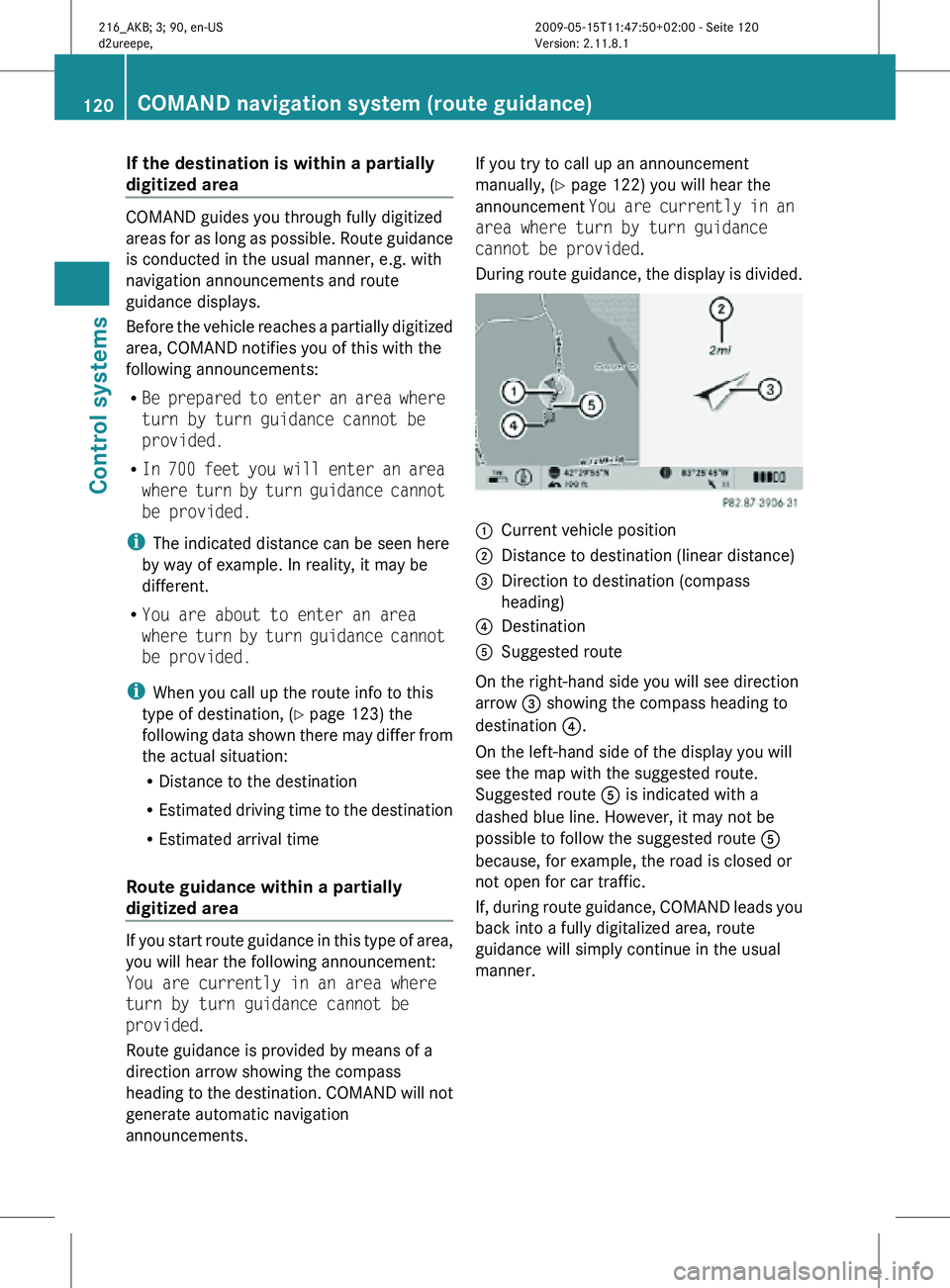
During route guidance, the display is divided. :
Current vehicle position
; Distance to destination (linear distance)
= Direction to destination (compass
heading)
? Destination
A Suggested route
On the right-hand side you will see direction
arrow = showing the compass heading to
destination ?.
On the left-hand side of the display you will
see the map with the suggested route.
Suggested route A is indicated with a
dashed blue line. However, it may not be
possible to follow the suggested route A
because, for example, the road is closed or
not open for car traffic.
If, during route guidance, COMAND leads you
back into a fully digitalized area, route
guidance will simply continue in the usual
manner. 120
COMAND navigation system (route guidance)Control systems
216_AKB; 3; 90, en-US
d2ureepe,
Version: 2.11.8.1 2009-05-15T11:47:50+02:00 - Seite 120
Page 123 of 500
Off-road and off-map
Route guidance to an off-road
destination G
Warning!
The COMAND navigation system may direct
you to off-road routes that your vehicle may
not be capable of traversing through without
damaging your tires, wheels or vehicle. It is
the driver’s sole responsibility to determine
the suitability of the route. Off-road routes
may be of varying conditions and their
appropriateness for use may be affected by
various factors such as time of day, time of
year and immediate weather conditions that
cannot be judged or taken into consideration
by the COMAND system.
COMAND can guide you to destinations
within the area covered by the digital map,
even if a destination is not located at a road
known to the system.
These destinations are shown as off-road
destinations, which you can enter using the
map, for example. In these cases, COMAND
guides you for as long as possible with
navigation announcements and displays on
roads known to the system.
Shortly before you reach the last known the
point to leave the digitized road network, you
will hear the announcement The
destination is nearby. Follow the
arrow on the display.
You will then see an arrow that indicates the
direction to the off-road destination. When
the off-road destination is close to the road,
Area of dest. reached appears in addition
below the arrow.
The section of the route from the last known
point on the map to the off-road destination
is indicated with a dashed line after a certain
length. It simply shows the direction to the
off-road destination without taking account of
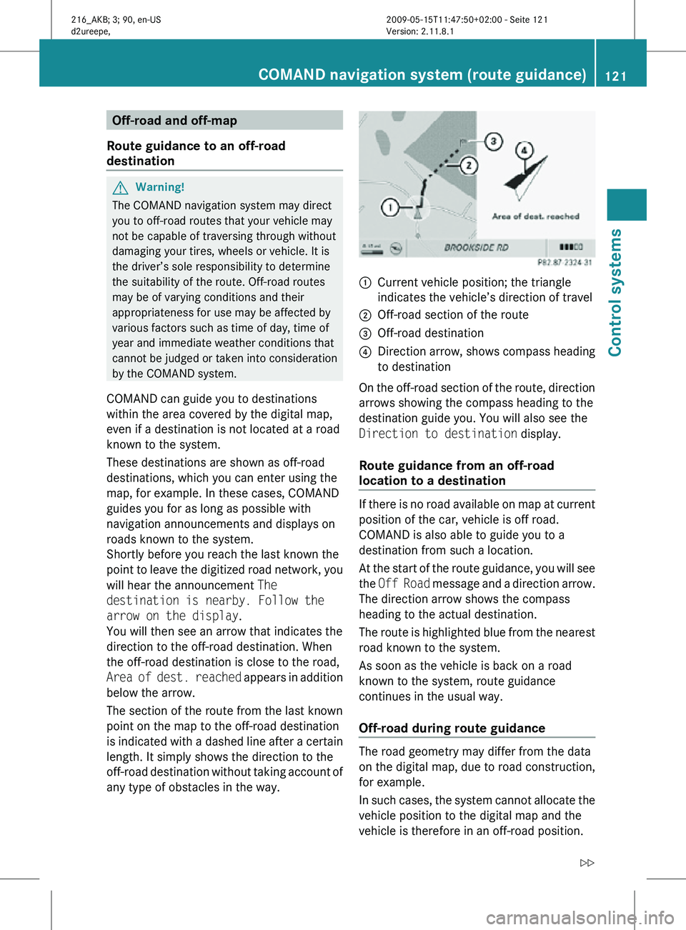
any type of obstacles in the way. :
Current vehicle position; the triangle
indicates the vehicle’s direction of travel
; Off-road section of the route
= Off-road destination
? Direction arrow, shows compass heading
to destination
On the off-road section of the route, direction
arrows showing the compass heading to the
destination guide you. You will also see the
Direction to destination display.
Route guidance from an off-road
location to a destination If there is no road available on map at current
position of the car, vehicle is off road.
COMAND is also able to guide you to a
destination from such a location.
At the start of the route guidance, you will see
the
Off Road message and a direction arrow.
The direction arrow shows the compass
heading to the actual destination.
The route is highlighted blue from the nearest
road known to the system.
As soon as the vehicle is back on a road
known to the system, route guidance
continues in the usual way.
Off-road during route guidance The road geometry may differ from the data
on the digital map, due to road construction,
for example.
In such cases, the system cannot allocate the
vehicle position to the digital map and the
vehicle is therefore in an off-road position.COMAND navigation system (route guidance)
121Control systems
216_AKB; 3; 90, en-US
d2ureepe,Version: 2.11.8.1 2009-05-15T11:47:50+02:00 - Seite 121 Z
Page 124 of 500
The
Off Road
message and an arrow showing
the compass heading to the destination
appear on the display.
As soon as the system can allocate the
vehicle position to the map again, route
guidance continues in the usual way. Navigation announcements
G
Warning!
Navigation announcements are intended to
direct you
while driving without diverting your
attention from the road and driving.
Please always use navigation announcements
instead of consulting the map display for
directions. Consulting the symbols or map
display for directions may cause you to divert
your attention from driving and increase your
risk of an accident.
i If Chinese is set as the system language,
the navigation announcements are in
English. For information on how to set the
system language see ( Y page 81).
Navigation announcements are muted
during telephone calls. You can, however,
call up a current announcement at any
time. You can also call up a current
announcement at any time if you have
missed an announcement.
Route guidance is active already.
X Calling up a current announcement:
Select Navi Q RPT.
or
X Press favorite button h if
the button has
been programmed with this function
(Y page 81). X
Switching off navigation messages:
Press button 8 during an
announcement.
You will see the message The driving
instructions have been muted. for a
short while.
i The announcements remain switched off
even if
you start a new route guidance or if
COMAND is switched off/on with button
u.
If you switch COMAND off by removing the
SmartKey from the starter switch and then
switch the ignition back on after more than
3 minutes, the announcements are
automatically switched back on.
X Switching navigation announcements
back on manually: Select Navi Q RPT.
X Adjusting volume of the messages:
Adjust the volume during an automatic
announcement (
Y page 76).
or
X Call up an announcement manually using
Navi Q RPT and adjust the volume
(Y page 76).
i You can use the function Audio
Fadeout (Y
page 93) to reduce the volume
of audio sources during navigation
announcements. COMAND navigation system (during
route guidance)
Cancel route guidance
X Select Destination Q Cancel Route
Guidance in map view with the menu
system displayed (Y
page 89). Continuing canceled route guidance
X Select Destination Q Continue
Route Guidance in map view with the
menu system displayed (Y
page 89).
COMAND calculates the route. 122
COMAND navigation system (during route guidance)
Control systems
216_AKB; 3; 90, en-US
d2ureepe,
Version: 2.11.8.1 2009-05-15T11:47:50+02:00 - Seite 122
Page 125 of 500

Displaying info
X Select Info in map view with the menu
system displayed ( Y page 89).
The route information appears. Example illustration: Display with main destination
and stopover
:
Distance/estimated time of arrival/
estimated journey time to the stopover
destination
; Stopover destination P
= Street, city and state/province
? Main destination O
A Distance/estimated time of arrival/
estimated journey time to the main
destination
i COMAND uses the time set in COMAND
as the basis for calculating the estimated
arrival time. The clock must be set correctly
in COMAND (Y page 79). The arrival time is
displayed in local vehicle time, based on
the time zone set in the vehicle.
The following data cannot be seen until the
route calculation has been completed:
R Distance to destination
R Estimated arrival time
R Estimated remaining travel time If the destination is located within a
partially digitized area, the following data
may differ from the facts:
R
Distance to destination
R Estimated arrival time
R Estimated remaining travel time Displaying route information
X Select Route Q Route Info in map view
with the menu system displayed
(Y page 89).
The route information appears. :
Information for highlighted portion of
route
; Highlighted portion of route
= Next portion of route
X Closing route info: Select Back and press
W or press back button % in the center
console (Y page 75).
X Displaying next or previous route
section: Select Next or Previous.
X Zooming into or out of route: Select N
or M. Where am I?
You can display your current position while
route guidance is active as well as when route
guidance has been canceled. COMAND navigation system (during route guidance)
123Control systems
216_AKB; 3; 90, en-US
d2ureepe,Version: 2.11.8.1 2009-05-15T11:47:50+02:00 - Seite 123 Z
Page 126 of 500
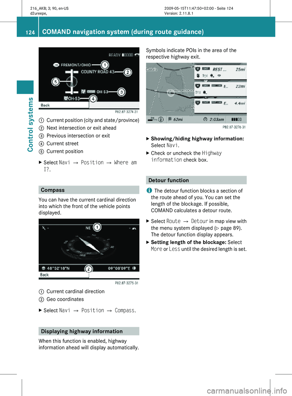
:
Current position (city and state/province)
; Next intersection or exit ahead
= Previous intersection or exit
? Current street
A Current position
X Select Navi Q Position Q Where am
I?. Compass
You can have the current cardinal direction
into which the front of the vehicle points
displayed. :
Current cardinal direction
; Geo coordinates
X Select Navi Q Position Q Compass. Displaying highway information
When this function is enabled, highway
information ahead will display automatically. Symbols indicate POIs in the area of the
respective highway exit.
X
Showing/hiding highway information:
Select Navi.
X Check or uncheck the Highway
information check box. Detour function
i The detour function blocks a section of
the route ahead of you. You can set the
length of the blockage. If possible,
COMAND calculates a detour route.
X Select Route Q Detour in map view with
the menu system displayed (Y page 89).
The detour function display appears.
X Setting length of the blockage: Select
More or Less until the desired length is set. 124
COMAND navigation system (during route guidance)Control systems
216_AKB; 3; 90, en-US
d2ureepe,
Version: 2.11.8.1 2009-05-15T11:47:50+02:00 - Seite 124
Page 127 of 500
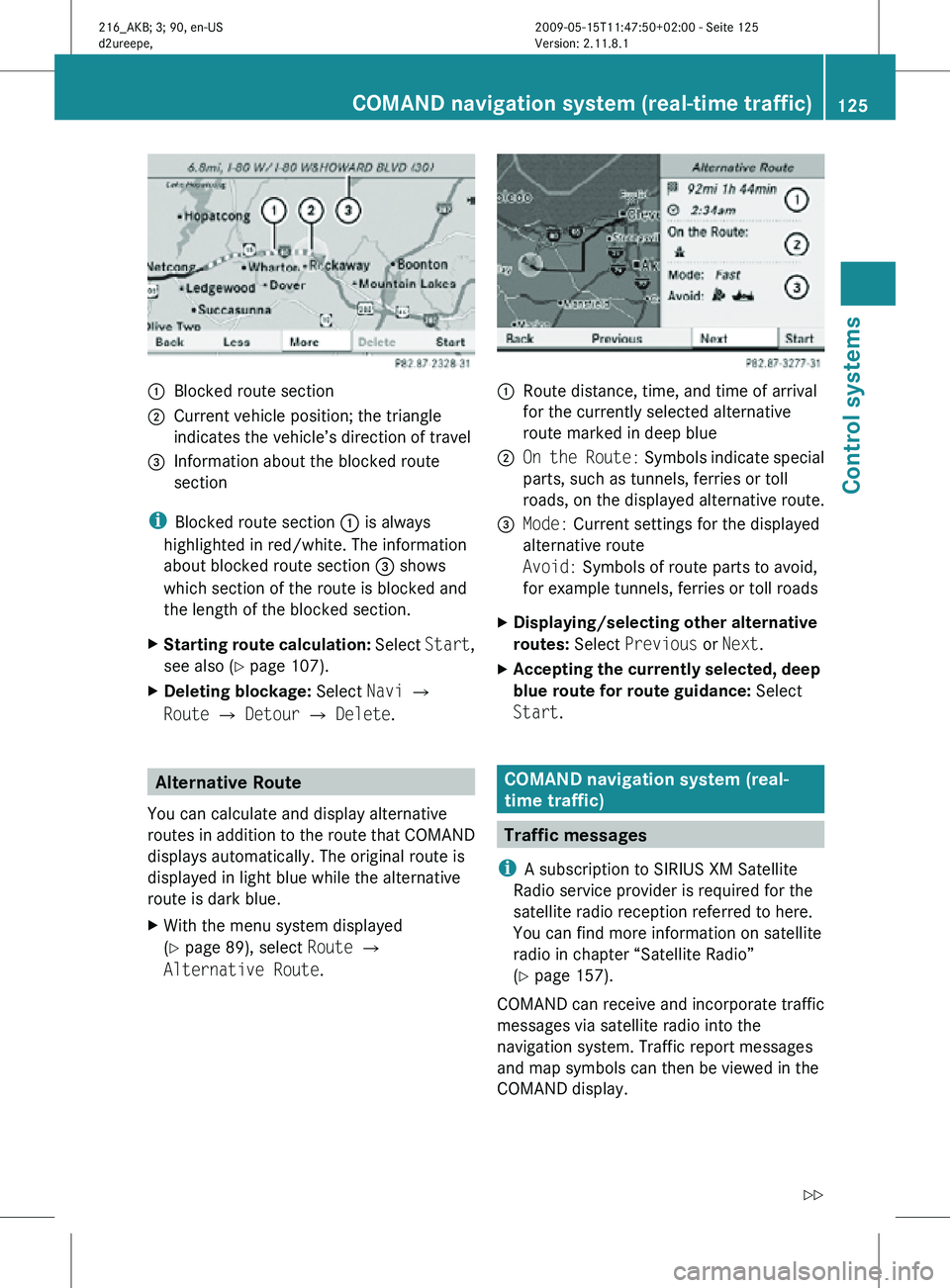
:
Blocked route section
; Current vehicle position; the triangle
indicates the vehicle’s direction of travel
= Information about the blocked route
section
i Blocked route section : is always
highlighted in red/white. The information
about blocked route section = shows
which section of the route is blocked and
the length of the blocked section.
X Starting route calculation: Select Start,
see also ( Y page 107).
X Deleting blockage: Select Navi Q
Route Q Detour Q Delete. Alternative Route
You can calculate and display alternative
routes in addition to the route that COMAND
displays automatically. The original route is
displayed in light blue while the alternative
route is dark blue.
X With the menu system displayed
(Y page 89), select Route Q
Alternative Route. :
Route distance, time, and time of arrival
for the currently selected alternative
route marked in deep blue
; On the Route: Symbols indicate special
parts, such as tunnels, ferries or toll
roads, on the displayed alternative route.
= Mode: Current settings for the displayed
alternative route
Avoid: Symbols of route parts to avoid,
for example tunnels, ferries or toll roads
X Displaying/selecting other alternative
routes: Select Previous or Next.
X Accepting the currently selected, deep
blue route for route guidance: Select
Start. COMAND navigation system (real-
time traffic)
Traffic messages
i A subscription to SIRIUS XM Satellite
Radio service provider is required for the
satellite radio reception referred to here.
You can find more information on satellite
radio in chapter “Satellite Radio”
(Y page 157).
COMAND can receive and incorporate traffic
messages via satellite radio into the
navigation system. Traffic report messages
and map symbols can then be viewed in the
COMAND display. COMAND navigation system (real-time traffic)
125Control systems
216_AKB; 3; 90, en-US
d2ureepe,Version: 2.11.8.1 2009-05-15T11:47:50+02:00 - Seite 125 Z
Page 128 of 500
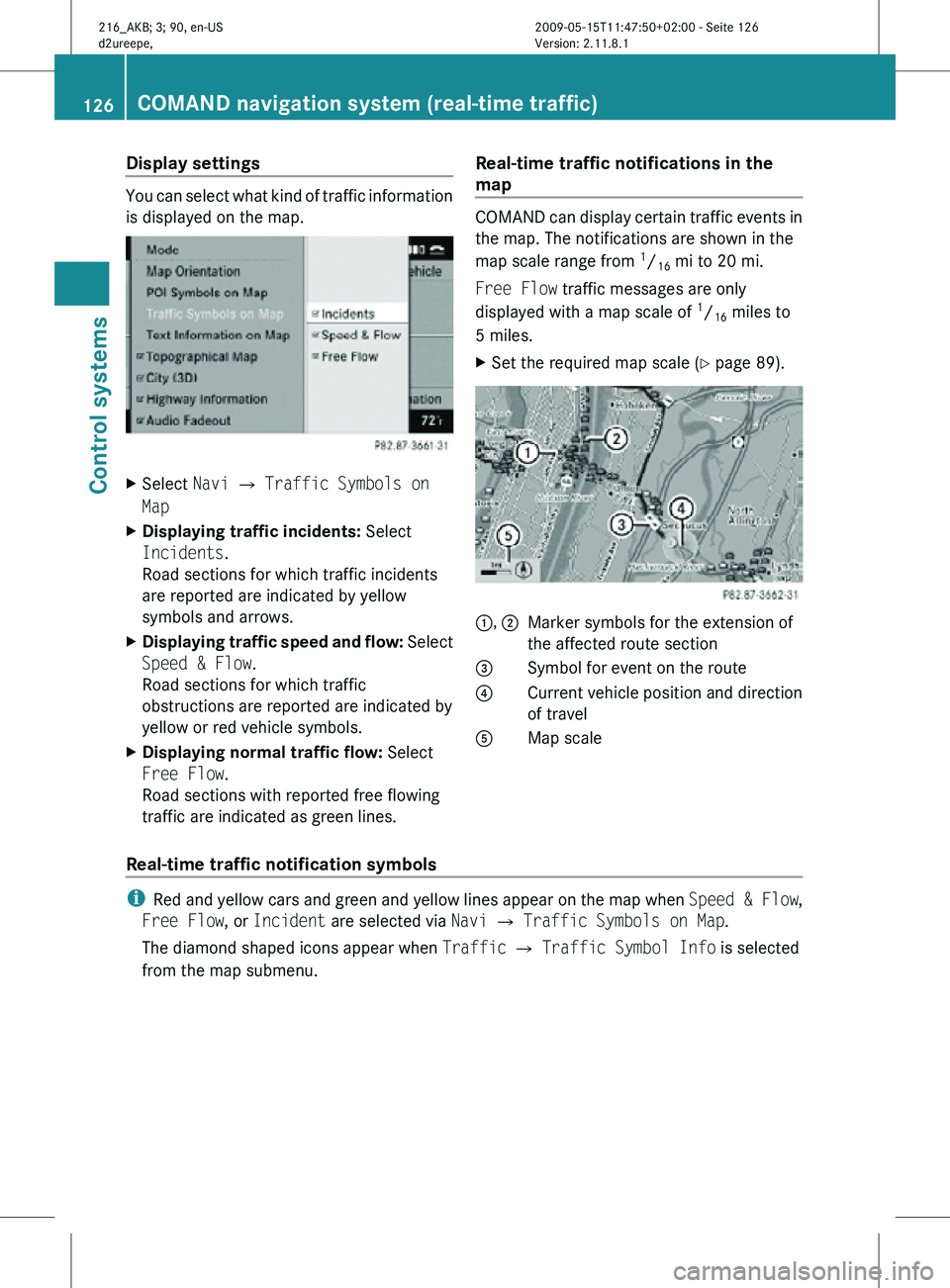
Display settings
You can select what kind of traffic information
is displayed on the map.
X
Select Navi Q Traffic Symbols on
Map
X Displaying traffic incidents: Select
Incidents.
Road sections for which traffic incidents
are reported are indicated by yellow
symbols and arrows.
X Displaying traffic speed and flow: Select
Speed & Flow.
Road sections for which traffic
obstructions are reported are indicated by
yellow or red vehicle symbols.
X Displaying normal traffic flow: Select
Free Flow.
Road sections with reported free flowing
traffic are indicated as green lines. Real-time traffic notifications in the
map COMAND can display certain traffic events in
the map. The notifications are shown in the
map scale range from
1
/ 16 mi to 20 mi.
Free Flow traffic messages are only
displayed with a map scale of 1
/ 16 miles to
5 miles.
X Set the required map scale ( Y page 89). 1, 2
Marker symbols for the extension of
the affected route section
3 Symbol for event on the route
4 Current vehicle position and direction
of travel
A Map scale
Real-time traffic notification symbols i
Red and yellow cars and green and yellow lines appear on the map when Speed & Flow,
Free Flow, or Incident are selected via Navi Q Traffic Symbols on Map.
The diamond shaped icons appear when Traffic Q Traffic Symbol Info is selected
from the map submenu. 126
COMAND navigation system (real-time traffic)Control systems
216_AKB; 3; 90, en-US
d2ureepe,
Version: 2.11.8.1 2009-05-15T11:47:50+02:00 - Seite 126