navigation system MERCEDES-BENZ S-Class 2015 W222 Comand Manual
[x] Cancel search | Manufacturer: MERCEDES-BENZ, Model Year: 2015, Model line: S-Class, Model: MERCEDES-BENZ S-Class 2015 W222Pages: 298, PDF Size: 6.39 MB
Page 103 of 298

Recording the route
General notes When recording the route, bear in mind the
following:
R if the SD memory card is inserted, it must
not removed during recording.
R if route recording is started manually, it
must be finished manually before COMAND is switched off (e .g. when the engine is
switched off).
R COMAND minimizes the number of route
points recorded. Therefore when the
recorded route is subsequently com-
menced, it may differ from the route that
was originally recorded.
Starting/finishing route recording X
Insert the SD memory card (Y page 215).
X To switch to navigation mode: press the
00CB button.
X To show the menu: slide6the control-
ler.
X To select Destination
Destination: turn and press the
controller.
X Select From Memory Card From Memory Card.
X Select Start Route Recording
Start Route Recording .
The route is recorded and REC appears at
the bottom edge of the screen.
X To stop recording, select End Route
End Route
Recording
Recording from the menu.
The route is stored under Personal
Personal
Routes
Routes .
Displaying/editing the recorded route X
Insert the SD memory card (Y page 215).
X To switch to navigation mode: press the
00CB button.
X To show the menu: slide6the control-
ler.
X To select Destination
Destination: turn and press the
controller.
X Select From Memory Card
From Memory Card. X
Select Personal Routes
Personal Routes .
Previously recorded routes are displayed.
X To select Route: turn and press the con-
troller.
The map appears with a menu. The
recorded route is shown on the map in blue.
Starting route calculation
X Select Start Start.
Changing the name and symbol
X Select Edit Edit.
X Select Change Name
Change Name orEdit Icon
Edit Icon.
X To change the name: enter characters
(Y page 36).
X To change symbol: select a symbol.
The symbol is saved. Route guidance
General notes
For this reason, you must always observe
road and traffic rules and regulations during
your journey. Road and traffic rules and reg-
ulations always have priority over system
driving recommendations.
COMAND calculates the route to the destina- tion without taking account of the following,
for example:
R traffic lights
R stop and yield signs
R merging lanes
R parking or stopping in a no parking/no
stopping zone
R other road and traffic rules and regulations
R narrow bridges
COMAND may give differing navigation com-
mands if the actual street/traffic situation
does not correspond with the digital map's
data. For example, if the road layout or the
direction of a one-way street has been
changed.
For this reason, you must always observe
road and traffic rules and regulations during Route guidance
101Navigation Z
Page 114 of 298
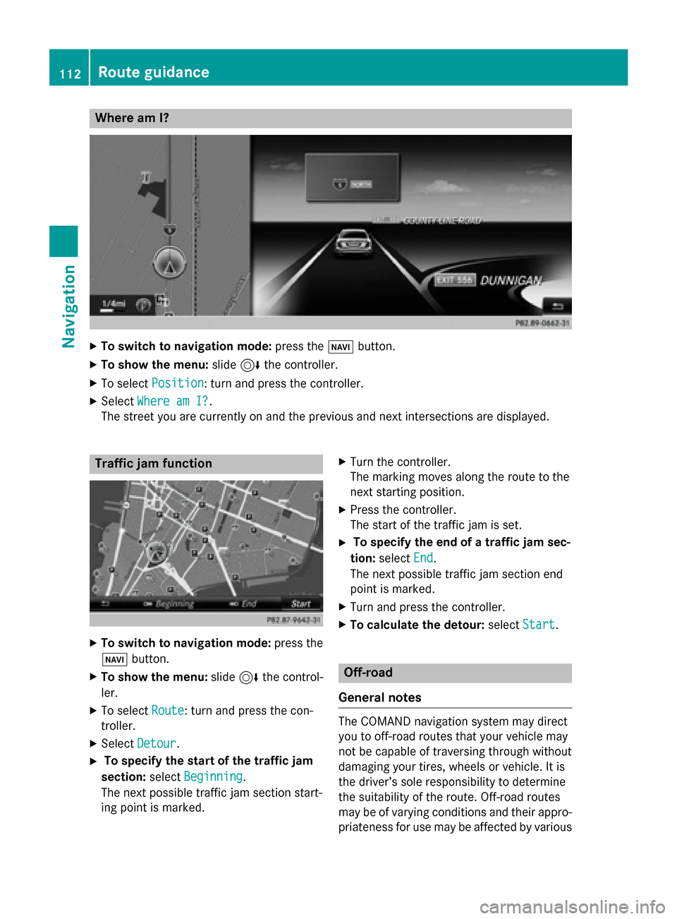
Where am I?
X
To switch to navigation mode: press the00BEbutton.
X To show the menu: slide6the controller.
X To select Position
Position: turn and press the controller.
X Select Where am I?
Where am I?.
The street you are currently on and the previous and next intersections are displayed. Traffic jam function
X
To switch to navigation mode: press the
00BE button.
X To show the menu: slide6the control-
ler.
X To select Route
Route: turn and press the con-
troller.
X Select Detour
Detour.
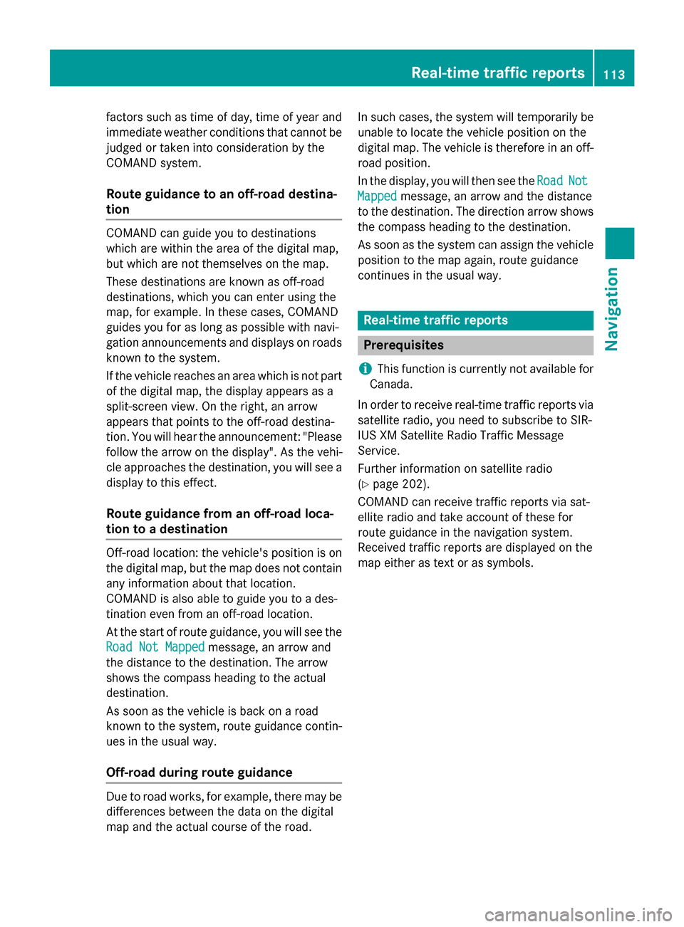
X To specify the start of the traffic jam
section: selectBeginning
Beginning.
The next possible traffic jam section start-
ing point is marked. X
Turn the controller.
The marking moves along the route to the
next starting position.
X Press the controller.
The start of the traffic jam is set.
X To specify the end of a traffic jam sec-
tion: select End End.
The next possible traffic jam section end
point is marked.
X Turn and press the controller.
X To calculate the detour: selectStart
Start. Off-road
General notes The COMAND navigation system may direct
you to off-road routes that your vehicle may
not be capable of traversing through without
damaging your tires, wheels or vehicle. It is
the driver’s sole responsibility to determine
the suitability of the route. Off-road routes
may be of varying conditions and their appro- priateness for use may be affected by various 112
Route guidanceNavigation
Page 115 of 298
factors such as time of day, time of year and
immediate weather conditions that cannot be judged or taken into consideration by the
COMAND system.
Route guidance to an off-road destina-
tion COMAND can guide you to destinations
which are within the area of the digital map,
but which are not themselves on the map.
These destinations are known as off-road
destinations, which you can enter using the
map, for example. In these cases, COMAND
guides you for as long as possible with navi-
gation announcements and displays on roads
known to the system.
If the vehicle reaches an area which is not part
of the digital map, the display appears as a
split-screen view. On the right, an arrow
appears that points to the off-road destina-
tion. You will hear the announcement: "Please follow the arrow on the display". As the vehi-
cle approaches the destination, you will see a
display to this effect.
Route guidance from an off-road loca-
tion to a destination Off-road location: the vehicle's position is on
the digital map, but the map does not contain
any information about that location.
COMAND is also able to guide you to a des-
tination even from an off-road location.
At the start of route guidance, you will see the
Road Not Mapped
Road Not Mapped message, an arrow and
the distance to the destination. The arrow
shows the compass heading to the actual
destination.
As soon as the vehicle is back on a road
known to the system, route guidance contin- ues in the usual way.
Off-road during route guidance Due to road works, for example, there may be
differences between the data on the digital
map and the actual course of the road. In such cases, the system will temporarily be
unable to locate the vehicle position on the
digital map. The vehicle is therefore in an off- road position.
In the display, you will then see the Road
Road Not Not
Mapped
Mapped message, an arrow and the distance
to the destination. The direction arrow shows
the compass heading to the destination.
As soon as the system can assign the vehicle
position to the map again, route guidance
continues in the usual way. Real-time traffic reports
Prerequisites
i This function is currently not available for
Canada.
In order to receive real-time traffic reports via satellite radio, you need to subscribe to SIR-
IUS XM Satellite Radio Traffic Message
Service.
Further information on satellite radio
(Y page 202).
COMAND can receive traffic reports via sat-
ellite radio and take account of these for
route guidance in the navigation system.
Received traffic reports are displayed on the
map either as text or as symbols. Real-time traffic reports
113Navigation Z
Page 122 of 298
Map functions
General notes
Company logos displayed on the map are trademarks of the respective companies and used
solely for the purpose of indicating the locations of these companies. The use of such logos on
the map does not indicate approval of, support of or advertising by these companies for the
navigation system itself. Map settings
Setting the map scale Requirement: the map is in full screen mode, the menu is faded out (Y
page 78).
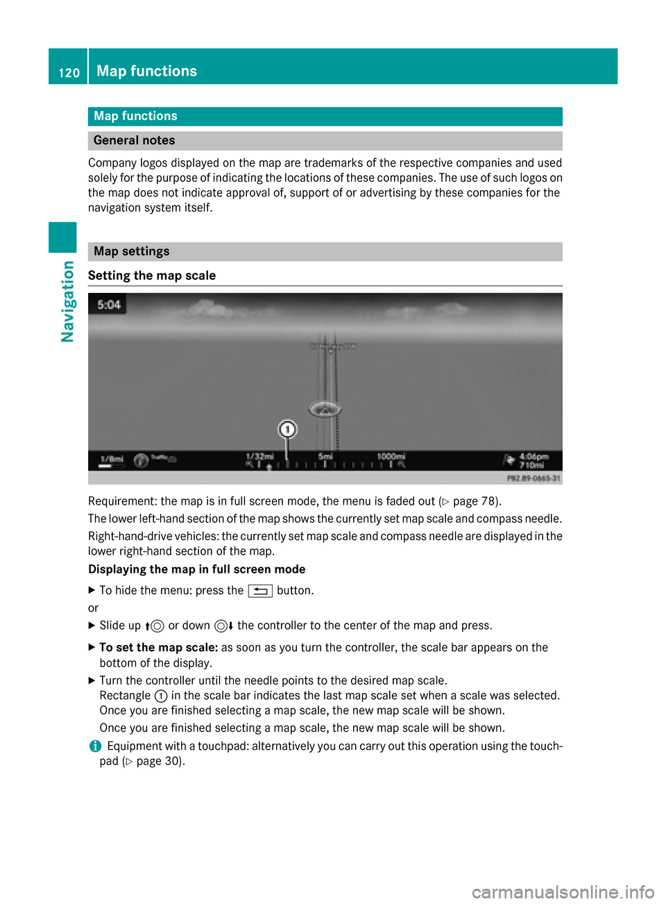
The lower left-hand section of the map shows the currently set map scale and compass needle. Right-hand-drive vehicles: the currently set map scale and compass needle are displayed in the lower right-hand section of the map.
Displaying the map in full screen mode
X To hide the menu: press the 0038button.
or
X Slide up 5or down 6the controller to the center of the map and press.
X To set the map scale: as soon as you turn the controller, the scale bar appears on the
bottom of the display.
X Turn the controller until the needle points to the desired map scale.
Rectangle 0043in the scale bar indicates the last map scale set when a scale was selected.
Once you are finished selecting a map scale, the new map scale will be shown.
Once you are finished selecting a map scale, the new map scale will be shown.
i Equipment with a touchpad: alternatively you can carry out this operation using the touch-
pad (Y page 30). 120
Map functionsNavigation
Page 131 of 298
X
Turn the controller.
The size of the blocked area changes.
X To accept changes: press the controller.
A message appears stating that the area has been set.
Deleting an area: X To select an area: turn the controller.
X Slide 9the controller.
X Select Delete
Delete.
A prompt appears asking whether you wish to delete the area.
X Select Yes
Yes orNo No.
After selecting Yes
Yes, the area is deleted.
Deleting all areas: X Slide 9and press the controller while the list is shown.
X Select Delete All
Delete All.
A prompt appears asking whether you wish to delete all areas.
X Select Yes
Yes orNo
No.
After selecting Yes
Yes, all areas are deleted.
i Equipment with a touchpad: alternatively you can carry out this operation using the touch-
pad (Y page 30). SIRIUS XM service
Displaying SIRIUS XM service informa-
tion You can display the SIRIUS XM service infor-
mation.
X To switch to navigation mode: press the
00BE button.
X To show the menu: press the controller.
X To select Traffic
Traffic: turn and press the con-
troller.
X Select SIRIUS Service
SIRIUS Service.
The window on the right half of the display shows the telephone number of the pro-
vider (SIRIUS XM) and the serial number of
your service module.
i Equipment with a touchpad: alternatively
you can carry out this operation using the
touchpad (Y page 30). Registering for the SIRIUS XM traffic
report service X
Call the provider telephone number shown
on the COMAND display.
i You can also have the satellite service
activated online. To do so, visit the SIRIUS
XM Radio website at
http://www.sirius.com (USA).
Once the connection has been established: X Follow the service employee's instructions.
The activation process may take up to ten
minutes.
If registration is not included when purchas-
ing the system, your credit card details will be required to activate your account. Map functions
129Navigation Z
Page 132 of 298
Updating the digital map
Introduction The digital maps generated by the map soft-
ware become outdated in the same way as
conventional road maps. Optimal route guid-
ance can only be provided by the navigation
system in conjunction with the most up-to-
date map software.
Information about new versions of the digital
map can be obtained from an authorized
Mercedes-Benz Center. You can have the dig-
ital map updated there using a data medium, or you can update it yourself. Navigation functions
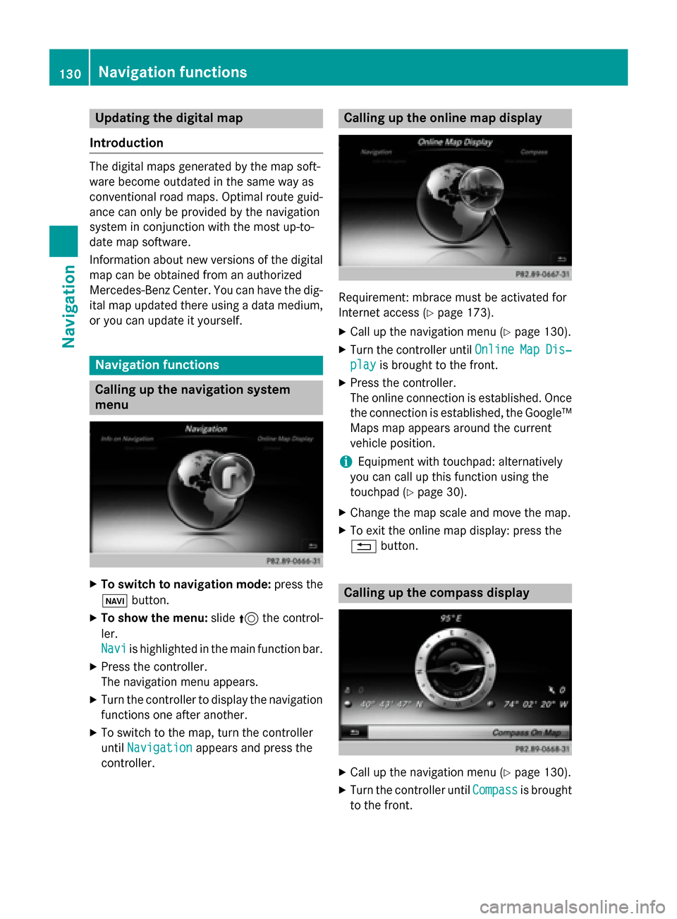
Calling up the navigation system
menu X
To switch to navigation mode: press the
00CB button.
X To show the menu: slide5the control-
ler.
Navi Navi is highlighted in the main function bar.
X Press the controller.
The navigation menu appears.
X Turn the controller to display the navigation
functions one after another.
X To switch to the map, turn the controller
until Navigation
Navigation appears and press the
controller. Calling up the online map display
Requirement: mbrace must be activated for
Internet access (Y
page 173).
X Call up the navigation menu (Y page 130).
X Turn the controller until Online OnlineMap
MapDis‐
Dis‐
play
play is brought to the front.
X Press the controller.
The online connection is established. Once
the connection is established, the Google™ Maps map appears around the current
vehicle position.
i Equipment with touchpad: alternatively
you can call up this function using the
touchpad (Y page 30).
X Change the map scale and move the map.
X To exit the online map display: press the
0038 button. Calling up the compass display
X
Call up the navigation menu (Y page 130).
X Turn the controller until Compass Compassis brought
to the front. 130
Navigation functionsNavigation
Page 134 of 298
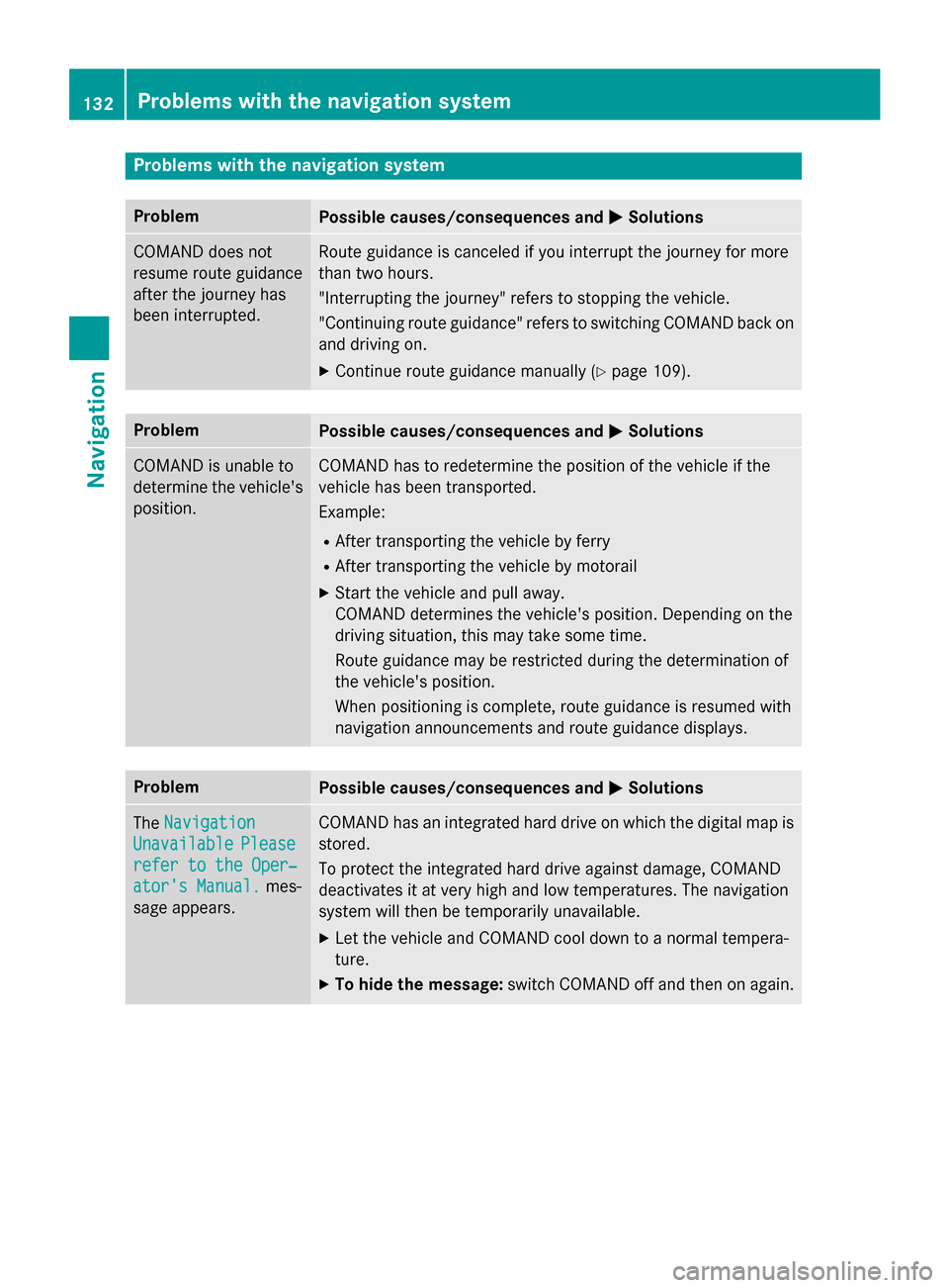
Problems with the navigation system
Problem
Possible causes/consequences and
0050
0050Solutions COMAND does not
resume route guidance
after the journey has
been interrupted. Route guidance is canceled if you interrupt the journey for more
than two hours.
"Interrupting the journey" refers to stopping the vehicle.
"Continuing route guidance" refers to switching COMAND back on
and driving on.
X Continue route guidance manually (Y page 109).Problem
Possible causes/consequences and
0050 0050Solutions COMAND is unable to
determine the vehicle's
position. COMAND has to redetermine the position of the vehicle if the
vehicle has been transported.
Example:
R After transporting the vehicle by ferry
R After transporting the vehicle by motorail
X Start the vehicle and pull away.
COMAND determines the vehicle's position. Depending on the
driving situation, this may take some time.
Route guidance may be restricted during the determination of
the vehicle's position.
When positioning is complete, route guidance is resumed with
navigation announcements and route guidance displays. Problem
Possible causes/consequences and
0050 0050Solutions The
Navigation
Navigation
Unavailable
Unavailable Please
Please
refer to the Oper‐
refer to the Oper‐
ator's Manual. ator's Manual. mes-
sage appears. COMAND has an integrated hard drive on which the digital map is
stored.
To protect the integrated hard drive against damage, COMAND
deactivates it at very high and low temperatures. The navigation
system will then be temporarily unavailable.
X Let the vehicle and COMAND cool down to a normal tempera-
ture.
X To hide the message: switch COMAND off and then on again.132
Problems with the navigation systemNavigation
Page 135 of 298
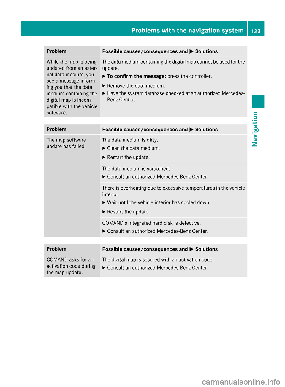
Problem
Possible causes/consequences and
0050
0050Solutions While the map is being
updated from an exter-
nal data medium, you
see a message inform-
ing you that the data
medium containing the
digital map is incom-
patible with the vehicle
software. The data medium containing the digital map cannot be used for the
update.
X To confirm the message: press the controller.
X Remove the data medium.
X Have the system database checked at an authorized Mercedes-
Benz Center. Problem
Possible causes/consequences and
0050 0050Solutions The map software
update has failed. The data medium is dirty.
X Clean the data medium.
X Restart the update. The data medium is scratched.
X Consult an authorized Mercedes-Benz Center. There is overheating due to excessive temperatures in the vehicle
interior.
X Wait until the vehicle interior has cooled down.
X Restart the update. COMAND's integrated hard disk is defective.
X Consult an authorized Mercedes-Benz Center. Problem
Possible causes/consequences and
0050 0050Solutions COMAND asks for an
activation code during
the map update. The digital map is secured with an activation code.
X Consult an authorized Mercedes-Benz Center. Problems with the navigation system
133Navigation Z
Page 184 of 298
tion number. Further information about the
vehicle identification number (VIN)
(Y page 184).
To download navigation locations, the
mbrace system must be:
R activated
R operational
R activated for the services of the system and
for Internet access
For information on the mbrace system, see
the separate vehicle Operator's Manual. Procedure and general information
Sign into your Google™ account on the Inter- net. Use the Google™ Maps website to send
the destination to a server (Y page 182).
Using the Download Download POI
POIApp, the destination
is displayed in the vehicle (Y page 182).
The destination can be:
R imported (Y page 183)
R used for route guidance (Y page 183)
R called up (Y page 183)
R deleted from the server (Y page 184)Sending destinations to the server
X Sign into your Google™ account.
X Call up the Google™ Maps website.
X Enter a destination.
X Click "More" at the destination.
X Click "Send".
X Enter the corresponding information in the
boxes shown.
X Select "Send to car".
X Select Mercedes-Benz as the vehicle
brand.
X Enter the mbrace e-mail address or the
vehicle identification number.
Further information about the vehicle iden- tification number (Y page 184).
X Click "Send".
The destination is sent to the server. The availability of the destination/route
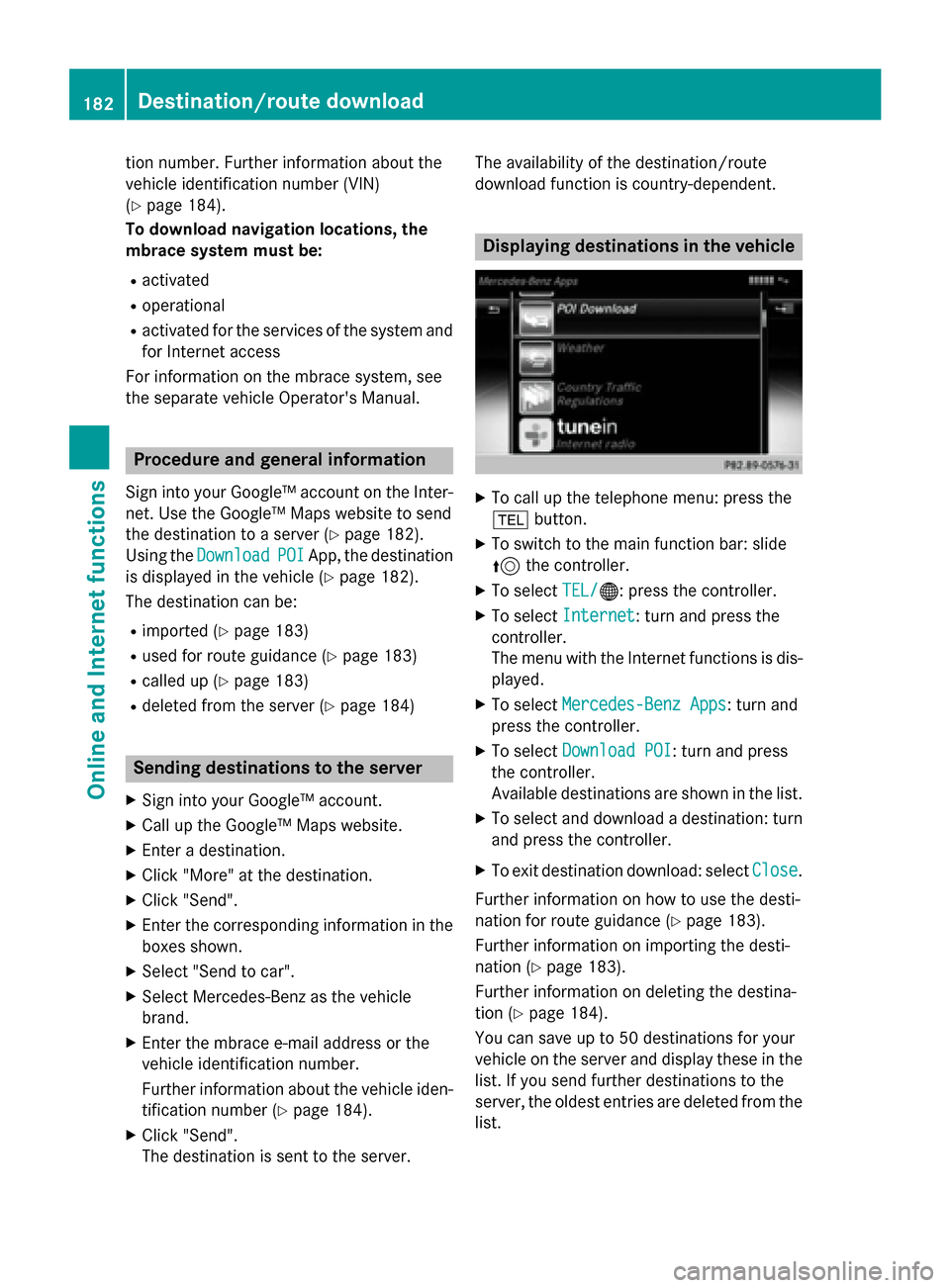
download function is country-dependent. Displaying destinations in the vehicle
X
To call up the telephone menu: press the
002B button.
X To switch to the main function bar: slide
5 the controller.
X To select TEL/ TEL/00A7: press the controller.
X To select Internet
Internet: turn and press the
controller.
The menu with the Internet functions is dis-
played.
X To select Mercedes-Benz Apps Mercedes-Benz Apps: turn and
press the controller.
X To select Download POI
Download POI : turn and press
the controller.
Available destinations are shown in the list.
X To select and download a destination: turn
and press the controller.
X To exit destination download: select Close Close.
Further information on how to use the desti-
nation for route guidance (Y page 183).
Further information on importing the desti-
nation (Y page 183).
Further information on deleting the destina-
tion (Y page 184).
You can save up to 50 destinations for your
vehicle on the server and display these in the list. If you send further destinations to the
server, the oldest entries are deleted from the
list. 182
Destina
tion/route do wnloadOnline and Internet functions
Page 191 of 298
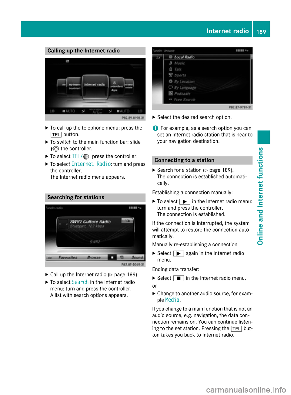
Calling up the Internet radio
X
To call up the telephone menu: press the
002B button.
X To switch to the main function bar: slide
5 the controller.
X To select TEL/
TEL/00A7: press the controller.
X To select Internet Radio
Internet Radio : turn and press
the controller.
The Internet radio menu appears. Searching for stations
X
Call up the Internet radio (Y page 189).
X To select Search
Search in the Internet radio
menu: turn and press the controller.
A list with search options appears. X
Select the desired search option.
i For example, as a search option you can
set an Internet radio station that is near to your navigation destination. Connecting to a station
X Search for a station (Y page 189).
The connection is established automati-
cally.
Establishing a connection manually: X To select 0065in the Internet radio menu:
turn and press the controller.
The connection is established.
If the connection is interrupted, the system
will attempt to restore the connection auto-
matically.
Manually re-establishing a connection
X Select 0065again in the Internet radio
menu.
Ending data transfer:
X Select 00DBin the Internet radio menu.
or
X Change to another audio source, for exam-
ple Media
Media.
If you change to a main function that is not an
audio source, e.g. navigation, the data con-
nection remains on. You can continue listen-
ing to the set station. Pressing the 002Bbut-
ton takes you back to Internet radio. Internet radio
189Online and Internet functions Z