navigation Seat Leon 5D 2005 RADIO-NAVIGATION MFD2
[x] Cancel search | Manufacturer: SEAT, Model Year: 2005, Model line: Leon 5D, Model: Seat Leon 5D 2005Pages: 50, PDF Size: 2.89 MB
Page 17 of 50
Navigation
16SafetyThe navigation system determines the position of the ve hicle, the direction
and distance and the route to a selected destination w ithout taking traffic
regulations into account. Navigation recommendation s are given as
announcements by the system. Direction arrows ar e also shown on the
screen. The destination is entered when the veh icle is stationary. The route
guidance function is designed for cars and is thus un suitable for larger
commercial vehicles.
WARNING
•
Please observe the laws of road traffic legislation when f ollowing the
recommendations made by your navigation system.
•
Route guidance is subject to constant changes despit e the information
about one-way streets, pedestrian zones etc. stored on the navigation CD.
Information on traffic lights, stop and right of way signs, parking and stop-
ping restrictions as well as lane constrictions is not incl uded in the naviga-
tion system. Traffic signs and legislation always hav e priority over the
recommendations made by the system.
•
Adjust your speed to suit road traffi c conditions and also weather and
visibility conditions. Do not be guided exclusively by the n avigation system
indications and always respect traffic rules.
The navigation CDInserting the navigation CD
– Press the button ⇒page 4, fig. 1 to eject any CD in the
CD slot.
– Remove the CD and insert the navigation CD with the writt en side
facing up. – Push the CD into the slot until the MFD2 radio navigation syst
em
pulls it in. The program stored on the navigation CD is loaded . Do
not remove the navigation CD before the loading proc ess is
finished.
The navigation CD contains a digitalised road map. Th e extent to which small
villages, streets and house numbers are contained on the CD de pends on the
CD version.
The content of the CD is constantly being updat ed. You will receive informa-
tion on new updates at your next SEAT Official Service. Yo u will need a new
navigation CD for every country that you travel to.
Note
If the text CD ?
is displayed in the small marking above the /
button, the CD inserted in the CD drive can not be re ad and may be
damaged.General notesYou can continue to listen to the radio or CD (via the CD changer) whilst you
are being guided to your destination.
When entering an address (town, street ) only those letters or symbols which
make up a logical entry depending on th e contents of the navigation CD will
be presented. A list of possible names will be shown. Do not forget to enter
the blank space in names made up of more than one w ord, such as High
Wycombe.
The route will be recalculated if you leave or disregard the route that was orig-
inally calculated. This process takes only a few secon ds.
The last announcement made can be repeated. The volume of a navigation
recommendation can be changed whilst it is being made.
A8
CD6
NAVI
radionaving Seite 16 Mittwoch, 30. März 2005 12 :26 12
Page 18 of 50
Navigation17
A variety of different information on th e route can be called up during active
route guidance. The scroll function can be used to page th rough lists shown
on the screen, either line by line or page by page.
If the display “ Off Road
” appears on the screen, it means you are locate d on
a non-digitalised street, (e.g. on a fa rm track). The GPS satellites will not be
able to reach your antenna when you are in a tunnel or underground garage,
meaning that the unit orientates itself via the wheel sensors. If you try to carry
out a route calculation in this situation you may hear the announcement:
“You are located on a non-digitalised street”. Drive on until the display “Off
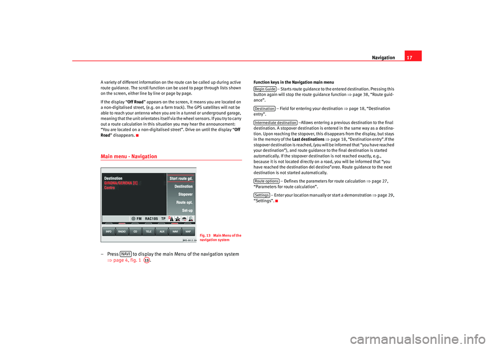
Road ” disappears.Main menu - Navigation– Press to display the main Menu of the navigation sy stem
⇒ page 4, fig. 1 .
Function keys in the Navigation main menu
– Starts route guidance to the entered destinatio n. Pressing this
button again will stop the route guidance function ⇒ page 38, “Route guid-
ance”.
– Field for entering your destination ⇒
page 18, “Destination
entry”.
–Allows entering a previous destination to the fina l
destination. A stopover destination is entered in the sa me way as a destina-
tion. Upon reaching the stopover, this disappears fr om the display, but stays
in the memory of the Last destinations
⇒ page 18, “Destination entry”.If the
stopover destination is reached, (you will be informed that “you have reached
your destination”), and route guidance to the fina l destination is started
automatically. If the stopover destin ation is not reached exactly, e.g.,
because it is not located directly on a road, you will be informed that “you
have reached the destination del destino” area. Route guidance to the next
destination is not started automatically.
– Defines the parameters for route calculation
⇒page 27,
“Parameters for route calculation”.
– Enter your location manually or start a demonstration ⇒
page 29,
“Settings”.
Fig. 13 Main Menu of the
navigation system
NAVI
A13
Begin GuideDestinationIntermediate destinationRoute optionsSettings
radionaving Seite 17 Mittwoch, 30. März 2005 12 :26 12
Page 19 of 50
Navigation
18Destination entryStarting destination entry
Two addresses can be entered for the route calculation; the
address of the destination and the address of the stopover
destination.
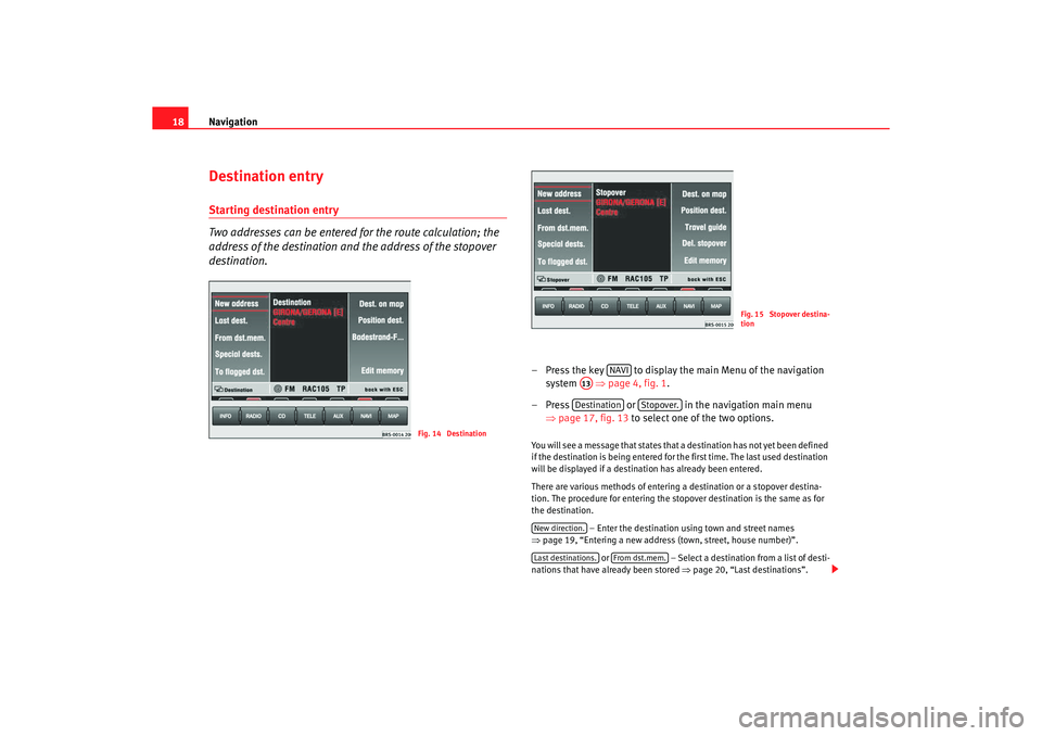
– Press the key to display the main Menu of the nav igation
system ⇒
page 4, fig. 1 .
– Press or in the navigation main menu
⇒ page 17, fig. 13 to select one of the two options. You will see a message that states that a destination h as not yet been defined
if the destination is being entered for the first time . The last used destination
will be displayed if a destination has already be en entered.
There are various methods of entering a destination or a s topover destina-
tion. The procedure for entering the stopover dest ination is the same as for
the destination.
– Enter the destination using town and street names
⇒ page 19, “Entering a new address (town, street, h ouse number)”.
or – Select a destination from a list of desti-
nations that have already been stored ⇒
page 20, “Last destinations”.
Fig. 14 Destination
Fig. 15 Stopover destina-
tion
NAVI
A13Destination
Stopover.
New direction.Last destinations.
From dst.mem.
radionaving Seite 18 Mittwoch, 30. März 2005 12 :26 12
Page 20 of 50
Navigation19
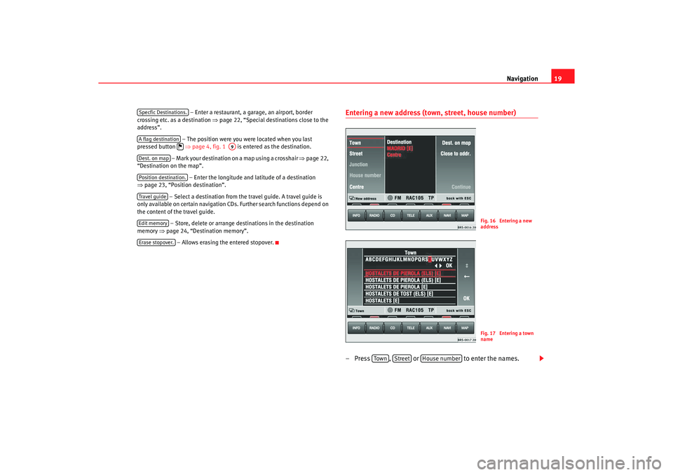
– Enter a restaurant, a garage, an airport, border
crossing etc. as a destination ⇒page 22, “Special destinations close to the
address”.
– The position were you were located when you last
pressed button ⇒
page 4, fig. 1 is entered as the destination.
– Mark your destination on a map using a crosshair ⇒
page 22,
“Destination on the map”.
– Enter the longitude and latitude of a destination
⇒ page 23, “Position destination”.
– Select a destination from the travel guide. A travel guide is
only available on certain navigation CDs. Further se arch functions depend on
the content of the travel guide.
– Store, delete or arrange destinations in the desti nation
memory ⇒
page 24, “Destination memory”.
– Allows erasing the entered stopover.
Entering a new address (town, street, house number)– Press , or to enter the names.
Specfic Destinations.A flag destination
A9
Dest. on mapPosition destination.Travel guideEdit memoryErase stopover.
Fig. 16 Entering a new
addressFig. 17 Entering a town
name
Tow n
Street
House number
radionaving Seite 19 Mittwoch, 30. März 2005 12 :26 12
Page 21 of 50
Navigation
20
– Enter the letters or numbers by turning and pressing the me nu
knob.
– A list of names or numbers is seen on the lower part of the screen. Press to go to the list.
– Select a name from the list by turning and pushing the menu
knob. You can scroll through several pages of the list u sing the
scroll markers , , and and confirm your selection by
pressing .
– Press to select a special destination close to
the destination address (town, str eet etc.) that you have already
entered. and mark characters and deleted characters.
will display language-specific characters as necessary.
The term “Town” is used regardless of how many peopl e live there. Both a
village of 100 inhabitants and a city with 1 million are named as towns. A list
of names to choose from will appear for town name s which are used more
than once. The system will automatically switch to str eet entry after town
entry and then to house number entry. The centre of the town will be offered
as a destination if the town is so small that none of the streets have been
digitally mapped.
The keys and will not be active if a town name has not
been entered.
Note
Enter an intersection and house number as described.
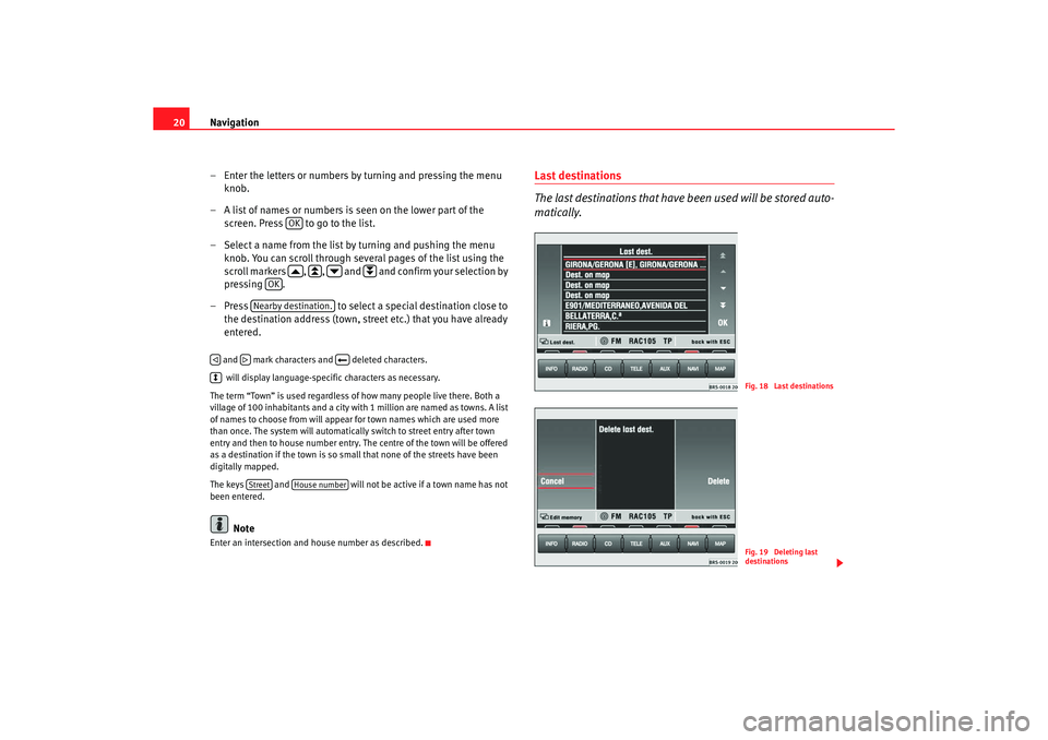
Last destinations
The last destinations that have been used will be stored auto-
matically.
OK
OK
Nearby destination.
Street
House number
Fig. 18 Last destinationsFig. 19 Deleting last
destinations
radionaving Seite 20 Mittwoch, 30. März 2005 12 :26 12
Page 22 of 50
Navigation21
Making a selection from the last destinations
–Press ⇒page 18, fig. 14 to make a selection
from the list of the last destinations stored ⇒
page 18.
–Turn the menu knob to make a sele ction from the list of the last
used destinations ⇒
page 20, fig. 18 . Press to make an
address fully visible, if it cannot be read fully.
– Press the menu knob to select the address marked in red . The
Navigation main menu will appear with your selected address
after a few seconds.
Deleting the list of last destinations
– Starting in the Navigation main menu ⇒
page 17, fig. 13 press
the following function keys in the order indicated: ,
and .
– Select or when confirmation is asked for. If you
select , all
of the last destinations, including the current
destination, will be deleted.
The addresses collected in the Last dest.
memory can only be deleted all at
once, not individually.
A total of 14 last destinations can be st ored in the memory. A destination will
not be stored in Last dest. until route guidance has started. If you are not able
to store any more destinations, the destination memor y is full. Delete either
the last destinations memory or destinations fr om the destination memory
⇒ page 26.
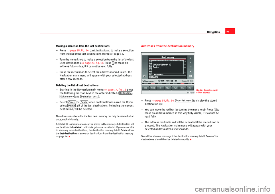
Addresses from the destination memory– Press ⇒
page 18, fig. 14 to display the stored
destination list.
– You can move the red bar ,by turning the menu knob. Press to
make an address marked in this way fully visible, if it cannot be
read fully.
– The address marked in red will be activated if the menu knob is
pressed. The Navigation main menu will appear with your
selected address after a few seconds.You will be shown a message if the dest ination memory is full. Some of the
destinations should then be deleted manually.
Last destinations.
Destination
Edit memory
Delete last dest.
Cancel
Delete
Delete
Fig. 20 Complete desti-
nation address
From dst.mem.
radionaving Seite 21 Mittwoch, 30. März 2005 12 :26 12
Page 23 of 50
Navigation
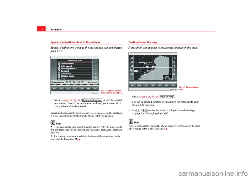
22Special destinations close to the address
Special destinations close to the destination can be selected
from a list.– Press ⇒
page 19, fig. 16 to select a special
destination close to the destination address (town, street etc.)
that you have already entered.Special destinations of the same category, e.g. restaur ants, will be displayed
in a list. The nearest destination will be shown in the firs t position.
Note
•
If you have not changed your destination address entry, the area close to
this last destination will be analysed and the spec ial destinations there will
be listed.
•
The type and number of special destinations will be det ermined by the
content of the Navigation CD.
Destination on the map
A crosshair can be used to mark a destination on the map.–Press ⇒
page 18, fig. 14 .
– Use the right-hand function keys to move the crossh air to your
required destination.
– Use or to alter the scale to suit your search strate gy
⇒ page 33, “Changing the scale” .
NoteThe next section of the map will be shown after a few sec onds when the cross-
hair is moved to the side of the screen.
Fig. 21 Special destina-
tions close to the address
Nearby destination.
Fig. 22 Destination on
map
Dest. on map
radionaving Seite 22 Mittwoch, 30. März 2005 12 :26 12
Page 24 of 50
Navigation23
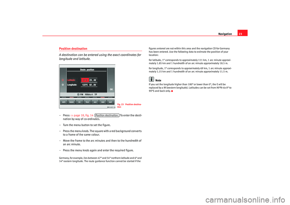
Position destination
A destination can be entered using the exact coordinates for
longitude and latitude.–Press ⇒
page 18, fig. 14 To e nte r t h e dest i -
nation by way of co-ordinates.
– Turn the menu button to set the figure.
– Press the menu knob. The square with a red background c onverts
to a frame of the same colour.
– Move the frame to the arc minute s and then to the hundredth of
an arc minute.
– Press the menu knob again and enter the required figure.Germany, for example, lies between 47° and 54° northern latitude and 6° and
14° eastern longitude. The route guidance function c annot be started if the figures entered are not within this area and the navigation CD f
or Germany
has been entered. Use the following data to estima te the position of your
location:
for latitude, 1° corresponds to approximately 111 km, 1 a rc minute approxi-
mately 1.85 km and 1 hundredth of an arc minute approximately 18.5 m.
for longitude, 1° corresponds to approximately 69 km, 1 a rc minute approxi-
mately 1.15 km and 1 hundredth of an arc minute ap proximately 11.5 m.
Note
If you set the longitude higher than
180° or lower than 0°, the E will be
replaced by a W (western longitude). Latitudes can be set from 90°N via 0° to
90°S and back only.
Fig. 23 Position destina-
tion
Position destination.
radionaving Seite 23 Mittwoch, 30. März 2005 12 :26 12
Page 25 of 50
Navigation
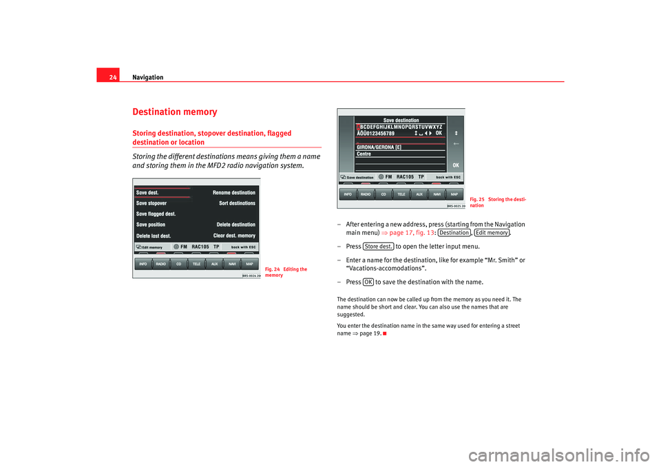
24Destination memoryStoring destination, stopover destination, flagged destination or location
Storing the different destinations means giving them a name
and storing them in the MFD2 radio navigation system.
– After entering a new address, press (starting from the Nav igation
main menu) ⇒ page 17, fig. 13: , .
– Press to open the letter input menu.
– Enter a name for the destination, like for example “Mr. Sm ith” or
“Vacations-accomodations”.
– Press to save the destination with the name.The destination can now be called up from the memor y as you need it. The
name should be short and clear. You can also use th e names that are
suggested.
You enter the destination name in the same way u sed for entering a street
name ⇒
page 19.
Fig. 24 Editing the
memory
Fig. 25 Storing the desti-
nation
Destination
Edit memory
Store dest.OK
radionaving Seite 24 Mittwoch, 30. März 2005 12 :26 12
Page 26 of 50
Navigation25
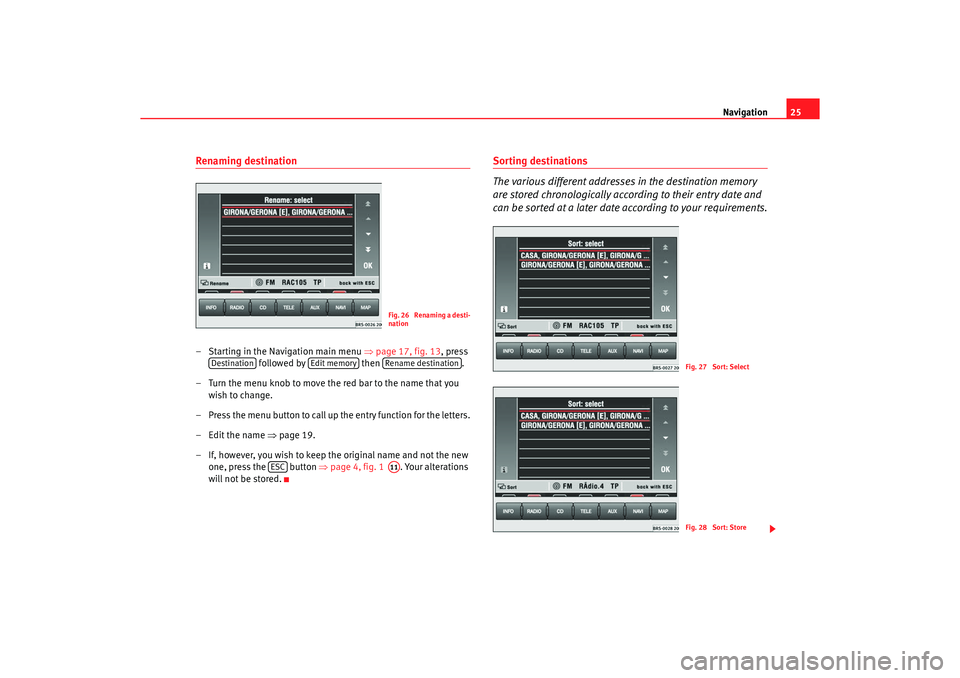
Renaming destination– Starting in the Navigation main menu ⇒
page 17, fig. 13 , press
followed by then .
– Turn the menu knob to move the red bar to the name that you
wish to change.
– Press the menu button to call up the entry function for the lett ers.
– Edit the name ⇒
page 19.
– If, however, you wish to keep the original name and n ot the new
one, press the button ⇒
page 4, fig. 1 . Your alterations
will not be stored.
Sorting destinations
The various different addresses in the destination memory
are stored chronologically according to their entry date and
can be sorted at a later date according to your requirements.
Fig. 26 Renaming a desti-
nation
Destination
Edit memory
Rename destination
ESC
A11
Fig. 27 Sort: SelectFig. 28 Sort: Store
radionaving Seite 25 Mittwoch, 30. März 2005 12 :26 12