radio Seat Toledo 2007 RADIO-NAVIGATION MFD2
[x] Cancel search | Manufacturer: SEAT, Model Year: 2007, Model line: Toledo, Model: Seat Toledo 2007Pages: 63, PDF Size: 2.89 MB
Page 25 of 63
USB* Connection
22
Disconnecting the memory stick
– Change the input device, for example from CD to radio FM.
– Then disconnect the memory stick or the extension cable from the USB port ⇒.Once the device is connected the songs stored can be played using the car
radio fitted.
WARNING
Please keep your attention on driving as a priority!•
Adjust the volume so that external noise can be heard at all times, such
as police, fire and emergency services sirens.
•
Never remove the memory stick or MP3 player when driving.Caution
•
The temperature range of the Memory stick and MP3 is limited and is
normally between 0° and 40°C. Therefore, do not leave it in the vehicle for
long.
•
Never connect the MP3 player directly into the USB port, as it may be
damaged. Always use an extension cable.
•
Never disconnect the device while USB port (CD) is selected as source.
The device may be damaged.
•
The USB port is only for connectiing a memory stick or MP3 player. Hard
disks or USB hubs etc. cannot be connected
•
The maximum voltage of the the memory stick or MP3 should not exceed
2.5 watts (500mA/5V)
•
Never insert metal objects into the USB port, as it may shortcircuit.
Note
•
The memory stick, the MP3 player or the USB extension cable are not
standard equipment for your vehicle.
•
If the USB port does not detect the memory stick after 15 seconds, discon-
nect it and reconnect it.
•
In some cases the MP3 must be activa ted to make the connection with the
USB port. Consult the instructions of your MP3 player.
MFD2 ingles Seite 22 Montag, 15. Mai 2006 9:19 09
Page 26 of 63
USB* Connection23
Authorised memory devices and radios
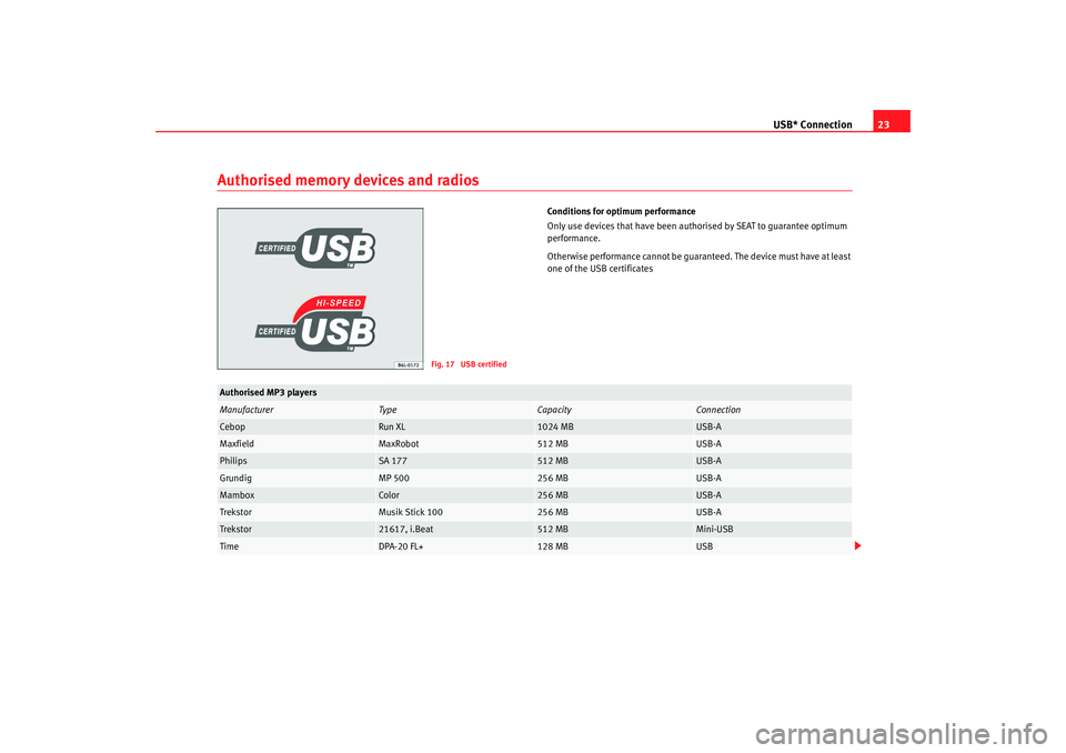
Conditions for optimum performance
Only use devices that have been auth orised by SEAT to guarantee optimum
performance.
Otherwise performance cannot be guaranteed. The device must have at least
one of the USB certificates
Fig. 17 USB certified
Authorised MP3 playersManufacturer
Type
Capacity
Connection
Cebop
Run XL
1024 MB
USB-A
Maxfield
MaxRobot
512 MB
USB-A
Philips
SA 177
512 MB
USB-A
Grundig
MP 500
256 MB
USB-A
Mambox
Color
256 MB
USB-A
Trekstor
Musik Stick 100
256 MB
USB-A
Trekstor
21617, i.Beat
512 MB
Mini-USB
Time
DPA-20 FL+
128 MB
USB
MFD2 ingles Seite 23 Montag, 15. Mai 2006 9:19 09
Page 27 of 63
USB* Connection
24Authorised radio equipment
To guarantee optimum performance your vehicle should have an RCD series
SEAT radio or an RNS series SEAT navigator.
If your vehicle uses other brands we cannot guarantee their performance.
Compatible music formats
The following are the compatible music formats:•
mp3 (MPEG1 Layer3 32 to 320 kbps)
•
wma (8 to 192 kbps)
•
wav (sample frequency: 16 kHz with 16 bit coding, stereo)
•
ogg vorbis (to q10, 48 kHz, stereo)
DRM formats are not supported.Caution
Never store vital data in the memory stick or MP3 player SEAT will not accept
any responsibility for data or files that are corrupted or lost.
Note
If unauthorised memory sticks or MP 3 players are used, the music may not
play, or play poorly
Authorised memory sticksManufacturer
Ty pe
Capacity
Connection
Blue Pearl
CnMemory
64 MB
USB-A
Buffalo
Firestix
2 GB
USB-A
Lexar Media
JumpDrive
128 MB
USB-A
LG
Mirror USB Drive
128 MB
USB-A
Silver Pearl
Micro X
1024 MB
USB-A
Pretec
I-Disk Tiny 2.0
128 MB
USB-A
MFD2 ingles Seite 24 Montag, 15. Mai 2006 9:19 09
Page 28 of 63
USB* Connection25
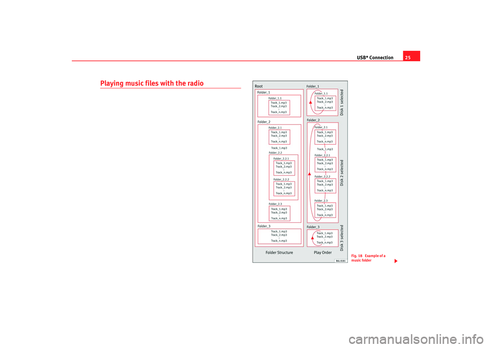
Playing music files with the radio
Fig. 18 Example of a
music folder
MFD2 ingles Seite 25 Montag, 15. Mai 2006 9:19 09
Page 29 of 63
USB* Connection
26As many as 99 tracks can be shown, although all those contained in the
folder can be played
A title with three figures will not show the hundreds on the screen, only the
last two.
The music can be controlled via the radio keys. Choosing and playing songs,
fast forward and rewind and random playback are described in the radio
manual of your vehicle.
If there are folders in the root director y individual files will not be played, so
all data in the root directory should be in folders
Storing files in a memory stick or MP3 player
Store files in folders instead of using th e root directory of the memory stick or
player. In this way the songs can be st ored in order (eg all the songs in a
certain style in the same folder).
The function keys to of the radio can only select the first 5 folders.
If there are more than 6 folders in the memory stick or MP3 player their
content cannot be played.
The folders can be subdivided into subfolders eg different albums by an
artist.
Example of a music folder structure:
Playback of music via USB connection
Connect the memory stick or MP3 player with the USB extension cable to the
USB port.
The screen will show the first 6 folders detected by the USB port, displayed as
CD 1 to CD 6 . Folders without music files will not be included.
If there are more than 6 music folders in the device, the exact number of
folders can be shown using the CD options. If the music files are not classified into
folders, but stored directly in the root
directory, the radio will read the files and play them in the same order. The
display then shows CD 1.
Music files and folders will be played in alphabetical order, so files begin-
niing woth numbers will be selected first, before those with letters. A file with
the name 1XXXXXXXX will be played before another with the name AAAAAA.
Screen indications
When selecting a music file with the CD keys, it appears iin the radio equip-
ment screen Track 1 .
As many as 99 tracks can be shown.
WARNING
Please keep your attention on driving as a priority!•
Adjust the volume so that external no ise can be heard at all times, such
as police, fire and emergency services sirens.
•
Never remove the memory stick or MP3 player when driving.Note
•
Before turning off the engine, the USB port memorises the position of the
song playing As long as the content is not changed, the system will start
again from this point.
•
If many songs are skipped, there may be a delay during playback.
•
The detection of the memory stick or MP3 playere requires a few seconds
depending on the type of memory used.
•
The title of the song is not shown on the screen.
CD 1
CD 6
MFD2 ingles Seite 26 Montag, 15. Mai 2006 9:19 09
Page 30 of 63
Navigation27
Navigation OverviewHow does the navigation system work, and how is it operated?
An optimal route is defined us ing sensors, satellites and
traffic reports and the driver is then guided to his or her desti-
nation.The current vehicle position is determined using a system of satellites (GPS -
Global Positioning System). Sensors in the vehicle measure distances that
have been driven. Measured values are compared using the detailed map
material on the navigation CD and corrected with the assistance of TMC traffic
announcements as necessary. An optimal route to the destination is deter-
mined in this way.
Navigation announcements and direction arrows shown on the screen and in
the instrument panel* guide you safely and conveniently to your destination.
You can drive to a given address in towns you are unfamiliar with, or drive to
the nearest garage or be guided to a hotel.
In this chapter, answers can be found to the following questions:•
What rules do I have to keep to when using the navigation system?
⇒ page 27, “Safety”
•
How do I use the navigation CD? ⇒page 28, “The navigation CD”
•
Can I listen to music when using the navigation system? ⇒ page 28,
“General notes”
•
What happens if I leave the recommended route? ⇒page 28, “General
notes”
•
Can a navigation announcement be repeated? ⇒page 51, “Announce-
ment of navigation recommendations”
•
How does the MFD2 radio navigation system respond when driving in an
underground car park or a tunnel? ⇒page 28, “General notes”
•
How do I enter destinations? ⇒page 30, “Destination entry”
•
How can I enter garages, restaurants or hotels as destinations?
⇒ page 34, “Special destinations close to the address”
•
Can I store destinations in a memory? ⇒ page 36, “Destination memory”
•
What parameters can I set for route calculation? ⇒page 39, “Parameters
for route calculation”
•
What can I see on the screen? ⇒page 44, “Map and symbol displays”
•
Can I stop the destination guide functi on before I reach my destination?
⇒ page 50, “Destination guide”
SafetyThe navigation system determines the position of the vehicle, the direction
and distance and the route to a selected destination without taking traffic
regulations into account. Navigation recommendations are given as
announcements by the system. Direction arrows are also shown on the
screen. The destination is entered when the vehicle is stationary. The desti-
nation guide function is designed for cars and is thus unsuitable for larger
commercial vehicles.
WARNING
•
Please observe the laws of road traffic legislation when following the
recommendations made by your navigation system.
MFD2 ingles Seite 27 Montag, 15. Mai 2006 9:19 09
Page 31 of 63
Navigation
28•
The destination guide is subject to constant changes despite the infor-
mation about one-way streets, pedestrian zones etc. stored on the naviga-
tion CD. Information on traffic lights, stop and right of way signs, parking
and stopping restrictions as well as lane constrictions is not included in
the navigation system. Traffic signs and legislation always have priority
over the recommendations made by the system.
•
Adjust your speed to suit road traffi c conditions and also weather and
visibility conditions. Do not be guided exclusively by the navigation system
indications and always respect traffic rules.
The navigation CDInserting the navigation CD
– Press the button ⇒page 4, fig. 1 to eject any CD in the
CD slot.
– Remove the CD and insert the navigation CD with the written side facing up.
– Push the CD into the slot until the MFD2 radio navigation system pulls it in. The program stored on the navigation CD is loaded. Do
not remove the navigation CD before the loading process is
finished.The navigation CD contains a digitalised road map. The extent to which small
villages, streets and house numbers are contained on the CD depends on the
CD version. The content of the CD is constantly being updated. You will receive informa-
tion on new updates at your next SEAT Official Service. You will need a new
navigation CD for every country that you travel to.
Note
If the text
CD ? is displayed in the small marking above the /
button, the CD inserted in the CD drive cannot be read and may be
damaged.General notesYou can continue to listen to the radio or CD (via the CD changer) whilst you
are being guided to your destination.
When entering an address (town, street ) only those letters or symbols which
make up a logical entry depending on th e contents of the navigation CD will
be presented. A list of possible names will be shown. Do not forget to enter
the blank space in names made up of more than one word, such as Milton
Keynes.
The route will be recalculated if you leave or disregard the route that was orig-
inally calculated. This process takes only a few seconds.
The last voice message can be repeate d. The volume of a navigation recom-
mendation can be changed whilst it is being made.
A variety of different information on the route can be called up during active
route guidance. The scroll function can be used to page through lists shown
on the screen, either line by line or page by page.
If the display “ Off Road” appears on the screen, it means you are located on
a non-digitalised street, e.g. on a farm tr ack. The GPS satellites will not be
able to reach your antenna when you are in a tunnel or underground garage,
meaning that the unit orientates itself via the wheel sensors. If you try to carry
out a route calculation in this situation you may hear the message: “You are
WARNING (continued)
A8
CD6
NAVI
MFD2 ingles Seite 28 Montag, 15. Mai 2006 9:19 09
Page 39 of 63
Navigation
36Destination memoryStoring destination, stopover destination, flagged destination or location
Storing the different destinations means giving them a name
and storing them in the MFD2 radio navigation system.
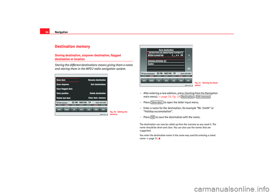
– After entering a new address, press (starting from the Navigation
main menu) ⇒ page 29, fig. 19 , .
– Press to open the letter input menu.
– Enter a name for the destination, for example “Mr. Smith” or “Holiday-accomodation”.
– Press to save the destination with the name.The destination can now be called up from the memory as you need it. The
name should be short and clear. You can also use the names that are
suggested.
You enter the destination name in the same way used for entering a street
name ⇒page 31.
Fig. 30 Editing the
memory
Fig. 31 Storing the desti-
nation
Destination
Edit memory
Store dest.OK
MFD2 ingles Seite 36 Montag, 15. Mai 2006 9:19 09
Page 43 of 63
Navigation
40
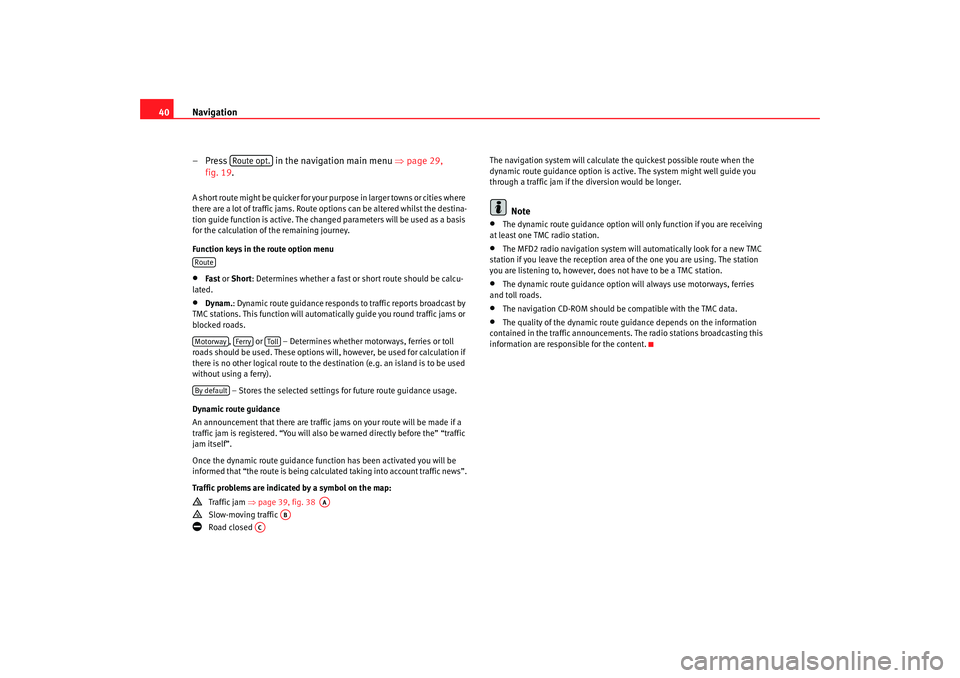
– Press in the navigation main menu ⇒page 29,
fig. 19.A short route might be quicker for your purpose in larger towns or cities where
there are a lot of traffic jams. Route options can be altered whilst the destina-
tion guide function is active. The change d parameters will be used as a basis
for the calculation of the remaining journey.
Function keys in the route option menu•
Fast or Short: Determines whether a fast or short route should be calcu-
lated.
•
Dynam. : Dynamic route guidance responds to traffic reports broadcast by
TMC stations. This function will automatically guide you round traffic jams or
blocked roads.
, or – Determines whether motorways, ferries or toll
roads should be used. These options will, however, be used for calculation if
there is no other logical route to the destination (e.g. an island is to be used
without using a ferry).
– Stores the selected settings for future route guidance usage.
Dynamic route guidance
An announcement that there are traffic jams on your route will be made if a
traffic jam is registered. “You will also be warned directly before the” “traffic
jam itself”.
Once the dynamic route guidance function has been activated you will be
informed that “the route is being calculat ed taking into account traffic news”.
Traffic problems are indicated by a symbol on the map:
Traffic jam ⇒page 39, fig. 38
Slow-moving traffic
Road closed The navigation system will calculate the quickest possible route when the
dynamic route guidance option is active. The system might well guide you
through a traffic jam if the diversion would be longer.
Note
•
The dynamic route guidance option will only function if you are receiving
at least one TMC radio station.
•
The MFD2 radio navigation system will automatically look for a new TMC
station if you leave the re ception area of the one you are using. The station
you are listening to, however, does not have to be a TMC station.
•
The dynamic route guidance option wi ll always use motorways, ferries
and toll roads.
•
The navigation CD-ROM should be compatible with the TMC data.
•
The quality of the dynamic route guidance depends on the information
contained in the traffic announcements. The radio stations broadcasting this
information are responsible for the content.
Route opt.
RouteMotorway
Ferry
Toll
By default
AA
AB
AC
MFD2 ingles Seite 40 Montag, 15. Mai 2006 9:19 09
Page 45 of 63
Navigation
42
– The MFD2 radio navigation system will now travel along the route virtually from start to finish if the route guidance function is
started. You can listen to announcements and look at displays.The navigation system will need some time for an exact definition of your
position if you have transported your vehicle using the train or a ferry. Your
position can be entered manually if the automatic definition is not
successful.
The manual position input can be used to calculate a route between any two
points regardless of where the vehicle is actually located.Manually excluding stretches of the journey
Stretches of the journey ahead and/or parts of the route list
can be blocked manually.
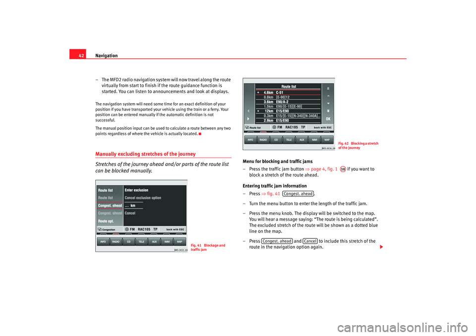
Menu for blocking and traffic jams
– Press the traffic jam button ⇒page 4, fig. 1 if you want to
block a stretch of the route ahead.
Entering traffic jam information
–Press ⇒fig. 41 .
– Turn the menu button to enter the length of the traffic jam.
– Press the menu knob. The display will be switched to the map. You will hear a message saying: “The route is being calculated”.
The excluded stretch of the route will be shown as a dotted blue
line on the map.
– Press and to include this stretch of the
route in the navigation option again.
Fig. 41 Blockage and
traffic jam
Fig. 42 Blocking a stretch
of the journeyA10
Congest. ahead
Congest. ahead
Cancel
MFD2 ingles Seite 42 Montag, 15. Mai 2006 9:19 09