key SKODA OCTAVIA 2008 2.G / (1Z) Amundsen Infotainment Navigation System Manual
[x] Cancel search | Manufacturer: SKODA, Model Year: 2008, Model line: OCTAVIA, Model: SKODA OCTAVIA 2008 2.G / (1Z)Pages: 37, PDF Size: 2.02 MB
Page 24 of 37
Range selector key MEDIA
22
Note•
If an external audio source is connected via AUX, which is equipped with an
adapter for external power supply, it can occur that the audio signal is interrupted.
This depends on the quality of the adapter which is used.
•
The loudspeakers in the vehicle are matched to a power output of the radio of
30°W.
s3lk.book Page 22 Friday, November 7, 2008 11:07 AM
Page 25 of 37
Range selector key NAV (Navigation)23
Range selector key NAV (Navigation)OverviewSafety information regarding the use of the navigation systemThe route is recalculated each time if you ignore driving recommendations or
change the route. This process takes only a few seconds. Driving recommendations
can only then be re-transmitted.
Incomplete navigation data
The navigation system cannot receive any data from GPS satellites if you drive for
longer periods under thick forest canopy or when your vehicle is in a garage, under-
pass or tunnel. In this case, the navigation system orientates itself solely with the
help of the vehicle sensors.
In regions not at all or only partially digitalised and stored as such on the navigation
CD, the navigation system will try to prov ide guidance to the destination. Please
note that under these circumstances the guidance to the destination may not be
completely correct if, for example, one-wa y streets and road categories (motorway,
country road etc.) are not at all or only partially included in the navigation data
used.
WARNING
Always concentrate fully on your drivin g. Inattention by the driver can lead
to accidents and injuries.•
Do not allow yourself to be distracted or loose your concentration, pay
attention to the traffic situation and do not carry out settings or use the radio
navigation system.
•
Only use the radio navigation system if road, weather and traffic situa-
tions permit this and you are not distracted.
•
The various volume settings must be selected in such a way that audible
signals from the outside, su ch as e.g. a Martins horn from police cars and fire
brigade, can be heard at all times.
WARNING
Please observe the legal requirements for road traffic when following the
driving recommendations provided by your radio navigation system.•
The driving recommendations provided may vary from current situa-
tions, e.g. due to road works or out of date navigation data. In such a case,
always observe the traffic regulations and ignore the driving recommenda-
tions.
•
Traffic signs and traffice regulations always have priority over the
driving recommendations provided by the navigation system.
•
Route guidance is subject to constant changes despite the information
about one-way streets, pedestrian zone s etc. stored on the navigation CD.
Information on traffic lights, stop and right of way signs, parking and stop-
ping restrictions as well as lane constrictions and speed restrictions is not
included in the radio navigation system.
•
Adjust your speed to suit weather, road and traffic conditions. Do not
allow the navigation system to make you drive faster in fog – risk of
accident!
GeneralYou can continue to listen to the radi o or play CDs during the route guidance
When entering an address (town, street), only those letters or symbols which make
up a logical entry will be presented. A list of possible names will be shown. Do not
forget to enter the blank space in names made up of more than one word, such as
High Wycombe.
The route will be recalculated if you leave or disregard the route that was originally
calculated. This process takes only a few seconds.
The last voice response can be repeated by pressing the button or the menu
control button . The volume of a navigation recommendation can be changed
whilst it is being made.
A10
s3lk.book Page 23 Friday, November 7, 2008 11:07 AM
Page 26 of 37
Range selector key NAV (Navigation)
24The GPS satellites will not be able to reac h the aerial once you are in a tunnel or
underground garage. The uni t will orientate itself via the wheel sensors.
Note
All dtns. (country-, village-, road-, special destination names) must be entered
including all country specific (or language-spe cific for points of interest) special
characters.Navigation data, navigation CD and memory cardInserting the navigation CD
– Push a navigation CD with the written side facing up as far as possible into the CD case until it is automatically drawn in.
– If you wish to take out the na vigation CD, press the button .
Update navigation data
– If the data of the navigation CD is not identical to the data on the SD
card, a corresponding message will be displayed.
– Press on the function key to overwrite the data stored on the SD card with the data from the navigation CD.
Store the navigation data from the navigation CD onto the memory
card
– Push a navigation CD with the written side facing up as far as possible into the CD case until it is automatically drawn in.
– Push the memory card into the card case .
– Press the range selector key and while in the main menu Navi-
gation , press the range selector key .
– Select the function key using the menu control
button and then press the function keys and .
The navigation data can be stored ei ther on the CD or on the SD card.
If an SD card with navigation data of the same country as on the CD is inserted in
the unit (however the data on the CD corr espond to a newer version), a question is
displayed after inserting the CD asking if the data should be overwritten with the
new version or if only the data of th e CD should be used for navigating.
If an SD card is inserted with the cards of other countries than the card contained
on the CD, a question is displayed asking if the data on the CD should be added
onto the SD card or if only the data of the CD should be used.
You can copy data from several navigation CDs onto an SD card. The navigation
data on the SD card are automatically li nked by the navigation system. For this
reason, we recommend to use an SD card with sufficient memory capacity. A
memory capacity of approx. 4°GB is necess ary in order to copy the navigation data
of Western Europe.
Using the data of a navigation CD for a short period of time
If you only drive for short periods through an area which is not stored on the SD
card, insert the navigation CD for the driven area.
Up to date navigation data and new navigation CD
Road guidance is subject to constant changes (e.g. new streets, changes of street
names and house numbers). A navigation CD is a huge data store, which unfortu-
nately will not be up to date after a certain time. This can lead to complaints during
route guidance.
It is for this reason that you must regula rly update the navigation data on your unit
with a current navigation CD.
Remaining function buttons
The following function buttons are only active if a navigation CD is inserted in the
unit and the memory card contains navigation data.•
- displays information regarding the navigation CD
(area and version number of the navigation CD);
•
- displays information regarding the stored naviga-
tion data and their volume;
•
- opens the menu with whic h you can delete the navi-
gation data on the memory card;
Copy
A12
NAV
SETUP
Navigation data basis
A10
Copy data
Start
Show CD data informationShow SD data informationDelete SD navigation data
s3lk.book Page 24 Friday, November 7, 2008 11:07 AM
Page 27 of 37
Range selector key NAV (Navigation)25
•
- activates the storage of the navigation data from the navigation CD
onto the memory card.
Note
•
Copying a navigation CD ca n last up to one hour, during the copying the navi-
gation functions (route guidance, map disp lay) cannot be used, the mode TRAFFIC
(traffic report) as well as the MP3 play func tion of the SD card are not available. In
the menus Radio and Media , the symbol of the SD card is displayed on the top left
during the copying
.
•
Do not remove the SD card from the unit during the copying of the data from
the navigation CD onto the SD card.
Main menu Navigation
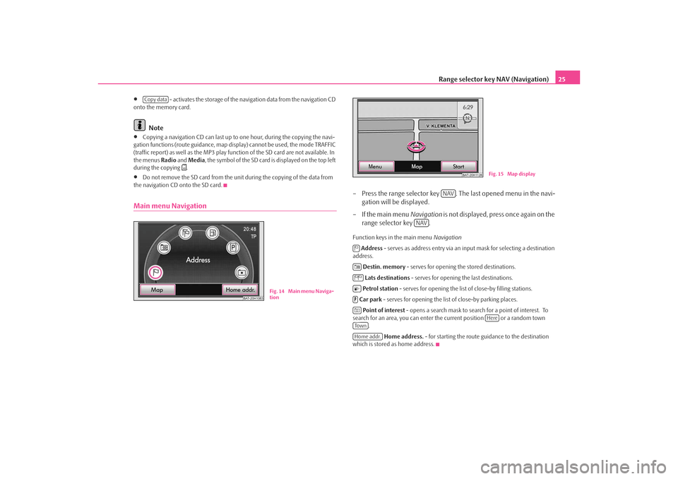
– Press the range selector key . The last opened menu in the navi- gation will be displayed.
– If the main menu Navigation is not displayed, press once again on the
range selector key .Function keys in the main menu Navigation
Address - serves as address entry via an input mask for selecting a destination
address.
Destin. memory - serves for opening the stored destinations.
Lats destinations - serves for opening the last destinations.
Petrol station - serves for opening the list of close-by filling stations.
Car park - serves for opening the list of close-by parking places.
Point of interest - opens a search mask to search for a point of interest. To
search for an area, you can enter the current position or a random town
.
Home address. - for starting the route guidance to the destination
which is stored as home address.
Copy data
BAT-20H1083
Fig. 14 Main menu Naviga-
tion
BAT-20H1128
Fig. 15 Map display
NAV
NAV
Here
To w nHome addr.
s3lk.book Page 25 Friday, November 7, 2008 11:07 AM
Page 28 of 37
Range selector key NAV (Navigation)
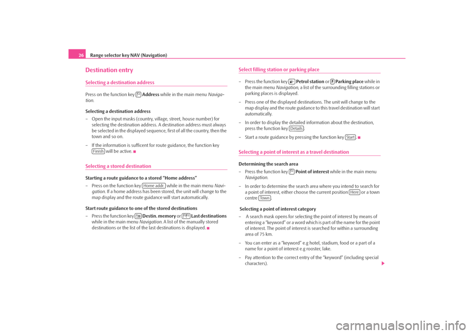
26Destination entrySelecting a destination addressPress on the function key Address while in the main menu Naviga-
tion .
Selecting a destination address
– Open the input masks (country, village, street, house number) for selecting the destination address. A destination address must always
be selected in the displayed sequence, first of all the country, then the
town and so on.
– If the information is sufficent for route guidance, the function key will be active.Selecting a stored destinationStarting a route guidance to a stored “Home address”
– Press on the function key while in the main menu Navi-
gation . If a home address has been stored, the unit will change to the
map display and the route guidance will start automatically.
Start route guidance to one of the stored destinations
– Press the function key Destin. memory or Last destinations
while in the main menu Navigation. A list of the manually stored
destinations or the list of the last destinations is displayed.
Select filling statio n or parking place– Press the function key Petrol station or Parking place while in
the main menu Navigation, a list of the surrounding filling stations or
parking places is displayed.
– Press one of the displayed destinations. The unit will change to the map display and the route guidance to this travel destination will start
automatically.
– In order to display the detailed information about the destination, press the function key .
– Start a route guidance by pressing the function key .Selecting a point of interest as a travel destinationDetermining the search area
– Press the function key Point of interest while in the main menu
Navigation .
– In order to determine the search area where you intend to search for a point of interest, either choose the current position or a town
centre .
Selecting a point of interest category
– A search mask opens for selecting the point of interest by means of entering a “keyword” or a word which is part of the name for the point
of interest. The point of interest is searched for within a surrounding
area of 75 km.
– You can enter as a “keyword” e.g hotel, stadium, food or a part of a name for a point of interest e.g rooster, lake.
– Pay attention to the correct entry of the “keyword” (including special characters).
Finish
Home addr.
Details
Start
Here
To w n
s3lk.book Page 26 Friday, November 7, 2008 11:07 AM
Page 29 of 37
Range selector key NAV (Navigation)27
Starting the search
– If you have completed your entries in the search mask, press on the function key . A pop-up window will open and the search for
the points of interest, which correspond to the entry, will start.
– The surrounding area where the points of interest are searched for is displayed and continues to increase.
– If you press on the function key the search will be terminated without a display.
– From the moment when all the points of interest are found, which correspond to the entered text, they are displayed in the list.
– The search extends up to a distance of approx. 75 km from the entered position. You can interrupt the search of the displayed
distance by pressing the function key .
– When the search has ended, the function key changes to the function key .
Selecting a point of interest from the search results
– Selecting the menu point from the list of the points of interest found, starts the route guidance.
– If several points of interest were found, they will first of all be displayed in a list. At the top of th e list you can find the points of
interest closest to the entered search area (distance and direction
information refer to linear distance).
– If you press the function key , the details for the point of interest are displayed. A route guidance is started after pressing the
function key .
– In the list of the points of interest or in the display of the details for a destination, you can store the point of interest in a destination
memory by pressing the function key .
Destination memoryStore last destinations– Press on the function key Last destinations while in the main
menu Navigation .
– Press one of the displayed destin ations. The unit will change to the
map display and the route guidance to this travel destination will start
automatically.
– If you press the function key , the detailed information for the
destination is displayed.
– If you wish to store a destination, press on the function key .Store destinations in the destination memory– If you press the function key , an input mask for entering the destination name opens.
– After entering the destination name, press the function key .
– If you wish to change the destin ation name, press the function key
and select your own destination name.Edit stored destinations– Press the function key Destin. memory while in the main menu
Navigation . A list of the manually stored destinations in the destina-
tion memory is displayed.
– Press one of the displayed destin ations. The unit will change to the
map display and the route guidance to this travel destination will start
automatically.
Search
Cancel
Stop
Stop
Details
Details
Start
Store
Details
Store
Store
OK
Delete
s3lk.book Page 27 Friday, November 7, 2008 11:07 AM
Page 30 of 37
Range selector key NAV (Navigation)
28
– If you press the function key , the detailed information for the destination is displayed. You can modify the entry here.
– If you wish to change the destination name, select the menu point .
– A route guidance to the displayed destination is started with the func- tion key .
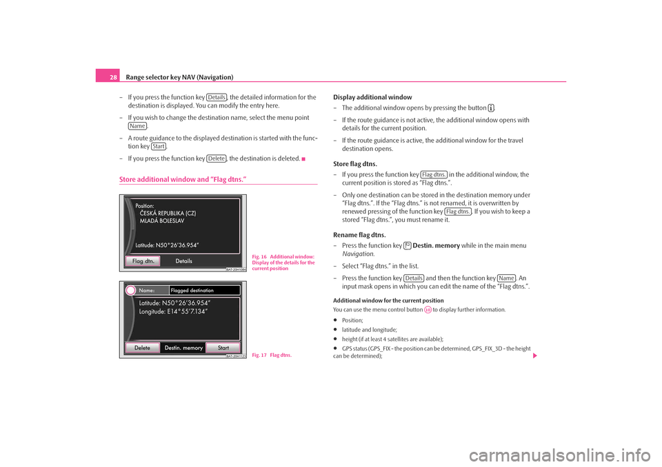
– If you press the function key , the destination is deleted.Store additional window and “Flag dtns.”
Display additional window
– The additional window opens by pressing the button .
– If the route guidance is not active, the additional window opens with details for the current position.
– If the route guidance is active, the additional window for the travel destination opens.
Store flag dtns.
– If you press the function key in the additional window, the
current position is stored as “Flag dtns.”.
– Only one destination can be stored in the destination memory under
“Flag dtns.”. If the “Flag dtns.” is not renamed, it is overwritten by
renewed pressing of the function key . If you wish to keep a
stored “Flag dtns.”, you must rename it.
Rename flag dtns.
– Press the function key Destin. memory while in the main menu
Navigation .
– Select “Flag dtns.” in the list.
– Press the function key and then the function key . An input mask opens in which you can ed it the name of the “Flag dtns.”.Additional window for the current position
You can use the menu control button to display further information.•
Position;
•
latitude and longitude;
•
height (if at least 4 satellites are available);
•
GPS status (GPS_FIX - the position can be determined, GPS_FIX_3D - the height
can be determined);
Details
Name
Start
Delete
BAT-20H1084
Fig. 16 Additional window:
Display of the details for the
current position
BAT-20H1123
Fig. 17 Flag dtns.
Flag dtns.
Flag dtns.
Details
Name
A10
s3lk.book Page 28 Friday, November 7, 2008 11:07 AM
Page 31 of 37
Range selector key NAV (Navigation)29
•
The number of available satellites to be received (the number of available satel-
lites determines the GPS status).
Delete destinations in the destinations memory or in the list of the last destinations– Press the button while in a random menu of the Navigation.
– You can select the function key using the
menu control button .
– In the pop-up window, you can dele te all manually or automatically
stored destinations or only the la st destinations using the function
keys or .Store or edit your home addressStoring the current position as a home address
– Press on the function key while in the main menu Navi-
gation .
– If your home address has not yet been stored, confirm the following
question with the function key .
– Press on the function key and your current position is stored as home address.
Editing a stored home address
– If your home address has already been stored, the automatic route guidance starts after pressing the function key .
– If you wish to change your home address, press the button and then the menu point while in the menu
Navigation .
Route guidanceEntering a stopover destinationIf, in addition to the displayed travel destination, a stopover destination is
added, proceed as follows. The stopover destination can only be entered
when starting the route guidance.
– Select the destination and start the route guidance.
– Press on the range selector key to change into the main menu
Navigation .
– Select a destination and start the route guidance.
– If you wish to store the newly entered destination as a stopover desti- nation, press the function key .
– If you wish to end the route guid ance which has started, press the
function key .Only one destination and one stopover destination can be entered during the route
guidance.
A corresponding navigation announcemen t sounds when reaching the stopover
destination. The route guidance is renewed after a few seconds. Then you can re-
enter a new stopover destination.
If you enter a new stopover destination be fore reaching the original destination,
you must decide if you wish to overwrite the “old” stopover destination with the
“new” stopover destination.Route options The menu Route options is used to determine th e criteria according to
which a route is to be calculated and what types of destinations you wish
to allow for the route calculation. The route options can also be changed
during a route guidance.
SETUP
Delete destinations memory
A10
All dtns.
Last destins.
Home addr.
Ye s
Position
Home addr.
SETUP
Enter home address
NAVStopover
New destination
s3lk.book Page 29 Friday, November 7, 2008 11:07 AM
Page 32 of 37
Range selector key NAV (Navigation)
30
– Press the button and then the function key
while in the main menu Navigation.
– Press on the function key .
– You can determine which types of destinations should be provided or not by using the function keys ,
and . These types of destinations will, however,
be used for the route calculation if there is no other logical route to the
destination (e.g an island is to be used without using a ferry).Determining the parameters for the route calculation•
Fa st : It calculates the fastest route to your destination, even if a detour is neces-
sary.
•
Short : Longer driving time in favour of a shorter route is acceptable. Please
note that the setting “Short route” duri ng route guidance can sometimes lead to
unexpected results.
•
Economical : The aim of the calculation is a balance between minimal driving
time and driving distance.
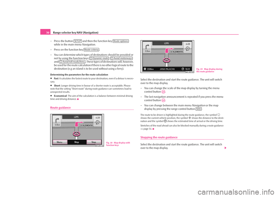
Route guidance
Select the destination and start the route guidance. The unit will switch
over to the map display.
– You can change the scale of the map display by turning the menu control button .
– The last navigation announcement is repeated if you press the menu
control button .
– You can change between the main menu Navigation or the map
display by pressing the range control button .The route to be driven is highlighted during the route guidance, the symbol
shows the current vehicle position, the symbol
shows the distance to the desti-
nation and the symbol
shows the estimated time of arrival or the driving time.
Stretches of the road ahead can also be blocked manually during a route guidance
⇒ page 31.
Stopping the route guidanceSelect the destination and start the route guidance. The unit will switch
over to the map display.
SETUP
Route options
Route criteria
Dynamic route
Avoid motorways
Avoid toll roads/ferry
BAT-20H1126
Fig. 18 Map display with
function keys
Fig. 19 Map display during
the route guidance
A10A10
NAV
s3lk.book Page 30 Friday, November 7, 2008 11:07 AM
Page 33 of 37
Range selector key NAV (Navigation)31
– The route guidance is interrupted and the function key changes to “Start ” by pressing the range control button and then the func-
tion key .
– If you press on the function key the route guidance will continue at the current position.
Inserting routenlistThe routenlist for the trip can only be displayed during a route guidance.
Additional window in the map display
– An additional window opens if you press the button during the route guidance.
– Select the function key in the additional window. The routenlist is displayed. The list of the points (street names, street
descriptions and stretches of the road ) still to be driven, is displayed
in the Routenlist .
– In addition, the distance still to be driven on the driven road and the estimated time to the following turning point are displayed.
Manually excluding a stretch of the road
– You can select the beginning of the stretch of the road to be excluded
by using the control button .
– Press on the function key , this changes to the function key .
– Select the end of the stretch of the road to be excluded and select the
function key .
– The route is newly calculated.
– If you wish to cancel the exclusion of the stretch of the road, press the
function key .
Dynamic route guidance with TMC use Switching the dynamic navigation on or off
– Press the button and then select the function key while in the main menu Navigation.
– In the menu Route options, activate the check box
and select the desired set-up by pressing your choice in the pop-up
window.Requirements for a dynamic route guidance
TMC (Traffic Message Channel) is a digital radio data service for continuous trans-
mission of traffic information.
The unit has a continuous background of TMC traffic reports providing a TMC
station at the current location can be received.
The quality of the transmitted traffic reports depends on the broadcast editing
carried out by the radio station. The rece ption of the TMC traffic reports cannot be
switched on or off.
The station you are listening to does not have to be a TMC station.
TMC traffic reports can only be evaluated and displayed by the unit if the navigation
data for the currently driven area is stored in the unit memory or can be called up
via an inserted navigation CD.
The current TMC traffic reports can be di splayed by pressing the selector key
.
Note
•
There may not be any advantage in avoiding the traffic jam if, as a result of the
TMC traffic reports, the diversion is also heavily congested.
•
You can manually block the information for the route in front of you if a traffic
problem ahead has not yet been included in the TMC traffic reports ⇒page 31.
NAV
Stop
Start
Routenlist
A1Exclude
Exclude to
Exclude toCancel
SETUP
Route options
Dynamic route
TRAFFIC
s3lk.book Page 31 Friday, November 7, 2008 11:07 AM