navigation system TOYOTA PRIUS 2021 Accessories, Audio & Navigation (in English)
[x] Cancel search | Manufacturer: TOYOTA, Model Year: 2021, Model line: PRIUS, Model: TOYOTA PRIUS 2021Pages: 310, PDF Size: 7.07 MB
Page 205 of 310
205
1. BASIC OPERATION
PRIUS_Navi_OM47E22U_(U)
20.03.26 18:17
NAVIGATION SYSTEM
8
Route informa-
tion buttonSelect to change the display between the current
street name and the distance with the estimated
travel/arrival time.240
Route informa-
tion bar
Displays the current street name, or the distance
with the estimated travel time/arrival time to the
destination. The route information bar fills from
left to right as the vehicle progresses on the
route.
240
Speed limit iconIndicates the speed limit on the current road. The
display of the speed limit icon can be set to on/off.213
Destination but-
tonSelect to display the “Destination” screen.223
Zoom in/out but-
tonSelect to magnify or reduce the map scale. When
either button is selected, the map scale indicator
bar appears at the bottom of the screen.
208
Scale indicatorThis figure indicates the map scale.208
Traffic indicator
Shows that traffic informat ion is received. Select
to start voice guidance for traffic information.
When traffic information is received via HD, HD
mark is displayed on the right.
220
“GPS” mark
(Global Position-
ing System)Shows that the vehicle is receiving signals from
the GPS.272
No.NameFunctionPage
Page 207 of 310
207
1. BASIC OPERATION
PRIUS_Navi_OM47E22U_(U)
20.03.26 18:17
NAVIGATION SYSTEM
8
2. MAP SCREEN OPERATION
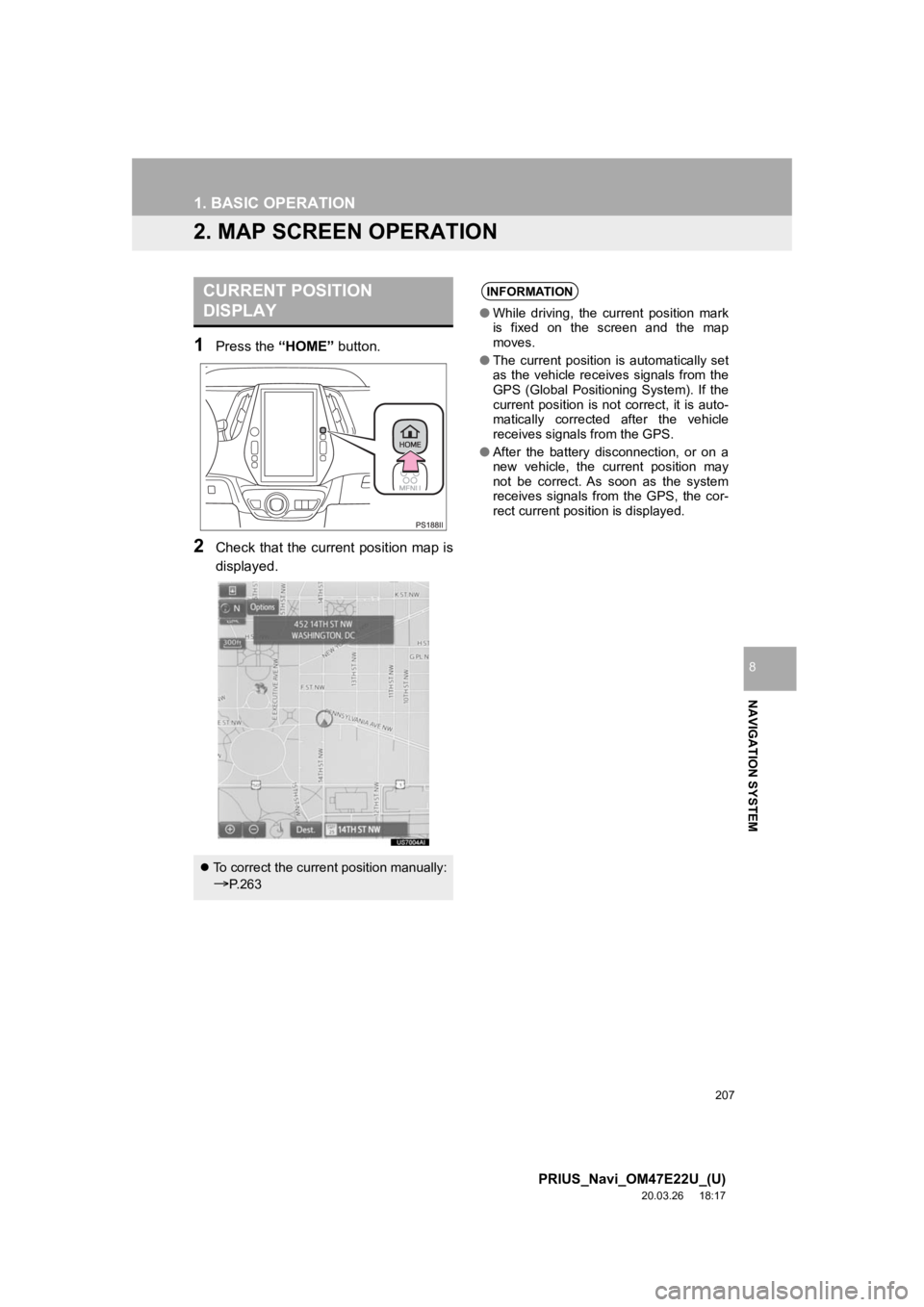
1Press the “HOME” button.
2Check that the current position map is
displayed.
CURRENT POSITION
DISPLAY
To correct the current position manually:
P. 2 6 3
INFORMATION
● While driving, the current position mark
is fixed on the screen and the map
moves.
● The current position is automatically set
as the vehicle receives signals from the
GPS (Global Positioning System). If the
current position is not correct, it is auto-
matically corrected after the vehicle
receives signals from the GPS.
● After the battery disconnection, or on a
new vehicle, the current position may
not be correct. As soon as the system
receives signals from the GPS, the cor-
rect current position is displayed.
Page 209 of 310
209
1. BASIC OPERATION
PRIUS_Navi_OM47E22U_(U)
20.03.26 18:17
NAVIGATION SYSTEM
8
3D screen
The map cannot be rotated on the 3D Map
screen. Only the one-touch (short press)
scroll and linear scroll (long press) opera-
tions are available.
: North-up symbol
Regardless of the direction of vehicle trav-
el, north is always up.
: Heading-up symbol
The direction of vehicle travel is always up.
: 3D Heading-up symbol
The direction of vehicle travel is always up.
The letter(s) beside this symbol indicate
the vehicle’s heading direction (e.g. N for
north).
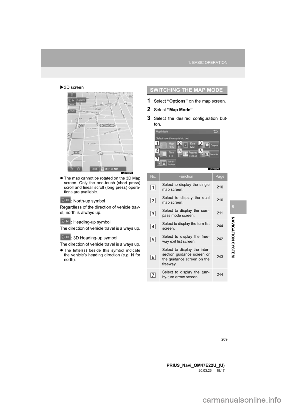
1Select “Options” on the map screen.
2Select “Map Mode” .
3Select the desired configuration but-
ton.
SWITCHING THE MAP MODE
No.FunctionPage
Select to display the single
map screen. 210
Select to display the dual
map screen.210
Select to display the com-
pass mode screen.211
Select to display the turn list
screen.244
Select to display the free-
way exit list screen.242
Select to display the inter-
section guidance screen or
the guidance screen on the
freeway.
243
Select to display the turn-
by-turn arrow screen.244
Page 211 of 310
211
1. BASIC OPERATION
PRIUS_Navi_OM47E22U_(U)
20.03.26 18:17
NAVIGATION SYSTEM
8
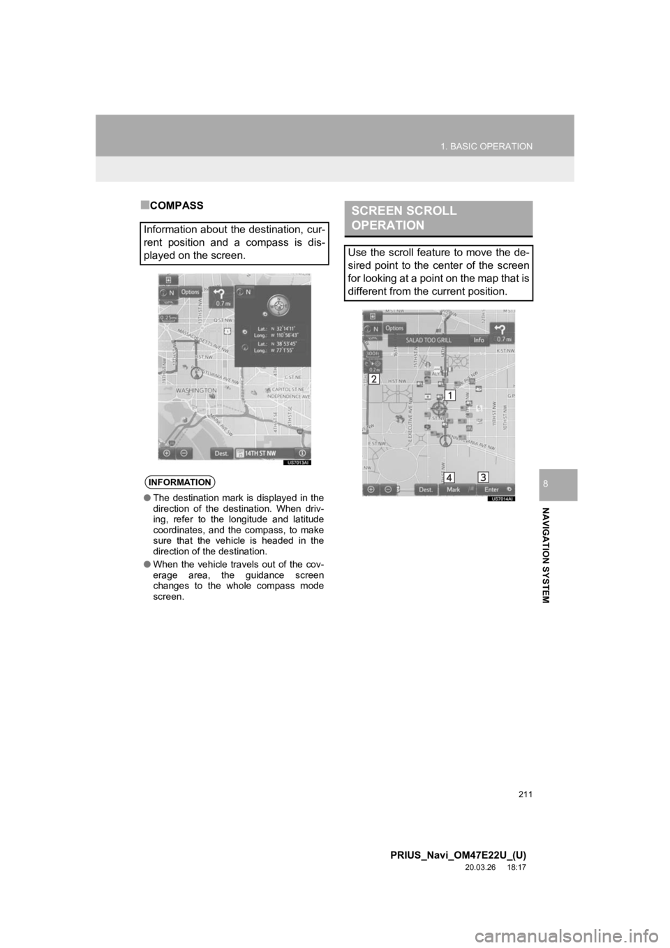
■COMPASS
Information about the destination, cur-
rent position and a compass is dis-
played on the screen.
INFORMATION
● The destination mark is displayed in the
direction of the destination. When driv-
ing, refer to the longitude and latitude
coordinates, and the compass, to make
sure that the vehicle is headed in the
direction of the destination.
● When the vehicle travels out of the cov-
erage area, the guidance screen
changes to the whole compass mode
screen.
SCREEN SCROLL
OPERATION
Use the scroll feature to move the de-
sired point to the center of the screen
for looking at a point on the map that is
different from the current position.
Page 212 of 310
212
1. BASIC OPERATION
PRIUS_Navi_OM47E22U_(U)
20.03.26 18:17
To scroll over the map screen, place the
cursor mark in the desired position and
then touch and hold the map screen. The
map will continue scrolling in that direction
until the finger is released. (Only for 3D
map screen)
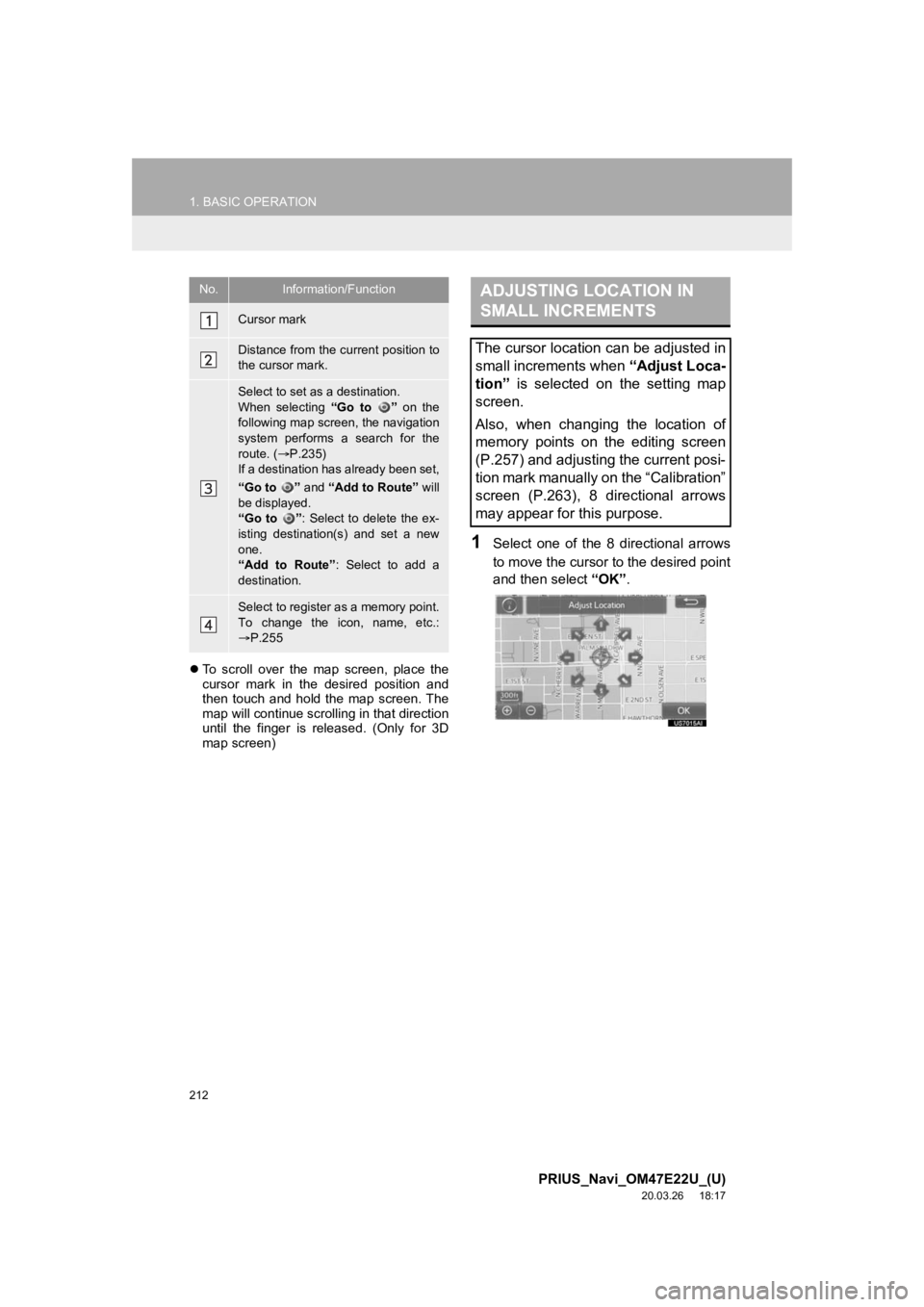
1Select one of the 8 directional arrows
to move the cursor to the desired point
and then select “OK”.
No.Information/Function
Cursor mark
Distance from the current position to
the cursor mark.
Select to set as a destination.
When selecting “Go to ” on the
following map screen, the navigation
system performs a search for the
route. ( P.235)
If a destination has already been set,
“Go to ” and “Add to Route” will
be displayed.
“Go to ” : Select to delete the ex-
isting destination(s) and set a new
one.
“Add to Route” : Select to add a
destination.
Select to register as a memory point.
To change the icon, name, etc.:
P.255
ADJUSTING LOCATION IN
SMALL INCREMENTS
The cursor location can be adjusted in
small increments when “Adjust Loca-
tion” is selected on the setting map
screen.
Also, when changing the location of
memory points on the editing screen
(P.257) and adjusting the current posi-
tion mark manually on the “Calibration”
screen (P.263), 8 directional arrows
may appear for this purpose.
Page 213 of 310
213
1. BASIC OPERATION
PRIUS_Navi_OM47E22U_(U)
20.03.26 18:17
NAVIGATION SYSTEM
8
3. MAP SCREEN INFORMATION
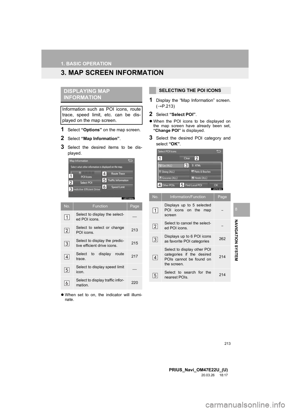
1Select “Options” on the map screen.
2Select “Map Information” .
3Select the desired items to be dis-
played.
When set to on, the indicator will illumi-
nate.
1Display the “Map Information” screen.
(P.213)
2Select “Select POI”.
When the POI icons to be displayed on
the map screen have already been set,
“Change POI” is displayed.
3Select the desired POI category and
select “OK”.
DISPLAYING MAP
INFORMATION
Information such as POI icons, route
trace, speed limit, etc. can be dis-
played on the map screen.
No.FunctionPage
Select to display the select-
ed POI icons.
Select to select or change
POI icons.213
Select to display the predic-
tive efficient drive icons.215
Select to display route
trace.217
Select to display speed limit
icon.
Select to display traffic infor-
mation.220
SELECTING THE POI ICONS
No.Information/FunctionPage
Displays up to 5 selected
POI icons on the map
screen
Select to cancel the select-
ed POI icons.
Displays up to 6 POI icons
as favorite POI categories262
Select to display other POI
categories if the desired
POIs cannot be found on
the screen.
214
Select to search for the
nearest POIs.214
Page 215 of 310
215
1. BASIC OPERATION
PRIUS_Navi_OM47E22U_(U)
20.03.26 18:17
NAVIGATION SYSTEM
8
When “Near...” is selected
1Select the desired item.
“Near Here” : Select to search for POIs
near the current position.
“Along My Route” : Select to search for
POIs along the route.
The predictive efficient drive function can
be turned on/off. ( P.261)
PREDICTIVE EFFICIENT DRIVE
(PREDICTIVE DECELERATION
SUPPORT)
The system automatically stores and
registers support points where the driv-
er always decelerates or stops based
on pedal operation and the vehicle
speed of the driver.
The registered points are shown on the
map as icons for use as predictive
deceleration support points.
When registered support points are
approached, the optimal timing for re-
leasing the accelerator pedal is notified
to the user using the eco acceleration
guide of the hybrid system indicator
along with emphasizing the display of
the icon. (Refer to the separate Prius
owner’s manual for details on the eco
acceleration guide)
After releasing the accelerator pedal,
the engine brake (regeneration brake)
amount increases. (regeneration boost
control)
As a result, the battery charge amount
can be increased when decelerating or
stopping the vehicle contributing to im-
proved power and fuel economy.
This function only operates in the con-
tiguous United States.
This function does not operate outside
the contiguous United States (Exam-
ple: Alaska and Hawaii).
Page 217 of 310
217
1. BASIC OPERATION
PRIUS_Navi_OM47E22U_(U)
20.03.26 18:17
NAVIGATION SYSTEM
8
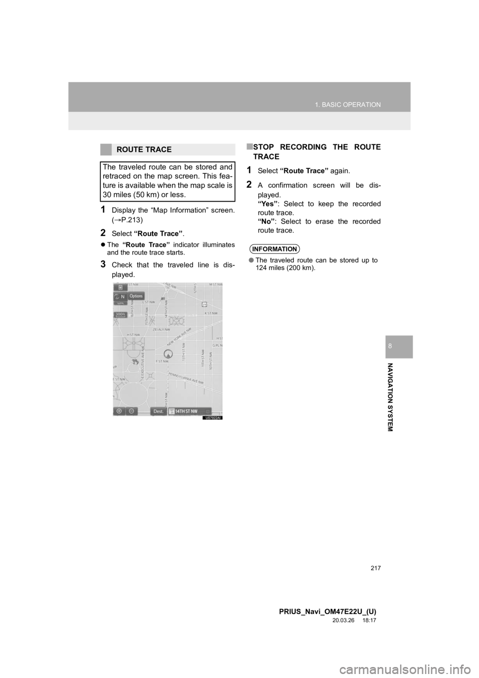
1Display the “Map Information” screen.
(P.213)
2Select “Route Trace”.
The “Route Trace” indicator illuminates
and the route trace starts.
3Check that the traveled line is dis-
played.
■STOP RECORDING THE ROUTE
TRACE
1Select “Route Trace” again.
2A confirmation screen will be dis-
played.
“Yes”: Select to keep the recorded
route trace.
“No” : Select to erase the recorded
route trace.
ROUTE TRACE
The traveled route can be stored and
retraced on the map screen. This fea-
ture is available when the map scale is
30 miles (50 km) or less.
INFORMATION
● The traveled route can be stored up to
124 miles (200 km).
Page 219 of 310
219
1. BASIC OPERATION
PRIUS_Navi_OM47E22U_(U)
20.03.26 18:17
NAVIGATION SYSTEM
8
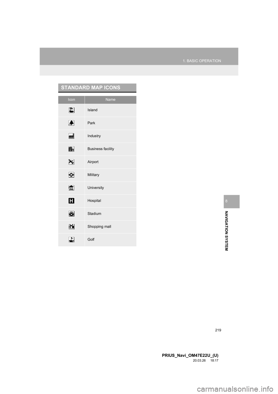
STANDARD MAP ICONS
IconName
Island
Park
Industry
Business facility
Airport
Military
University
Hospital
Stadium
Shopping mall
Golf
Page 221 of 310
221
1. BASIC OPERATION
PRIUS_Navi_OM47E22U_(U)
20.03.26 18:17
NAVIGATION SYSTEM
8
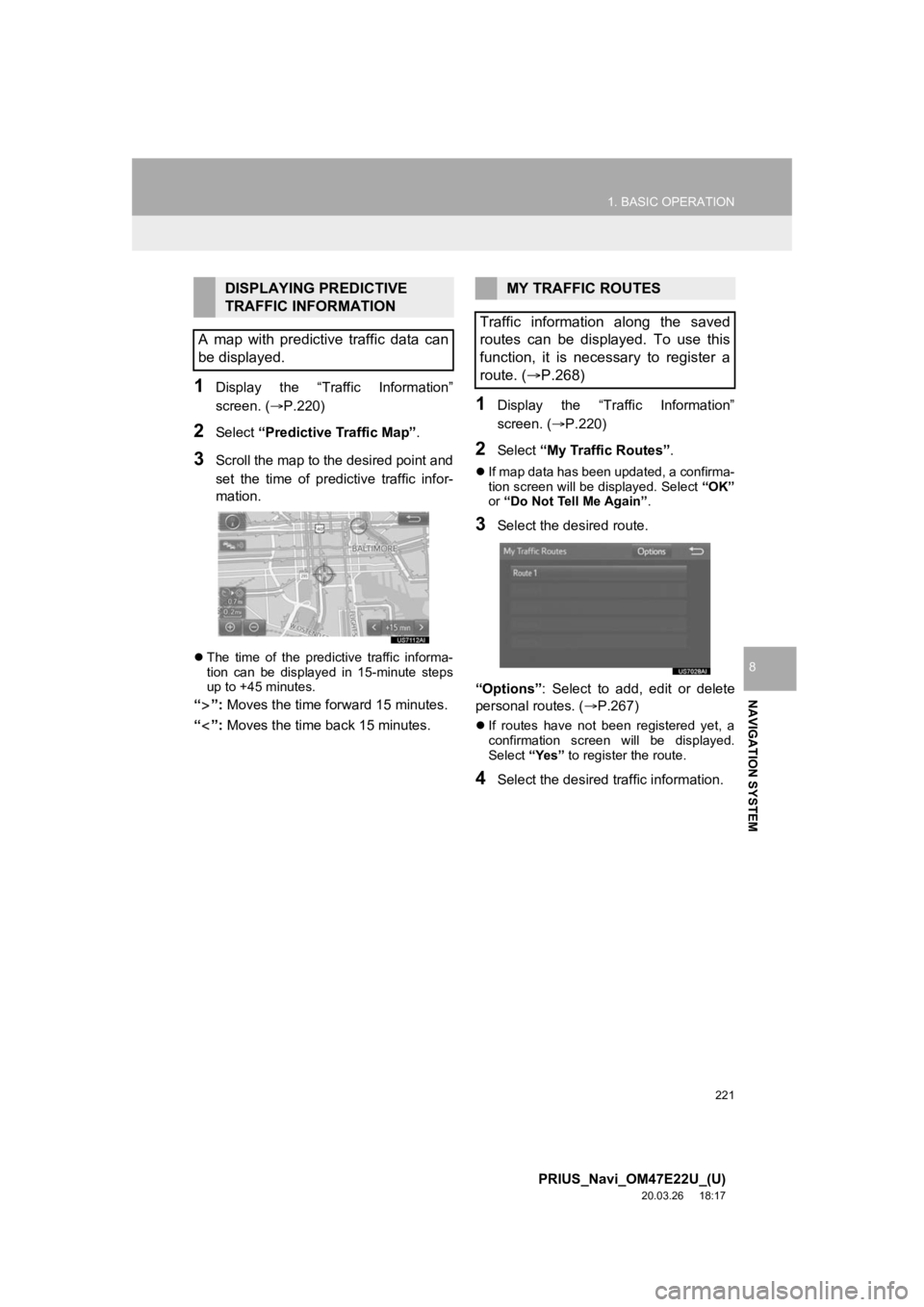
1Display the “Traffic Information”
screen. (P.220)
2Select “Predictive Traffic Map” .
3Scroll the map to the desired point and
set the time of predictive traffic infor-
mation.
The time of the predictive traffic informa-
tion can be displayed in 15-minute steps
up to +45 minutes.
“”: Moves the time for ward 15 minutes.
“”: Moves the time back 15 minutes.
1Display the “Traffic Information”
screen. ( P.220)
2Select “My Traffic Routes” .
If map data has been updated, a confirma-
tion screen will be displayed. Select “OK”
or “Do Not Tell Me Again” .
3Select the desired route.
“Options” : Select to add, edit or delete
personal routes. ( P.267)
If routes have not been registered yet, a
confirmation screen will be displayed.
Select “Yes” to register the route.
4Select the desired traffic information.
DISPLAYING PREDICTIVE
TRAFFIC INFORMATION
A map with predictive traffic data can
be displayed.MY TRAFFIC ROUTES
Traffic information along the saved
routes can be displayed. To use this
function, it is necessary to register a
route. ( P.268)