ad blue TOYOTA YARIS HATCHBACK 2020 Accessories, Audio & Navigation (in English)
[x] Cancel search | Manufacturer: TOYOTA, Model Year: 2020, Model line: YARIS HATCHBACK, Model: TOYOTA YARIS HATCHBACK 2020Pages: 94, PDF Size: 1.68 MB
Page 19 of 94

19
1
2
3
4
5
6
Yaris_Yaris hatchback_Navi_OM99V62z_(U)
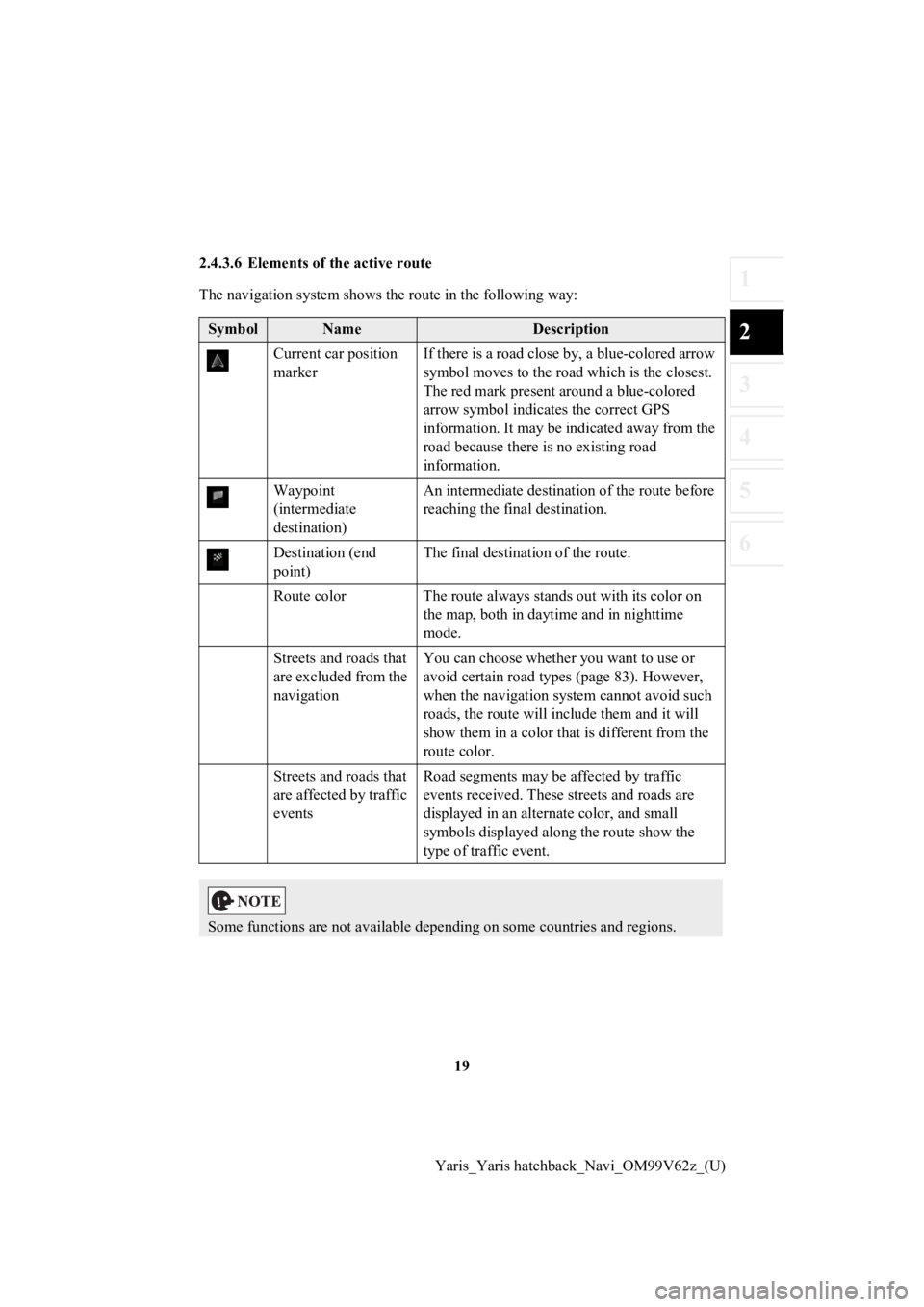
2.4.3.6 Elements of the active route
The navigation system shows the route in the following way:
SymbolNameDescription
Current car position
marker If there is a road close by, a blue-colored arrow
symbol moves to the road which is the closest.
The red mark present around a blue-colored
arrow symbol indicat
es the correct GPS
information. It may be indicated away from the
road because there is no existing road
information.
Waypoint
(intermediate
destination) An intermediate destination of the route before
reaching the fina
l destination.
Destination (end
point) The final destination of the route.
Route color The route always s tands out with its color on
the map, both in daytime and in nighttime
mode.
Streets and roads that
are excluded from the
navigation You can choose whether you want to use or
avoid certain road types (page 83). However,
when the navigation system cannot avoid such
roads, the route will include them and it will
show them in a color that is different from the
route color.
Streets and roads that
are affected by traffic
events Road segments may be affected by traffic
events received. These s
treets and roads are
displayed in an alternate color, and small
symbols displayed along the route show the
type of traffic event.
Some functions are not available depending on some countries an d regions.
Page 89 of 94

89
1
2
3
4
5
6
Yaris_Yaris hatchback_Navi_OM99V62z_(U)
Map
The navigation system works with
digital maps which are not simply the
computerized versions of traditional paper maps. Similarly to p aper road maps, the
2D mode of digital maps show you streets, roads, and elevation by colors.
In 3D mode, you can see the altitude differences, for example v alleys and mountains,
elevated roads, and in selected cities 3D landmarks and 3D buil dings are also
displayed.
You can use digital maps inter actively: you can zoom in and out (increase or
decrease the scale), yo u can tilt them up and down, and rotate them left and right. In
GPS-supported navigation, digital maps facilitate route plannin g.
North-up map orientation
In North-up mode the map is rotated so its top always faces North. This is the
orientation for example in Find on Map.
Road Safety Camera
This function is not available in some countries and regions.
Special alert points for speed, red light or bus lane cameras. Different data sources
are available. You can configure the navigation system to warn you when you
approach one of these cameras.
Detecting the location of Road Sa fety Cameras is prohibited in certain countries. It is
the sole responsibility of the dr iver to check whether this feature can be used during
the trip.
The software is capable of showing and warning for more than ju st cameras. Various
other types of proximity alert points like school zones and rai lway crossings are also
available.
Route
A sequence of maneuvers (for ex ample, turns and roundabouts) to reach the
destination. The route contains o ne start point and one or more destinations.
Track-up map orientation
In Track-up mode the map is rota ted so its top always points in the current driving
direction. This is the default orientation in 3D map view mode.
Vehicle marker
The current position is indicated by a blue arrow on the map. T he direction the blue
arrow is pointed indicat es the current heading.