display CADILLAC ESCALADE EXT 2010 3.G Manual PDF
[x] Cancel search | Manufacturer: CADILLAC, Model Year: 2010, Model line: ESCALADE EXT, Model: CADILLAC ESCALADE EXT 2010 3.GPages: 580, PDF Size: 6.23 MB
Page 286 of 580
Ejecting the DVD Map Disc
Z
(DVD Map Disc Eject):Press twice to eject the
DVD map disc. This button is located next to the upper
disc slot.
Handling the DVD Map Disc
When handling the DVD map disc, be careful of the
following:
.Handle the disc very carefully to avoid
contamination or flaws. Signals may not read out
properly if the disc gets contaminated or flawed.
.If the disc gets soiled, use a soft cloth to gently
wipe it out from the center of the disc to the
outside. Do not use photographic record cleaner,
solvents, or other cleaners.
.Do not use the disc to rest on while writing or
drawing using any writing utensil or attach a seal to
any of the sides or the disc.
.Do not keep the disc in direct sunlight, high
temperatures, or humidity.
.After using the disc, place it back into the
original case.
Map Adjustments
The system lets you adjust the scale of view on the
map. Also, as you drive, the map scrolls automatically
based on the direction of travel.
Map Scales
+ / −(Zoom In/Zoom Out) : Touch the zoom in or out
screen buttons or the scale on the bar to change the
level of map detail. The scale appears on the screen
once the zoom in or zoom out screen buttons are
selected. The system adjusts the map accordingly.
The scale of a map can range from 1/32 mi. (50 m)
to 256 mi. (400 km). To change English or metric,
see DIC Operation and Displays
on page 4‑40for
more information.
Scrolling the Map
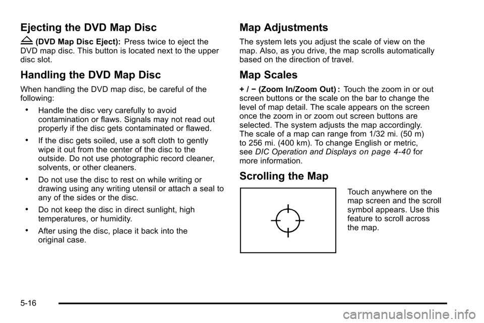
Touch anywhere on the
map screen and the scroll
symbol appears. Use this
feature to scroll across
the map.
5-16
Page 288 of 580
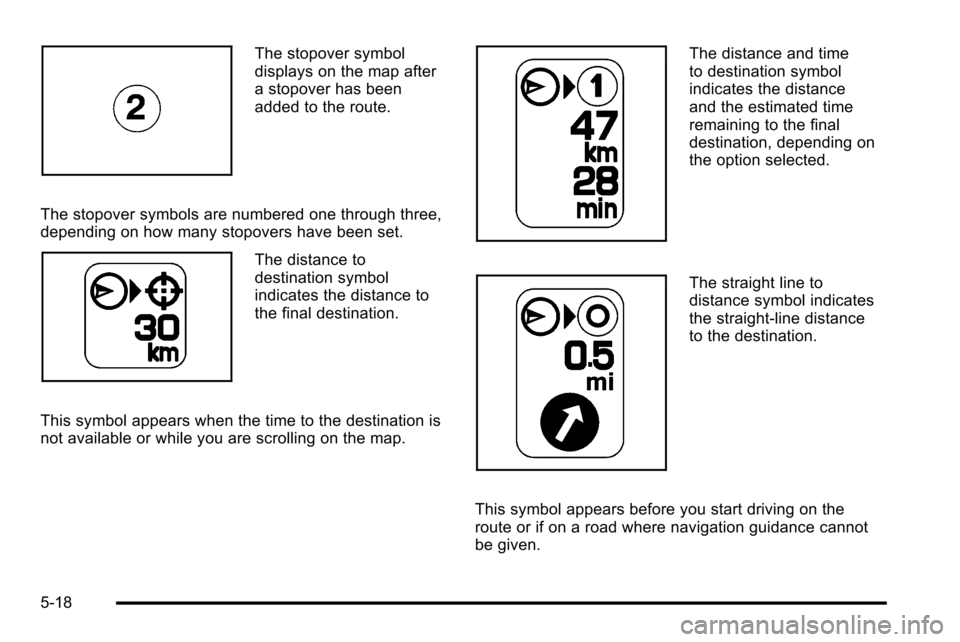
The stopover symbol
displays on the map after
a stopover has been
added to the route.
The stopover symbols are numbered one through three,
depending on how many stopovers have been set.
The distance to
destination symbol
indicates the distance to
the final destination.
This symbol appears when the time to the destination is
not available or while you are scrolling on the map.
The distance and time
to destination symbol
indicates the distance
and the estimated time
remaining to the final
destination, depending on
the option selected.
The straight line to
distance symbol indicates
the straight-line distance
to the destination.
This symbol appears before you start driving on the
route or if on a road where navigation guidance cannot
be given.
5-18
Page 289 of 580
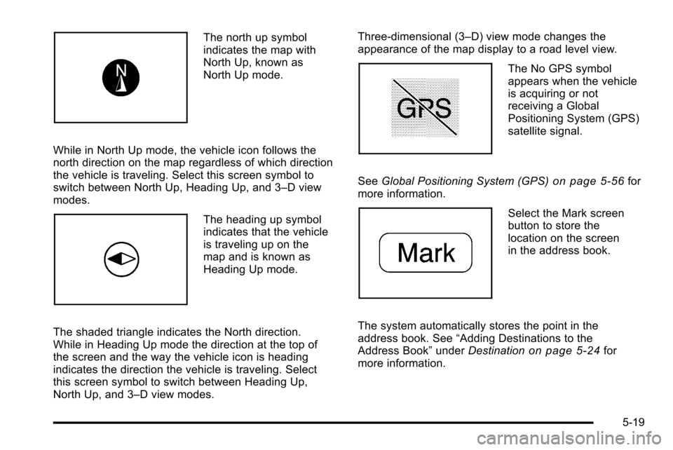
The north up symbol
indicates the map with
North Up, known as
North Up mode.
While in North Up mode, the vehicle icon follows the
north direction on the map regardless of which direction
the vehicle is traveling. Select this screen symbol to
switch between North Up, Heading Up, and 3–D view
modes.
The heading up symbol
indicates that the vehicle
is traveling up on the
map and is known as
Heading Up mode.
The shaded triangle indicates the North direction.
While in Heading Up mode the direction at the top of
the screen and the way the vehicle icon is heading
indicates the direction the vehicle is traveling. Select
this screen symbol to switch between Heading Up,
North Up, and 3–D view modes. Three-dimensional (3–D) view mode changes the
appearance of the map display to a road level view.
The No GPS symbol
appears when the vehicle
is acquiring or not
receiving a Global
Positioning System (GPS)
satellite signal.
See Global Positioning System (GPS)
on page 5‑56for
more information.
Select the Mark screen
button to store the
location on the screen
in the address book.
The system automatically stores the point in the
address book. See “Adding Destinations to the
Address Book” underDestination
on page 5‑24for
more information.
5-19
Page 290 of 580
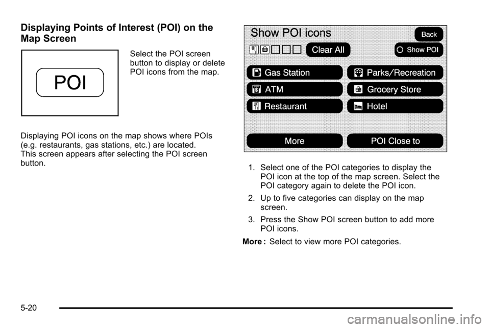
Displaying Points of Interest (POI) on the
Map Screen
Select the POI screen
button to display or delete
POI icons from the map.
Displaying POI icons on the map shows where POIs
(e.g. restaurants, gas stations, etc.) are located.
This screen appears after selecting the POI screen
button.
1. Select one of the POI categories to display the POI icon at the top of the map screen. Select the
POI category again to delete the POI icon.
2. Up to five categories can display on the map screen.
3. Press the Show POI screen button to add more POI icons.
More : Select to view more POI categories.
5-20
Page 291 of 580
POI Close to:1. Once a category has been selected, touch this button to display the list of available POIs for the
selected POI category. The list provides the POI
icon, the name, the direction, and the distance to
the POI from the vehicle's current position.
2. Use the scroll arrows to move up and down the list.
3. Use the sorting screen buttons: Dist (distance),Icon, Name, and on Route as needed.
Go : Select this screen button, next to the desired POI,
to make this POI a destination or a stopover. Select a POI name to receive information about the
POI. From this screen you can select: Address Book,
Go, Map, or Call (if Bluetooth
®or OnStar®personal
calling is activated).
Address Book : Press to add this POI to the address
book. See “Nav”under Configure Menu
on page 5‑42for information on editing address book entries.
Go :Select to make this POI a destination or a
stopover.
Map : Select to display the map showing the location
of the POI.
Call : Select to dial the phone number using your
Bluetooth
®phone (if “paired”with the vehicle) or
the OnStar HandsFree Calling system. For more
information about Bluetooth calling, see Bluetooth
®on
page 4‑66. For more information about OnStar
HandsFree calling, see the OnStar Owner Guide.
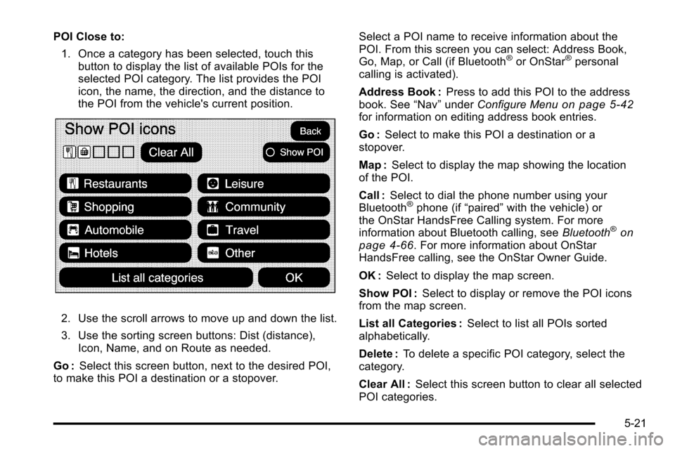
OK : Select to display the map screen.
Show POI : Select to display or remove the POI icons
from the map screen.
List all Categories : Select to list all POIs sorted
alphabetically.
Delete : To delete a specific POI category, select the
category.
Clear All : Select this screen button to clear all selected
POI categories.
5-21
Page 292 of 580
Driving on a Route
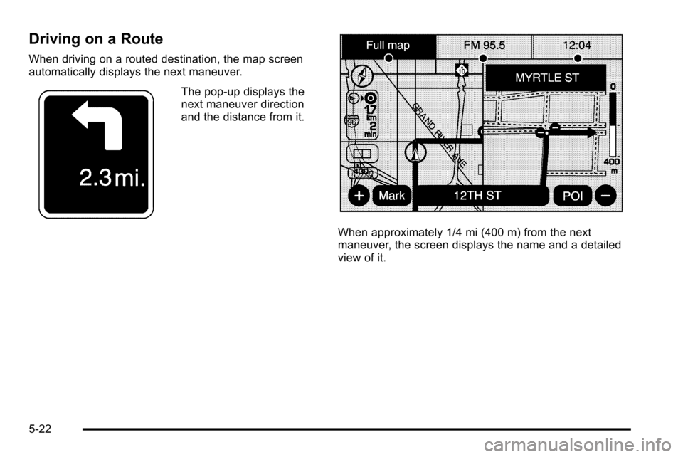
When driving on a routed destination, the map screen
automatically displays the next maneuver.
The pop-up displays the
next maneuver direction
and the distance from it.
When approximately 1/4 mi (400 m) from the next
maneuver, the screen displays the name and a detailed
view of it.
5-22
Page 293 of 580
3–D Lane Guidance
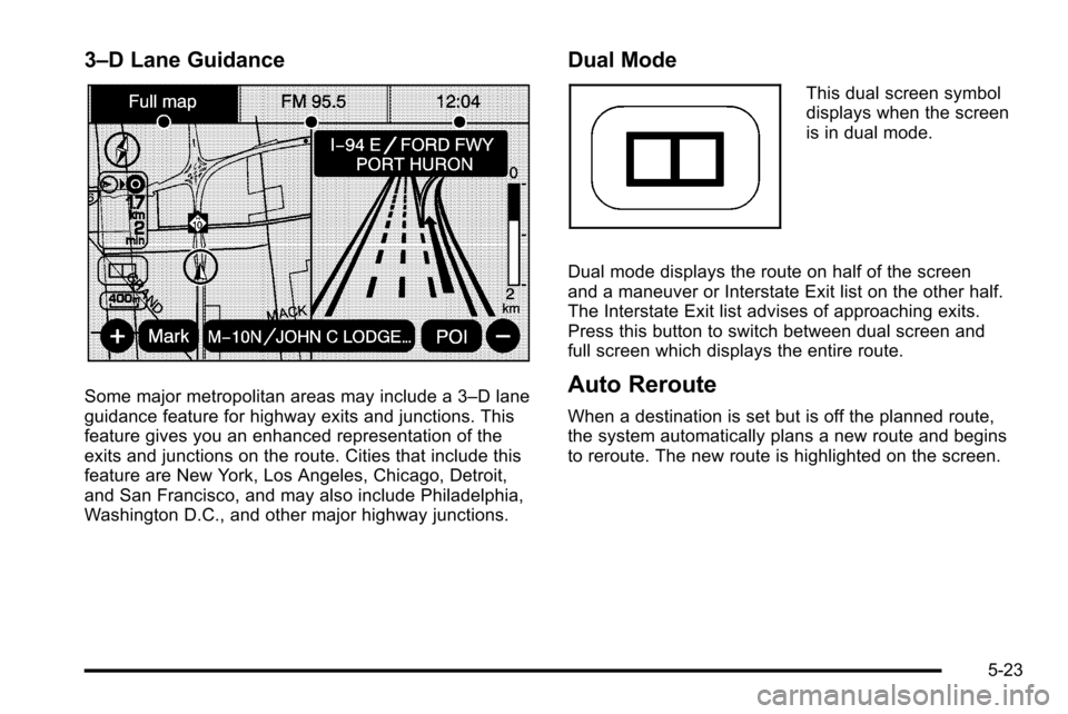
Some major metropolitan areas may include a 3–D lane
guidance feature for highway exits and junctions. This
feature gives you an enhanced representation of the
exits and junctions on the route. Cities that include this
feature are New York, Los Angeles, Chicago, Detroit,
and San Francisco, and may also include Philadelphia,
Washington D.C., and other major highway junctions.
Dual Mode
This dual screen symbol
displays when the screen
is in dual mode.
Dual mode displays the route on half of the screen
and a maneuver or Interstate Exit list on the other half.
The Interstate Exit list advises of approaching exits.
Press this button to switch between dual screen and
full screen which displays the entire route.
Auto Reroute
When a destination is set but is off the planned route,
the system automatically plans a new route and begins
to reroute. The new route is highlighted on the screen.
5-23
Page 295 of 580
3. Select the state/province screen button, if needed,to change the current state or province. A list of all
of the available states and provinces appear.
Select the state or province.
4. Once a state or province has been selected the City name category is automatically selected for
entry.
Enter the City Name or touch the Last 5 Cities
screen button.
The Last 5 Cities screen displays a list of the last
five city names that had been entered. Select a city
from the list and it appears in the City name area.
If using the alpha keyboard, finish entering the city
name. If five or less names are available, a list
displays. If more than five are available, the List
screen button displays a number. This number
represents the number of available cities. Select
this button to view the list and select a city.
5. Once a city has been selected the Street name category is automatically selected for entry.
Start entering the street name. If five or less names
are available, a list displays. If more than five are
available, the List screen button displays a
number. This number represents the number of
available streets. Select this button to view the list. 6. Once a street has been selected, press the
House # screen button to enter the house number.
The system displays the house number range that
is available for the street.
7. Select the Go screen button. The map screen, with the destination marked displays.
8. Select the route preference (Fastest, Shortest, or Other). The system calculates and highlights
the route.
9. Select the Start Guidance screen button. The route is now ready to be started.
See “Getting Started on Your Route” later in this
section for more information.
To enter a destination by entering the street name first: 1. Press the DEST hard key.
2. Select the
2screen button.
3. Select the state/province screen button, if needed, to change the current state or province. A list of
all of the available states and provinces appear.
Select the state or province.
4. Select the Street screen button and start entering the street name or touch the Last 5 Streets screen
button.
If the street name is common, the city might need
to be entered first.
5-25
Page 296 of 580
The Last 5 Streets screen displays a list of the last
five street names that had been entered. Select a
street from the list and it appears in the Street
name area.
If using the alpha keyboard, finish entering the
street name. If five or less names are available,
a list displays. If more than five are available, the
List screen button displays a number. This number
represents the number of available streets. Select
this button to view the list and select a street.
5. Once a street has been selected, select the House # screen button to enter the house number.
The system displays the house number range that
is available for the street.
6. Once the house number is selected, the city name automatically populates. If there is more than one
city available for selection, a list of cities display.
Select the city.
7. Select the Go screen button. The map screen, with the destination marked displays.
8. Select the route preference (Fastest, Shortest, or Other). The system calculates and highlights
the route.
9. Select the Start Guidance screen button. The route is now ready to be started.
See “Getting Started on Your Route” later in this
section for more information. To enter a destination by entering a cross street:
1. Press the DEST hard key.
2. Select the
2screen button.
3. Select the state/province screen button, if needed, to change the current state or province. A list of all
of the available states and provinces appear.
Select the state or province.
4. Select the Street screen button and start entering the street name or touch the Last 5 Streets screen
button.
If the street name is common, the city might need
to be entered first.
The Last 5 Streets screen displays a list of the
last five street names that had been entered.
Select a street from the list and it appears in the
Street name area.
If using the alpha keyboard, finish entering the
street name. If five or less names are available,
a list displays. If more than five are available, the
List screen button displays a number. This number
represents the number of available streets. Select
this button to view the list and select a street.
5-26
Page 297 of 580
5. Once a street has been selected, select the CrossStreet screen button and start entering the cross
street name. If five or less names are available,
a list displays. If more than five are available,
the List screen button displays a number.
This number represents the number of available
streets. Select this button to view the list and
select a street.
6. Select the Go screen button. The map screen, with the destination marked displays.
7. Select the route preference (Fastest, Shortest, or Other). The system calculates and highlights
the route.
8. Select the Start Guidance screen button. The route is now ready to be started.
See “Getting Started on Your Route” later in this
section for more information.Point of Interest (POI)
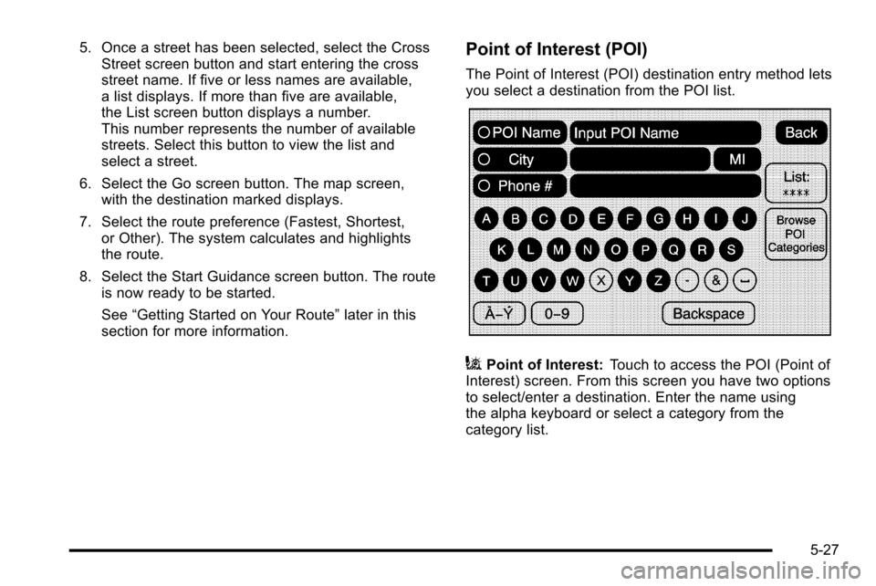
The Point of Interest (POI) destination entry method lets
you select a destination from the POI list.
iPoint of Interest: Touch to access the POI (Point of
Interest) screen. From this screen you have two options
to select/enter a destination. Enter the name using
the alpha keyboard or select a category from the
category list.
5-27