HONDA CIVIC SEDAN 2020 Navigation Manual (in English)
Manufacturer: HONDA, Model Year: 2020, Model line: CIVIC SEDAN, Model: HONDA CIVIC SEDAN 2020Pages: 143, PDF Size: 3.67 MB
Page 71 of 143
69
uu Entering a Destination u Categories
Continued
Navigation
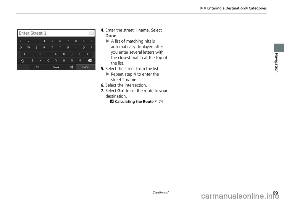
4. Enter the street 1 name. Select
Done .
uA list of matching hits is
automatically displayed after
you enter several letters with
the closest match at the top of
the list.
5. Select the stree
t from the list.
u Repeat step 4 to
enter the
street 2 name.
6. Select the intersect
ion.
7. Select Go! to
set the route to your
destination.
2 Calculating the Route P. 74
Page 72 of 143
uu Entering a Destination u Categories
70
Navigation
H u u Categories u Cities
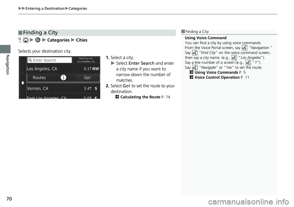
Selects your destination city. 1.Select a
city.
u Select Ente
r Search and enter
a city name if you want to
narrow down the number of
matches.
2. Select Go! to
set the route to your
destination.
2 Calculating the Route P. 74
■Finding a City1
Finding a City
Using Voice Command
You can find a city by using voice commands.
From the Voice Portal screen, say “ Navigation.”
Say “ Find City” on the voice command screen,
then say a city name. (e.g., “ Los Angeles”).
Say a line number of a screen (e.g., “ 1”).
Say “ Navigate” or “Yes” to set the route.
2 Using Voice Commands P. 5
2 Voice Control Operation P. 11
Page 73 of 143
71
uu Entering a Destination u Categories
Navigation
H u u Categories u Coordinates
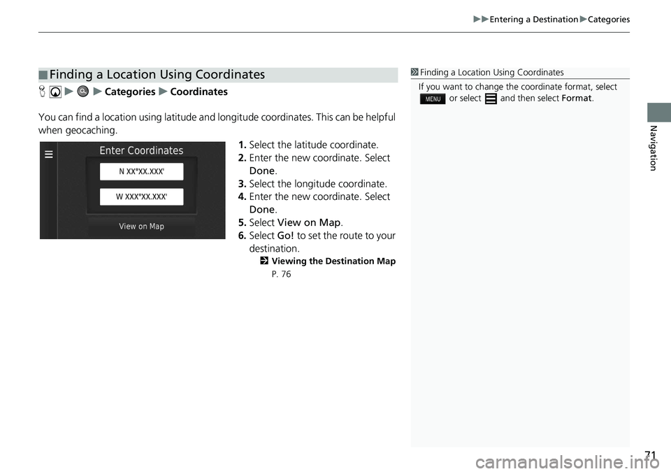
You can find a location using latitude and longitude coordinates. This can be helpful
wh
en geocaching.
1.Select the latitude coordinat
e.
2. Enter
the new coordinate. Select
Done .
3. Select the long
itude coordinate.
4. Enter
the new coordinate. Select
Done .
5. Select View on
Map.
6. Select Go! to
set the route to your
destination.
2 Viewing the Destination Map
P. 76
■ Finding a Location Using Coordinates1
Finding a Location Using Coordinates
If you want to change the coordinate format, select
or select and then select Format.
Page 74 of 143
72
uu Entering a Destination u Saved
Navigation
Saved
H u u Saved
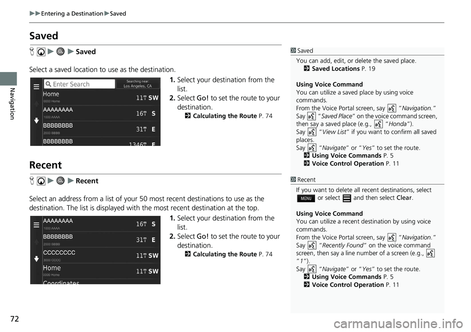
Select a saved location to use
as the destination.
1.Selec
t your destination from the
list.
2. Select Go! to
set the route to your
destination.
2 Calculating the Route P. 74
Recent
H u u Recent
Select an address from a list of your 50 most
recent destinations to use as the
destination. The list is displayed with the most recent destination at the top.
1.Selec
t your destination from the
list.
2. Select Go! to
set the route to your
destination.
2 Calculating the Route P. 74
1 Saved
You can add, edit, or delete the saved place.
2 Saved Locations P. 19
Using Voice Command
You can utilize a saved place by using voice
commands.
From the Voice Portal screen, say “ Navigation.”
Say “ Saved Place” on the voice command screen,
then say a saved place (e.g., “ Honda”).
Say “ View List” if you want to confirm all saved
places.
Say “ Navigate” or “Yes” to set the route.
2 Using Voice Commands P. 5
2 Voice Control Operation P. 11
1Recent
If you want to delete all recent destinations, select
or select and then select Clear.
Using Voice Command
You can utilize a recent de stination by using voice
commands.
From the Voice Portal screen, say “ Navigation.”
Say “ Recently Found ” on the voice command
screen, then say a line num ber of a screen (e.g.,
”1”).
Say “ Navigate” or “Yes” to set the route.
2 Using Voice Commands P. 5
2 Voice Control Operation P. 11
Page 75 of 143
73
uu Entering a Destination u Map Input
Navigation
Map Input
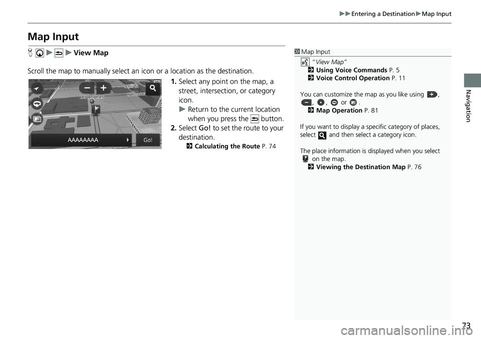
H u u View Map
Scroll the map to manually select an icon or
a location as the destination.
1. Select any
point on the map, a
street, intersection, or category
icon.
u Return to the current location
when you
press the button.
2. Select Go! to
set the route to your
destination.
2 Calculating the Route P. 74
1 Map Input
“View Map ”
2 Using Voice Commands P. 5
2 Voice Control Operation P. 11
You can customize the map as you like using , , , or .
2 Map Operation P. 81
If you want to display a sp ecific category of places,
select and then select a category icon.
The place information is di splayed when you select
on the map.
2 Viewing the Destination Map P. 76
Page 76 of 143
74
Navigation
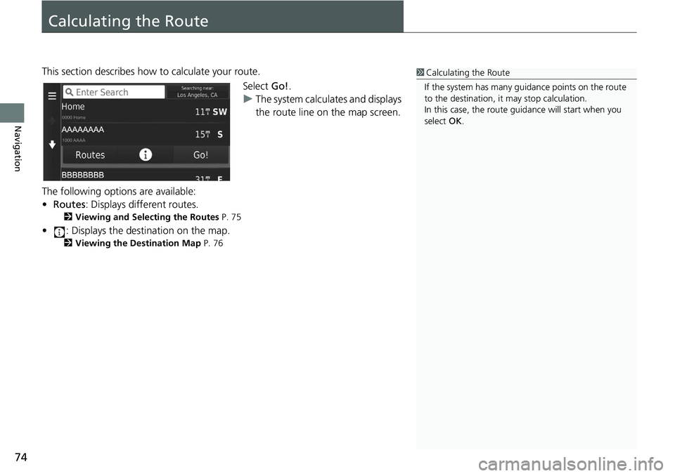
Calculating the Route
This section describes how to calculate your route.Select Go!.
u The system
calculates and displays
the route line on the map screen.
The following options are available:
• Ro
utes : Displays different routes.
2 Viewing and Selecting the Routes P. 75
• : Displays the destination on the map.
2 Viewing the Destination Map P. 76
1 Calculating the Route
If the system has many guidance points on the route
to the destination, it may stop calculation.
In this case, the route guidance will start when you
select OK.
Page 77 of 143
75
uu Calculating the Route u Viewing and Selecting the Routes
Navigation
Viewing and Selecting the Routes
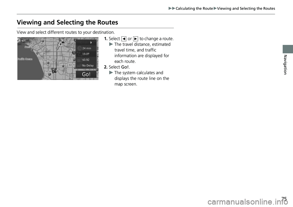
View and select different r outes to your destination.
1.Select or to change a route.
u The tr
avel distance, estimated
travel time, and traffic
information are displayed for
each route.
2. Select Go!.
u The syste
m calculates and
displays the route line on the
map screen.
Page 78 of 143
76
uu Calculating the Route u Viewing the Destination Map
Navigation
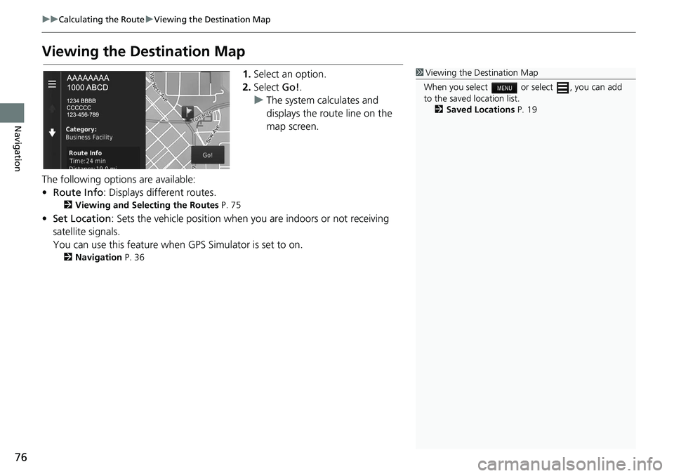
Viewing the Destination Map
1. Select an option.
2. Select Go!.
u The
system calculates and
displays the route line on the
map screen.
The following options are available:
• Ro
ute Info : Displays different routes.
2 Viewing and Selecting the Routes P. 75
• Set Location : Sets the vehicle position when you are indoors or not receiving
sa
tellite signals.
You can use this feature when GPS Sim
ulator is set to on.
2Navigation P. 36
1 Viewing the Destination Map
When you select or select , you can add
to the saved location list. 2 Saved Locations P. 19
Page 79 of 143
77Continued
Navigation
Driving to Your Destination
Viewing the Route
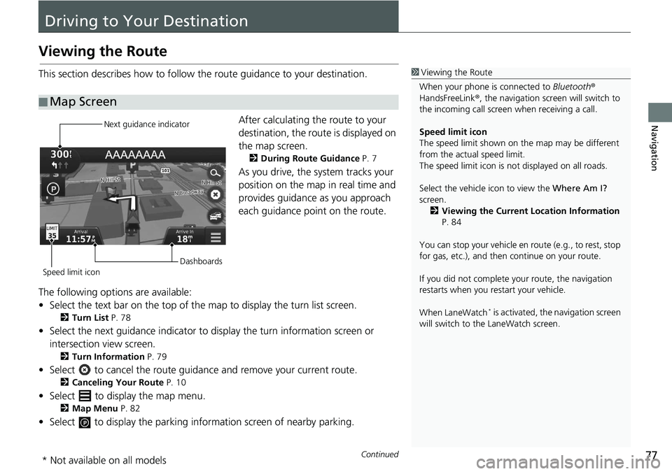
This section describes how to follow the route guidance to your destination.After calculating the route to your
destination,
the route is displayed on
the map screen.
2 During Route Guidance P. 7
As you drive, the system tracks your
position on the map in real time and
provides guidance as you approach
each guidance point on the route.
The following options are available:
• Select the text bar on the top of the map to display
the turn list screen.
2Turn List P. 78
• Select the next guidance indicator to display the turn information screen or
intersection view screen.
2 Turn Information P. 79
• Select to cancel the route guidance and remove your current route.
2Canceling Your Route P. 10
• Select to display the map menu.
2Map Menu P. 82
• Select to display the parking informat ion screen of nearby parking.
■Map Screen
1
Viewing the Route
When your phone is connected to Bluetooth®
HandsFreeLink ®, the navigation screen will switch to
the incoming call screen when receiving a call.
Speed limit icon
The speed limit shown on th e map may be different
from the actual speed limit.
The speed limit icon is not displayed on all roads.
Select the vehicle icon to view the Where Am I?
screen.
2 Viewing the Current Location Information
P. 84
You can stop your vehicle en route (e.g., to rest, stop
for gas, etc.), and then continue on your route.
If you did not complete y our route, the navigation
restarts when you re start your vehicle.
When LaneWatch
* is activated, the navigation screen
will switch to the LaneWatch screen.
Next guidance indicator
Speed limit icon Dashboards
* Not available on all models
Page 80 of 143
uu Driving to Your Destination u Viewing the Route
78
Navigation
• Select the map dashboards when you want to change the information that is
displayed. Select the following options:
Arrival Time , Distance , Time to Destination , Via Arrival , Distance to Via ,
Time to Via , Direction of Travel , Elevation.
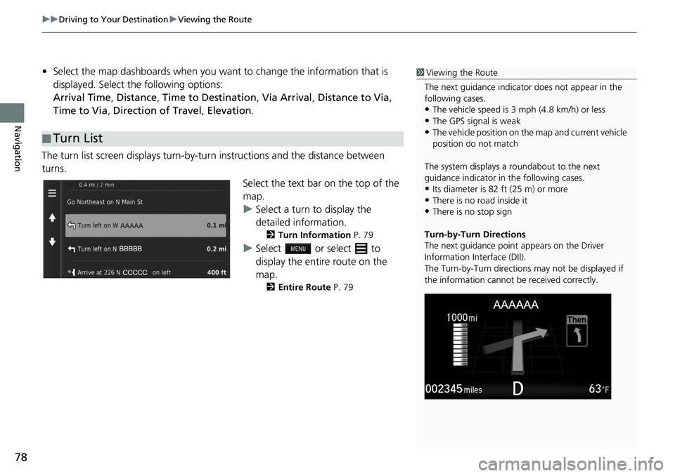
The turn list screen displays turn-by-turn instr
uctions and the distance between
turns.
Select the text bar on the top of the
ma
p.
u Select a
turn to display the
detailed information.
2Turn Information P. 79
u Select or select to
display the entire route on the
ma
p.
2Entire Route P. 79
■Turn List
1
Viewing the Route
The next guidance indicator does not appear in the
following cases.
•The vehicle speed is 3 mph (4.8 km/h) or less
•The GPS signal is weak•The vehicle position on the map and current vehicle
position do not match
The system displays a roundabout to the next
guidance indicator in the following cases.
•Its diameter is 82 ft (25 m) or more•There is no road inside it
•There is no stop sign
Turn-by-Turn Directions
The next guidance point appears on the Driver
Information Interface (DII).
The Turn-by-Turn directions may not be displayed if
the information cannot be received correctly.