NISSAN ALTIMA HYBRID 2008 L32A / 4.G Navigation Manual
ALTIMA HYBRID 2008 L32A / 4.G
NISSAN
NISSAN
https://www.carmanualsonline.info/img/5/220/w960_220-0.png
NISSAN ALTIMA HYBRID 2008 L32A / 4.G Navigation Manual
Trending: steering, lights, phone, service reset, navigation system, navigation update, ad blue
Page 51 of 237
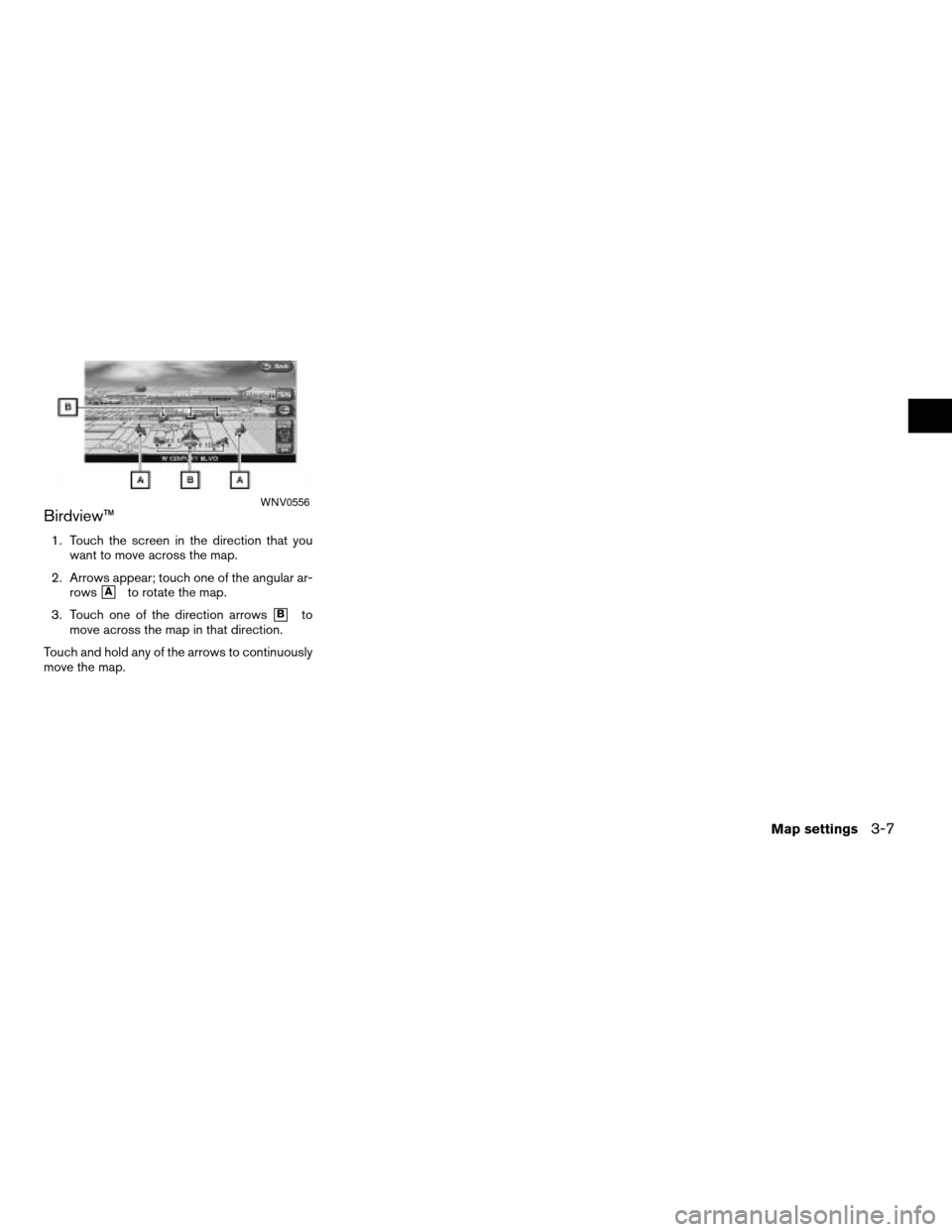
Birdview™
1. Touch the screen in the direction that you
want to move across the map.
2. Arrows appear; touch one of the angular ar-
rows
hAto rotate the map.
3. Touch one of the direction arrows
hBto
move across the map in that direction.
Touch and hold any of the arrows to continuously
move the map.
WNV0556
Map settings3-7
ZREVIEW COPYÐ2008 Altima(alt)
Navigation System OMÐUSA_English(nna)
03/06/07Ðarosenma
X
Page 52 of 237
RETURNING TO THE CURRENT VE-
HICLE LOCATION
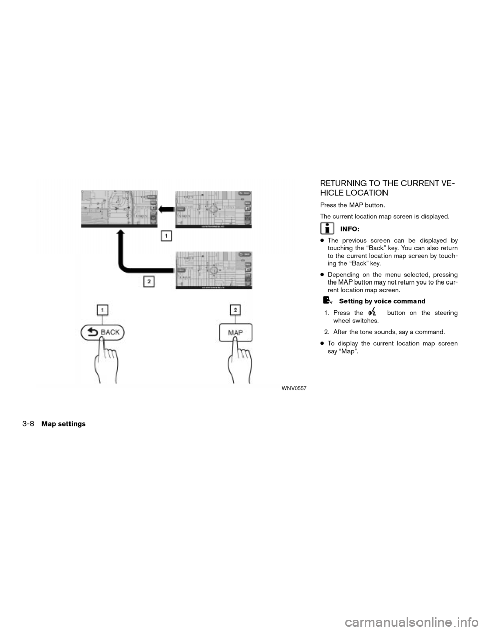
Press the MAP button.
The current location map screen is displayed.
INFO:
cThe previous screen can be displayed by
touching the “Back” key. You can also return
to the current location map screen by touch-
ing the “Back” key.
cDepending on the menu selected, pressing
the MAP button may not return you to the cur-
rent location map screen.
Setting by voice command
1. Press the
button on the steering
wheel switches.
2. After the tone sounds, say a command.
cTo display the current location map screen
say “Map”.
WNV0557
3-8Map settings
ZREVIEW COPYÐ2008 Altima(alt)
Navigation System OMÐUSA_English(nna)
03/06/07Ðarosenma
X
Page 53 of 237
MAP SCROLLING INFORMATION
Information about the location, on which the cen-
ter of the cross pointer is placed by scrolling on
the map, can be set to be displayed.
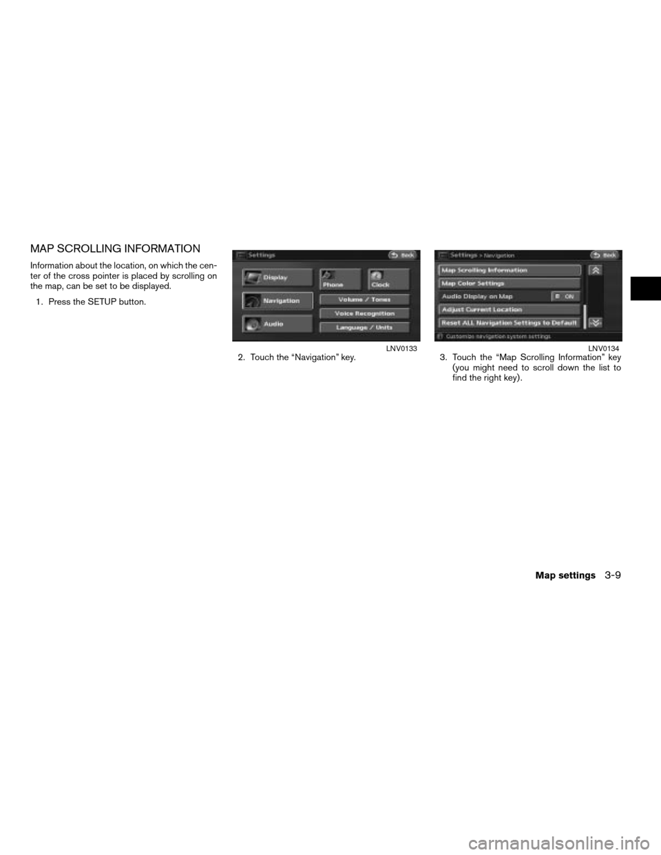
1. Press the SETUP button.
2. Touch the “Navigation” key. 3. Touch the “Map Scrolling Information” key
(you might need to scroll down the list to
find the right key) .
LNV0133LNV0134
Map settings3-9
ZREVIEW COPYÐ2008 Altima(alt)
Navigation System OMÐUSA_English(nna)
03/06/07Ðarosenma
X
Page 54 of 237
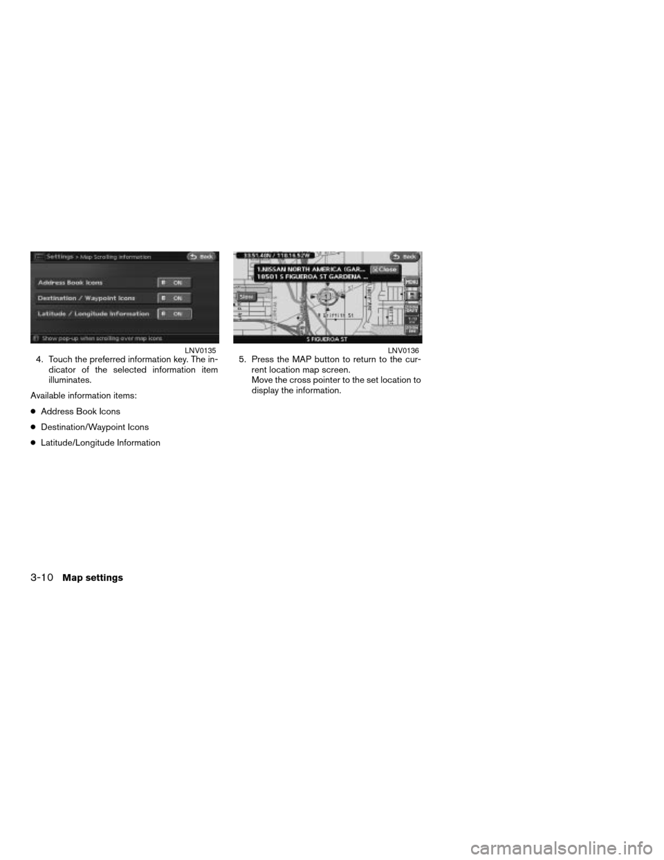
4. Touch the preferred information key. The in-
dicator of the selected information item
illuminates.
Available information items:
cAddress Book Icons
cDestination/Waypoint Icons
cLatitude/Longitude Information5. Press the MAP button to return to the cur-
rent location map screen.
Move the cross pointer to the set location to
display the information.LNV0135LNV0136
3-10Map settings
ZREVIEW COPYÐ2008 Altima(alt)
Navigation System OMÐUSA_English(nna)
03/06/07Ðarosenma
X
Page 55 of 237
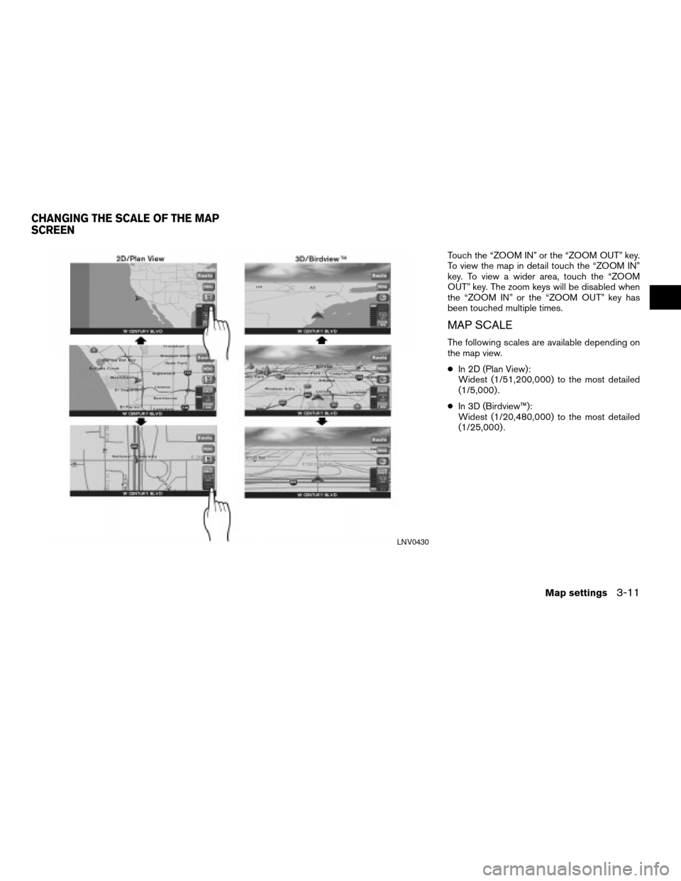
Touch the “ZOOM IN” or the “ZOOM OUT” key.
To view the map in detail touch the “ZOOM IN”
key. To view a wider area, touch the “ZOOM
OUT” key. The zoom keys will be disabled when
the “ZOOM IN” or the “ZOOM OUT” key has
been touched multiple times.
MAP SCALE
The following scales are available depending on
the map view.
cIn 2D (Plan View):
Widest (1/51,200,000) to the most detailed
(1/5,000) .
cIn 3D (Birdview™):
Widest (1/20,480,000) to the most detailed
(1/25,000) .
LNV0430
CHANGING THE SCALE OF THE MAP
SCREEN
Map settings3-11
ZREVIEW COPYÐ2008 Altima(alt)
Navigation System OMÐUSA_English(nna)
03/06/07Ðarosenma
X
Page 56 of 237
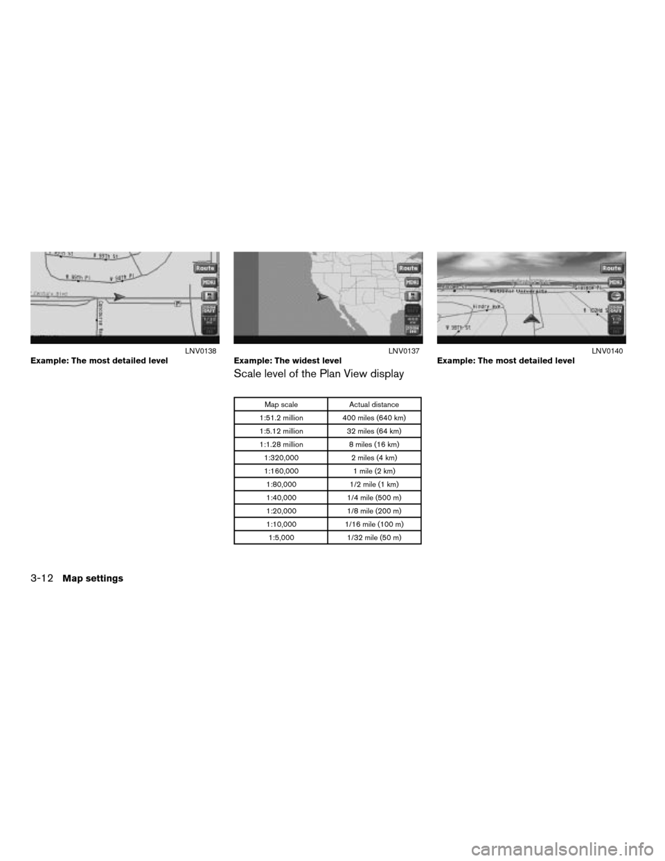
Scale level of the Plan View display
Map scale Actual distance
1:51.2 million 400 miles (640 km)
1:5.12 million 32 miles (64 km)
1:1.28 million 8 miles (16 km)
1:320,000 2 miles (4 km)
1:160,000 1 mile (2 km)
1:80,000 1/2 mile (1 km)
1:40,000 1/4 mile (500 m)
1:20,000 1/8 mile (200 m)
1:10,000 1/16 mile (100 m)
1:5,000 1/32 mile (50 m)
Example: The most detailed levelLNV0138Example: The widest levelLNV0137Example: The most detailed levelLNV0140
3-12Map settings
ZREVIEW COPYÐ2008 Altima(alt)
Navigation System OMÐUSA_English(nna)
03/06/07Ðarosenma
X
Page 57 of 237
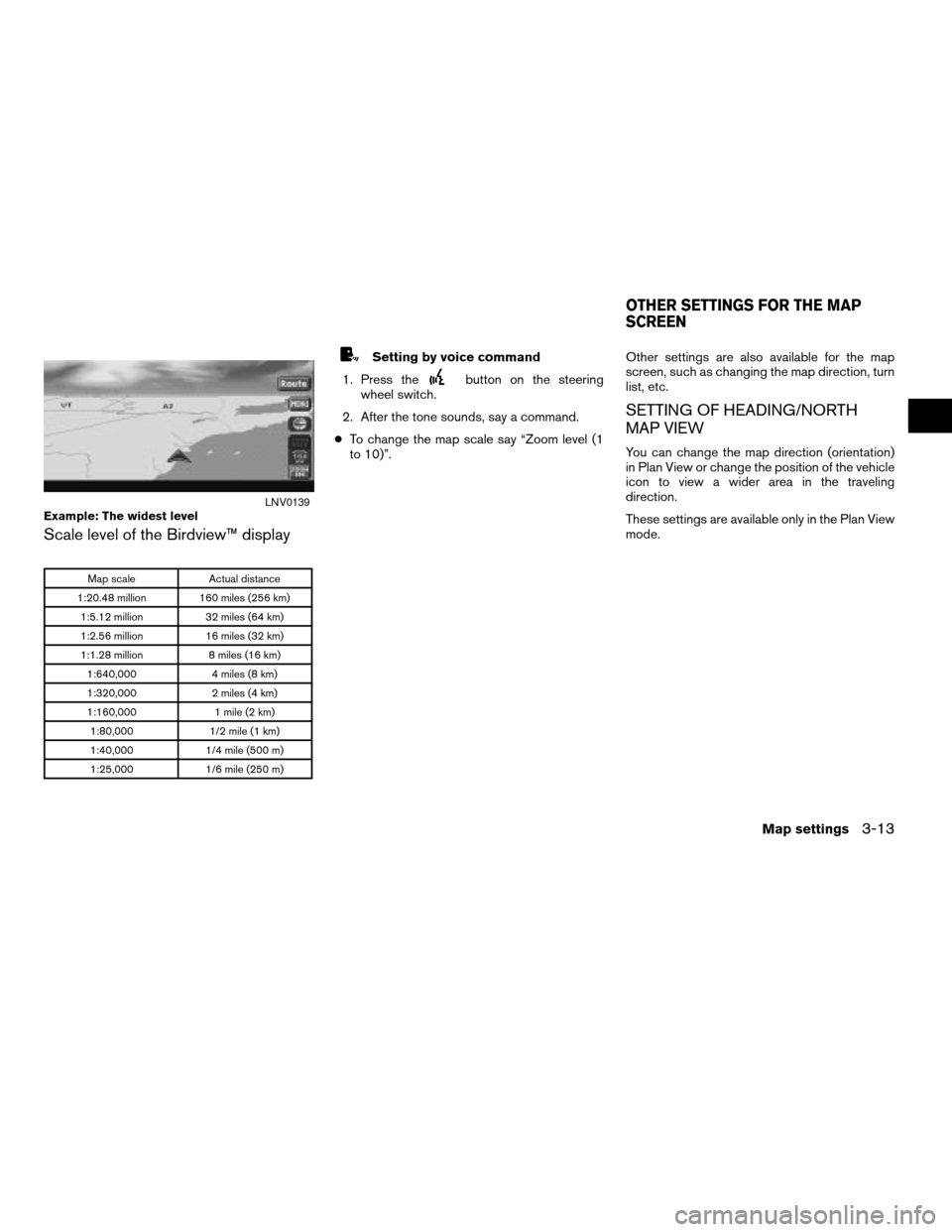
Scale level of the Birdview™ display
Map scale Actual distance
1:20.48 million 160 miles (256 km)
1:5.12 million 32 miles (64 km)
1:2.56 million 16 miles (32 km)
1:1.28 million 8 miles (16 km)
1:640,000 4 miles (8 km)
1:320,000 2 miles (4 km)
1:160,000 1 mile (2 km)
1:80,000 1/2 mile (1 km)
1:40,000 1/4 mile (500 m)
1:25,000 1/6 mile (250 m)
Setting by voice command
1. Press the
button on the steering
wheel switch.
2. After the tone sounds, say a command.
cTo change the map scale say “Zoom level (1
to 10)”.Other settings are also available for the map
screen, such as changing the map direction, turn
list, etc.
SETTING OF HEADING/NORTH
MAP VIEW
You can change the map direction (orientation)
in Plan View or change the position of the vehicle
icon to view a wider area in the traveling
direction.
These settings are available only in the Plan View
mode.
Example: The widest levelLNV0139
OTHER SETTINGS FOR THE MAP
SCREEN
Map settings3-13
ZREVIEW COPYÐ2008 Altima(alt)
Navigation System OMÐUSA_English(nna)
03/06/07Ðarosenma
X
Page 58 of 237
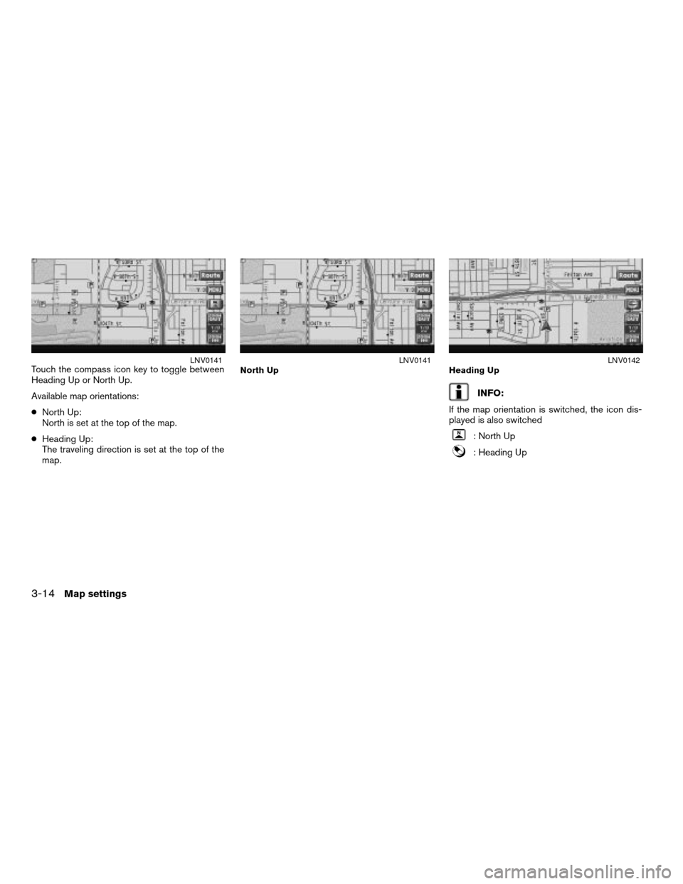
Touch the compass icon key to toggle between
Heading Up or North Up.
Available map orientations:
cNorth Up:
North is set at the top of the map.
cHeading Up:
The traveling direction is set at the top of the
map.
INFO:
If the map orientation is switched, the icon dis-
played is also switched
: North Up
: Heading Up
LNV0141North UpLNV0141Heading UpLNV0142
3-14Map settings
ZREVIEW COPYÐ2008 Altima(alt)
Navigation System OMÐUSA_English(nna)
03/06/07Ðarosenma
X
Page 59 of 237
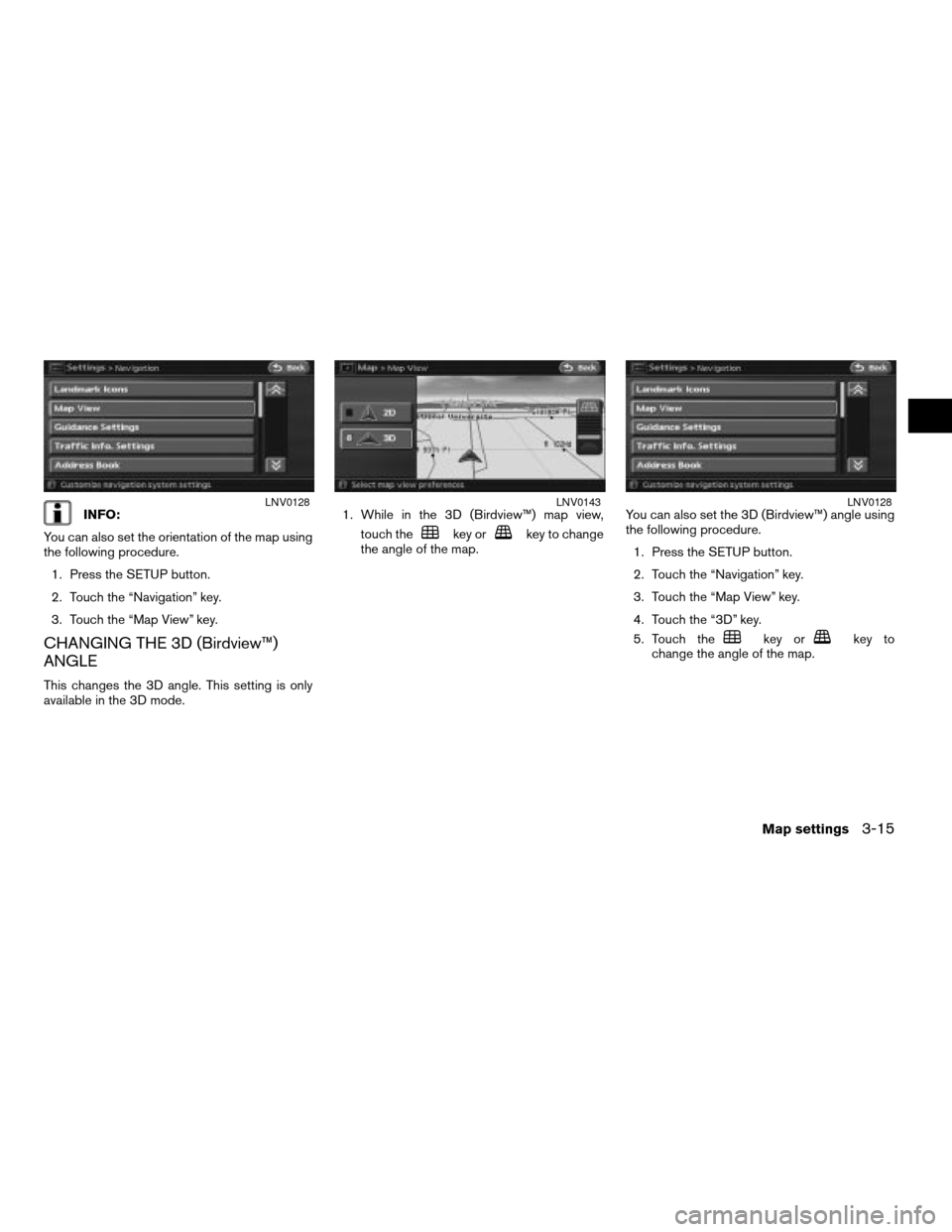
INFO:
You can also set the orientation of the map using
the following procedure.
1. Press the SETUP button.
2. Touch the “Navigation” key.
3. Touch the “Map View” key.
CHANGING THE 3D (Birdview™)
ANGLE
This changes the 3D angle. This setting is only
available in the 3D mode.1. While in the 3D (Birdview™) map view,
touch the
key orkey to change
the angle of the map.You can also set the 3D (Birdview™) angle using
the following procedure.
1. Press the SETUP button.
2. Touch the “Navigation” key.
3. Touch the “Map View” key.
4. Touch the “3D” key.
5. Touch the
key orkey to
change the angle of the map.
LNV0128LNV0143LNV0128
Map settings3-15
ZREVIEW COPYÐ2008 Altima(alt)
Navigation System OMÐUSA_English(nna)
03/06/07Ðarosenma
X
Page 60 of 237
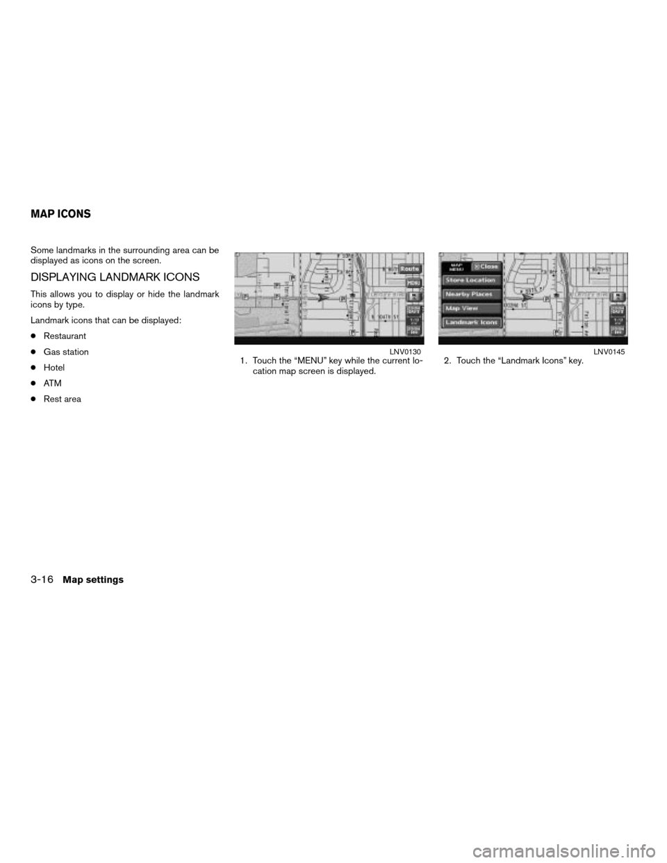
Some landmarks in the surrounding area can be
displayed as icons on the screen.
DISPLAYING LANDMARK ICONS
This allows you to display or hide the landmark
icons by type.
Landmark icons that can be displayed:
cRestaurant
cGas station
cHotel
cAT M
cRest area1. Touch the “MENU” key while the current lo-
cation map screen is displayed.2. Touch the “Landmark Icons” key.
LNV0130LNV0145
MAP ICONS
3-16Map settings
ZREVIEW COPYÐ2008 Altima(alt)
Navigation System OMÐUSA_English(nna)
03/06/07Ðarosenma
X
Trending: service reset, ESP, heater, ignition, brake, sat nav, navigation update
