service indicator NISSAN PATHFINDER 2017 R52 / 4.G Navigation Manual
[x] Cancel search | Manufacturer: NISSAN, Model Year: 2017, Model line: PATHFINDER, Model: NISSAN PATHFINDER 2017 R52 / 4.GPages: 164, PDF Size: 0.78 MB
Page 27 of 164

*6Starting point:
Displays the vehicle location, with which the
route is set, as the starting point.
*7Speed limit icon:
Displays the speed limit of the current
driving road.
*8NissanConnectSMServices antenna
icon
When the system connects to the Nissan-
Connect
SMServices Data Center, an an-
tenna icon will appear on the screen.
“NissanConnectSMServices features”
(page 7-14)
*9Clock
Display current time.
“Clock settings” (page 7-26)
*10Remaining time and distance to the
destination:
Indicates the approximate remaining time
and distance to the destination or waypoint.
This indicator will appear when a destination
or waypoint is set and route guidance is
started.
*11IVR soft button:
Touch the icon to connect to the Nissan-
Connect
SMServices Interactive Voice
Menu.
“Connecting to Interactive Voice
Menu” (page 7-18)
*12Map menu icon:
Touch the icon to display the shortcut menu
or map menu.
“Shortcut menu” (page 2-7)“Map menu” (page 2-8)
*13Scale indicator:
Indicates the scale of the map.
Touch the icon to display the scale bar. The
map scale can be adjusted using the scale
bar.
“Changing scale of map” (page 3-6)
*14/Direction indicator:
Indicates the directional setting of the map.
Touch the icon to change the setting.
: North always pointing up.
: Direction of the vehicle always pointing
up.
*15Avoid area (green or blue):
Displays the areas to avoid that are stored in
the Address Book. During the route search,
the route guidance is performed by search-
ing for a route that avoids those areas.
*16Street name:
Displays the name of the street that the vehicle is currently driving on.
*17Suggested route:
Appears in bold blue during route guidance.
*18Stored location (yellow):
Displays the locations that are stored in the
Address Book. The icons can be changed
according to your preferences.
*19Destination:
Indicates the destination location of the
route guidance.
Upon reaching the destination, the address
will be displayed on the map screen.
BirdviewTM(3D) MAP
BirdviewTMdisplays the map from an elevated
perspective. In BirdviewTM, it is easy to recognize
an image of the route because it provides a
panoramic view over a long distance.
3-3
3. Map operation
Page 92 of 164
![NISSAN PATHFINDER 2017 R52 / 4.G Navigation Manual TRAFFIC INFORMATION SETTINGS
This displays or changes the settings for the
traffic information related functions.
1. Push<SETTING>.
2. Touch [Navigation].
3. Touch [Traffic Info Settings].
4. Touch th NISSAN PATHFINDER 2017 R52 / 4.G Navigation Manual TRAFFIC INFORMATION SETTINGS
This displays or changes the settings for the
traffic information related functions.
1. Push<SETTING>.
2. Touch [Navigation].
3. Touch [Traffic Info Settings].
4. Touch th](/img/5/542/w960_542-91.png)
TRAFFIC INFORMATION SETTINGS
This displays or changes the settings for the
traffic information related functions.
1. Push
2. Touch [Navigation].
3. Touch [Traffic Info Settings].
4. Touch the preferred setting. The indicator for the selected setting illuminates.
Available setting items . [Use Traffic Info]:
Enables all traffic information related func-
tions.
. [Show Incidents on Map]:
Displays the traffic incidents (e.g., accident)
on the map screen.
. [Show Traffic Info]:
Displays the traffic flow with an arrow on the
map screen. .
[Traffic Announcements]:
Announces the traffic information event on
the route.
INFO:
. Even when [Show Traffic Info] and [Show
Incidents on Map] are set to off, the list
display of [Info on Route] and [Nearby Traffic
Info] will not be affected.
. Even when [Traffic Announcement] is set to
off, the route guidance will not be affected.
Also, the announcement of emergency in-
formation and weather information will not be
turned off.
Voice command
1. Push <
>located on the steering-wheel.
2. After the tone sounds, speak a command. To turn the traffic information system on or
off:
“Traffic Information”
TRAFFIC INFORMATION ON MAP
With a subscription to SiriusXM Traffic service,
traffic information is displayed on both 2D map
and Birdview
TMmap screen.
“Notes on SiriusXM Traffic information”
(page 7-13)
Screen information
7-6
7. Information and settings
Page 93 of 164

*1Traffic indicator:
Displays the reception condition of traffic
information transmitted from the provider.When reception condition of traffic
information transmitted from the provider is
not detected, the traffic indicator will be
“grayed-out”.
*2Estimated travel time to destination calcu-
lated with consideration of traffic informa-
tion on route.
*3Road conditions
Free Flow: Green arrow
Moderate traffic: Yellow arrow
Heavy traffic: Red arrow
Section affected by serious traffic event:
Purple arrow
*4Traffic information icon:
If a route is not already set, all of the traffic
information icons on the map screen are
displayed in color. When a route is already
set, the icons on the route are displayed in
color, and the icons outside the route are
displayed in gray.
: Accident
: Closed road
: Information
: Road work
: Slippery road
: Weather
: Incident
Traffic information display and scale levels
2D map and Birdview Map
5 miles 10 km
2 miles 4 km
1 mile 2 km
1/2 mile 1 km
1/4 mile 400 m
1/8 mile 200 m
1/16 mile 100 m
1/32 mile 50 m
1/64 mile 25 m
SiriusXM TRAVEL LINK�Š
SiriusXM Travel Link information is a subscription
service offered by SiriusXM Satellite Radio. It is
necessary to subscribe to use the SiriusXM
Travel Link information.
This service provides real-time information re-
garding current weather, fuel prices, sports
scores, stock tickers and movie times where
available. The SiriusXM Travel Link is broadcast
to the vehicle by SiriusXM Satellite Radio.
The service enables you to view the following
information on the navigation system: *Current information around the destination
*Detailed information and forecasts of an area of
interest
*Countrywide and local maps with the current
weather, temperature, warnings and road condi-
tion information
*List of warning/watches events detected
around the current location
*Pop-up messages on the navigation screen with
voice announcements when warnings and
watches are detected around the current loca-
tion
7-7
7. Information and settings
Page 108 of 164

1-855-426-6628
WARNING
.Please note that the Automatic Colli-
sion Notification service and Emer-
gency Call function cannot be used
under the following conditions:
— NissanConnect
SMServices sub-
scription has expired or was can-
celed.
— The vehicle is outside the area where the cellular network service
is receivable.
— The vehicle is in a location with poor signal reception such as a
tunnel, underground parking gar-
age, behind a building or in a
mountainous areas.
— The line is busy.
— The TCU (Telematics Control Unit) or other systems of your vehicle
are not working properly.
— The NissanConnect
SMServices
network system is disabled.
— It may not be possible to make an emergency call in the event of some accidents or emergencies,
or if you are in a location without
reception.
. Park the vehicle in a safe location
and set the parking brake before
operating
. Only use this service in the event of
an emergency. There may be a pen-
alty for inappropriate use of the
service.
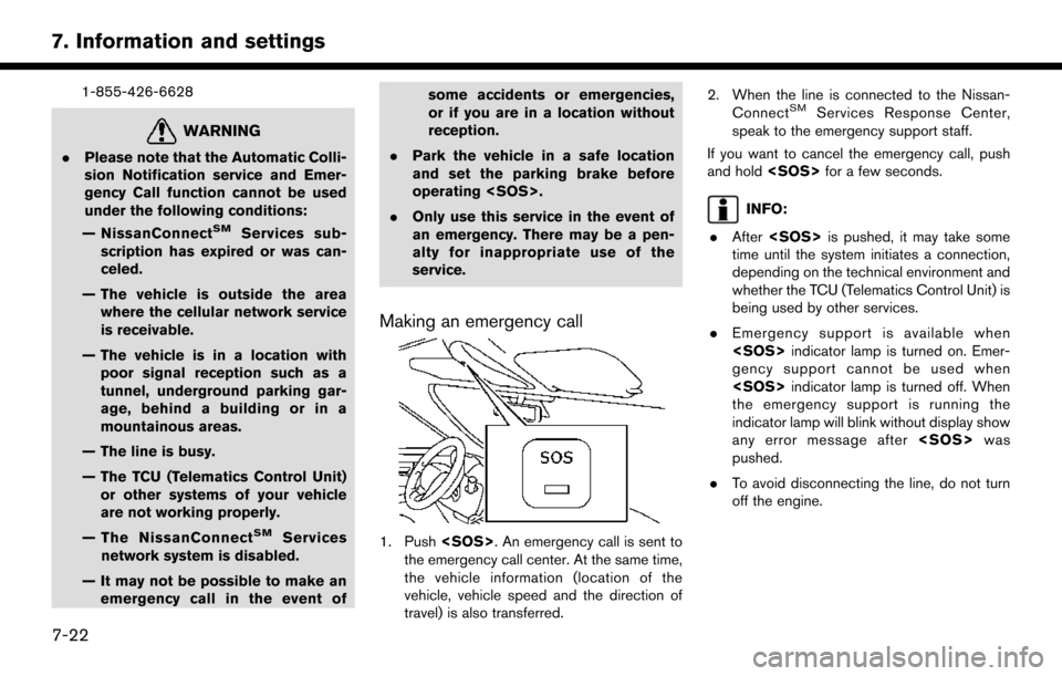
Making an emergency call
1. Push
the emergency call center. At the same time,
the vehicle information (location of the
vehicle, vehicle speed and the direction of
travel) is also transferred. 2. When the line is connected to the Nissan-
Connect
SMServices Response Center,
speak to the emergency support staff.
If you want to cancel the emergency call, push
and hold
INFO:
. After
time until the system initiates a connection,
depending on the technical environment and
whether the TCU (Telematics Control Unit) is
being used by other services.
. Emergency support is available when
gency support cannot be used when
the emergency support is running the
indicator lamp will blink without display show
any error message after
pushed.
. To avoid disconnecting the line, do not turn
off the engine.
7-22
7. Information and settings