SKODA FABIA 2004 1.G / 6Y Sat Compass Navigation System Manual
Manufacturer: SKODA, Model Year: 2004, Model line: FABIA, Model: SKODA FABIA 2004 1.G / 6YPages: 71, PDF Size: 2.81 MB
Page 51 of 71
50RADIO NAVIGATION SYSTEM
NAVIGATION
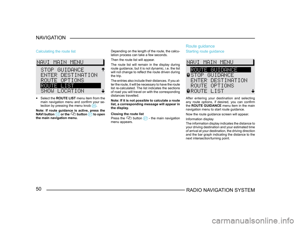
Calculating the route list
•
Select the ROUTE LIST menu item from the
main navigation menu and confirm your se-
lection by pressing the menu knob
.
Note: If route guidance is active, press the
NAVI button or the button to open the main navigation menu. Depending on the length of the route, the calcu-
lation process can take a few seconds.
Then the route list will appear.
The route list will remain in the display during
route guidance, but it is not dynamic, i.e. the list
will not change to reflect the route driven during
the trip.
The entries also include their distances. If you al
-
ter the route, it will be necessary to have the route
list re-calculated. The list indicates the sections
of road you will travel on with the corresponding
distances travelled.
Note: If it is not possible to calculate a route
list, a corresponding message will appear in
the display.
Closing the route list
Press the button - the main navigation menu appears.
Route guidance
Starting route guidance
After entering your destination and selecting
any route options, if desired, you can confirm
the ROUTE GUIDANCE menu item in the main
navigation menu to start route guidance.
Now the route guidance screen will appear.
Information display
The information display indicates the distance to
your driving destination and your estimated time
of arrival at your destination, the driving direction
and the bar graph indicating the distance to the
next intersection/turning point.
Page 52 of 71
51RADIO NAVIGATION SYSTEMNAVIGATION
If the
DRIVE SYMBOLS: ON option is set in the
navigation setup menu (see page 14), the visual
driving recommendations will appear in the radio
navigation system’s display and in the instrument
cluster. If the DRIVE SYMBOLS: OFF option is
selected, the visual driving recommendations will
only appear in the instrument cluster’s display. In
this case, the radio navigation system’s display
will contain information on your destination. If the
instrument cluster is not equipped with a display
and the DRIVE SYMBOLS: OFF option is set,
route guidance will only provide spoken driving
recommendations.
Displaying the complete destination ad -
dress
Press INFO
to display the current destination along with detailed information. The most recent
spoken driving recommendation will also be re-
peated at this time.
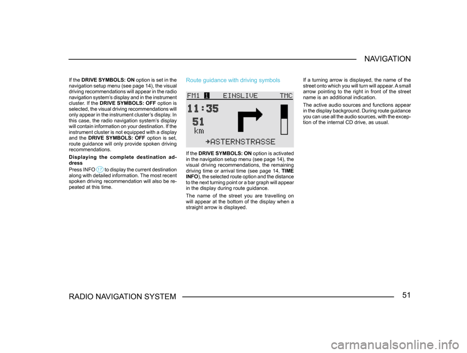
Route guidance with driving symbols
If the DRIVE SYMBOLS: ON option is activated
in the navigation setup menu (see page 14), the
visual driving recommendations, the remaining
driving time or arrival time (see page 14, TIME
INFO ), the selected route option and the distance
to the next turning point or a bar graph will appear
in the display during route guidance.
The name of the street you are travelling on
will appear at the bottom of the display when a
straight arrow is displayed. If a turning arrow is displayed, the name of the
street onto which you will turn will appear. A small
arrow pointing to the right in front of the street
name is an additional indication.
The active audio sources and functions appear
in the display background. During route guidance
you can use all the audio sources, with the excep
-
tion of the internal CD drive, as usual.
Page 53 of 71
52RADIO NAVIGATION SYSTEM
NAVIGATION
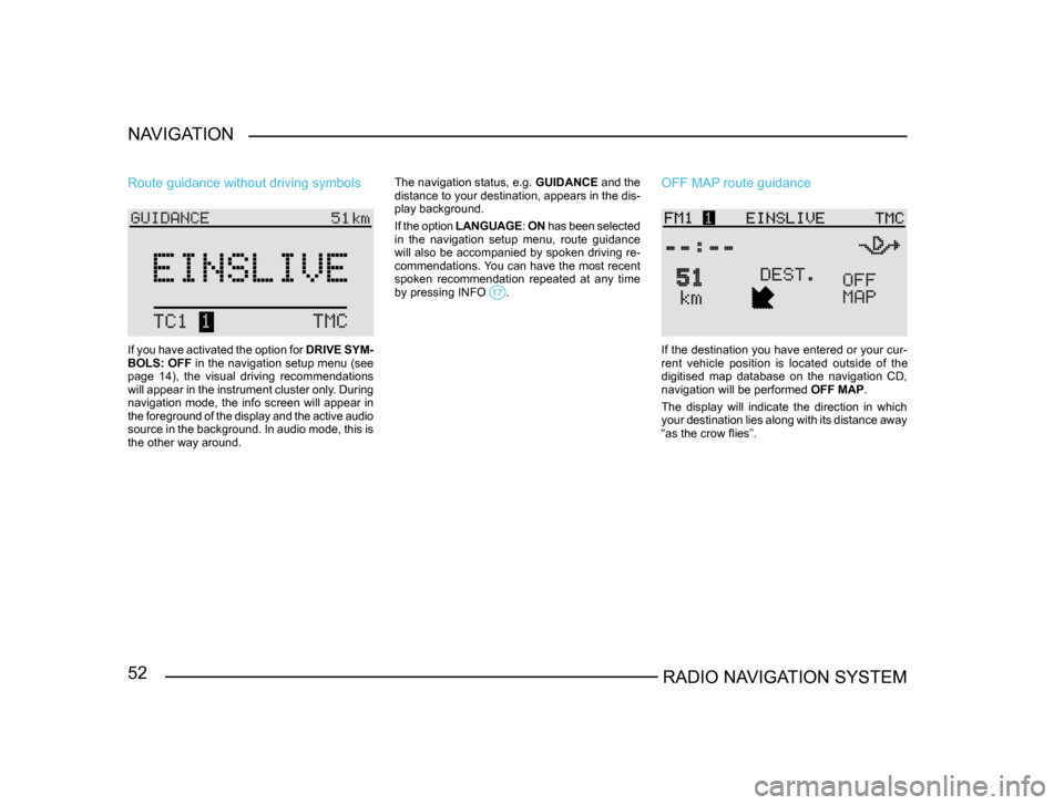
Route guidance without driving symbols
If you have activated the option for
DRIVE SYM-
BOLS: OFF in the navigation setup menu (see
page 14), the visual driving recommendations
will appear in the instrument cluster only. During
navigation mode, the info screen will appear in
the foreground of the display and the active audio
source in the background. In audio mode, this is
the other way around. The navigation status, e.g.
GUIDANCE and the
distance to your destination, appears in the dis-
play background.
If the option LANGUAGE : ON has been selected
in the navigation setup menu, route guidance
will also be accompanied by spoken driving re-
commendations. You can have the most recent
spoken recommendation repeated at any time
by pressing INFO
.
OFF MAP route guidance
If the destination you have entered or your cur-
rent vehicle position is located outside of the
digitised map database on the navigation CD,
navigation will be performed OFF MAP.
The display will indicate the direction in which
your destination lies along with its distance away
“as the crow flies”.
Page 54 of 71
53RADIO NAVIGATION SYSTEMNAVIGATION
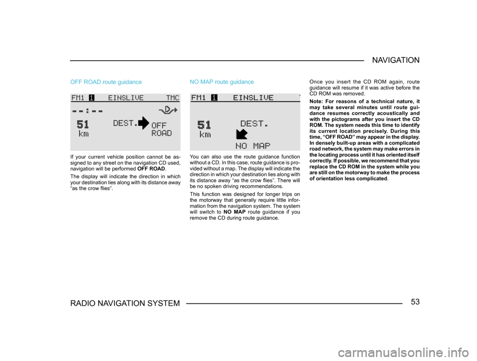
OFF ROAD route guidance
If your current vehicle position cannot be as
-
signed to any street on the navigation CD used,
navigation will be performed OFF ROAD.
The display will indicate the direction in which
your destination lies along with its distance away
“as the crow flies”.
NO MAP route guidance
You can also use the route guidance function
without a CD. In this case, route guidance is pro -
vided without a map. The display will indicate the
direction in which your destination lies along with
its distance away “as the crow flies”. There will
be no spoken driving recommendations.
This function was designed for longer trips on
the motorway that generally require little infor-
mation from the navigation system. The system
will switch to NO MAP route guidance if you
remove the CD during route guidance. Once you insert the CD ROM again, route
guidance will resume if it was active before the
CD ROM was removed.
Note: For reasons of a technical nature, it
may take several minutes until route gui-
dance resumes correctly acoustically and
with the pictograms after you insert the CD
ROM. The system needs this time to identify
its current location precisely. During this
time, “OFF ROAD” may appear in the display.
In densely built-up areas with a complicated
road network, the system may make errors in
the locating process until it has oriented itself
correctly. If possible, we recommend that you
replace the CD ROM in the system while you
are still on the motorway to make the process
of orientation less complicated
.
Page 55 of 71
54RADIO NAVIGATION SYSTEM
NAVIGATION
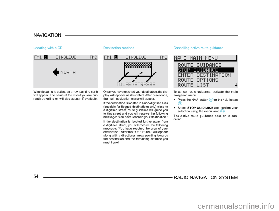
Locating with a CD
When locating is active, an arrow pointing north
will appear. The name of the street you are cur-
rently travelling on will also appear, if available.
Destination reached
Once you have reached your destination, the dis
-
play will appear as illustrated. After 5 seconds,
the main navigation menu will appear.
If the destination is located in a non-digitised area
(possible for flagged destinations only) close to
a digitised street, route guidance will guide you
to this street and you will receive the following
message: “You have reached your destination.”
If the destination is located further away from
a digitised street, you will receive the following
message: “You have reached the area of your
destination.” After that “OFF ROAD” will appear
along with a directional arrow pointing towards
the destination and the remaining distance you
must travel.
Cancelling active route guidance
To cancel route guidance, activate the main
navigation menu.
• Press the NAVI button or the button .
• Select STOP GUIDANCE and confirm your
selection using the menu knob .
The active route guidance session is can -
celled.
Page 56 of 71
55RADIO NAVIGATION SYSTEMNAVIGATION
Destination memory
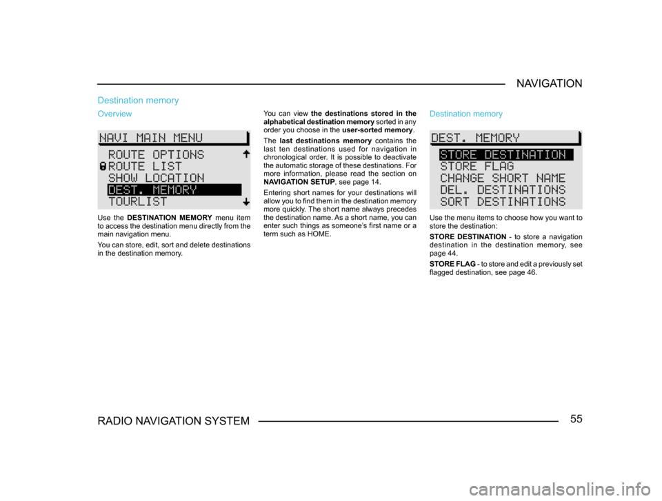
Overview
Use the
DESTINATION MEMORY menu item
to access the destination menu directly from the
main navigation menu.
You can store, edit, sort and delete destinations
in the destination memory. You can view
the destinations stored in the
alphabetical destination memory sorted in any
order you choose in the user-sorted memory.
The last destinations memory contains the
last ten destinations used for navigation in
chronological order. It is possible to deactivate
the automatic storage of these destinations. For
more information, please read the section on
NAVIGATION SETUP , see page 14.
Entering short names for your destinations will
allow you to find them in the destination memory
more quickly. The short name always precedes
the destination name. As a short name, you can
enter such things as someone’s first name or a
term such as HOME.
Destination memory
Use the menu items to choose how you want to
store the destination:
STORE DESTINATION - to store a navigation
destination in the destination memory, see
page 44.
STORE FLAG - to store and edit a previously set
flagged destination, see page 46.
Page 57 of 71
56RADIO NAVIGATION SYSTEM
NAVIGATION
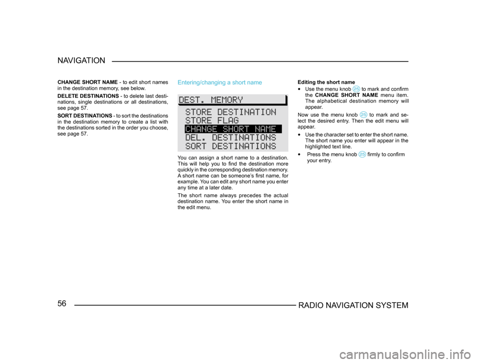
CHANGE SHORT NAME
- to edit short names
in the destination memory, see below.
DELETE DESTINATIONS - to delete last desti-
nations, single destinations or all destinations,
see page 57.
SORT DESTINATIONS - to sort the destinations
in the destination memory to create a list with
the destinations sorted in the order you choose,
see page 57.Entering/changing a short name
You can assign a short name to a destination.
This will help you to find the destination more
quickly in the corresponding destination memory.
A short name can be someone’s first name, for
example. You can edit any short name you enter
any time at a later date.
The short name always precedes the actual
destination name. You enter the short name in
the edit menu. Editing the short name
• Use the menu knob to mark and confirm the CHANGE SHORT NAME menu item.
The alphabetical destination memory will
appear.
Now use the menu knob
to mark and se-lect the desired entry. Then the edit menu will
appear.
• Use the character set to enter the short name.
The short name you enter will appear in the
highlighted text line.
• Press the menu knob firmly to confirm
your entry .
Page 58 of 71
57RADIO NAVIGATION SYSTEMNAVIGATION
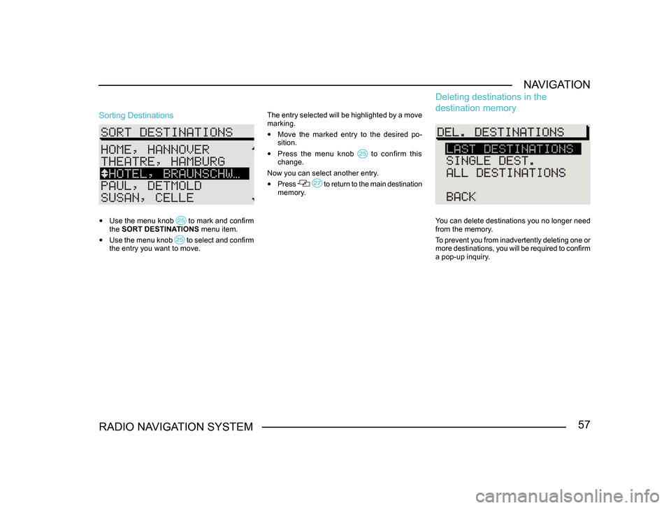
Sorting Destinations
•
Use the menu knob to mark and confirm the SORT DESTINATIONS menu item.
• Use the menu knob to select and confirm the entry you want to move. The entry selected will be highlighted by a move
marking.
•
Move the marked entry to the desired po-
sition.
• Press the menu knob to confirm this change.
Now you can select another entry.
• Press to return to the main destination memory.
Deleting destinations in the
destination memory
You can delete destinations you no longer need
from the memory.
To prevent you from inadvertently deleting one or
more destinations, you will be required to confirm
a pop-up inquiry.
Page 59 of 71
58RADIO NAVIGATION SYSTEM
NAVIGATION
•
Use the menu knob to mark and confirm the DELETE DESTINATIONS menu item in
the main destination memory menu.
LAST DESTINATIONS - The memory containing
the last destinations will be deleted. This option is
not available unless the last destinations memory
has been activated (see NAVIGATION SETUP,
page 14).
SINGLE DESTINATION - You can also delete
single destinations from the memory. First you
will see a list of all the destinations to allow you
to select the destination you want to delete.
ALL DESTINATIONS - All the destinations in the
destination memory will be deleted.
After you select one of these menu items, you
will be required to confirm a pop-up inquiry. The
cursor will automatically mark CANCEL in the
inquiry.
Bypassing traffic congestion
Activating the traffic congestion function
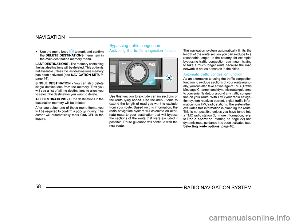
Use this function to exclude certain sections of
the route lying ahead. Use the menu items to
extend the length of road you want to exclude
from your route. Based on this information, the
radio navigation system will calculate an alter-
nate route to your destination that will bypass
the sections of the route that were excluded if
possible. Route guidance will continue with the
new route. The navigation system automatically limits the
length of the route section you can exclude to a
reasonable length. In the country, for example,
bypassing traffic congestion can mean having
to take a much longer route because the road
network is not as dense as in the cities.
Automatic traffic congestion function
As an alternative to using the traffic congestion
function to exclude sections of your route manu
-
ally, you can also take advantage of TMC (Traffic
Message Channel) and dynamic route guidance
to conveniently detour around any traffic conges -
tion on your route. With TMC your radio naviga-
tion system receives current, digital traffic infor -
mation from TMC radio stations. The system then
evaluates this information in planning the route.
This is not possible unless you have tuned into
a TMC radio station (for more information, refer
to Radio operation, starting on page 22) and
dynamic route guidance has been activated (see
Selecting route options , page 48).
Page 60 of 71
59RADIO NAVIGATION SYSTEMNAVIGATION
Note: The radio navigation system always
calculates the best route in terms of time for
the automatic traffic congestion function,
i.e. if bypassing the congestion means that
you will have to drive much farther, the radio
navigation system may choose to go through
the congestion. This depends on the length
and type of traffic congestion involved as
reported in the traffic information and the
length of a possible detour
.
Activating the main traffic congestion menu
• Press the traffic congestion button du-ring route guidance to calculate an alternate
route.
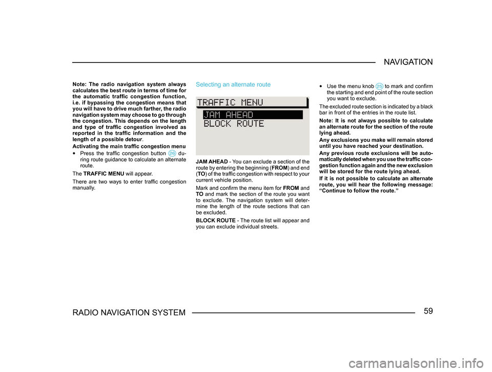
The TRAFFIC MENU will appear.
There are two ways to enter traffic congestion
manually.
Selecting an alternate route
JAM AHEAD - You can exclude a section of the
route by entering the beginning ( FROM) and end
( TO ) of the traffic congestion with respect to your
current vehicle position.
Mark and confirm the menu item for FROM and
TO and mark the section of the route you want
to exclude. The navigation system will deter-
mine the length of the route sections that can
be excluded.
BLOCK ROUTE - The route list will appear and
you can exclude individual streets.
• Use the menu knob to mark and confirm the starting and end point of the route section
you want to exclude.
The excluded route section is indicated by a black
bar in front of the entries in the route list.
Note: It is not always possible to calculate
an alternate route for the section of the route
lying ahead.
Any exclusions you make will remain stored
until you have reached your destination.
Any previous route exclusions will be auto-
matically deleted when you use the traffic con-
gestion function again and the new exclusion
will be stored for the route lying ahead.
If it is not possible to calculate an alternate
route, you will hear the following message:
“Continue to follow the route.”