sat nav TOYOTA tC 2016 Accessories, Audio & Navigation (in English)
[x] Cancel search | Manufacturer: TOYOTA, Model Year: 2016, Model line: tC, Model: TOYOTA tC 2016Pages: 164, PDF Size: 6.21 MB
Page 4 of 164

PREMIUM AUDIO SYST EM OWNER’S M ANUAL
This manual explains the operation of the Premium Audio system. Please read
this manual carefully to ensure proper use.
The screen shots in this document and the actual screens of the Premium Audio
s ystem may differ depending on wh ether the functions and/or a c ontract existed
and the map data available at the time o f producing this document.
Please be aware that the content of th is manual may be different from the
nav ig atio n/multimedia system in some cases, such as w hen the syst em’s
software is updated.
NAVIG ATION SYSTEM
The Navigation System is one of the most technologically advanced vehicle
ac ce ssories ever devel oped. The system re ce ives satel lite sig nals from the
Global Positioning System (GPS) o perated by the U.S. Departm ent of Defense.
Using these signals and other vehicle sensors, the system indicates your
present p os ition and assists in locating a desired destination.
The navigation system is designed to select efficient routes from your present
s ta rting location to you r destination. The system is also designed to direct you
to a destination that is unfamiliar to you in an efficient manne r. The s ystem is
devel oped by “Harman International” us ing “HERE ” maps. The calculated
routes may not be the sh ortest n or th e least tra ffic co ngested. Your own
personal local knowledge or “short cut” may at times be faster than the
calculated routes.
The navigation system’s database includes Point of Interest (POI) categories to
allow yo u to eas ily select destinations such as restaurants, hotels and others . If
a destination is not in the database , you can enter the street address or a
major intersection c lose to it and the system will guide you there.
The system will provide both a visual map and audio instructions. The audio
in structions will announce the distance remain ing and the direction to turn in
approaching an
intersection. These voice instructions will help you keep your
eyes on the road and are tim ed to provide enough time to allow you to
maneuver, c hange lanes or slow down.
Pl ease be aw are th at all curre nt vehicle navigation systems have certain
limit atio ns that may affect their ability to perform properly. The accurac y of the
vehi cle’s position depends on the satellite condition, road co nf ig uration,
vehicle co ndi tion or other circumstances. For more in formation on the
limitations of the s ystem, refer to page 156.
4
Page 73 of 164

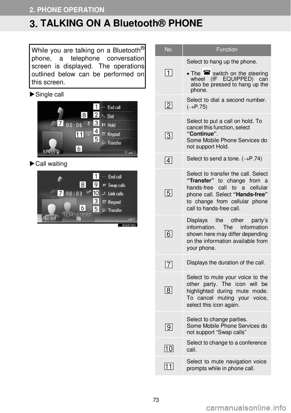
No. F unction
Select to hang up the phon e.
• T he switch on the steering wh eel (IF EQUIPPED) can also be pressed to hang up the phone .
Select to dial a second number. (→ P.7 5)
Select to put a c a ll on hold. T o cancel this functi on, select “Contin ue”. Some Mobile Phone Services do not support Hold.
Select to send a to ne. ( → P.74)
Select to transfer the call. Select “ T ransfer” to change from a
hands -fr ee call to a cellular phone call. Select “Ha nds -free”
to change f rom cellular phon e call to hands -fr ee ca ll.
Displays the other par ty’s
information . The information show n here m ay differ depending on th e infor mation available fr om your phone.
Displays the dur ation of the call.
Select to mute your voice to th e other par ty. The icon will be highlighted during mute mode. To cancel muting your voice, select this icon a gain.
Select to change parties. Some Mobile Phone Services do not support “Swap calls”
Select to change to a confer ence ca ll.
Select to mute navigation voice prompts while in p hone call.
2. PHONE OPERATION
3. TALKING ON A Bluetooth® PHONE
While you are tal king on a Bluetoot h®
phone, a telephon e conversation
s creen is displayed. The operations
outline d belo w can be performed on
this screen.
Single call
C all waitin g
1
2
3
4
5
6
7
8
9
10
11
11
73
Page 113 of 164

1. BASIC INFORMATION BEFORE OPERATION 1. BASIC INFORMATION BEFORE OPERATION
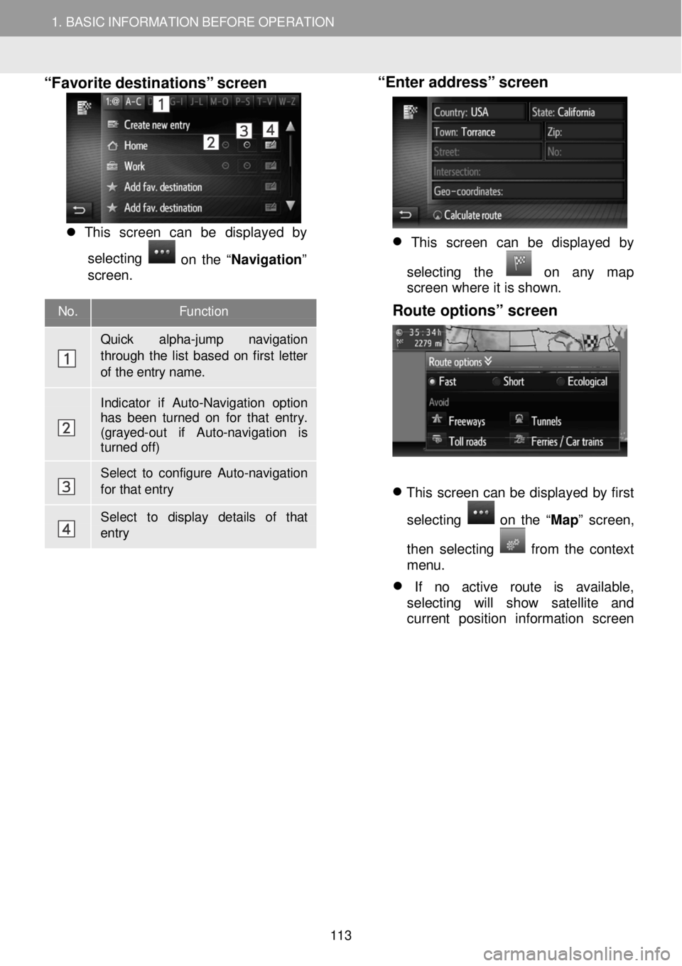
No. Function
Quick alpha-jump navigation through the list based on first letter
of the entry name.
Indicator if Auto-Navigation option has been turned on for that entry. (grayed-out if Auto -navigation is turned off)
Select to configure Auto- navigation for that entry
Select to display details of that entry
“Favorite destinations” s creen
Thi s scr een can be disp laye d by
s e le cting
o n th e “Nav igat io n ”
screen .
“Enter address” screen
This screen can be displayed by
selecting the
on any map
screen where it is shown.
Route options” screen
This screen can be displayed by first
selecting
on the “ Map” screen,
then selecting
fr om the context
menu.
If no active route is available,
selecting will show satellite and
current position information screen
113
Page 156 of 164

7. NAVIGATION SYSTEM INFORMATION
1. LIMITATIONS OF THE NAVIGATION SYSTEM
7. NAVIGATION SYSTEM INFORMATION
This navigation system calculates the
c u rrent vehicle position using satellite
s ignals, various vehicle signals, map
data, etc. However, an accurate
positi on may not be shown depending
on sa tellite condition, road
configuration, ve hicle condition or
other c irc umstances.
The Globa l Pos iti o n in g System (GPS)
d eve lope d and operated by th e U.S.
Dep art m ent of D efe nse provides an
a ccurate c urre nt vehic le pos it io n, normal ly
using 4 or more sa te llites, a nd in some
case 3 sat ellites. The GPS system h a s a
certa in le ve l o f inaccuracy. W hile the
navi gation system will compe nsa te for this
m ost of th e time, occasio nal positio ning
errors of up to
1 00 m (3 00 feet) can and sh ould be
ex pected. Gene rally, p osit ion errors w ill
b e c orre cted w ith in a few second s.
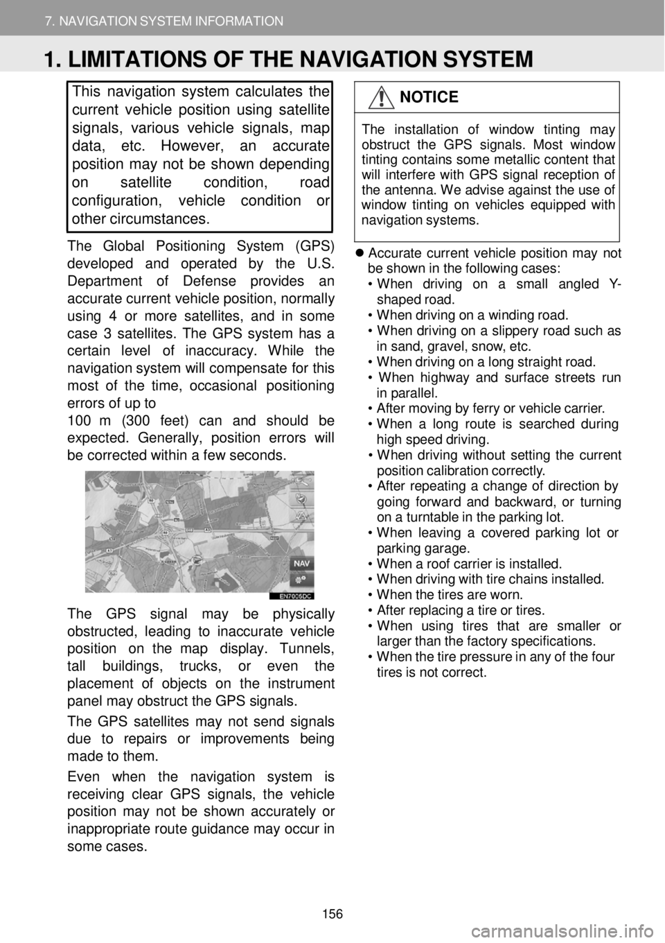
The GPS signa l may be physic ally
o bstructed, l ead ing to in acc u ra te veh icle
p ositi o n on t he map display. Tunne ls,
ta ll bu ildin gs, trucks, or eve n th e
p laceme nt of obje cts on the in str um ent
pan el may obstruct the GPS signals.
T he GPS satel lites may not send sign als
d ue to r epa irs or im pro ve m en ts being
m ade to the m.
Even when the navigation system is
re ce iving clear GPS s ignal s, the v ehicle
p osition m ay not be shown accurately or
i na pprop riate ro ute g u id an ce m ay occ ur in
so me ca se s.
NOTICE
T he in sta lla tio n of windo w tint in g may
obs truc t th e GP S sig nal s. Mos t w indow
t in tin g co ntain s som e me tallic con tent t hat
w ill in terf ere wi th GP S s ign al re cept io n o f
t h e an tenn a. W e a dvi se aga inst t he us e o f
win dow ti ntin g on veh ic les eq uip ped w ith
n av iga tio n s yst ems.
Accurate current v e hi cle po sit io n m ay n ot
b e s h ow n in th e fo llo w in g c a ses:
• When d riv in g o n a sm all a ng le d Y -
shap ed r o ad.
• When dr iv in g o n a w indi ng roa d.
• When drivi ng on a s lipper y ro ad su ch as
i n sa nd, grav el, sno w, e tc.
• When dr iv in g o n a lo ng s tra ight r o ad.
• When highw ay a nd s u rfac e s treet s run
i n p ar all el.
• A ft e r moving by ferry o r veh icle carri er.
• When a lon g ro ute is searc hed dur ing
hi gh s peed dr iv ing .
• When drivi ng w ith out s e ttin g th e c u rre nt
pos it io n ca librat io n c o rre ctly .
• A ft e r re peati ng a chan ge o f d irec tio n by
go in g fo rwar d a nd backward , o r turni ng
o n a turnt able in t h e p a rk in g lo t.
• When le avi ng a c o vere d p ark in g lo t or
p ark in g garag e.
• When a roof carrie r is ins ta lle d.
• When dr iv in g w ith tir e ch ain s ins tal led.
• When t h e t ire s ar e wor n.
• A ft e r repl acin g a tir e o r t ires .
• When u sin g tire s th at ar e sma ller or
large r t han t h e f a ct ory s p ec if ica tio ns.
• When t h e t ir e pr essur e i n a ny o f t h e f our
ti re s is not c o rre ct.
1. LIMITATIONS OF THE NAVIGATION SYSTEM
156