navigation system HONDA HR-V 2016 2.G Navigation Manual
[x] Cancel search | Manufacturer: HONDA, Model Year: 2016, Model line: HR-V, Model: HONDA HR-V 2016 2.GPages: 250, PDF Size: 4.84 MB
Page 35 of 250
34
uu Personal Information u PIN Numbers
System Setup
PIN Numbers
H HOME u Settings u Navigation u Personal Info tab u PIN Number
Set a 4-digit PIN for protecting personal addresse
s and your home addresses. Once
you set a PIN, you are prompted to enter it whenever you access a personal address
or a home address for the first time afte r setting the power mode to ACCESSORY or
ON.
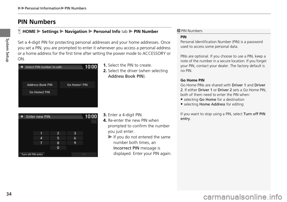
1.Select the PIN to create.
2. Select the driver (when
selecting
Address Book PIN ).
3. Enter a 4-digit PIN.
4. Re-enter the new PIN when
p
rompted to confirm the number
you just enter.
u If yo u do not entered the same
number
both times, an
Incorrect PIN message is
displayed. Enter your PIN again.
1 PIN Numbers
PIN
Personal Identification Nu mber (PIN) is a password
used to access some personal data.
PINs are optional. If you choose to use a PIN, keep a
note of the number in a secure location. If you forget
your PIN, contact your deal er. The factory default is
no PIN.
Go Home PIN
Go Home PINs are shared with Driver 1 and Driver
2. If either Driver 1 or Driver 2 sets a Go Home PIN,
both of them need to enter the PIN when:
•selecting Go Home for a destination
•selecting Home Address for editing
If you want to stop using a PIN, select Turn off PIN
entry .
Page 36 of 250
35
uu Personal Information u User Name
System Setup
User Name
H HOME u Settings u Navigation u Personal Info tab u User Name
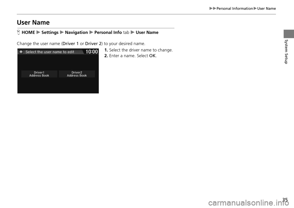
Change the user name ( Driver 1 or Driver 2 ) to y
our desired name.
1. Select the driver
name to change.
2. Enter a name. Select OK.
Page 37 of 250
36
uu Personal Information u Previous Destination
System Setup
Previous Destination
H HOME u Settings u Navigation u Personal Info tab u Previous
Dest
ination
The navigation system maintain s a list of your
previously routed destinations as a
shortcut for entering the same destination in the future. You can delete some or all
of your previous destinations from the list.
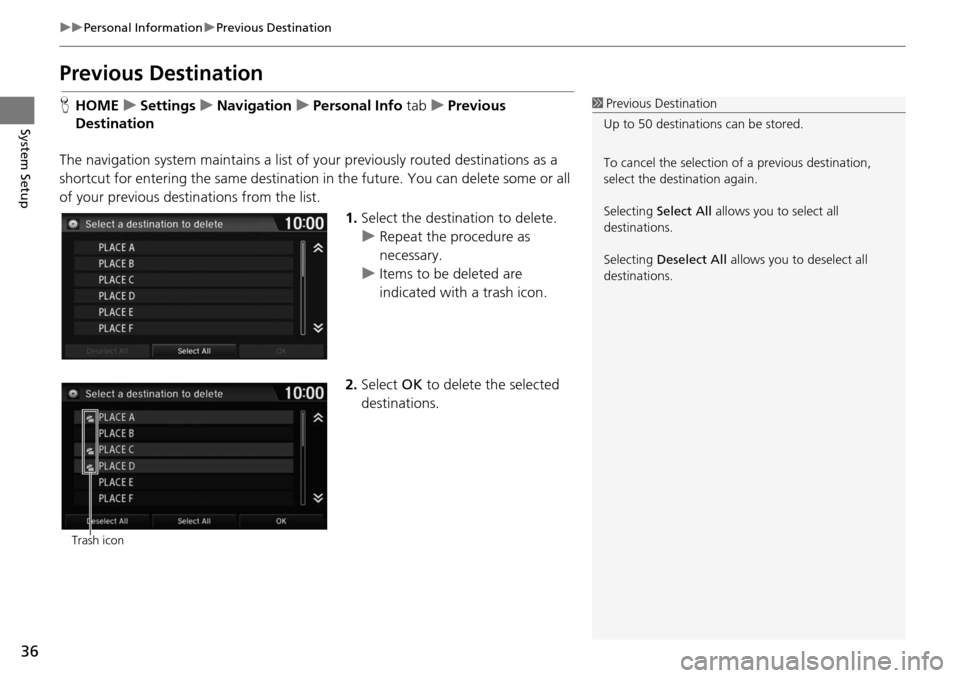
1.Select the destination to delete.
u Repeat the procedure as
necessary.
u Items to be deleted are
indicate d
with a trash icon.
2. Select OK to dele
te the selected
destinations.
1 Previous Destination
Up to 50 destinations can be stored.
To cancel the selection of a previous destination,
select the destination again.
Selecting Select All allows you to select all
destinations.
Selecting Deselect All allows you to deselect all
destinations.
Trash icon
Page 38 of 250
37
uu Personal Information u Category History
System Setup
Category History
H HOME u Settings u Navigation u Personal Info tab u Category History
The navigation system maintains a list of your recentl
y used place categories as a
shortcut for selecting the same categories in the future. You can delete some or all
of your recently used categories from the list.
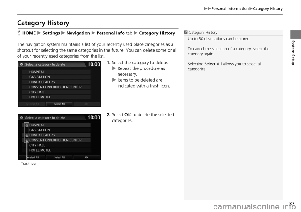
1.Select the category to
delete.
u Repeat the procedure as
necessary.
u Items to be deleted are
indica
ted with a trash icon.
2. Select OK to delete t h
e selected
categories.
1 Category History
Up to 50 destinations can be stored.
To cancel the selection of a category, select the
category again.
Selecting Select All allows you to select all
categories.
Trash icon
Page 39 of 250
38
System Setup
Routing
HHOME u Settings u Navigation u Routing tab
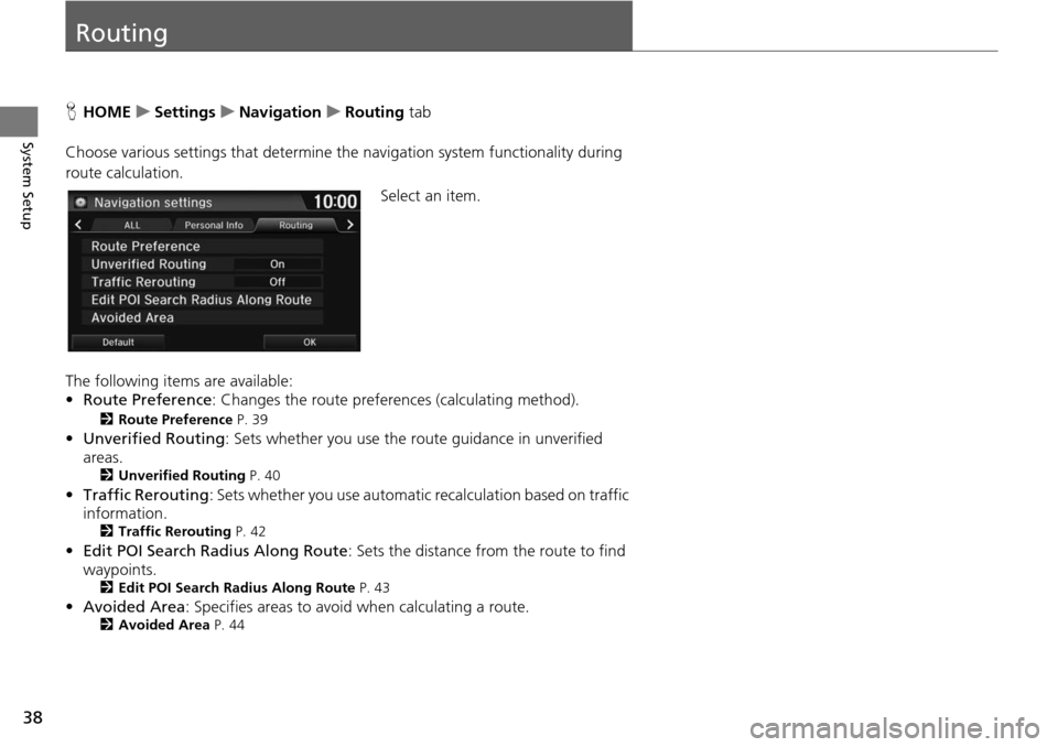
Choose various settings that determine th e n
avigation system functionality during
route calculation.
Select an item.
The following items are available:
• Rou te Preference : Changes the route prefer
ences (calculating method).
2Route Preference P. 39
• Unverified Routing : Sets whether you use the r oute guidance in unverified
areas.
2 Unverified Routing P. 40
•Traffic Rerouting : Sets whether you use automatic recalculation based on traffic
information.
2 Traffic Rerouting P. 42
• Edit POI Search Radius Along Route : Sets the distance from the route to find
waypoints.
2 Edit POI Search Radius Along Route P. 43
• Avoided Area : Specifies areas to avoid when calculating a route.2Avoided Area P. 44
Page 40 of 250
39
uu Routing u Route Preference
System Setup
Route Preference
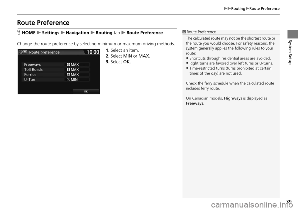
H HOME u Settings u Navigation u Routing tab u R oute Preference
Change the route preference by selecting minimum or maximum driving methods. 1.Select an item.
2. Select MIN or MAX .
3. Select OK.1Route Preference
The calculated route may not be the shortest route or
the route you would choose. For safety reasons, the
system generally a pplies the following rules to your
route:
•Shortcuts through residential areas are avoided.
•Right turns are favored over left turns or U-turns.•Time-restricted turns (tur ns prohibited at certain
times of the day) are not used.
Check the ferry schedule when the calculated route
includes ferry route.
On Canadian models, Highways is displayed as
Freeways .
Page 41 of 250
40
uu Routing u Unverified Routing
System Setup
Unverified Routing
H HOME u Settings u Navigation u Routing tab u Unverified Routing
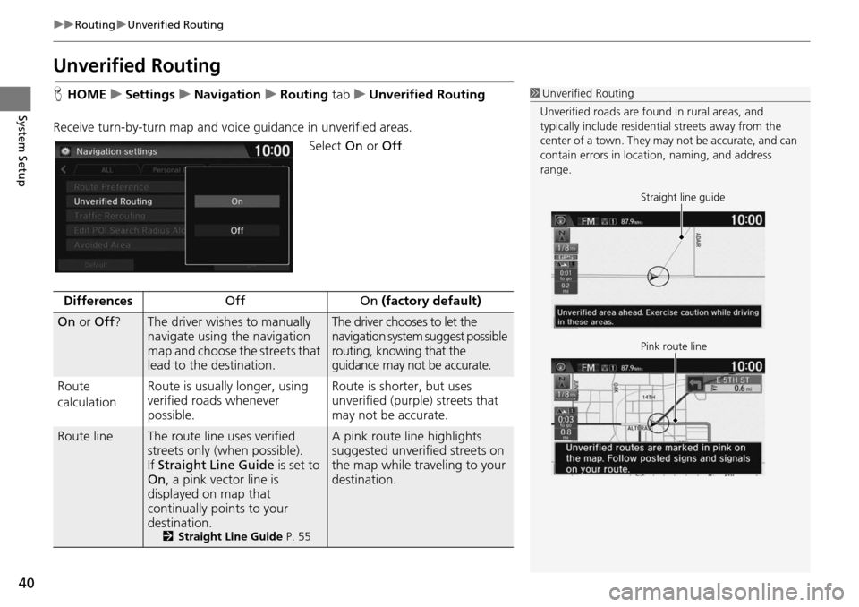
Receive turn-by-turn map
and voice guidance in unverified areas.
Select On or Off .
1Unverified Routing
Unverified roads are found in rural areas, and
typically include residentia l streets away from the
center of a town. They ma y not be accurate, and can
contain errors in locati on, naming, and address
range.
Straight line guide
Pink route line
DifferencesOffOn (factory default)
On or Off ?The driver wishes to manually
navigate using the navigation
map and choose the streets that
lead to the destination.The driver chooses to let the
navigation system suggest possible
routing, knowing that the
guidance may not be accurate.
Route
c a
lculation Route is usually longer, using
veri
fied roads whenever
possible.Route is shorter, but uses
unverified (purple) streets that
may not be accurate.
Route lineThe route line uses verified
streets only (when possible).
If Straight Line Guide is
set to
On , a pink vector line is
displayed on map that
continually points to your
destination.
2 Straight Line Guide P. 55
A pink route line highlights
suggested unverified streets on
the map while traveling to your
destination.
Page 43 of 250
42
uu Routing u Traffic Rerouting
System Setup
Traffic Rerouting
H HOME u Settings u Navigation u Routing tab u Traffic Rerouting
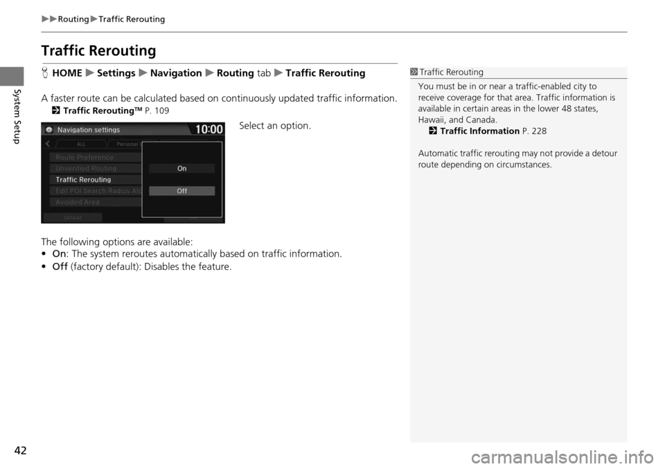
A faster route can be calculated based on continuously updated tr
affic information.
2Traffic ReroutingTM P. 109
Select an option.
The following options are available:
• On : The system reroutes automatica lly based on
traffic information.
• Off (factory default): Disables the feature.
1Traffic Rerouting
You must be in or near a traffic-enabled city to
receive coverage for that area. Traffic information is
available in certain areas in the lower 48 states,
Hawaii, and Canada. 2 Traffic Information P. 228
Automatic traffic rerouting may not provide a detour
route depending on circumstances.
Page 44 of 250
43
uu Routing u Edit POI Search Radius Along Route
System Setup
Edit POI Search Ra dius Along Route
HHOME u Settings u Navigation u Routing tab u Edit POI Se arch Radius
Alon
g Route
Select the distance from your highlighted ro ute line (on eit
her side of your route)
that the system will search for a waypoint.
2Adding Waypoints P. 112
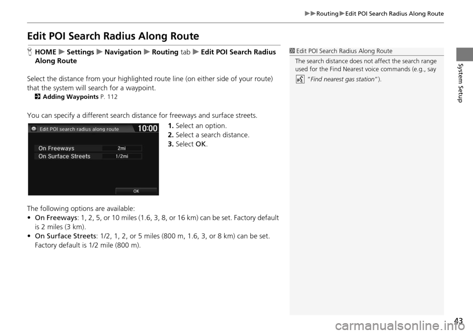
You can specify a different search dist ance for freeways and surface streets.
1.Select an option.
2. Select a search distance.
3. Select OK.
The following options
are available:
• On Freeways : 1, 2,
5, or 10 miles (1.6, 3, 8, or 16 km) can be set. Factory default
is 2 miles (3 km).
• On Surf ace Streets :
1/2, 1, 2, or 5 miles (800 m, 1.6, 3, or 8 km) can be set.
Factory default is 1/2 mile (800 m).
1 Edit POI Search Radius Along Route
The search distance does not affect the search range
used for the Find Nearest voice commands (e.g., say
“Find nearest gas station ”).
Page 45 of 250
44
uu Routing u Avoided Area
System Setup
Avoided Area
H HOME u Settings u Navigation u Routing tab u Avoided Area
Specify up to five areas to avoid (e
.g., road construction, closures), if possible, when
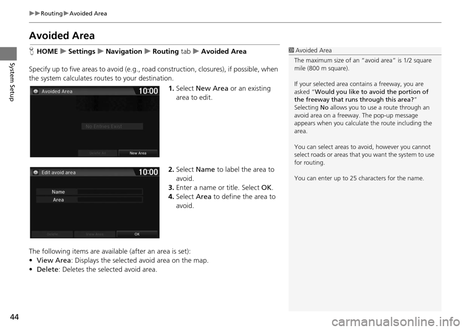
the system calculates rout es to your destination.
1.Select New Are
a or an existing
area to edit.
2. Select Name
to label the area to
avoid.
3. Enter a name or title. Select OK.
4. Select Area to define the area to
av
oid.
The following items are availa ble (after an
area is set):
• View Area : Displays the selecte
d avoid area on the map.
• Delete: Deletes the selected avoid area.
1Avoided Area
The maximum size of an “a void area” is 1/2 square
mile (800 m square).
If your selected area contains a freeway, you are
asked “Would you like to avoid the portion of
the freeway that runs through this area? ”
Selecting No allows you to use a route through an
avoid area on a freeway . The pop-up message
appears when you calculat e the route including the
area.
You can select areas to avoid, however you cannot
select roads or areas that you want the system to use
for routing.
You can enter up to 25 ch aracters for the name.