display HONDA HR-V 2016 2.G Navigation Manual
[x] Cancel search | Manufacturer: HONDA, Model Year: 2016, Model line: HR-V, Model: HONDA HR-V 2016 2.GPages: 250, PDF Size: 4.84 MB
Page 103 of 250
uu Driving to Your Destination u Viewing the Route
102
Navigation
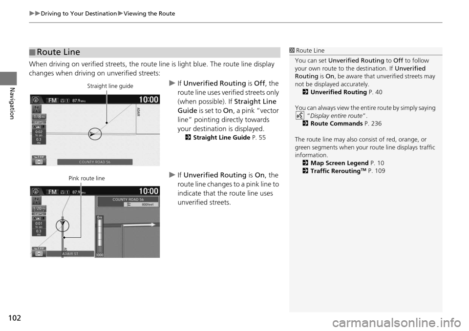
When driving on verified streets, the route line is light blue. The route line display
changes when driving on unverified streets:
u If Unverified Routing is Off , the
route line uses verified streets only
(when possible). If Straight Line
Guide is set to On, a pink “vector
line” pointing directly towards
your destination is displayed.
2 Straight Line Guide P. 55
u If Unverified Routing is On , the
route line changes to a pink line to
indicate that the route line uses
unverified streets.
■ Route Line1
Route Line
You can set Unverified Routing to Off to follow
your own route to the destination. If Unverified
Routing is On, be aware that unv erified streets may
not be displayed accurately. 2 Unverified Routing P. 40
You can always view the enti re route by simply saying
“ Display entire route ”.
2 Route Commands P. 236
The route line may also c onsist of red, orange, or
green segments when your route line displays traffic
information. 2 Map Screen Legend P. 10
2 Traffic Rerouting
TM P. 109
Straight line guide
Pink route line
Page 104 of 250
103
uu Driving to Your Destination u Viewing the Route
Navigation
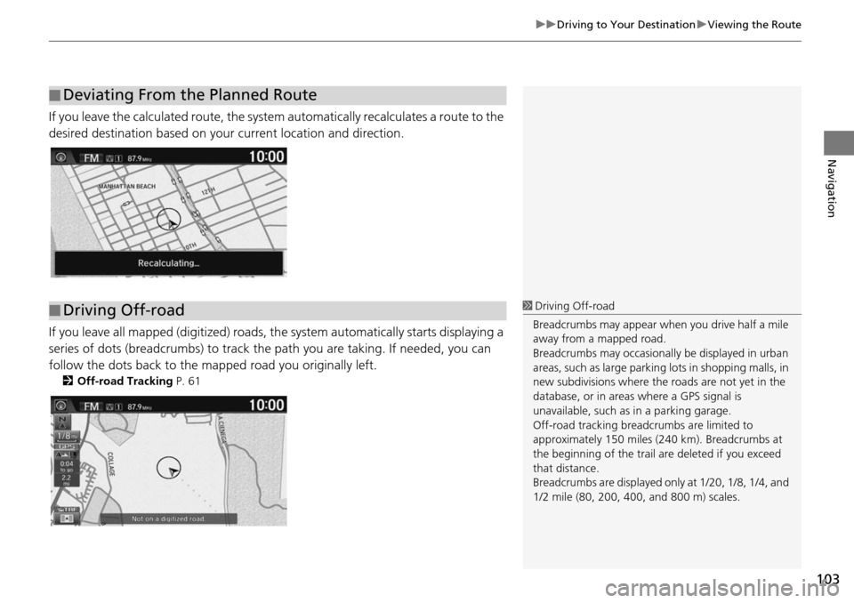
If you leave the calculated r oute, the system automatically recalculates a route to the
desired destination based on your current location and direction.
If you leave all mapped (digitized) roads, the system automatically starts displaying a
series of dots (breadcrumbs) to track the path you are taking. If needed, you can
follow the dots back to the mapp ed road you originally left.
2Off-road Tracking P. 61
■Deviating From the Planned Route
■Driving Off-road1
Driving Off-road
Breadcrumbs may appear when you drive half a mile
away from a mapped road.
Breadcrumbs may occasionall y be displayed in urban
areas, such as large parking lots in shopping malls, in
new subdivisions where the roads are not yet in the
database, or in areas where a GPS signal is
unavailable, such as in a parking garage.
Off-road tracking breadcrumbs are limited to
approximately 150 miles (240 km). Breadcrumbs at
the beginning of the trail are deleted if you exceed
that distance.
Breadcrumbs are displayed onl y at 1/20, 1/8, 1/4, and
1/2 mile (80, 200, 400, and 800 m) scales.
Page 105 of 250
104
uu Driving to Your Destination u Listening to Voice Guidance
Navigation
Listening to Voice Guidance
H HOME u Navi u (Map menu) (on map) u Voice
As you approach each guidance point, a pop-up window is displayed on the map
screen
with instructions for you to follow. Voice guidance for each guidance point is
also provided.
Typically, you hear three prompts:
• 1/2 mile (800 m) from the guidance point
(2 miles (3 km
) on freeway)
• 1/4 mile (400 m) from the guidance point (1 mile (1.5 km) on freeway)
• Just before the guidance point
To replay voice guidance, select Voice in
the Map Menu.
If you select Voice between guidance points, voice gui
dance for the next guidance
point is provided.
1 Listening to Voice Guidance
“Voice ” (on the map screen)
You can turn voice guidance off if you prefer. 2 Volume Setting P. 68
When driving in unverified areas, the phrase “ if
possible ” is inserted after each voice guidance
prompt.
Voice in the Map menu may be grayed out if:
•The system is in proce ss of gathering the route
guidance information.
•The vehicle is out of the road (e.g., pulling in a
parking lot).
The timing of voice guidanc e varies depending on the
type of road you are on and the distance to the next
guidance point.
Page 106 of 250
105Continued
Navigation
Map Menu
Displaying the Map Menu
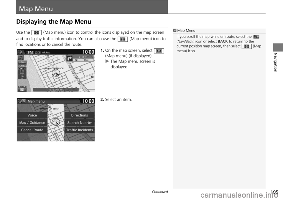
Use the (Map menu) icon to control the icons displayed on the map screen
and to display traffic inform ation. You can also use the (Map m
enu) icon to
find locations or to cancel the route.
1.On the map
screen, select
(Map menu) (if displayed).
u The Map m e
nu screen is
displayed.
2. Select an item.
1Map Menu
If you scroll the map whil e en route, select the
(Navi/Back) ic on or select BACK to return to the
current position map screen, then select (Map
menu) icon.
Page 107 of 250
uu Map Menu u Displaying the Map Menu
106
Navigation
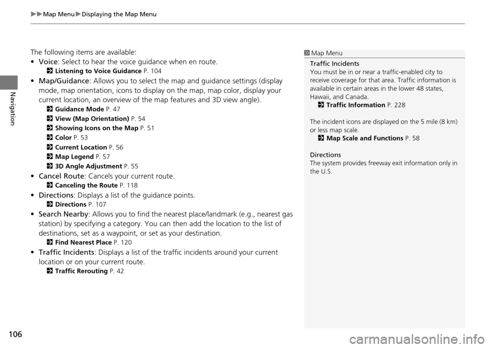
The following items are available:
• Voice : Select to hear the voice guidance when en route.
2Listening to Voice Guidance P. 104
• Map/Guidance : Allows you to select the map and guidance settings (display
mode, map orientation, icons to display on the map, map color, display your
current location, an overview of th e map features and 3D view angle).
2Guidance Mode P. 47
2 View (Map Orientation) P. 54
2 Showing Icons on the Map P. 51
2 Color P. 53
2 Current Location P. 56
2 Map Legend P. 57
2 3D Angle Adjustment P. 55
• Cancel Route : Cancels your current route.
2Canceling the Route P. 118
• Directions : Displays a list of the guidance points.
2Directions P. 107
• Search Nearby : Allows you to find the nearest place/landmark (e.g., nearest gas
station) by specifying a category. You ca n then add the location to the list of
destinations, set as a waypoint, or set as your destination.
2 Find Nearest Place P. 120
• Traffic Incidents : Displays a list of the traffic incidents around your current
location or on your current route.
2 Traffic Rerouting P. 42
1 Map Menu
Traffic Incidents
You must be in or near a traffic-enabled city to
receive coverage for that area. Traffic information is
available in certain areas in the lower 48 states,
Hawaii, and Canada. 2 Traffic Information P. 228
The incident icons are disp layed on the 5 mile (8 km)
or less map scale. 2 Map Scale and Functions P. 58
Directions
The system provides freeway exit information only in
the U.S.
Page 108 of 250
107
uu Map Menu u Directions
Continued
Navigation
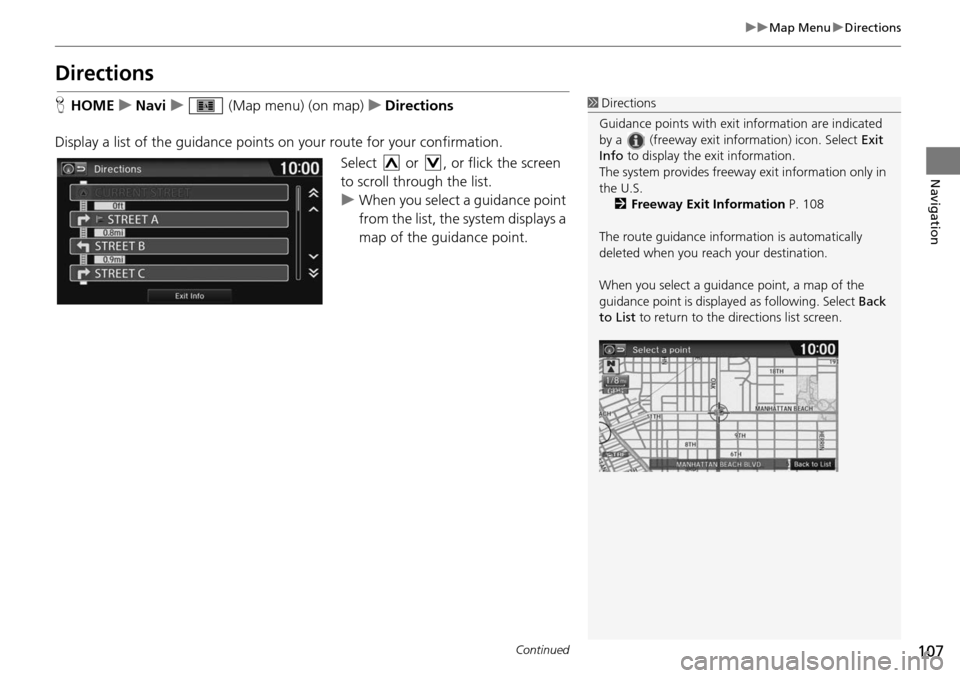
Directions
H HOME u Navi u (Map menu) (on map) u Directions
Display a list of the guidance points on your route
for your confirmation.
Select or , or flick the screen
to scroll through the list.
u When you select a guidance point
f
rom the list, the system displays a
map of the guidance point.
1 Directions
Guidance points with exit information are indicated
by a (freeway exit information) icon. Select Exit
Info to display the exit information.
The system provides freeway exit information only in
the U.S. 2 Freeway Exit Information P. 108
The route guidance inform ation is automatically
deleted when you reac h your destination.
When you select a guidance point, a map of the
guidance point is displaye d as following. Select Back
to List to return to the directions list screen.
Page 109 of 250
uu Map Menu u Directions
108
Navigation
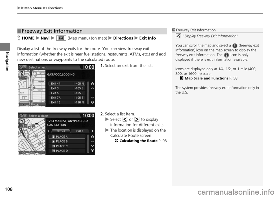
H HOME u Navi u (Map menu) (on map) u Directions u Exit Info
Display a list of the freeway exits for the route. You can view fre
eway exit
information (whether the exit is near fuel stations, restaurants, ATMs, etc.) and add
new destinations or waypoints to the calculated route.
1.Select an exit from
the list.
2. Select a list item.
u Select or to display
informa
tion for different exits.
u The location is displayed on the
Calculate Route scre
en.
2Calculating the Route P. 98
■Freeway Exit Information1
Freeway Exit Information
“Display Freeway Exit Information ”
You can scroll the map and select a (freeway exit
information) icon on the map screen to display the
freeway exit information. The icon is only
displayed if there is exit information available.
Icons are displayed only at 1/4, 1/2, or 1 mile (400,
800, or 1600 m) scale. 2 Map Scale and Functions P. 58
The system provides freeway exit information only in
the U.S.
Page 111 of 250
uu Map Menu u Traffic ReroutingTM
110
Navigation
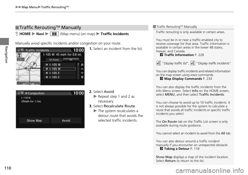
H HOME u Navi u (Map menu) (on map) u Traffic Incidents
Manually avoid specific incidents and
/or congestion on your route.
1.Select an incide
nt from the list.
2. Select Avoid.
u Repea t step 1 and 2 as
necessary.
3. Select Recalculate Route .
u The system recalculates a
detour route that
avoids the
selected traffic incidents.
■ Traffic ReroutingTM Manually1
Traffic ReroutingTM Manually
Traffic rerouting is only available in certain areas.
You must be in or near a traffic-enabled city to
receive coverage for that area. Traffic information is
available in certain areas in the lower 48 states,
Hawaii, and Canada. 2 Traffic Information P. 228
“ Display traffic list ”, “Display traffic incidents ”
You can display traffic incidents and related information
on the map screen using voice commands. 2 Map Display Commands P. 234
You can also display the tr affic incidents from the
Info Menu screen. Select Info on the HOME screen,
select MENU , and then select Traffic Incidents .
You can choose to avoid up to 10 traffic incidents. It
is not always possible for the system to calculate a
route that avoids all traffic incidents or specific traffic
incidents you select.
The On Route tab on the Traffic List screen is only
available during route guidance.
You cannot select an incident to avoid from the All tab.
You can also detour ar ound a traffic incident
manually if you encounter an unexpected obstacle.
2 Taking a Detour P. 118
Show Map displays a map of th e incident location.
Select Return to return to the list.
Page 112 of 250
111
Navigation
Changing Your Route
HHOME u Navi u MENU (when en route)
This sec
tion describes how to alter your rout e, add an inter
im “waypoint” (pit stop),
choose a different destination, cancel your current destination, and continue your
trip after stopping.
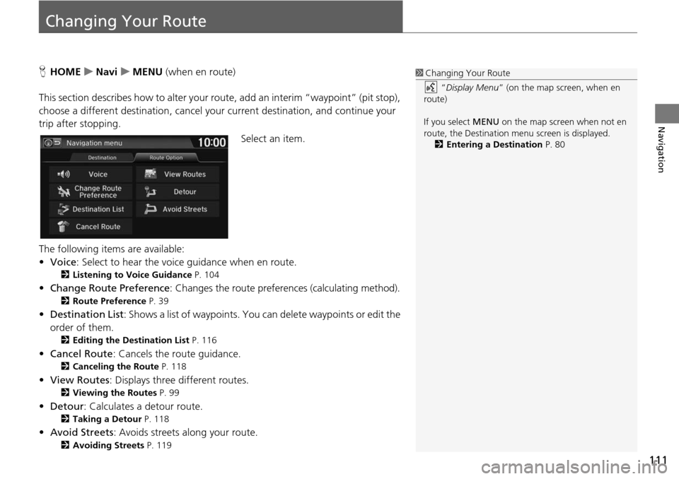
Select an item.
The following items are available:
• Voice : Select to hear
the voice guidance when en route.
2Listening to Voice Guidance P. 104
• Change Route Preference : Changes the route preferences (calculating method).
2Route Preference P. 39
• Destination List : Shows a list of waypoints. You can delete waypoints or edit the
order of them.
2 Editing the Destination List P. 116
• Cancel Route : Cancels the route guidance.
2Canceling the Route P. 118
• View Routes : Displays three different routes.
2Viewing the Routes P. 99
• Detour : Calculates a detour route.
2Taking a Detour P. 118
• Avoid Streets : Avoids streets along your route.
2Avoiding Streets P. 119
1 Changing Your Route
“Display Menu” (on the map screen, when en
route)
If you select MENU on the map screen when not en
route, the Destination me nu screen is displayed.
2 Entering a Destination P. 80
Page 113 of 250
112
uu Changing Your Route u Adding Waypoints
Navigation
Adding Waypoints
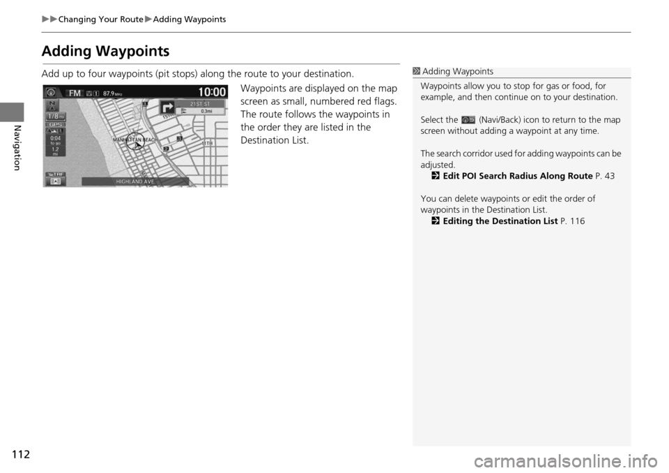
Add up to four waypoints (pit stops) along the route to your destination.
Waypoints are displayed on the map
screen as
small, numbered red flags.
The route follows the waypoints in
the order they are listed in the
Destination List.
1 Adding Waypoints
Waypoints allow you to stop for gas or food, for
example, and then continue on to your destination.
Select the (Navi/Back) icon to return to the map
screen without adding a waypoint at any time.
The search corridor used fo r adding waypoints can be
adjusted. 2 Edit POI Search Radius Along Route P. 43
You can delete waypoints or edit the order of
waypoints in the Destination List. 2 Editing the Destination List P. 116