INFINITI QX60 2020 Infiniti Connection
Manufacturer: INFINITI, Model Year: 2020, Model line: QX60, Model: INFINITI QX60 2020Pages: 276, PDF Size: 1.17 MB
Page 161 of 276
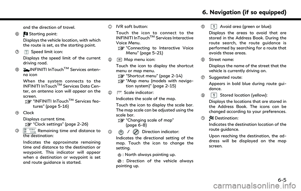
and the direction of travel.
Starting point:
Displays the vehicle location, with which
the route is set, as the starting point.
Speed limit icon:
Displays the speed limit of the current
driving road.
INFINITI InTouchTMServices anten-
na icon
When the system connects to the
INFINITI InTouch
TMServices Data Cen-
ter, an antenna icon will appear on the
screen.
“INFINITI InTouchTMServices fea-
tures” (page 5-16)
Clock
Displays current time.
“Clock settings” (page 2-26)
Remaining time and distance to
the destination:
Indicates the approximate remaining
time and distance to the destination or
waypoint. This indicator will appear
when a destination or waypoint is set
and route guidance is started.
IVR soft button:
Touch the icon to connect to the
INFINITI InTouch
TMServices Interactive
Voice Menu.
“Connecting to Interactive Voice
Menu” (page 5-21)
Map menu icon:
Touch the icon to display the shortcut
menu or map menu.
“Shortcut menu” (page 2-14)“Map menu (models with naviga-
tion system)” (page 2-15)
Scale indicator:
Indicates the scale of the map.
Touch the icon to display the scale bar.
The map scale can be adjusted using the
scale bar.
“Changing scale of map”
(page 6-8)
/Direction indicator:
Indicates the directional setting of the
map. Touch the icon to change the
setting.
: North always pointing up.
: Direction of the vehicle always
pointing up.
Avoid area (green or blue):
Displays the areas to avoid that are
stored in the Address Book. During the
route search, the route guidance is
performed by searching for a route that
avoids those areas.
Street name:
Displays the name of the street that the
vehicle is currently driving on.
Suggested route:
Appears in bold blue during route gui-
dance.
Stored location (yellow):
Displays the locations that are stored in
the Address Book. The icons can be
changed according to your preferences.
Destination:
Indicates the destination location of the
route guidance.
Upon reaching the destination, the ad-
dress will be displayed on the map
screen.
6. Navigation (if so equipped)
6-5
Page 162 of 276
6. Navigation (if so equipped)
Birdview (3D) map
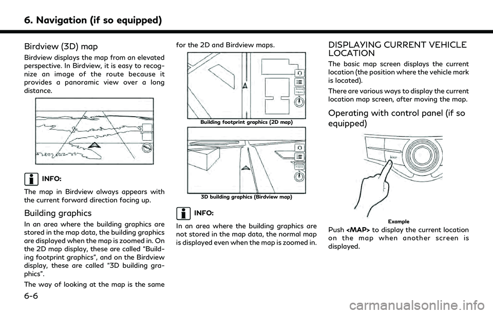
Birdview displays the map from an elevated
perspective. In Birdview, it is easy to recog-
nize an image of the route because it
provides a panoramic view over a long
distance.
INFO:
The map in Birdview always appears with
the current forward direction facing up.
Building graphics
In an area where the building graphics are
stored in the map data, the building graphics
are displayed when the map is zoomed in. On
the 2D map display, these are called “Build-
ing footprint graphics”, and on the Birdview
display, these are called “3D building gra-
phics”.
The way of looking at the map is the same for the 2D and Birdview maps.
Building footprint graphics (2D map)
3D building graphics (Birdview map)
INFO:
In an area where the building graphics are
not stored in the map data, the normal map
is displayed even when the map is zoomed in.
DISPLAYING CURRENT VEHICLE
LOCATION
The basic map screen displays the current
location (the position where the vehicle mark
is located).
There are various ways to display the current
location map screen, after moving the map.
Operating with control panel (if so
equipped)
Example
Push
Page 163 of 276
Operating with INFINITI controller
(if so equipped)
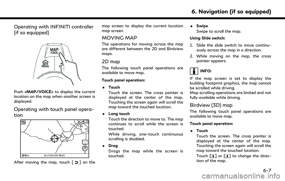
Push
Page 164 of 276
![INFINITI QX60 2020 Infiniti Connection 6. Navigation (if so equipped)
.Long touch
Touch and hold a point on the map or
touch and hold [
]or[] in the
direction to move the map to. The map
continues to move while the screen is
touched.
While INFINITI QX60 2020 Infiniti Connection 6. Navigation (if so equipped)
.Long touch
Touch and hold a point on the map or
touch and hold [
]or[] in the
direction to move the map to. The map
continues to move while the screen is
touched.
While](/img/42/35140/w960_35140-163.png)
6. Navigation (if so equipped)
.Long touch
Touch and hold a point on the map or
touch and hold [
]or[] in the
direction to move the map to. The map
continues to move while the screen is
touched.
While driving, one-touch continuous
scrolling is disabled.
. Drag
Drags the map while the screen is
touched.
. Swipe
Swipe the touch panel to scroll the map
screen quickly.
Using slide switch:
1. Slide the slide switch to move continu- ously across the map in a direction.
2. While moving on the map, the cross pointer appears.
INFO:
If the map screen is set to display the
building footprint graphics, the map cannot
be scrolled while driving.
Map scrolling operations are limited and not
fully available while driving.
CHANGING SCALE OF MAP
There are several methods for changing the
map scale.
INFO:
While driving, operation for changing map
scale is limited.
Touch panel operation
1. Touch [].
The scale bar is displayed.
2. Touch [Zoom In] or [Zoom Out] to change the scale.
Pinch-in
To view a wider area, pinch-in the map
screen.
Pinch-out
To view the map in detail, pinch-out the map
screen.
INFO:
While driving, pinch-in/pinch-out are dis-
abled.
6-8
Page 165 of 276
![INFINITI QX60 2020 Infiniti Connection Center dial operation
Turn the center dial clockwise or counter-
clockwise to change the map scale.
Clockwise: Zoom in
Counterclockwise: Zoom out
Free Zoom:
When [Small Step Zoom With Dial] is turned
INFINITI QX60 2020 Infiniti Connection Center dial operation
Turn the center dial clockwise or counter-
clockwise to change the map scale.
Clockwise: Zoom in
Counterclockwise: Zoom out
Free Zoom:
When [Small Step Zoom With Dial] is turned](/img/42/35140/w960_35140-164.png)
Center dial operation
Turn the center dial clockwise or counter-
clockwise to change the map scale.
Clockwise: Zoom in
Counterclockwise: Zoom out
Free Zoom:
When [Small Step Zoom With Dial] is turned
on, the map scale may be adjusted in free
zoom (finer scale adjustment in smaller
steps) when the center dial is rotated or
[Zoom In]/[Zoom Out] is touched and held.
“Navigation settings” (page 6-56)
Map scale
Any required map scale (map coverage)
between 320 miles (640 km) and 1/64 mile
(25 m) can be selected.
US UnitsMetric Units
320 miles 640 km
80 miles 160 km
32 miles 64 km
8 miles 16 km
5 miles 10 km
2 miles 4 km
1 mile 2 km 1/2 mile
1 km
1/4 mile 500 m
1/8 mile 200 m
1/16 mile 100 m
1/32 mile 50 m
1/64 mile 25 m
INFO:
The traffic information icons are not dis-
played on the map screen when the map
scale is set to 8 miles (16 km) or higher.
“Traffic information on map” (page 5-7)
CHANGING MAP ORIENTATION
The map view type can be changed by
touching []/[] on the map screen.
The screen will change to North Up, Heading
Up and Birdview each time [
]/[]is
touched.
North Up
Heading Up
Birdview
You can also set the map view from Settings
menu screen.
“Map view settings” (page 6-11)
SETTING SPLIT SCREEN
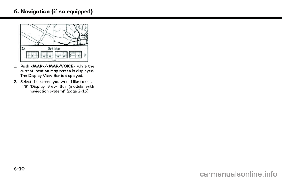
It is possible to view the two types of map
view or the map view, and other information
at the same time. The right screen displays
the map screen, and the left screen displays
a turn list or an information screen.
6. Navigation (if so equipped)
6-9
Page 166 of 276
6. Navigation (if so equipped)
1. Push
Page 167 of 276
![INFINITI QX60 2020 Infiniti Connection MAP VIEW SETTINGS
1. Display the Settings menu screen.“Displaying operation screen” (page 2-10)
2. Touch [Navigation].
Available setting items may vary depending on models and specifications.
Menu INFINITI QX60 2020 Infiniti Connection MAP VIEW SETTINGS
1. Display the Settings menu screen.“Displaying operation screen” (page 2-10)
2. Touch [Navigation].
Available setting items may vary depending on models and specifications.
Menu](/img/42/35140/w960_35140-166.png)
MAP VIEW SETTINGS
1. Display the Settings menu screen.“Displaying operation screen” (page 2-10)
2. Touch [Navigation].
Available setting items may vary depending on models and specifications.
Menu item Action
[Map & Display View] [Change Order] Change the order of items shown on the Display View Bar. [Full Map] Display full map screen.
[Split Map] Select one of the settings to be applied to the display.
“Display View Bar (models with navigation system)” (page 2-16)
[Intersection]
[Turn List]
[Where am I?]
[Turn by Turn]
[Fuel Economy]
[Eco Drive Report]
6. Navigation (if so equipped)
6-11
Page 168 of 276
![INFINITI QX60 2020 Infiniti Connection 6. Navigation (if so equipped)
Menu itemAction
[Map Prefer-
ences] [Map View]
[North Up] Select one of the map views to be applied to the map
screen.
[Heading Up]
[Birdview (3D)]
[Long Range Heading U INFINITI QX60 2020 Infiniti Connection 6. Navigation (if so equipped)
Menu itemAction
[Map Prefer-
ences] [Map View]
[North Up] Select one of the map views to be applied to the map
screen.
[Heading Up]
[Birdview (3D)]
[Long Range Heading U](/img/42/35140/w960_35140-167.png)
6. Navigation (if so equipped)
Menu itemAction
[Map Prefer-
ences] [Map View]
[North Up] Select one of the map views to be applied to the map
screen.
[Heading Up]
[Birdview (3D)]
[Long Range Heading Up] The position of the vehicle icon can be changed to view a
wider area in the traveling direction. The vehicle icon is
located slightly lower than the center of the screen.
Long Range Map View is available only when the map
view is “Heading Up”.
[Map Color] Select a preferred map color.
[Map Text Size] [Large] Sets the font size.
[Medium]
[Small]
[Birdview Angle] Adjusts the Birdview angle.
[Auto North Up] Sets the top of the map to remain oriented to the north.
[Show FWY Exit] Sets the display of the freeway exit information icon on/
off.
[Automatic Display in Fwy Mode] The turn list can be set to on or off to be displayed
automatically while driving on a freeway.
[Names Displayed on Map] [Place Names] Allows place names to be displayed on the map screen.
[POI Names] Allows facilities names to be displayed on the map screen.
[Road Names] Allows road names to be displayed on the map screen.
6-12
Page 169 of 276
![INFINITI QX60 2020 Infiniti Connection Menu itemAction
[Map Prefer-
ences] [Left Split Map Settings] [Left Side Map Orientation] The map view for the left side of split screen can be
selected from North Up or Heading Up.
[Long-Range Drivin INFINITI QX60 2020 Infiniti Connection Menu itemAction
[Map Prefer-
ences] [Left Split Map Settings] [Left Side Map Orientation] The map view for the left side of split screen can be
selected from North Up or Heading Up.
[Long-Range Drivin](/img/42/35140/w960_35140-168.png)
Menu itemAction
[Map Prefer-
ences] [Left Split Map Settings] [Left Side Map Orientation] The map view for the left side of split screen can be
selected from North Up or Heading Up.
[Long-Range Driving Direction] Allows the map view for the left side of the split screen to change the position of the vehicle icon so that a wider
area in the traveling direction can be viewed. The vehicle
icon is located slightly lower than the center of the screen.
6. Navigation (if so equipped)
6-13
Page 170 of 276
6. Navigation (if so equipped)
SETTING INFORMATION ON
MAP
Some information on the map can be
displayed or hidden.
Displaying facility icons
The facility icons can be displayed or hidden
by type.
1. Display the Settings menu screen.
“Displaying operation screen”
(page 2-10)
2. Touch [Navigation].
3. Touch [POI Icons Displayed on Map].
4. Touch the preferred icon. The indicator of the selected icon illuminates.
Available setting icon
.
: Restaurant
.
: Gas Station
.
: Hotel
.
: ATM
.
: Rest Area
INFO:
. The map icons are not displayed on the
map screen when the map scale is set to
0.1 mile (500 m) or higher in the 2D and
Birdview map.
. If brand icons are registered in the map
data, they will be displayed on the map
instead of the general map icons listed.
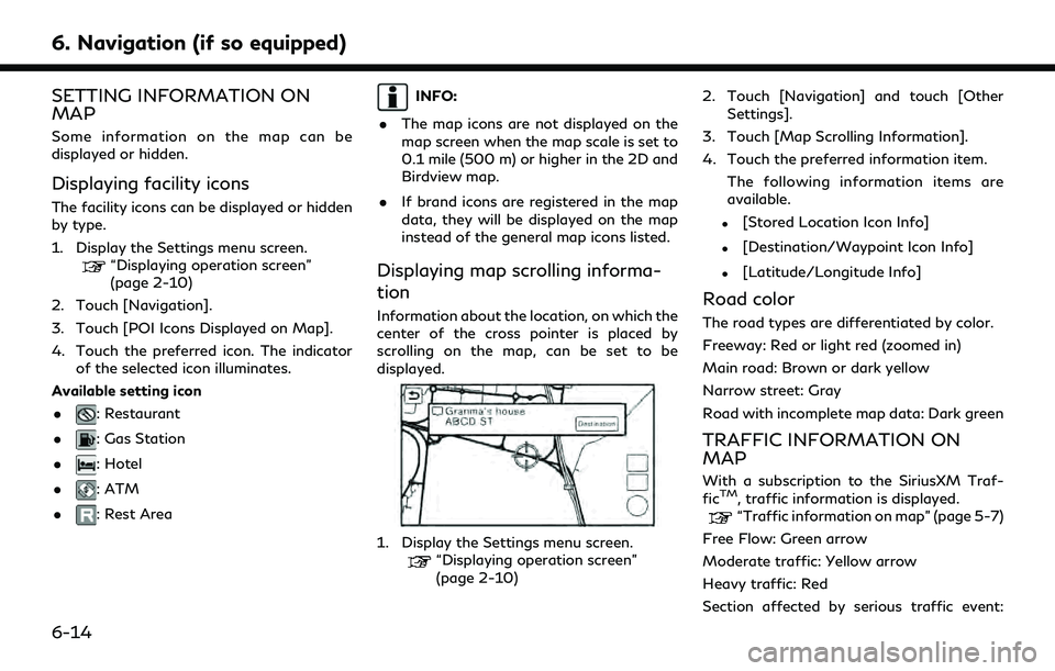
Displaying map scrolling informa-
tion
Information about the location, on which the
center of the cross pointer is placed by
scrolling on the map, can be set to be
displayed.
1. Display the Settings menu screen.“Displaying operation screen”
(page 2-10) 2. Touch [Navigation] and touch [Other
Settings].
3. Touch [Map Scrolling Information].
4. Touch the preferred information item. The following information items are
available.
.[Stored Location Icon Info]
.[Destination/Waypoint Icon Info]
.[Latitude/Longitude Info]
Road color
The road types are differentiated by color.
Freeway: Red or light red (zoomed in)
Main road: Brown or dark yellow
Narrow street: Gray
Road with incomplete map data: Dark green
TRAFFIC INFORMATION ON
MAP
With a subscription to the SiriusXM Traf-
ficTM, traffic information is displayed.“Traffic information on map” (page 5-7)
Free Flow: Green arrow
Moderate traffic: Yellow arrow
Heavy traffic: Red
Section affected by serious traffic event:
6-14