navigation INFINITI QX80 2021 Owner's Guide
[x] Cancel search | Manufacturer: INFINITI, Model Year: 2021, Model line: QX80, Model: INFINITI QX80 2021Pages: 268, PDF Size: 1.13 MB
Page 156 of 268

Editing stored information .................................... 6-48
Deleting stored item ................................................. 6-51
Navigation settings ........................................................ 6-54 General information for navigation system ........... 6-56
Current vehicle location ........................................ 6-56
Route guidance ........................................................ 6-59
Route calculation .................................................... 6-61
How to update map data ..................................... 6-62
Page 157 of 268
SAFETY INFORMATION
The navigation system is primarily designed
to help you reach your destination. However,
you, the driver, must use the system safely
and properly. Information concerning road
conditions, traffic signs and the availability
of services may not always be up to date.
The system is not a substitute for safe,
proper, and legal driving.
WARNING
Do not rely on route guidance alone.
Always be sure that all driving maneuvers
are legal and safe in order to avoid
accidents.
MAP OPERATION
MAP TYPES
Maps are displayed on the upper touch
screen display (upper display).
Two types of map views are available: 2D
and 3D.
2D map
The 2D map displays the map in a two-
dimensional environment similar to a road
map.
6. Navigation (if so equipped)
6-3
Page 158 of 268
6. Navigation (if so equipped)
Example
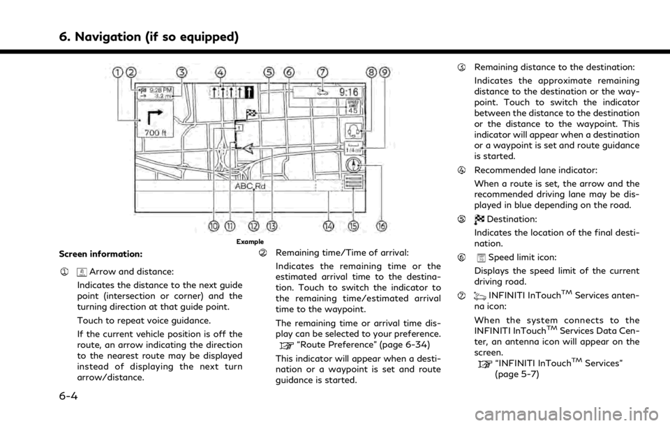
Screen information:
Arrow and distance:
Indicates the distance to the next guide
point (intersection or corner) and the
turning direction at that guide point.
Touch to repeat voice guidance.
If the current vehicle position is off the
route, an arrow indicating the direction
to the nearest route may be displayed
instead of displaying the next turn
arrow/distance.
Remaining time/Time of arrival:
Indicates the remaining time or the
estimated arrival time to the destina-
tion. Touch to switch the indicator to
the remaining time/estimated arrival
time to the waypoint.
The remaining time or arrival time dis-
play can be selected to your preference.
“Route Preference” (page 6-34)
This indicator will appear when a desti-
nation or a waypoint is set and route
guidance is started.
Remaining distance to the destination:
Indicates the approximate remaining
distance to the destination or the way-
point. Touch to switch the indicator
between the distance to the destination
or the distance to the waypoint. This
indicator will appear when a destination
or a waypoint is set and route guidance
is started.
Recommended lane indicator:
When a route is set, the arrow and the
recommended driving lane may be dis-
played in blue depending on the road.
Destination:
Indicates the location of the final desti-
nation.
Speed limit icon:
Displays the speed limit of the current
driving road.
INFINITI InTouchTMServices anten-
na icon:
When the system connects to the
INFINITI InTouch
TMServices Data Cen-
ter, an antenna icon will appear on the
screen.
“INFINITI InTouchTMServices”
(page 5-7)
6-4
Page 159 of 268
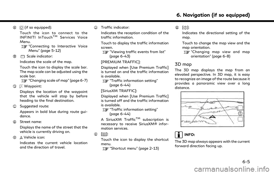
(if so equipped):
Touch the icon to connect to the
INFINITI InTouch
TMServices Voice
Menu.
“Connecting to Interactive Voice
Menu” (page 5-12)
Scale indicator:
Indicates the scale of the map.
Touch the icon to display the scale bar.
The map scale can be adjusted using the
scale bar.
“Changing scale of map” (page 6-7)
Waypoint:
Displays the location of the waypoint
that the vehicle will stop by before
heading to the final destination.
Suggested route:
Appears in bold blue during route gui-
dance.
Street name:
Displays the name of the street that the
vehicle is currently driving on.
Vehicle icon:
Indicates the current vehicle location
and the direction of travel.
Traffic indicator:
Indicates the reception condition of the
traffic information.
Touch to display the traffic information
screen.
“Viewing traffic events from list”
(page 6-43)
[PREMIUM TRAFFIC]:
Displayed when [Use Premium Traffic]
is turned on and the traffic information
is available.
“Traffic information setting”
(page 6-44)
[SiriusXM TRAFFIC]:
Displayed when [Use Premium Traffic]
is turned off and the traffic information
is available.
“Traffic information setting”
(page 6-44)
A SiriusXM Traffic
TMsubscription is
necessary to receive SiriusXM® infor-
mation services.
[]:
Touch the icon to display the shortcut
menu.
“Shortcut menu” (page 2-13)
[]:
Indicates the directional setting of the
map.
Touch to change the map view and the
map orientation.
“Changing map view and map
orientation” (page 6-8)
3D map
The 3D map displays the map from an
elevated perspective. In 3D map, it is easy
to recognize an image of the route because it
provides a panoramic view over a long
distance.
INFO:
The 3D map always appears with the current
forward direction facing up.
6. Navigation (if so equipped)
6-5
Page 160 of 268
6. Navigation (if so equipped)
Building graphics
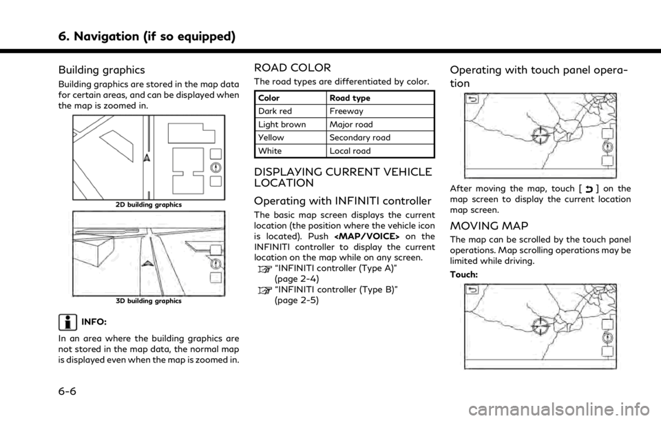
Building graphics are stored in the map data
for certain areas, and can be displayed when
the map is zoomed in.
2D building graphics
3D building graphics
INFO:
In an area where the building graphics are
not stored in the map data, the normal map
is displayed even when the map is zoomed in.
ROAD COLOR
The road types are differentiated by color.
Color Road type
Dark red Freeway
Light brown Major road
Yellow Secondary road
White Local road
DISPLAYING CURRENT VEHICLE
LOCATION
Operating with INFINITI controller
The basic map screen displays the current
location (the position where the vehicle icon
is located). Push
Page 161 of 268
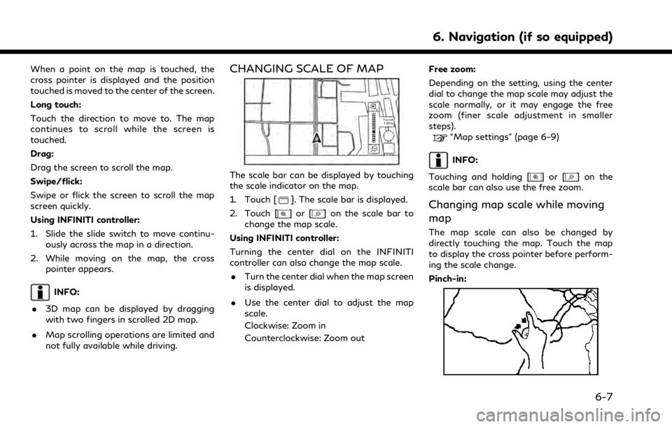
When a point on the map is touched, the
cross pointer is displayed and the position
touched is moved to the center of the screen.
Long touch:
Touch the direction to move to. The map
continues to scroll while the screen is
touched.
Drag:
Drag the screen to scroll the map.
Swipe/flick:
Swipe or flick the screen to scroll the map
screen quickly.
Using INFINITI controller:
1. Slide the slide switch to move continu-ously across the map in a direction.
2. While moving on the map, the cross pointer appears.
INFO:
. 3D map can be displayed by dragging
with two fingers in scrolled 2D map.
. Map scrolling operations are limited and
not fully available while driving.
CHANGING SCALE OF MAP
The scale bar can be displayed by touching
the scale indicator on the map.
1. Touch [
]. The scale bar is displayed.
2. Touch [
]or[] on the scale bar to
change the map scale.
Using INFINITI controller:
Turning the center dial on the INFINITI
controller can also change the map scale. . Turn the center dial when the map screen
is displayed.
. Use the center dial to adjust the map
scale.
Clockwise: Zoom in
Counterclockwise: Zoom out Free zoom:
Depending on the setting, using the center
dial to change the map scale may adjust the
scale normally, or it may engage the free
zoom (finer scale adjustment in smaller
steps).
“Map settings” (page 6-9)
INFO:
Touching and holding [
]or[] on the
scale bar can also use the free zoom.
Changing map scale while moving
map
The map scale can also be changed by
directly touching the map. Touch the map
to display the cross pointer before perform-
ing the scale change.
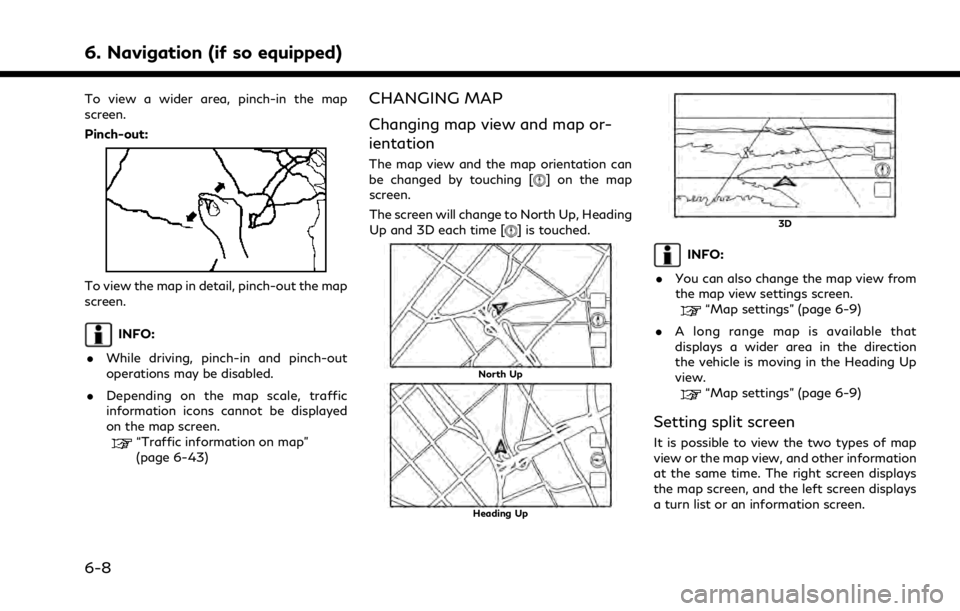
Pinch-in:
6. Navigation (if so equipped)
6-7
Page 162 of 268
6. Navigation (if so equipped)
To view a wider area, pinch-in the map
screen.
Pinch-out:
To view the map in detail, pinch-out the map
screen.
INFO:
. While driving, pinch-in and pinch-out
operations may be disabled.
. Depending on the map scale, traffic
information icons cannot be displayed
on the map screen.
“Traffic information on map”
(page 6-43)
CHANGING MAP
Changing map view and map or-
ientation
The map view and the map orientation can
be changed by touching [] on the map
screen.
The screen will change to North Up, Heading
Up and 3D each time [
] is touched.
North Up
Heading Up
3D
INFO:
. You can also change the map view from
the map view settings screen.
“Map settings” (page 6-9)
. A long range map is available that
displays a wider area in the direction
the vehicle is moving in the Heading Up
view.
“Map settings” (page 6-9)
Setting split screen
It is possible to view the two types of map
view or the map view, and other information
at the same time. The right screen displays
the map screen, and the left screen displays
a turn list or an information screen.
6-8
Page 163 of 268
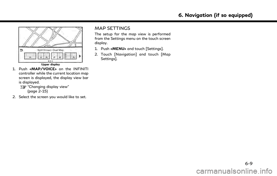
Upper display
1. Push
Page 164 of 268
![INFINITI QX80 2021 Owners Guide 6. Navigation (if so equipped)
Available setting items may vary depending on models and specifications.
Available setting items
Menu itemAction
[Split Screen View] [Change Order] Change the display or INFINITI QX80 2021 Owners Guide 6. Navigation (if so equipped)
Available setting items may vary depending on models and specifications.
Available setting items
Menu itemAction
[Split Screen View] [Change Order] Change the display or](/img/42/41148/w960_41148-163.png)
6. Navigation (if so equipped)
Available setting items may vary depending on models and specifications.
Available setting items
Menu itemAction
[Split Screen View] [Change Order] Change the display order of the display view bar items.
[Full Map] Display full map screen.
[Split Screen: Dual Map] Select a split screen view to be applied.
“Changing display view” (page 2-15)
[Intersection]
[Turn List]
[Where Am I?]
[Split Screen: Turn by turn]
[Fuel Economy]
[Audio]
[TomTom Current Conditions]
[TomTom 5–Day Weather Forecast]
[TomTom Hourly Weather Forecast]
[SXM Current Conditions]
[SXM 5–Day Weather Forecast]
[SXM Hourly Weather Forecast]
[SXM Sports Scores]
[Analog Clock]
[Digital Clock]
6-10
Page 165 of 268
![INFINITI QX80 2021 Owners Guide Menu itemAction
[Map Icons] Select the categories of POI icons to display on the map screen.
“Displaying map icons” (page 6-13)
[Map View] [North Up] Select one of the map views to be applied to t INFINITI QX80 2021 Owners Guide Menu itemAction
[Map Icons] Select the categories of POI icons to display on the map screen.
“Displaying map icons” (page 6-13)
[Map View] [North Up] Select one of the map views to be applied to t](/img/42/41148/w960_41148-164.png)
Menu itemAction
[Map Icons] Select the categories of POI icons to display on the map screen.
“Displaying map icons” (page 6-13)
[Map View] [North Up] Select one of the map views to be applied to the map screen. [Heading Up]
[3D Map]
[Long Range] The position of the vehicle icon is located slightly lower than the center of the screen to view a wider area in the traveling direction. Long Range
is available only when the map view is in [Heading Up] mode.
[Left Split Map Settings] [Map Orientation] The map orientation for the left side of split screen can be selected from [North Up] or [Heading Up].
[Long Range] With this item turned on, the vehicle position icon on the left screen will be located slightly lower than the center of the screen so that a wider
area in the traveling direction can be viewed.
Long Range Map View is available only when the left side of split screen
is in [Heading Up] mode.
[Map Scale] Sets the map scale of the left screen.
[Audio Display on Map] Turns on/off the audio information displayed at the bottom of the map screen.
[Map Color] Sets map color from standard, emphasize roads, emphasize text and emphasize traffic.
[Map Text Size] [Large] Sets the font size of the text displayed on the map screen.
[Medium]
[Small]
6. Navigation (if so equipped)
6-11