light MERCEDES-BENZ CL-Class 2002 C215 Comand Manual
[x] Cancel search | Manufacturer: MERCEDES-BENZ, Model Year: 2002, Model line: CL-Class, Model: MERCEDES-BENZ CL-Class 2002 C215Pages: 251
Page 169 of 251
167 Destination input
Introduction
Audio
Telephone
Navigation
Index Info Services and
system settings Destination entry via coordinates
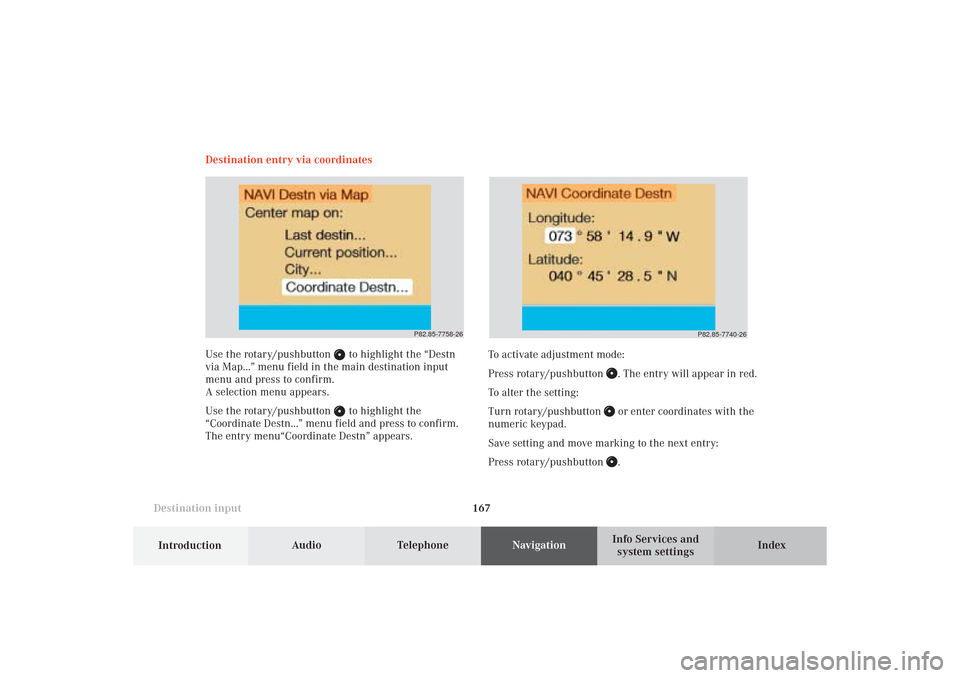
Use the rotary/pushbutton
to highlight the “Destn
via Map...” menu field in the main destination input
menu and press to confirm.
A selection menu appears.
Use the rotary/pushbutton to highlight the
“Coordinate Destn...” menu field and press to confirm.
The entry menu“Coordinate Destn” appears.
P82.85-7758-26
To activate adjustment mode:
Press rotary/pushbutton
. The entry will appear in red.
To alter the setting:
Turn rotary/pushbutton or enter coordinates with the
numeric keypad.
Save setting and move marking to the next entry:
Press rotary/pushbutton .
P82.85-7740-26
09-NAVI1-25-US.pm509.07.2004, 14:27 Uhr 167
Page 170 of 251
168
Destination input
Audio TelephoneNavigation
Index Info Services and
system settings Introduction
Subsequently repeat operating sequence and enter
coordinates completely.
Adjustment range:
Latitude: 0-89°; 0-59 min; 0-59 s; 0.1-0.9 s
Longitude: 0-179°; 0-59 min; 0-59 s; 0.1-0.9 s
By repeatedly pressing the key
it is possible to
change between northern latitude (N) and southern
latitude (S).
By repeatedly pressing the key it is possible to
change between western longitude (W) and eastern
longitude (E).
Confirming coordinate destination:
Press the rotary/pushbutton
longer than
2 seconds.
P82.85-7766-26
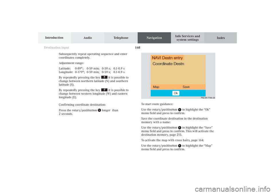
To start route guidance:
Use the rotary/pushbutton
to highlight the “Ok”
menu field and press to confirm.
Save the coordinate destination in the destination
memory with a name:
Use the rotary/pushbutton to highlight the “Save”
menu field and press to confirm. This will activate the
destination memory, page 215.
To activate the map with cross hairs, page 164:
Use the rotary/pushbutton to highlight the “Map”
menu field and press to confirm.
09-NAVI1-25-US.pm509.07.2004, 14:27 Uhr 168
Page 171 of 251
169 Destination input
Introduction
Audio
Telephone
Navigation
Index Info Services and
system settings Entering points of interest
This function allows you to select such points of
interest as gas stations, Mercedes-Benz Centers,
parking facilities, shopping centers or airports.
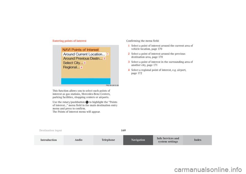
Use the rotary/pushbutton
to highlight the “Points
of interest...” menu field in the main destination entry
menu and press to confirm.
The Points of interest menu will appear.Confirming the menu field:
1Select a point of interest around the current area of
vehicle location, page 170
2Select a point of interest around the previous
destination area, page 170
3Select a point of interest in the surrounding area of
another city, page 171
4Select a regional point of interest, e.g. airport,
page 172
P82.85-2613-26
4
3
2
1
09-NAVI1-25-US.pm509.07.2004, 14:27 Uhr 169
Page 172 of 251
170
Destination input
Audio TelephoneNavigation
Index Info Services and
system settings Introduction
Selecting points of interest around current area of
vehicle location or previous destination area
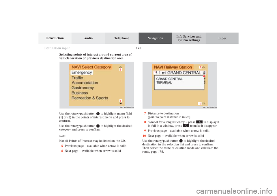
Use the rotary/pushbutton
to highlight menu field
(1) or (2) in the points of interest menu and press to
confirm.
Use the rotary/pushbutton to highlight the desired
category and press to confirm.
Note:
Not all Points of Interest may be listed on the CD.
5Previous page – available when arrow is solid
6Next page – available when arrow is solid
P82.85-2615-26
10
8
7
9
7Distance to destination
(point to point distance in miles)
8Symbol for a long list entry – press
to display it
in full in a window, press
to make it disappear
9Previous page – available when arrow is solid
10Next page – available when arrow is solid
Use the rotary/pushbutton
to highlight the desired
destination in the selection list and press to confirm.
Then select the route calculation mode and calculate the
route, page 175.
P82.85-6099-2665
09-NAVI1-25-US.pm509.07.2004, 14:27 Uhr 170
Page 173 of 251
171 Destination input
Introduction
Audio
Telephone
Navigation
Index Info Services and
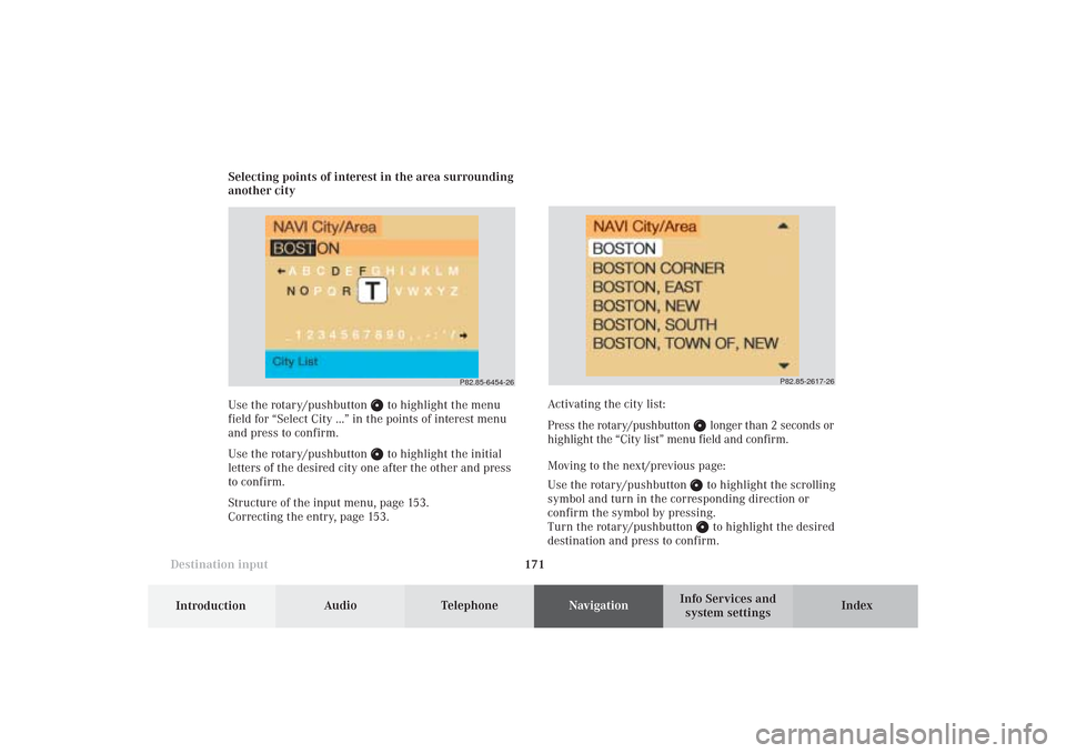
system settings Selecting points of interest in the area surrounding
another city
Use the rotary/pushbutton
to highlight the menu
field for “Select City ...” in the points of interest menu
and press to confirm.
Use the rotary/pushbutton to highlight the initial
letters of the desired city one after the other and press
to confirm.
Structure of the input menu, page 153.
Correcting the entry, page 153.
P82.85-2617-26
Activating the city list:
Press the rotary/pushbutton
longer than 2 seconds or
highlight the “City list” menu field and confirm.
Moving to the next/previous page:
Use the rotary/pushbutton to highlight the scrolling
symbol and turn in the corresponding direction or
confirm the symbol by pressing.
Turn the rotary/pushbutton to highlight the desired
destination and press to confirm.
P82.85-6454-26
09-NAVI1-25-US.pm509.07.2004, 14:27 Uhr 171
Page 174 of 251
172
Destination input
Audio TelephoneNavigation
Index Info Services and
system settings Introduction
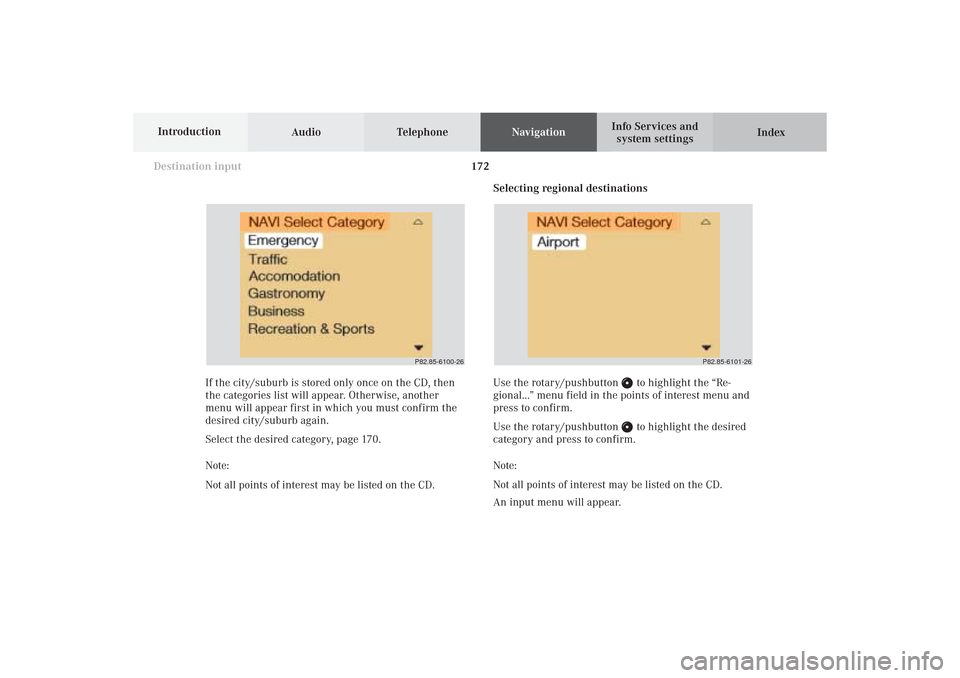
Selecting regional destinations
Use the rotary/pushbutton
to highlight the “Re-
gional...” menu field in the points of interest menu and
press to confirm.
Use the rotary/pushbutton to highlight the desired
category and press to confirm.
Note:
Not all points of interest may be listed on the CD.
An input menu will appear. If the city/suburb is stored only once on the CD, then
the categories list will appear. Otherwise, another
menu will appear first in which you must confirm the
desired city/suburb again.
Select the desired category, page 170.
Note:
Not all points of interest may be listed on the CD.
P82.85-6100-26
P82.85-6101-26
09-NAVI1-25-US.pm509.07.2004, 14:28 Uhr 172
Page 175 of 251
173 Destination input
Introduction
Audio
Telephone
Navigation
Index Info Services and
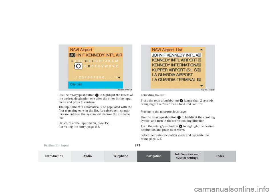
system settings Use the rotary/pushbutton
to highlight the letters of
the desired destination one after the other in the input
menu and press to confirm.
The input line will automatically be populated with the
first matching enry in the list. As subsequent charac-
ters are entered, the system will narrow the available
list.
Structure of the input menu, page 153.
Correcting the entry, page 153.Activating the list:
Press the rotary/pushbutton
longer than 2 seconds
or highlight the “List” menu field and confirm.
Moving to the next/previous page:
Use the rotary/pushbutton to highlight the scrolling
symbol and turn in the corresponding direction.
Turn the rotary/pushbutton to highlight the desired
destination and press to confirm.
Select the route calculation mode and calculate the
route, page 175.
P82.85-6455-26
P82.85-7742-26
09-NAVI1-25-US.pm509.07.2004, 14:28 Uhr 173
Page 176 of 251
174
Destination input
Audio TelephoneNavigation
Index Info Services and
system settings Introduction
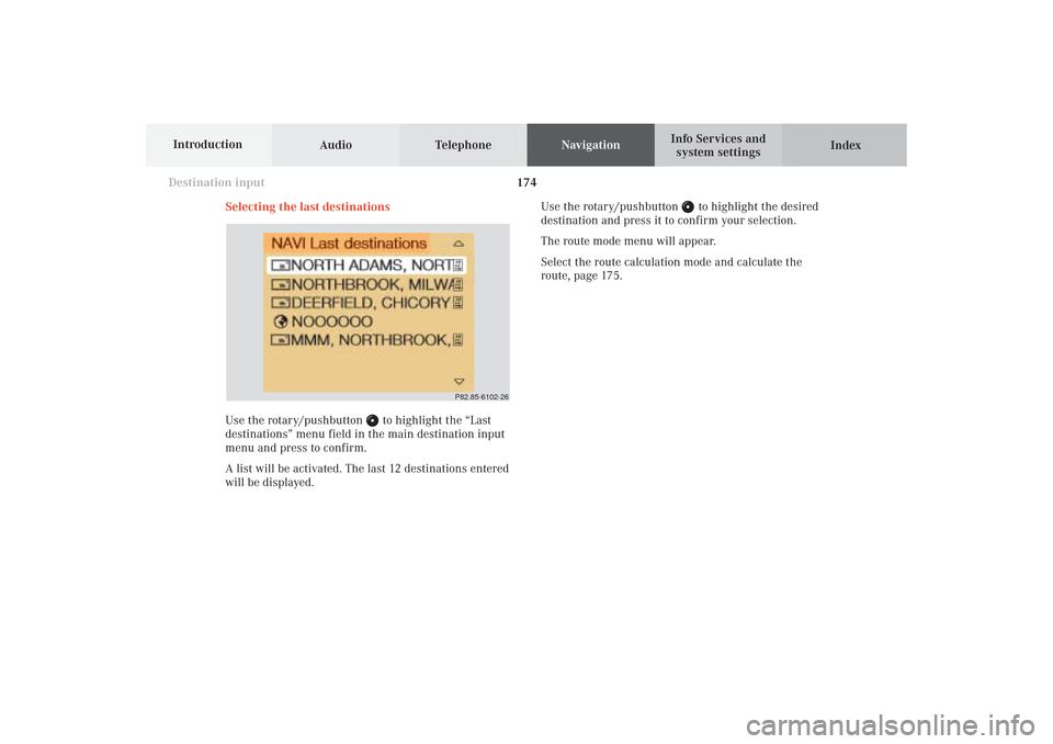
Selecting the last destinations
Use the rotary/pushbutton
to highlight the “Last
destinations” menu field in the main destination input
menu and press to confirm.
A list will be activated. The last 12 destinations entered
will be displayed.Use the rotary/pushbutton
to highlight the desired
destination and press it to confirm your selection.
The route mode menu will appear.
Select the route calculation mode and calculate the
route, page 175.
P82.85-6102-26
09-NAVI1-25-US.pm509.07.2004, 14:28 Uhr 174
Page 177 of 251
175 Destination input
Introduction
Audio
Telephone
Navigation
Index Info Services and
system settings
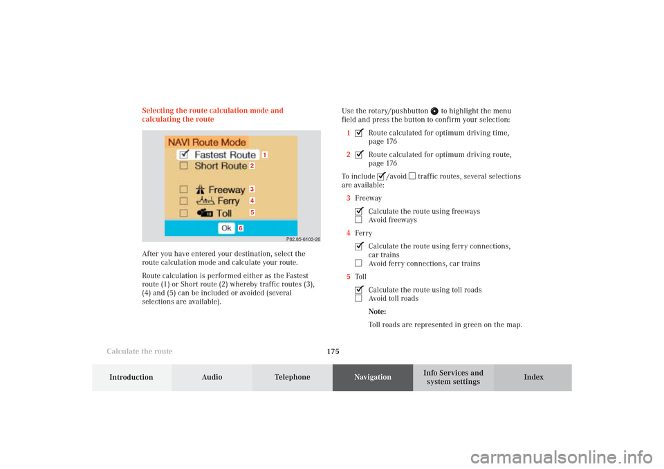
Calculate the routeSelecting the route calculation mode and
calculating the route
After you have entered your destination, select the
route calculation mode and calculate your route.
Route calculation is performed either as the Fastest
route (1) or Short route (2) whereby traffic routes (3),
(4) and (5) can be included or avoided (several
selections are available).Use the rotary/pushbutton
to highlight the menu
field and press the button to confirm your selection:
1
Route calculated for optimum driving time,
page 176
2Route calculated for optimum driving route,
page 176
To include
/avoid
traffic routes, several selections
are available:
3Freeway
Calculate the route using freewaysAvoid freeways
4FerryCalculate the route using ferry connections,
car trainsAvoid ferry connections, car trains
5TollCalculate the route using toll roadsAvoid toll roads
Note:
Toll roads are represented in green on the map.
P82.85-6103-26
1
6
3452
09-NAVI1-25-US.pm509.07.2004, 14:28 Uhr 175
Page 183 of 251

181
Route guidance
Introduction
Audio Telephone
Navigation
Index Info Services and
system settings Requesting destination and route information
After the route has been calculated, it is possible to
request destination and route information.
Use the rotary/pushbutton
to highlight the “Info”
menu field in the symbol display or on the map and
press to confirm.1Estimated time of arrival
2Distance from destination
Note:
If the vehicle drives on a non-digitized road (Message
OFF ROAD), (1) and (2) are then gray and display the
last available information. The message “Off Road: dest.
info not up-to-date” is displayed underneath.
Use the rotary/pushbutton
to highlight the menu
field and press it to confirm:
3Displays the route list, page 182
4Displays the location map, page 184
5Displays current destination, page 185
6Requests the route mode, page 186
7Activates the route map, page 187
8Displays stop-over, page 188
Route guidance is switched off:
The last destination driven to will appear in line (1).
P82.85-6106-26
12
3
6
7
45
8
10-NAVI2-25-US.pm517.10.2001, 10:42 Uhr 181