MERCEDES-BENZ S-Class SEDAN 2016 W222 Comand Manual
Manufacturer: MERCEDES-BENZ, Model Year: 2016, Model line: S-Class SEDAN, Model: MERCEDES-BENZ S-Class SEDAN 2016 W222Pages: 298, PDF Size: 9.16 MB
Page 131 of 298
The availability of information is country-
dependent. Information can include maxi-
mum speeds, driving with low-beam head-
lamps or legal alcohol limits, for example.
XTo switch to navigation mode:press the
Ø button.
XTo show the menu: slide6the control-
ler.
XTo select Position: turn and press the
controller.
XSelect Country Information.
When the online connection has been
established, the available country informa-
tion appears.
XTo return to navigation: press the%
button.
Map functions129
Navigation
Z
Page 132 of 298
Avoiding an area
Gene ral notes
COMAND enables you to avoi dareas you do no twish to driv ethrough.
If you activat eor deactivat e arout ebloc kwhile rout eguidance is active ,COMAND will cal-
culat e anewroute. If you activat eor deactivat e arout ebloc kwhile rout eguidance is inactive ,
COMAND will use th ene wsetting for th ene xt rout eguidance .
The calculated rout emay include an area to be avoided if:
Ryour destination is locate din suc han area.
Rthere is no alternative rout eof comparable lengt havailable
Highways within blocke dareas are always taken int oconsideration in th erout ecalculation .
iEquipment wit h atouchpad: alternativel yyou can carry out this operation usin gth etouch -
pad (
Ypage 32) .
Avoiding a new area
XTo switch to navigation mode: press theß button.
XTo sho wthemenu: slide6thecontroller .
XTo select Options:tur nand press th econtroller .
XSelectRoute Settings.
XSelec tAvoid Option s.
XSelectAvoid Are a.
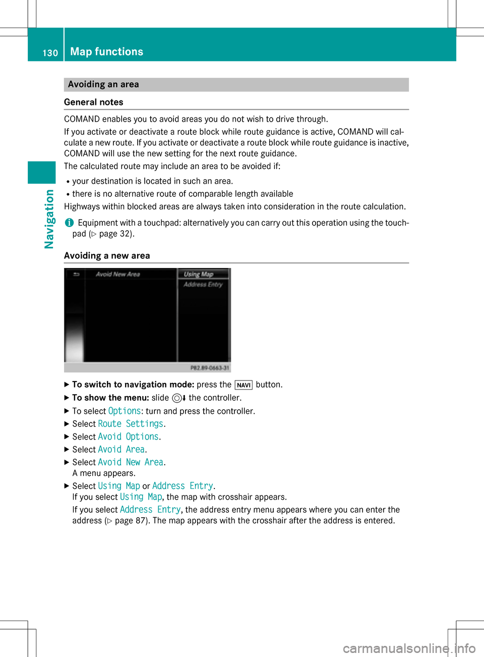
XSelectAvoid New Are a.
A men uappears.
XSelec tUsing Mapor Addres sEntry.
If you select Using Map
,th emap wit hcrosshair appears.
If you select AddressEntry
,th eaddress entr ymen uappear swher eyou can ente rth e
address (
Ypage 87). The map appear swit hth ecrosshair after th eaddress is entered .
130Map functions
Navigation
Page 133 of 298
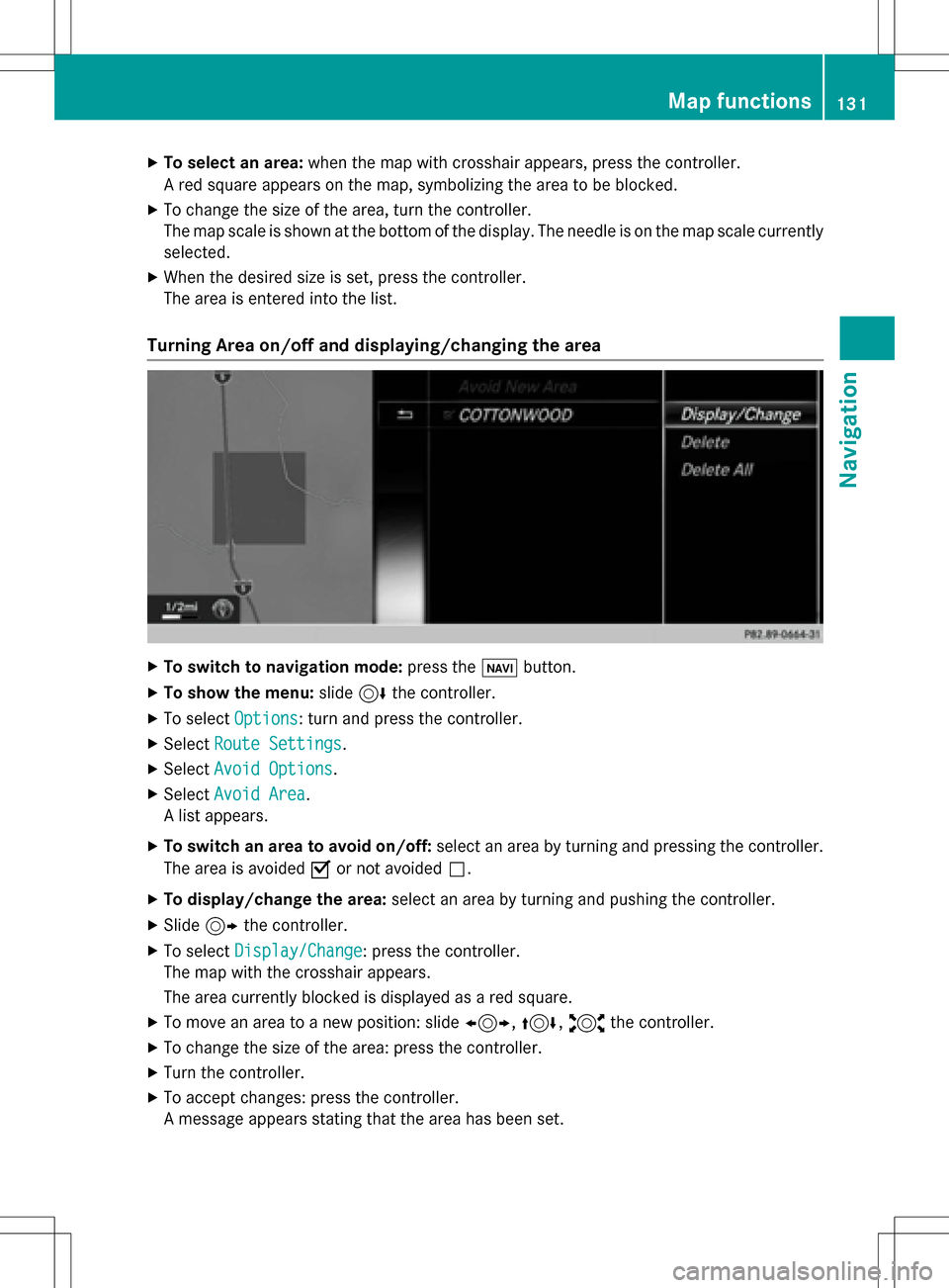
XTo select an area:when the map with crosshair appears, press the controller.
A red square appears on the map, symbolizing the area to be blocked.
XTo change the size of the area, turn the controller.
The map scale is shown at the bottom of the display. The needle is on the map scale currently
selected.
XWhen the desired size is set, press the controller.
The area is entered into the list.
Turning Area on/off and displaying/changing the area
XTo switch to navigation mode: press theßbutton.
XTo show the menu: slide6the controller.
XTo select Options: turn and press the controller.
XSelectRoute Settings.
XSelectAvoid Options.
XSelectAvoid Area.
A list appears.
XTo switch an area to avoid on/off: select an area by turning and pressing the controller.
The area is avoided Oor not avoided ª.
XTo display/change the area: select an area by turning and pushing the controller.
XSlide9the controller.
XTo select Display/Change: press the controller.
The map with the crosshair appears.
The area currently blocked is displayed as a red square.
XTo move an area to a new position: slide 1,4,2the controller.
XTo change the size of the area: press the controller.
XTurn the controller.
XTo accept changes: press the controller.
A message appears stating that the area has been set.
Map functions131
Navigation
Z
Page 134 of 298
Deleting one/all areas:
XTo switch to navigation mode: press theß button.
XTo show th emenu :slid e6 thecontroller .
XTo selectOption s:turn and press th econtroller .
XSelectRoute Settings.
XSelec tAvoid Option s.
XSelectAvoid Are a.
A list appears .
XTo deletean area: markan are aby turnin gth econtroller .
XSlide9thecontroller .
XSelectDelete.
A prompt appears askin gwhether you wish to delete th earea.
XSelec tYesor No.
Afte rselecting Yes
,th eare ais deleted.
XTo delet eall areas :slid e9 thecontroller when th elist is displayed .
XSelectDelete All.
A prompt appears askin gwhether you wish to delete all areas.
XSelec tYesor No.
Afte rselecting Yes
,all areas are deleted.
SIRIUS XM service
Displaying SIRIUS XM service informa -
tion
You can display th eSIRIU SXM servic einfor-
mation .
XTo switch to navigation mode: press the
Ø button.
XTo show th emenu :press th econtroller .
XTo selectTraffi c:turn and press th econ-
troller.
XSelec tSIRIUS Servic e.
The window on th eright half of th edisplay
shows th etelephon enumber of th epro -
vider (SIRIUS XM) and th eserial number of
your servic emodule.
Registering for th eSIRIUS XM traffic
repor tservice
XCall th eprovider telephon enumber shown
on th eCOMAN Ddisplay.
iYou can also hav eth esatellit eservic e
activated online. To do so, visit th eSIRIU S
XM Radio websit eat
http://www.sirius.com (USA).
Once th econnection has been established :
XFollow theservic eemployee's instructions.
The activation process may take up to te n
minutes.
If registration is no tincluded when purchas-
in gth esystem, your credit car ddetails will be
require dto activat eyour account.
132Map functions
Navigation
Page 135 of 298
Updating the digital map
Introduction
The digital maps generated by the map soft-
ware become outdated in the same way as
conventional road maps. Optimal route guid-
ance can only be provided by the navigation
system in conjunction with the most up-to-
date map software.
Information about new versions of the digital
map can be obtained from an authorized
Mercedes-Benz Center. You can have the dig-
ital map updated there using a data medium,
or you can update it yourself.
Navigation functions
Calling up the navigation system
menu
XTo switch to navigation mode: press the
ß button.
XTo show the menu: slide5the control-
ler.
Navi
is highlighted in the main function bar.
XPress the controller.
The navigation menu appears.
XTurn the controller to display the navigation
functions one after another.
XTo switch to the map, turn the controller
until Navigation
appears and press the
controller.
iEquipment with touchpad: alternatively,
you can carry out these steps on the touch-
pad (
Ypage 32).
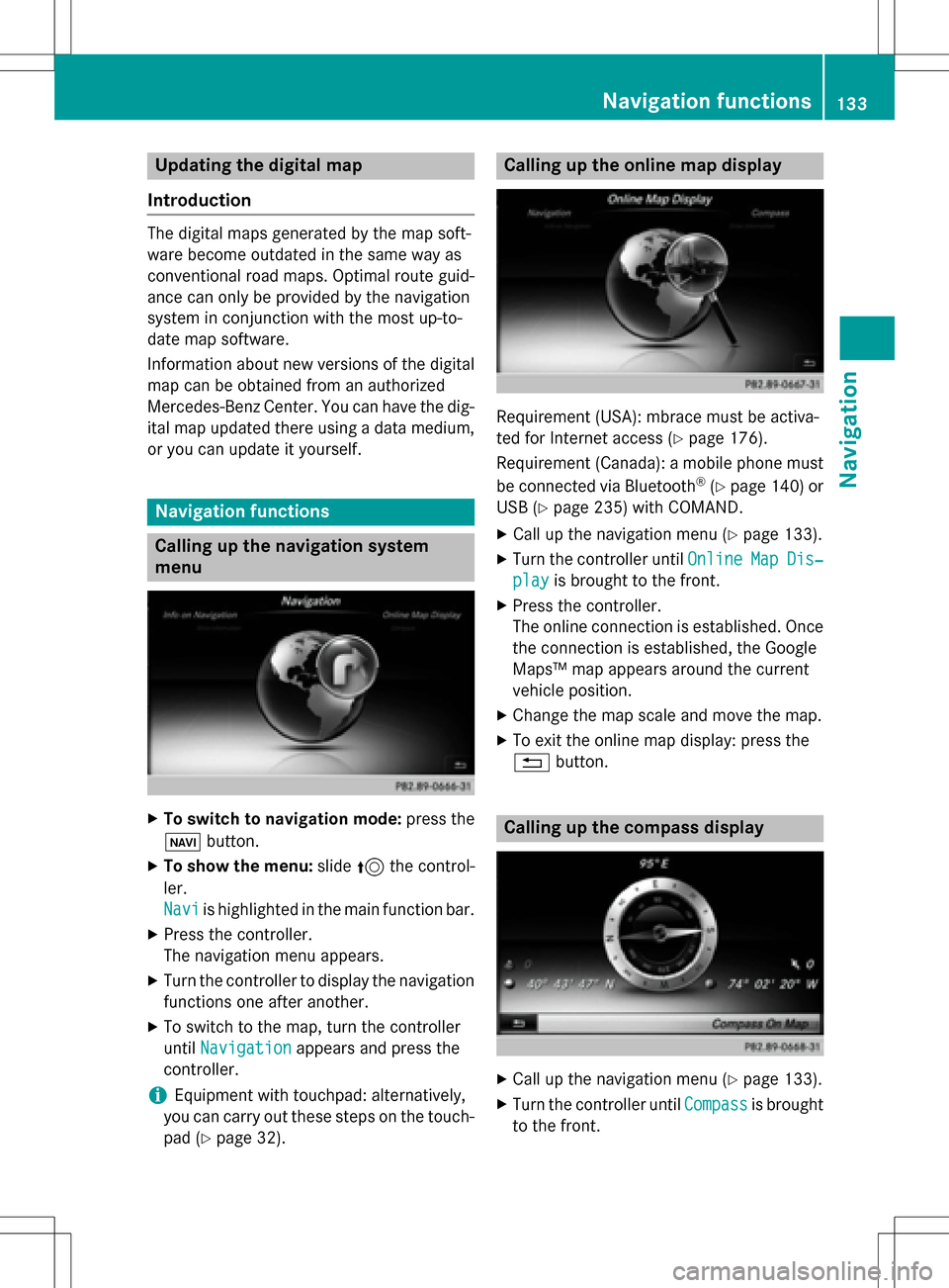
Calling up the online map display
Requirement (USA): mbrace must be activa-
ted for Internet access (
Ypage 176).
Requirement (Canada): a mobile phone must be connected via Bluetooth
®(Ypage 140) or
USB (
Ypage 235) with COMAND.
XCall up the navigation menu (Ypage 133).
XTurn the controller until OnlineMapDis‐
playis brought to the front.
XPress the controller.
The online connection is established. Once
the connection is established, the Google
Maps™ map appears around the current
vehicle position.
XChange the map scale and move the map.
XTo exit the online map display: press the
%button.
Calling up the compass display
XCall up the navigation menu (Ypage 133).
XTurn the controller until Compassis brought
to the front.
Navigation functions133
Navigation
Z
Page 136 of 298
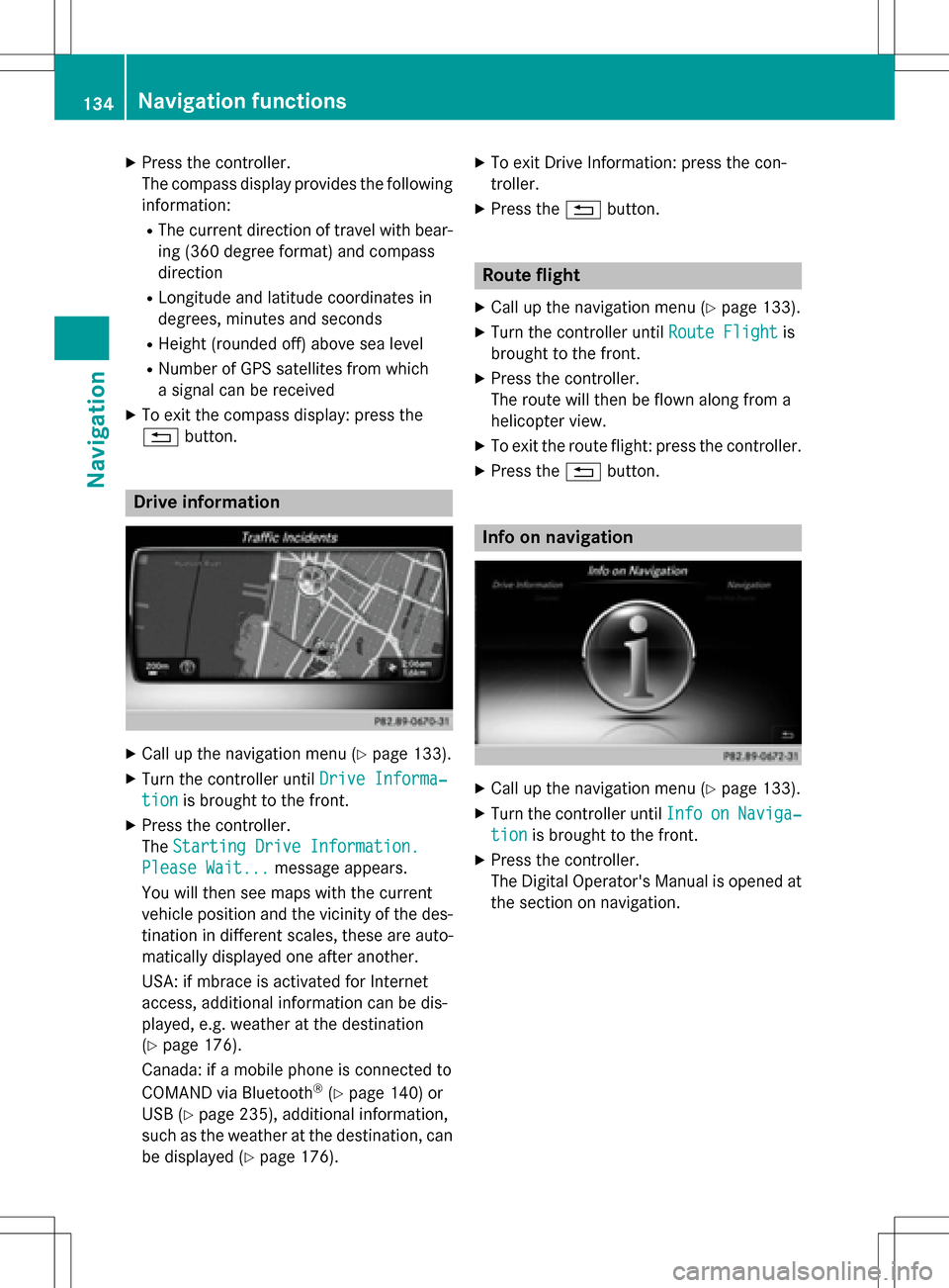
XPress the controller.
The compass display provides the followinginformation:
RThe current direction of travel with bear-
ing (360 degree format) and compass
direction
RLongitude and latitude coordinates in
degrees, minutes and seconds
RHeight (rounded off) above sea level
RNumber of GPS satellites from which
a signal can be received
XTo exit the compass display: press the
% button.
Drive information
XCall up the navigation menu (Ypage 133).
XTurn the controller until Drive Informa‐
tionis brought to the front.
XPress the controller.
TheStarting Drive Information.
Please Wait...message appears.
You will then see maps with the current
vehicle position and the vicinity of the des-
tination in different scales, these are auto-
matically displayed one after another.
USA: if mbrace is activated for Internet
access, additional information can be dis-
played, e.g. weather at the destination
(
Ypage 176).
Canada: if a mobile phone is connected to
COMAND via Bluetooth
®(Ypage 140) or
USB (
Ypage 235), additional information,
such as the weather at the destination, can
be displayed (
Ypage 176).
XTo exit Drive Information: press the con-
troller.
XPress the %button.
Route flight
XCall up the navigation menu (Ypage 133).
XTurn the controller until Route Flightis
brought to the front.
XPress the controller.
The route will then be flown along from a
helicopter view.
XTo exit the route flight: press the controller.
XPress the %button.
Info on navigation
XCall up the navigation menu (Ypage 133).
XTurn the controller until InfoonNaviga‐
tionis brought to the front.
XPress the controller.
The Digital Operator's Manual is opened at
the section on navigation.
134Navigation functions
Navigation
Page 137 of 298
Problems with the navigation system
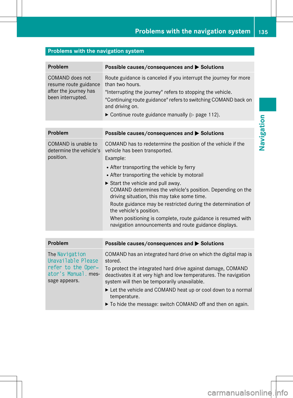
ProblemPossible causes/consequences andMSolutions
COMAND does not
resume route guidance
after the journey has
been interrupted.Route guidance is canceled if you interrupt the journey for more
than two hours.
"Interrupting the journey" refers to stopping the vehicle.
"Continuing route guidance" refers to switching COMAND back on
and driving on.
XContinue route guidance manually (Ypage 112).
ProblemPossible causes/consequences andMSolutions
COMAND is unable to
determine the vehicle's
position.COMAND has to redetermine the position of the vehicle if the
vehicle has been transported.
Example:
RAfter transporting the vehicle by ferry
RAfter transporting the vehicle by motorail
XStart the vehicle and pull away.
COMAND determines the vehicle's position. Depending on the
driving situation, this may take some time.
Route guidance may be restricted during the determination of
the vehicle's position.
When positioning is complete, route guidance is resumed with
navigation announcements and route guidance displays.
ProblemPossible causes/consequences andMSolutions
TheNavigation
UnavailablePlease
refer to the Oper‐
ator's Manual.mes-
sage appears.
COMAND has an integrated hard drive on which the digital map is
stored.
To protect the integrated hard drive against damage, COMAND
deactivates it at very high and low temperatures. The navigation
system will then be temporarily unavailable.
XLet the vehicle and COMAND heat up or cool down to a normal
temperature.
XTo hide the message: switch COMAND off and then on again.
Problems with the navigation system135
Navigation
Z
Page 138 of 298
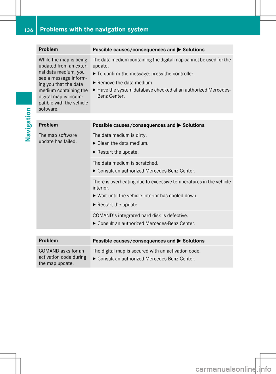
ProblemPossible causes/consequences andMSolutions
While the map is being
updated from an exter-
nal data medium, you
see a message inform-
ing you that the data
medium containing the
digital map is incom-
patible with the vehicle
software.The data medium containing the digital map cannot be used for the
update.
XTo confirm the message: press the controller.
XRemove the data medium.
XHave the system database checked at an authorized Mercedes-
Benz Center.
ProblemPossible causes/consequences andMSolutions
The map software
update has failed.The data medium is dirty.
XClean the data medium.
XRestart the update.
The data medium is scratched.
XConsult an authorized Mercedes-Benz Center.
There is overheating due to excessive temperatures in the vehicle
interior.
XWait until the vehicle interior has cooled down.
XRestart the update.
COMAND's integrated hard disk is defective.
XConsult an authorized Mercedes-Benz Center.
ProblemPossible causes/consequences andMSolutions
COMAND asks for an
activation code during
the map update.The digital map is secured with an activation code.
XConsult an authorized Mercedes-Benz Center.
136Problems with the navigation system
Navigation
Page 139 of 298
Your COMAND equipment................138
Important safet ynotes .................... .138
General notes .................................... 138
Telephon emenu ................................ 139
Connecting/disconnecting a
mobile phone .................................... .140
Reception an dtransmission vol-
um e.................................................... 145
Usin gth etelephon e........................ .146
Mobile phone voice recognition ......150
Phone book ........................................ 151
Cal llist s............................................ .154
Speed dial list s.................................. 157
Messages (text messages an de-
mails) ................................................ .158
Address book .................................... 165
137
Telephone
Page 140 of 298
Your COMANDequipment
i
These operatin ginstruction sdescribe all
th estandar dan doptional equipmen tof
your COMAN Dsystem, as available at th e
time of going to print .Country-specifi cdif -
ference sare possible. Bear in min dthat
your vehicle may no tfeature all function s
described here. Thi salso applies to safety-
relevant systems an dfunctions.
iRead th einformation on qualified special-
ist workshop sin th evehicle Operator's
Manual.
Important safet ynotes
GWARNING
If you operat emobile communication equip-
men twhil edriving, you will be distracted from
traffic conditions. You could also los econtro l
of th evehicle. There is aris kof an accident.
Only operat ethis equipment when th evehicle
is stationary.
If you mak e acallon your mobile phone whil e
driving, always use hands-free mode. Only
use th emobile phone when road, weather
an dtraffic condition spermit .Some jurisdic -
tion sprohibi tth edriver from usin g amobile
phone whil edrivin g avehicle.
Bear in min dthat at aspeed of 30 mph
(approximately 50 km/h), th evehicle cover s
a distanc eof 44 feet (approximately 14 m)
per second.
Excessive levels of electromagnetic radiation
may cause damage to your health an dth e
health of others.
There is scientific discussio nsurroundin gth e
possible health risks posed by electromag-
neti cfields .You can reduce this ris kby usin g
an exterio rantenna.
Therefore, connec tyour mobile communica-
tion sequipmen tto th evehicle' sexterio r
antenn awhereve rpossible.
General notes
Bluetoot h®interface
ABluetoot h®interface is available fo rteleph -
ony.
If your mobile phone supports th eBluetoot h
®
profilePBAP (Phone Book Access Profile) ,th e
contact sare automatically displaye din
COMAND. If your mobile phone doe sno tsup-
por tth eBluetoot h
®profilePBAP ,COMAN D
will attempt to display th econtact susin g
alternative methods.
You can use th emessag efunction if your
mobile phone supports th eMA PBluetoot h
®
profile (Messag eAccess Profile).
Wit h a suitable mobile phone ,you can use th e
hands-free syste man dreceiv evCards via th e
Bluetoot h
®interface .
You can obtain more information about suit -
able mobile phone son th eInternet at
www.mercedes-benz-mobile.com .
You can also obtain more information by call-
ing.
In th eUSA, you can get in touch wit hth e
Mercedes-Ben zCustomer Assistanc eCente r
on 1-800-FOR-MERCede s(1-800-367-6372).
In Canada, you can get in touch with the Cus- tomer Relations Center on 1-800-387-0100.
HD Voice®
COMAND supports telephone calls in HD
Voice®. The voice quality can be improved
with this procedure.
Requirements for HD Voice
®:
RYour mobile phone and mobile phone net-
work provider support HD Voice®.
RThe mobile phone and mobile phone net-
work provider of the person you are calling
support HD Voice
®.
Depending on the quality of the connection,
the voice quality may fluctuate.
138General notes
Telephone