navigation TOYOTA YARIS HATCHBACK 2020 Accessories, Audio & Navigation (in English)
[x] Cancel search | Manufacturer: TOYOTA, Model Year: 2020, Model line: YARIS HATCHBACK, Model: TOYOTA YARIS HATCHBACK 2020Pages: 94, PDF Size: 1.68 MB
Page 75 of 94
75
1
2
3
4
5
6
Yaris_Yaris hatchback_Navi_OM99V62z_(U)
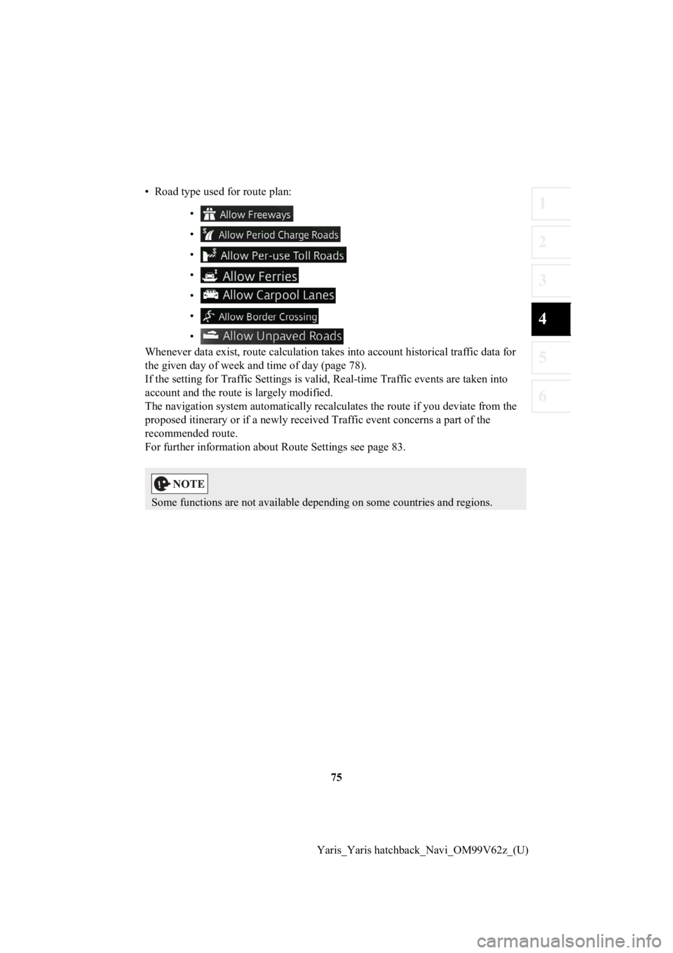
• Road type used for route plan:
•
•
•
•
•
•
•
Whenever data exist, route calculation takes into account histo rical traffic data for
the given day of week and time of day (page 78).
If the setting for Traffic Settin gs is valid, Real-time Traffic events are taken into
account and the route is largely modified.
The navigation system automati cally recalculates the route if you deviate from the
proposed itinerar y or if a newly received Traffic event concerns a part of the
recommended route.
For further information about Route Settings see page 83.
Some functions are not available depending on some countries an d regions.
Page 77 of 94
77
1
2
3
4
5
6
Yaris_Yaris hatchback_Navi_OM99V62z_(U)
4.1.4 Speed limit warning (Only
some countries and regions)
Maps may contain information about the speed limits of the road s. The navigation
system is able to warn you if you exceed the current limit. Thi s information may not
be available for your region (ask your local dealer), or may not be fully correct for all
roads on the map.
Except vehicles with Active Dri ving Display (Windshield type)
The speed warning can be set from the Warning Settings (page 81).
Setting can be selected using Warning Settings:
• Audio warning: You will hear a warning beep if you exceed the speed limit by a
certain percentage.
• Visual warning (other than vehicles with Traffic Sign Recognit ion System (TSR)):
If you exceed the speed limit on a road, the speed limit for th e current road is
shown on the map.
• Visual warning: If you exceed the speed limit on a road, the speed limit for the
current road is shown on the map or in the active driving display.
You can also choose to see the sp eed limit sign on the map all the time.
Vehicles with Active Driving Display (Windshield type)
1. Select the icon on the home screen to display the Settings s creen.
2. Select the tab.
3. Press the icon on the screen to select the item you
would like to change.
Safety
Speed Limit Warning
Page 78 of 94
78
Yaris_Yaris hatchback_Navi_OM99V62z_(U)
4.1.5 Traffic information in rout
e planning (Only some countries and regions)
The recommended route is not alway s the same between two points. Offline
historical traffic information (historical speed information or traffic patterns) can be
taken into account in the route calculation based on the time o f day and the day of
week whenever suitable data exis ts. In addition, real-time traffic information can
help you avoid current traffic events like temporary road closu res or a traffic jam
caused by an accident. Both functions are subject to data avail ability.
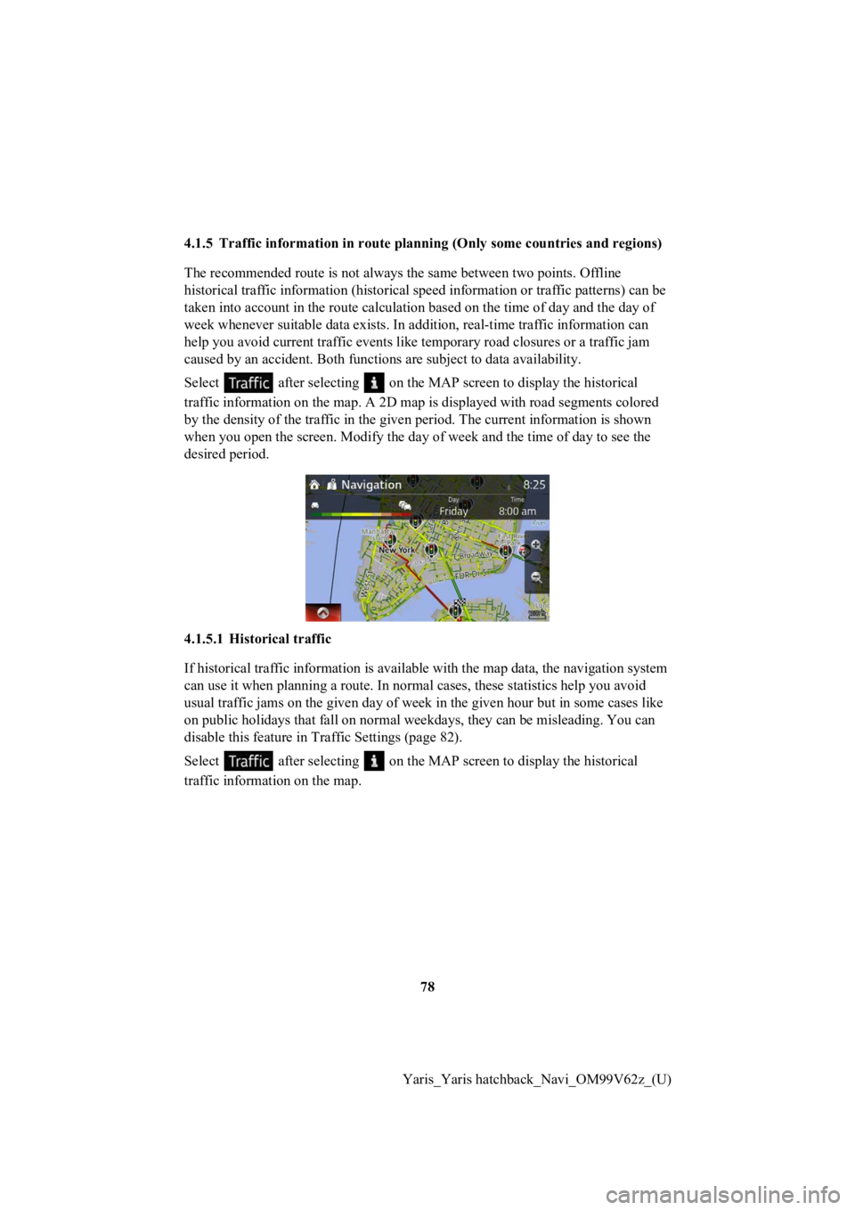
Select after selecting on the MAP screen to display the histo rical
traffic information on the map. A 2D map is displayed with road segments colored
by the density of the traffic in the given period. The current information is shown
when you open the screen. Modify the day of week and the time of day to see the
desired period.
4.1.5.1 Historical traffic
If historical traffic information is available with the map dat a, the navigation system
can use it when planning a route. In normal cases, these statis tics help you avoid
usual traffic jams on the given day of week in the given hour b ut in some cases like
on public holidays that fall on normal weekdays, they can be mi sleading. You can
disable this feature in Traffic Settings (page 82).
Select after selecting on the MAP screen to display the histo rical
traffic informat ion on the map.
Page 80 of 94
80
Yaris_Yaris hatchback_Navi_OM99V62z_(U)
4.2 Settings menu
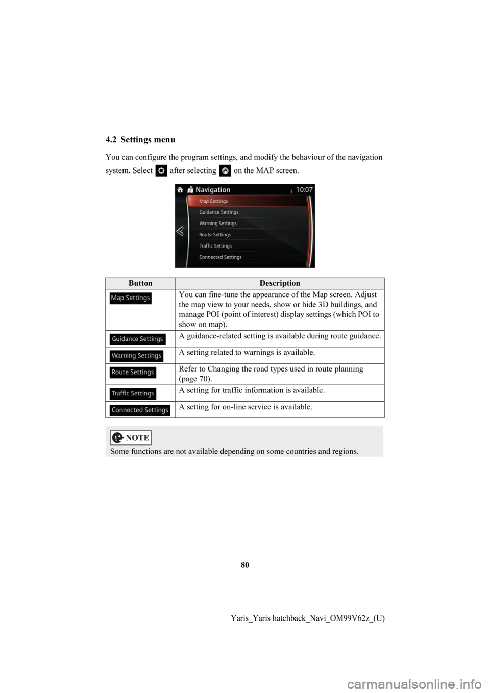
You can configure the program se ttings, and modify the behaviour of the navigation
system. Select after selecting on the MAP screen.
ButtonDescription
You can fine-tune th e appearance of the Map screen. Adjust
the map view to your needs, show or hide 3D buildings, and
manage POI (point of interest) display settings (which POI to
show on map).
A guidance-related setting is available during route guidance.
A setting related to warnings is available.
Refer to Changing the road types used in route planning
(page 70).
A setting for traffic in formation is available.
A setting for on-line service is available.
Some functions are not available depending on some countries an d regions.
Page 82 of 94
82
Yaris_Yaris hatchback_Navi_OM99V62z_(U)
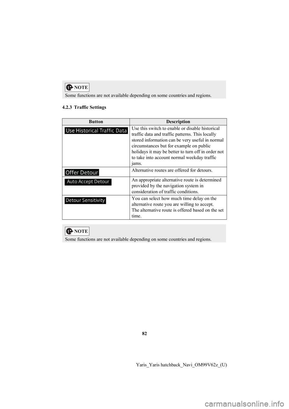
4.2.3 Traffic Settings
Some functions are not available
depending on some countries an d regions.
ButtonDescription
Use this switch to enable or disable historical
traffic data and traffic patterns. This locally
stored information can be very useful in normal
circumstances but for example on public
holidays it may be better to turn off in order not
to take into account normal weekday traffic
jams.
Alternative routes are offered for detours.
An appropriate alternative route is determined
provided by the navigation system in
consideration of traffic conditions.
You can select how muc h time delay on the
alternative route y ou are willing to accept.
The alternative route is offered based on the set
time.
Some functions are not available depending on some countries an d regions.
Page 83 of 94
83
1
2
3
4
5
6
Yaris_Yaris hatchback_Navi_OM99V62z_(U)
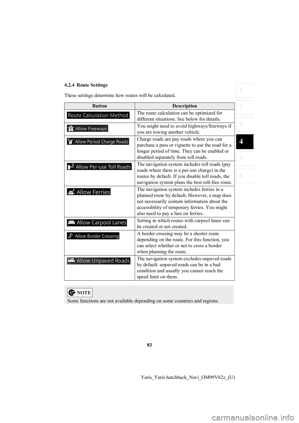
4.2.4 Route Settings
These settings determine how routes will be calculated.
ButtonDescription
The route calculation can be optimized for
different situations. See below for details.
You might need to avoid highways/freeways if
you are towing another vehicle.
Charge roads are pay roads where you can
purchase a pass or vignette to use the road for a
longer period of time. They can be enabled or
disabled separatel y from toll roads.
The navigation system includes toll roads (pay
roads where there is a per-use charge) in the
routes by default. If you d isable toll roads, the
navigation system plans the best toll-free route.
The navigation system includes ferries in a
planned route by default. However, a map does
not necessarily contain information about the
accessibility of temporary ferries. You might
also need to pay a fare on ferries.
Setting in which routes with carpool lanes can
be created or not created.
A border crossing may be a shorter route
depending on the route. For this function, you
can select whether or not to cross a border
when planning the route.
The navigation system excludes unpaved roads
by default: unpaved roads can be in a bad
condition and usually you cannot reach the
speed limit on them.
Some functions are not available depending on some countries an d regions.
Page 88 of 94

88
Yaris_Yaris hatchback_Navi_OM99V62z_(U)
5Glossary
Active route
The currently navigated route. Whenever a destination is set, t he route is active until
you delete it or reach your de stination. See also: Route.
City Center
The city center is not the geome tric center of the city but an arbitrary point the map
creators have chosen. In cities and villages, it is usually the most important
intersection; in larger cities, it is one of the important inte rsections.
Color theme
The navigation system has differe nt color themes for daytime and nighttime which
can be selected as desired.
One daytime scheme and one night time scheme is always selected for the map and
for the menus.
The navigation system uses them w hen it switches from day to night and back.
GPS accuracy
Several factors have impact on the deviation between your real position and the one
given by the GPS device. For examp le, signal delay in the ionosphere or reflecting
objects near the GPS device have a different and varying impact on how accurately
the GPS device can cal culate your position.
Page 89 of 94

89
1
2
3
4
5
6
Yaris_Yaris hatchback_Navi_OM99V62z_(U)
Map
The navigation system works with
digital maps which are not simply the
computerized versions of traditional paper maps. Similarly to p aper road maps, the
2D mode of digital maps show you streets, roads, and elevation by colors.
In 3D mode, you can see the altitude differences, for example v alleys and mountains,
elevated roads, and in selected cities 3D landmarks and 3D buil dings are also
displayed.
You can use digital maps inter actively: you can zoom in and out (increase or
decrease the scale), yo u can tilt them up and down, and rotate them left and right. In
GPS-supported navigation, digital maps facilitate route plannin g.
North-up map orientation
In North-up mode the map is rotated so its top always faces North. This is the
orientation for example in Find on Map.
Road Safety Camera
This function is not available in some countries and regions.
Special alert points for speed, red light or bus lane cameras. Different data sources
are available. You can configure the navigation system to warn you when you
approach one of these cameras.
Detecting the location of Road Sa fety Cameras is prohibited in certain countries. It is
the sole responsibility of the dr iver to check whether this feature can be used during
the trip.
The software is capable of showing and warning for more than ju st cameras. Various
other types of proximity alert points like school zones and rai lway crossings are also
available.
Route
A sequence of maneuvers (for ex ample, turns and roundabouts) to reach the
destination. The route contains o ne start point and one or more destinations.
Track-up map orientation
In Track-up mode the map is rota ted so its top always points in the current driving
direction. This is the default orientation in 3D map view mode.
Vehicle marker
The current position is indicated by a blue arrow on the map. T he direction the blue
arrow is pointed indicat es the current heading.
Page 90 of 94

90
Yaris_Yaris hatchback_Navi_OM99V62z_(U)
6 End-User Terms
HERE END-USER TERMS
The data is provided for your per sonal, internal use only and not for resale. It is
protected by copyright, and is sub ject to the following terms and conditions which
are agreed to by you, on the one h and, and VISTEON and its licensors (including
their licensors and supplie rs) on the other hand.
© 2013 HERE. All rights reserved.
The Data for areas of Canada includes information taken with pe rmission from
Canadian authorities, including: © Her Majesty the Queen in Right of Canada, ©
Queen’s Printer for Ont ario, © Canada Post Corporation, GeoBase
®, © Department
of Natural Resources Canada.
HERE holds a non-exclusive licen se from the United States Postal Service
® to
publish and sell ZIP+4
® information. ©United States Postal Service® 2013. Prices
are not established, controlled or approved by the United States Postal Service
®. The
following trademarks and registrations are owned by the USPS: U nited States Postal
Service, USPS, and ZIP+4.
The Data for Mexico in cludes certain data from Instituto Nacional de Estadística y
Geografía.
Terms and Conditions
Personal Use Only: You agree to use this Data together with VISTEON’s CMU for
the solely personal, non-commerci al purposes for which you were licensed, and not
for service bureau, tim e-sharing or other similar purposes. Acc ordingly, but subject
to the restrictions set forth in the following paragraphs, you agree not to otherwise
reproduce, copy, modify, decompile, disassemble, create any der ivative works of, or
reverse engineer any portion of t his Data, and may not transfer or distribute it in any
form, for any purpose, except to the extent permitted by mandatory laws.
Restrictions
: Except where you have been specifically licensed to do so by VISTEON,
and without limiting the preceding paragraph, you may not (a) u se this Data with any
products, systems, or applications installed or otherwise connected to or in
communication with vehicles, capable of vehicle navigation, pos itioning, dispatch, real
time route guidance, fleet managem ent or similar applications; or (b) with or in
communication with any positionin g devices or any mobile or wireless-connected
electronic or computer devices, including without limitation ce llular phones, palmtop
and handheld computers, pagers, and personal digital assistants or PDAs.