HONDA FIT 2013 3.G Navigation Manual
Manufacturer: HONDA, Model Year: 2013, Model line: FIT, Model: HONDA FIT 2013 3.GPages: 198, PDF Size: 14.02 MB
Page 171 of 198
170
FIT_KA-31TK6830.book 170 ページ 2011年7月4日 月曜日 午後2時45分
QRG
Index
Home
Page 172 of 198
171
Reference Information
System Initialization..............................172
Entering the Security Code .................... 172
Acquiring GPS Information .................... 172
Startup Confirmation Screen ................. 173
Map Matching ...................................... 173
System Limitations ................................174
GPS System........................................... 174
Address Calculation .............................. 174
Database .............................................. 174
Customer Assistance .............................176
Resolving Problems ............................... 176
Reporting Errors .................................... 176
Honda Automobile Customer Service
Contact Information ............................ 176Visiting Your Dealer .............................
176
Map Coverage ..................................... 177
Obtaining Navigation Update Data ....... 177
Operation in Alaska, Hawaii, Canada, and Puerto Rico......................................... 178
Legal Information ................................. 179
END-USER TERMS ................................ 179
As required by the FCC ........................ 181
FIT_KA-31TK6830.book 171 ページ 2011年7月4日 月曜日 午後2時45分
QRG
Index
Home2013 Fit Navigation
Page 173 of 198
172
Reference Information
System Initialization
The navigation system must be initialized if
power to the navigation system is
interrupted for any reason (e.g., the
battery was disconnected).
Entering the Security Code
Find the navigation system’s security code
and serial number label in your Owner’s
Manual kit. Do not store the label in your
vehicle. If you lose the label, you must first
retrieve the serial number, and then obtain
the code. You can find out about your
serial number and security code from a
dealer.
1. Turn the ignition swit ch to ON (II), and
turn on the audio system.
If you turn the i gnition switch to
ACCESSORY (I), and you will
requested to enter the security code.
See step 2.
2. Enter the security code.
If you do not enter the security code
correctly after 10 tries, leave the
system for one hour before trying
again, or visit a dealer to have the
system reset.
NOTE:
In the U.S., you can register the security
code on Owner Link (owners.honda.com.) .
To find information on how to retrieve the
serial number and obtain the code, visit
radio-navicode.honda.com .
Acquiring GPS Information
Depending on the length of time the
power was interrupted, your system may
require GPS initialization.
If initialization is not necessary, the system
proceeds directly to the Startup
Confirmation screen.
If the system fails to locate a sufficient
number of satellites to locate your position
within 10 minutes, the following screen is
displayed.
FIT_KA-31TK6830.book 172 ページ 2011年7月4日 月曜日 午後2時45分
QRG
Index
Home
TOC
Page 174 of 198
173
System InitializationStartup Confirmation Screen
Reference Information
If you are experiencing GPS reception
problems:
2GPS System P. 174
Startup Confirmation
Screen
The Startup Confirmation screen is
displayed when initialization has
successfully completed. It is displayed every
time you start your vehicle. Select OK to
continue.
NOTE:
“OK” cannot be selected using a voice
command.
Map Matching
Map matching is the process of using the
acquired GPS information to locate your
position on the map screen. If you are on a
mapped road, the name of the road is
displayed along the bottom of the map
screen when map matching is completed.
Do not enter a destination until the road
name is displayed.
The system may initially show your location
on a different street (e.g., in urban areas
where streets are close together), may
show an incorrect elevation, or may delay
the display of the vehi cle position icon at
intersections. This is normal; the system
will correct itself while you drive.
FIT_KA-31TK6830.book 173 ページ 2011年7月4日 月曜日 午後2時45分
QRG
Index
Home
TOC
Page 175 of 198
174
Reference Information
System Limitations
GPS System
The signals received from the GPS satellites
are extremely weak (less than a millionth
of the strength of a local FM station) and
require an unobstructed view of the sky.
The GPS antenna is located in the
dashboard. The signal reception can easily
be interrupted or interfered with by the
following:
• Metallic window tint on the front or side
windows
• Cell phones, PDAs, or other electronic
devices docked in a cradle or lying loose
on the dashboard
• Remote starters or “hidden” vehicle
tracking systems mounted near the
navigation unit
• Audio electronic devices mounted near
the navigation unit
• Trees, tall buildings, freeway overpasses,
tunnels, or overhead electrical power
wires
The GPS is operated by the U.S.
Department of Defense. For security reasons, there are certain inaccuracies built
into the GPS for wh
ich the navigation
system must constantly compensate. This
can cause occasional positioning errors of
up to several hundred feet.
Address Calculation
The destination icon shows only the
approximate location of a destination
address. This occurs if the number of
possible addresses is different from the
number of actual addresses on a block. For
example, the address 1425 on a 1400
block with 100 possible addresses
(because it is followed by the 1500 block)
will be shown a quarter of the way down
the block by the system. If there are only
25 actual addresses on the block, the
actual location of address 1425 would be
at the end of the block.
Database
The digitized map database reflects
conditions as they existed at various points
in time before production. Accordingly,
your database may contain inaccurate or
incomplete data or information due to the
passage of time, road construction,
changing conditions, or other causes.
For example, some places/landmarks may
be missing when you search the database
because the name was misspelled, the
place was improperly categorized, or a
place/landmark is not yet in the database.
This is also true for police stations,
hospitals, and other public institutions. Do
not rely on the navigation system if you
need law enforcement or hospital services.
Always check with local information
sources.
FIT_KA-31TK6830.book 174 ページ 2011年7月4日 月曜日 午後2時45分
QRG
Index
Home
TOC
Page 176 of 198
175
System LimitationsDatabase
Reference Information
In addition, the map database contains
verified and unverified areas. Unverified
streets may be missing from the map, in
the wrong location, or have an incorrect
name or address range. A message will
warn you if your route includes unverified
streets. Exercise additional caution when
driving in unve rified areas.
The database does not include, analyze,
process, consider, or reflect any of the
following categories of information:
• Neighborhood quality or safety
• Population density
• Availability or proximity of law
enforcement
• Emergency, rescue, medical, or other
assistance
• Construction work, zones, or hazards
• Road and lane closures
• Legal restrictions (such as vehicular type,
weight, load, height, and speed
restrictions)
• Road slope or grade •
Bridge height, width, weight, or other
limits
• Traffic facilities safety
• Special events
• Pavement characteristics or conditions
Every effort has been made to verify that
the database is accurate. The number of
inaccuracies you experience increases the
longer you go without obtaining an
updated map database.
2 Obtaining Navigation Update Data
P. 177
We assume no liability for any incident that
may result from an error in the program, or
from changed conditions not noted above.
FIT_KA-31TK6830.book 175 ページ 2011年7月4日 月曜日 午後2時45分
QRG
Index
Home
TOC
Page 177 of 198
176
Reference Information
Customer Assistance
Resolving Problems
If you run into a specific issue that you
cannot resolve, consult the following help
resources:
• For navigation system issues:
2 Troubleshooting P. 160
There are also FAQs available online at
automobiles.honda.com .
• For questions regarding Bluetooth®
HandsFreeLink:
2 Bluetooth ® HandsFreeLink® P. 138
• For reporting issues with the database
or places/landmarks:
2 Reporting Errors P. 176
• Call Honda Automobile Customer
Service.
2 Honda Automobile Customer Service
Contact Information
P. 176
Reporting Errors
You can help to improve database
accuracy by reporti ng any errors you
encounter.
• Report errors in freeways and main
“verified” roads shown in black on the
map at http://mapreporter.navteq.com/
dur-web-external/ .
• Please do not report errors in purple
“unverified” roads. Maps for these
areas are provided for reference only.
2 Unverified Area Routing P. 42
• Please do not report errors in places/
landmarks, such as changes in business
names. Information about points of
interest are constantly being updated.
An updated database is available for
purchase, usually in the fall of each year.
2 Obtaining Navigation Update Data
P. 177
• For vehicle position ic on errors, screen
error messages, or other GPS-related
errors:
2 Troubleshooting P. 160
2System Limitations P. 174
Honda Automobile
Customer Service Contact
Information
Honda Navi
American Honda Motor Co., Inc.
Honda Customer Service
Mail Stop 500-2N-7E
1919 Torrance Blvd.
Torrance, CA 90501-2746
Tel: (800) 999-1009
Fax: (310) 783-3273
Visiting Your Dealer
If you have a question that you cannot
resolve using the available help resources,
you can consult your dealer. Please identify
the specific is sue (e.g., error occurs when
you enter a specific a ddress, when driving
on a certain road, or just when it’s cold) so
that the service technician can refer the
issue to the factory so that a solution can
be found. Be patient, the service technician
may be unfamiliar with your specific issue.
FIT_KA-31TK6830.book 176 ページ 2011年7月4日 月曜日 午後2時45分
QRG
Index
Home
TOC
Page 178 of 198
177
Customer AssistanceMap Coverage
Reference Information
Map Coverage
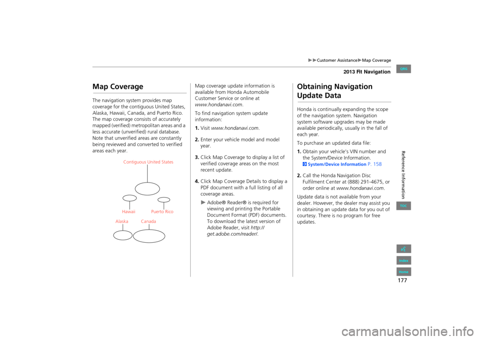
The navigation system provides map
coverage for the contiguous United States,
Alaska, Hawaii, Canada, and Puerto Rico.
The map coverage consists of accurately
mapped (verified) metropolitan areas and a
less accurate (unverified) rural database.
Note that unverified areas are constantly
being reviewed and converted to verified
areas each year.
Contiguous United States
Puerto Rico
Canada
Hawaii
Alaska
Map coverage update information is
available from Honda Automobile
Customer Service or online at
www.hondanavi.com .
To find navigation system update
information:
1. Visit www.hondanavi.com .
2. Enter your vehicle model and model
year.
3. Click Map Coverage to display a list of
verified coverage areas on the most
recent update.
4. Click Map Coverage Details to display a
PDF document with a full listing of all
coverage areas.
Adobe® Reader® is required for
viewing and printing the Portable
Document Format (PDF) documents.
To download the latest version of
Adobe Reader, visit http://
get.adobe.com/reader/ .
Obtaining Navigation
Update Data
Honda is continually expanding the scope
of the navigation system. Navigation
system software upgrades may be made
available periodically, usually in the fall of
each year.
To purchase an updated data file:
1.Obtain your vehicle’s VIN number and
the System/Device Information.
2 System/Device Information P. 158
2. Call the Honda Navigation Disc
Fulfilment Center at (888) 291-4675, or
order online at www.hondanavi.com .
Update data is not available from your
dealer. However, the d ealer may assist you
in obtaining an update data for you out of
courtesy. There is no program for free
updates.
FIT_KA-31TK6830.book 177 ページ 2011年7月4日 月曜日 午後2時45分
QRG
Index
Home
TOC
Page 179 of 198
178
Customer AssistanceOperation in Alaska, Hawaii, Canada, and Puerto Rico
Reference Information
Operation in Alaska,
Hawaii, Canada, and
Puerto Rico
All roads displayed on the map screens are
verified roads. Information in this manual
relating to “unverified” roads or areas is
not applicable.
■Map Coverage
Entering a destination address or place/
landmark on another island may result in a
screen caution messag e. This is because
there are no ferry routes between islands
in the database.
■ Address and Place Entry
Screens
FIT_KA-31TK6830.book 178 ページ 2011年7月4日 月曜日 午後2時45分
QRG
Index
Home
TOC
Page 180 of 198
179
Reference Information
Legal Information
END-USER TERMS
The data (“Data”) is provided for your
personal, internal use only and not for
resale. It is protected by copyright, and is
subject to the following terms and
conditions which are agreed to by you, on
the one hand, and NAVTEQ North
America, LLC (“NT”) and its licensors
(including their licensors and suppliers) on
the other hand.
© 2010 NAVTEQ. All rights reserved.
This data includes information taken with
permission from Canadian authorities,
including © Her Majesty the Queen in
Right of Canada, © Queen’s Printer for
Ontario, © Canada Post Corporation,
GeoBase®, © The Department of Natural
Resources Canada. All rights reserved.
NAVTEQ holds a non-exclusive license
from the United States Postal Service® to
publish and sell ZIP+4® information.
©United States Postal Service® 2010.
Prices are not establis hed, controlled or
approved by the United States Postal
Service®. The following trademarks and
registrations are owned by the USPS:
United States Postal Service, USPS, and
ZIP+4. Personal Use Only.
You agree to use this
Data for the solely personal, non-
commercial purposes for which you were
licensed, and not for service bureau, time-
sharing or other similar purposes.
Accordingly, but subjec t to the restrictions
set forth in the following paragraphs, you
may copy this Data only as necessary for
your personal use to (i) view it, and (ii) save
it, provided that you do not remove any
copyright notices that appear and do not
modify the Data in any way. You agree
not to otherwise reproduce, copy, modify,
decompile, disassemble or reverse
engineer any portion of this Data, and may
not transfer or distribute it in any form, for
any purpose, except to the extent
permitted by mandatory laws. Multi-disc
sets may only be transferred or sold as a
complete set as provided by you and not as
a subset thereof.
Restrictions. Except where you have been
specifically licensed to do so by NT, and
without limiting the preceding paragraph,
you may not (a) use this Data with any
products, systems, or applications installed
or otherwise connected to or in
communication with vehicles, capable of
■ TERMS AND CONDITIONSvehicle navigation, positioning, dispatch,
real time route guidance, fleet
management or similar applications; or (b)
with or in communication with any
positioning devices or any mobile or
wireless-connected electronic or computer
devices, including without limitation
cellular phones, palmtop and handheld
computers, pagers, and personal digital
assistants or PDAs.
Warning. The Data may contain
inaccurate or incomplete information due
to the passage of time, changing
circumstances, sources used and the
nature of collecting comprehensive
geographic data, any of which may lead to
incorrect results.
No Warranty. This Data is provided to
you “as is,” and you agree to use it at your
own risk. NT and its licensors (and their
licensors and suppliers) make no
guarantees, representations or warranties
of any kind, express or implied, arising by
law or otherwise, including but not limited
to, content, quality, accuracy,
completeness, effectiv eness, reliability,
fitness for a particula r purpose, usefulness,
use or results to be obtained from this
Data, or that the Data or server will be
uninterrupted or error-free.
FIT_KA-31TK6830.book 179 ページ 2011年7月4日 月曜日 午後2時45分
QRG
Index
Home
TOC