navigation INFINITI QX80 2022 Repair Manual
[x] Cancel search | Manufacturer: INFINITI, Model Year: 2022, Model line: QX80, Model: INFINITI QX80 2022Pages: 192, PDF Size: 0.74 MB
Page 138 of 192
6. Navigation (if so equipped)
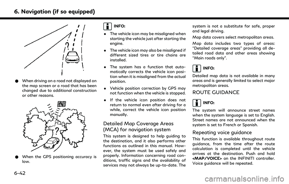
*When driving on a road not displayed on
the map screen or a road that has been
changed due to additional construction
or other reasons.
*When the GPS positioning accuracy is
low.
INFO:
. The vehicle icon may be misaligned when
starting the vehicle just after starting the
engine.
. The vehicle icon may also be misaligned if
different sized tires or tire chains are
installed.
. The system has a function that auto-
matically corrects the vehicle icon posi-
tion when it is misaligned from the actual
position.
. Vehicle position correction by GPS may
not function when the vehicle is stopped.
. If the vehicle icon position does not
return to normal even after driving for a
while, correct the vehicle icon position
manually.
Detailed Map Coverage Areas
(MCA) for navigation system
This system is designed to help guiding to
the destination, and it also performs other
functions as outlined in this manual. How-
ever, the system must be used safely and
properly. Information concerning road con-
ditions, traffic signs and the availability of
services may not always be up-to-date. The system is not a substitute for safe, proper
and legal driving.
Map data covers select metropolitan areas.
Map data includes two types of areas:
“Detailed coverage areas” providing all de-
tailed road data and other areas showing
“Main roads only”.
INFO:
Detailed map data is not available in many
areas and is generally limited to select major
metropolitan areas.
ROUTE GUIDANCE
INFO:
The system will announce street names
when the system language is set to English.
Street names are not announced when the
system is set to French or Spanish.
Repeating voice guidance
This function is available throughout route
guidance, from the time after the route
calculation is completed until the vehicle
arrives at the destination. Push and hold
Page 139 of 192
Notes on voice guidance
.Voice guidance in this system should be
regarded as a supplementary function.
When driving the vehicle, check the route
on the map and follow the actual roads
and traffic regulations.
. Voice guidance is activated only for
intersections with certain conditions.
There may be cases where the vehicle
has to turn, but voice guidance is not
provided.
. Voice guidance contents may vary, de-
pending on the direction of the turn and
the type of intersection.
. The voice guidance timing will vary
depending on the situation.
. When the vehicle has deviated from the
suggested route, voice guidance is not
available. The system will not announce
this. Refer to the map and recalculate the
route.
“Recalculating route” (page 6-19)
. Voice guidance may not accurately cor-
respond with road numbers and direc-
tions at freeway junctions. .
Voice guidance may not accurately cor-
respond to street names at freeway
exits.
. The displayed street names may some-
times differ from the actual names.
. Voice guidance is not available when the
[Guidance Voice] is turned off.
. Voice guidance will start when the
vehicle enters the suggested route. Refer
to the map for directions to the starting
point of the route.
. When approaching a waypoint, voice
guidance will announce, “You have ar-
rived at waypoint 1 (2, 3, 4,...).” Voice
guidance will switch to the next section
of the route. When voice guidance is not
available, refer to the map for directions.
. In some cases, voice guidance ends
before arrival at the destination. Refer
to the destination icon on the map to
reach the destination.
. If the system recognizes on which side
the destination (waypoint) is located,
voice guidance will announce “on the
right/left” after announcing the arrival at
the destination. .
Voice guidance may be partially opera-
tional or inoperative due to the angle of
roads at an intersection.
. Because freeway lane information is
available only for approximately 7,000
major freeways in North America, it is
not possible to display information for all
junctions and exits.
. Freeway exit information may differ
from the information on the actual exit
signs.
. Because it is not possible to consider
data concerning roads that are season-
ally available or unavailable, a route may
be displayed that does not match the
actual traffic restrictions. Be sure to
follow the actual traffic restrictions
while driving.
. Canada and Alaska contain many roads
with incomplete map data. As a result,
when searching for a route, the route
may include roads with incomplete data.
In regions where road data is not
complete, voice guidance may stop for
long periods of time. Be sure to follow
the actual traffic restrictions while driv-
ing.
6. Navigation (if so equipped)
6-43
Page 140 of 192
6. Navigation (if so equipped)
ROUTE CALCULATION
.There may be cases where carpool lanes
are included on a suggested route when
the automatic rerouting function is acti-
vated, even if the [Time Restricted
Roads] is set to [Use Restriction Info]
or [Avoid].
“Route Preference” (page 6-17)
. The suggested route may not be the
shortest, nor are other circumstances
such as traffic jams considered.
. Because of the inevitable difference in
road conditions and circumstances be-
tween the time you use this system and
the time the information was produced
for the map data, there may be discre-
pancies in roads and regulations. In such
cases, actual road conditions and regula-
tions take precedence over map data
information.
. During route calculation, the map will not
scroll, however the vehicle icon will move
according to the actual vehicle’s move-
ment.
. In some cases, after the calculation is
complete, the calculated route may not
be immediately displayed. .
Waypoints that have been passed will be
disregarded by rerouting calculation.
. If you scroll the map while the suggested
route is being drawn, it may take more
time to finish drawing.
. Route calculation may not be completed
in the following cases.
— If there is no main road within a range of 1.5 miles (2.5 km) from the vehicle,
a message saying so will appear on
the screen. Try recalculating when the
vehicle is closer to a main road.
— If there is no main road within a range of 1.5 miles (2.5 km) from the desti-
nation or waypoint, a message saying
so will appear on the screen. Try
setting the location closer to a main
road.
— If the vehicle is too close to the destination or if there are no roads
to the destination, a message saying
so will appear on the screen.
— If it is impossible to reach the destina- tion or waypoints because of traffic
regulations, etc.
— If the only route to reach the destina- tion or waypoints is extremely com- plicated.
. The following may occur when the route
is displayed.
— If you calculate a route on a main road, the starting point of the route may
not exactly match the current vehicle
location.
— The endpoint of the route may not exactly match the destination.
— If you calculate a route on a main road, the system may display a route from
another main road. This may be
because the position of the vehicle
icon is not accurate. In this case, park
the vehicle in a safe location and reset
the vehicle icon, or continue driving to
see if the position of the vehicle icon
is automatically adjusted before re-
calculating the route.
— There are cases in which the system shows an indirect route to reach the
destination or waypoints, if you set
them from stored or facility informa-
tion. In order to correct this, you must
be careful about the traffic direction,
especially when lanes with different
travel directions are shown sepa-
rately, such as interchanges and ser-
6-44
Page 141 of 192
vice areas.
— This system makes no distinction be- tween limited traffic control and total
control (blockage). It may show an
indirect route even if the road is
usable.
— Even if the ferry preference is set to OFF, a route that uses a ferry line
may be suggested.
HOW TO UPDATE MAP DATA
WARNING
TO AVOID RISK OF DEATH OR SER-
IOUS PERSONAL INJURY WHEN UP-
DATING THE MAP SOFTWARE:
If you choose to park the vehicle within
range of a Wi-Fi connection (if so
equipped) or a TCU (Telematics Control
Unit), park the vehicle in a secure, safe
well-ventilated location that is open to
the air. During the update process, if you
choose to park your vehicle, it should be
kept in a well-ventilated area to avoid
exposure to carbon monoxide. Do not
breathe exhaust gases; they contain
colorless and odorless carbon monoxide.
Carbon monoxide is dangerous. It can cause unconsciousness or death.
1.
Apply the parking brake.
2. Remain with the vehicle while the
update is in process.
3. Do not allow children, pets or people
who may need assistance to remain in
the vehicle while the software is
updating.
NOTE:
The vehicle is not required to be parked
during the map update process.
Map data can be updated via USB, Wi-Fi (if
so equipped) or a TCU (Telematics Control
Unit).
Updating with USB memory
The navigation map data can be updated
with the latest information by downloading
a new map database to a USB memory
device and installing it in the vehicle.
For map update, use the USB memory with
the following specifications:
Supported media: USB2.0
Supported file system: FAT32 1. Push
Page 142 of 192
![INFINITI QX80 2022 Repair Manual 6. Navigation (if so equipped)
10. Push<MENU> on the INFINITI controller
or touch [MENU] on the Launch Bar.
11. Touch [Info] on the Launch Bar and then touch [System Information].
12. Touch [Map Updat INFINITI QX80 2022 Repair Manual 6. Navigation (if so equipped)
10. Push<MENU> on the INFINITI controller
or touch [MENU] on the Launch Bar.
11. Touch [Info] on the Launch Bar and then touch [System Information].
12. Touch [Map Updat](/img/42/41149/w960_41149-141.png)
6. Navigation (if so equipped)
10. Push
Page 143 of 192
![INFINITI QX80 2022 Repair Manual Automatic map update
The map data can be updated using the TCU
(Telematics Control Unit).
1. Push<MENU> on the INFINITI controller
or touch [MENU] on the Launch Bar.
2. Touch [Info] on the Launch Bar INFINITI QX80 2022 Repair Manual Automatic map update
The map data can be updated using the TCU
(Telematics Control Unit).
1. Push<MENU> on the INFINITI controller
or touch [MENU] on the Launch Bar.
2. Touch [Info] on the Launch Bar](/img/42/41149/w960_41149-142.png)
Automatic map update
The map data can be updated using the TCU
(Telematics Control Unit).
1. Push
or touch [MENU] on the Launch Bar.
2. Touch [Info] on the Launch Bar and then touch [System Information].
3. Touch [Map Update].
4. Touch [Map Update Settings].
5. Select an area of the map you wish to update. A confirmation message is dis-
played. The next time you start the
system, a notification message will be
displayed if map data update is available.
6. When the new map data is available after the vehicle power is on, a pop-up
message informing that a map update is
available will appear. Touch [Yes] to
update the map data.
INFO:
If user selects [No] on the pop-up screen,
the automatic map update and software
update will not be available forever and
user always has to update map and
software manually from next time. When
the vehicle power is shutdown, the map update is suspended. When the map
update is resumed, select the same
region to update the map from [Update
by Wi-Fi].
7. Touch [OK] after completing the update.
INFO:
The update is done in the background, and
the updates are reflected in the map data the
next time the system is started.
Automotive products End User Li-
cense Provisions
This End-User License Agreement (“ EULA”)
is an agreement between you and TomTom
International B.V. (“TomTom”). You agree
that this EULA is enforceable. This EULA
applies to your use of the TomTom Map
data, software, Traffic and Travel services or
any other TomTom products (together with
the “Services”).
Please read this EULA carefully. By using the
Services you agree to all the terms and
conditions of this EULA.
1. GRANT OF LICENSE: In consideration
of you agreeing to abide by the terms of
this EULA, TomTom hereby grants to
you a non-exclusive, license to use the Services solely in connection with the
vehicle. If upgrades, updates or supple-
ments to the Services are provided the
use of such upgrades or updates is
governed by this EULA.
2. RESTRICTIONS: You are prohibited from renting, lending, public presenta-
tion, performance or broadcasting or any
other kind of distribution of the Services.
Other than as permitted by applicable
legislation, you will not, and you will not
allow any person to, copy or modify the
Services or any part thereof or to reverse
engineer, decompile or disassemble the
Services.
3. OWNERSHIP: Copyright and other in- tellectual, industrial and/or proprietary
rights to the Services are owned by
TomTom and/or its suppliers. TomTom
permits you to use the Services only in
accordance with the terms of this EULA.
All rights not specifically granted in this
EULA are reserved by TomTom. To the
extent applicable, you acknowledge that
you have no right to have access to the
Services in source code or in unlocked
coding.
6. Navigation (if so equipped)
6-47
Page 144 of 192
6. Navigation (if so equipped)
4. THIRD PARTY SOFTWARE LICENSES:The Services may make use of third party
software. Notwithstanding Clauses 2
and 3, use of some third party materials
included in the Software may be subject
to other terms and conditions. The
official copyright notices and specific
license conditions of these third party
software codes and algorithms are to be
found via http://www.tomtom.com.
You hereby agree to the terms and
conditions for such third party software.
5. LIMITED WARRANTY:
.YOU ACKNOWLEDGE THAT THE SERVICES HAVE NOT BEEN DE-
VELOPED TO MEET YOUR INDIVI-
DUAL REQUIREMENTS AND THAT
IT IS THEREFORE YOUR RESPON-
SIBILITY TO ENSURE THAT THE
FACILITIES AND FUNCTIONS OF
THE SERVICES MEET YOUR RE-
QUIREMENTS. TOMTOM DOES
NOT AND CANNOT WARRANT
THAT THE SERVICES OPERATE
UNINTERRUPTED OR ERROR-
FREE. YOU SHOULD BE PARTICU-
LARLY AWARE OF THE FACT THAT
CALCULATION ERRORS MAY OC-
CUR WHEN USING SOFTWARE IN A NAVIGATION SYSTEM FOR IN-
STANCE CAUSED BY LOCAL EN-
VIRONMENTAL CONDITIONS
AND/OR INCOMPLETE DATA.
.TO THE MAXIMUM EXTENT PER-
MITTED BY APPLICABLE LAW,
TOMTOM AND ITS SUPPLIERS
PROVIDE THE SERVICES “AS IS”,
AND HEREBY DISCLAIM ALL
OTHER WARRANTIES AND CONDI-
TIONS, WHETHER EXPRESS, IM-
PLIED OR STATUTORY,
INCLUDING, BUT NOT LIMITED
TO, ANY (IF ANY) IMPLIED WAR-
RANTIES, DUTIES OR CONDITIONS
OF SATISFACTORY QUALITY, OF
FITNESS FOR A PARTICULAR PUR-
POSE, OF RELIABILITY OR AVAIL-
ABILITY, OF ACCURACY OR
COMPLETENESS OF RESPONSES,
OF RESULTS, WITH REGARD TO
THE SERVICES, AND THE PROVI-
SION OF OR FAILURE TO PROVIDE
SUPPORT OR OTHER SERVICES,
INFORMATION, SOFTWARE, AND
RELATED CONTENT THROUGH
THE SERVICES OR OTHERWISE
ARISING OUT OF THE USE OF
THE SERVICES. SAFETY: THE SERVICES ARE IN-
TENDED TO BE USED FOR PRO-
VIDING INFORMATION AND
NAVIGATION SERVICES RELATED
TO YOUR JOURNEY ONLY AND
ARE NOT INTENDED TO BE USED
AS A SAFETY RELATED TOOL AND
CANNOT WARN YOU ABOUT ALL
DANGERS AND HAZARDS WITH
RESPECT TO THE ROAD YOU ARE
DRIVING. THEREFORE, IT RE-
MAINS YOUR DUTY TO DRIVE IN
A CAREFUL AND SAFE MANNER
(PAYING ALL DUE CARE AND AT-
TENTION TO THE ROAD) AS WELL
AS OBSERVING ALL APPLICABLE
TRAFFIC REGULATIONS AND
RULES. IT IS YOUR RESPONSIBIL-
ITY NOT TO USE THE SERVICES IN
A MANNER THAT WOULD DIS-
TRACT YOU FROM DRIVING
SAFELY.
6. LIMITATION OF LIABILITY: TO THE MAXIMUM EXTENT PER-
MITTED BY APPLICABLE LAW,
NEITHER TOMTOM NOR ITS LICEN-
SORS AND SUPPLIERS, OFFICERS,
DIRECTORS OR EMPLOYEES SHALL
BE LIABLE TO YOU OR TO ANY THIRD
6-48
Page 145 of 192
PARTY FOR ANY DAMAGES,
WHETHER DIRECT, SPECIAL, INCI-
DENTAL, INDIRECT OR CONSEQUEN-
TIAL (INCLUDING BUT NOT LIMITED
TO, DAMAGES FOR THE INABILITY
TO USE OR ACCESS THE SERVICES,
LOSS OF DATA, LOSS OF BUSINESS,
LOSS OF PROFITS, BUSINESS INTER-
RUPTION OR THE LIKE) ARISING OUT
OF OR RELATED TO THE USE OF, THE
INABILITY TO USE OR ACCESS, OR
OTHERWISE THE PERFORMANCE OF
THE SERVICES, EVEN IF INFINITI HAS
BEEN ADVISED OF THE POSSIBILITY
OF SUCH DAMAGES.
TO THE EXTENT TOMTOM IS NOT
PERMITTED UNDER APPLICABLE
LAW TO EXCLUDE ITS LIABILITY
PURSUANT TO CLAUSE 6.1 ABOVE,
TOMTOM’S TOTAL AGGREGATE LIA-
BILITY TO YOU SHALL BE LIMITED TO
THE AMOUNT OF US $100.00.
THE ABOVE LIMITATIONS OF LIABI-
LITY UNDER THIS CLAUSE 6 DO NOT:
(I) AFFECT YOUR RIGHTS UNDER ANY
APPLICABLE MANDATORY NA-
TIONAL LEGISLATION; (II) EXCLUDE
OR LIMIT ANY LIABILITY THAT CAN-
NOT BE EXCLUDED OR LIMITED UN-DER APPLICABLE LAW.
7. TERMINATION: Without prejudice to any other rights, TomTom may immedi-
ately terminate this EULA if you fail to
comply with any of its terms and condi-
tions. The provisions of this Agreement,
which by their nature are intended to
survive termination, will remain in effect
after termination of this EULA.
8. LINKS TO THIRD PARTY SITES: Tom- Tom and other third parties involved in
making the Services available to you
("Third Parties") are not responsible for
the contents of any third-party sites or
services, any links contained in third-
party sites or services, or any changes or
updates to third-party sites or services
which are delivered by the Services or
otherwise. TomTom (and, as applicable,
each of the Third Parties) is providing
these links and access to third-party
sites and services to you only as a
convenience, and the inclusion of any
link or access does not imply an endorse-
ment by TomTom or any Third Parties of
the third-party site or service. Any use by
you of such links or third party sites and
the manner in which you use such third
party sites and links shall be your responsibility and at your risk and you
shall not use them in any illegal or
fraudulent manner.
Should you have any questions concern-
ing this EULA, or if you desire to contact
TomTom for any reason, please visit
TomTom’s website at http://www.tom-
tom.com.
6. Navigation (if so equipped)
6-49
Page 146 of 192
6. Navigation (if so equipped)
MEMO
6-50
Page 149 of 192
operation is executed.
INFO:
To exit the Voice Recognition System, push
and hold <
>or <>(if so equipped) on
the steering wheel, or <>on the INFINITI
controller.
Pushing and holding the left side of
<
//> (if so equipped) on the
steering wheel can also exit the voice
recognition system.
Operating tips
. Speak a command after the tone.
. Some commands are only for English.
. If the command is not recognized, the
system will prompt you to speak the
command again. Repeat the command in
a clear voice.
. Push <
>(if so equipped) or push the
left side of (if so
equipped) on the steering wheel, push
<
> on the INFINITI controller or touch
[] on the touch screen display to
return to the previous screen.
. To adjust the volume of the system
feedback, push <
>on the steering wheel or turn
on the control panel while the system is
making an announcement.
. Models with navigation system:
When setting a destination for route
guidance with some search methods,
such as POI, Intersection or City Center
search, the search area is automatically
set to the state/province where your
vehicle is located. Change state/pro-
vince to change the search area to
another state/province if necessary.
Voice Prompt Interrupt:
In most cases, you can interrupt the voice
feedback to speak the next command by
pushing <
>on the steering wheel. After
interrupting the system, wait for a tone
before speaking your command.
One Shot Call:
To use the system faster when making a call,
you may speak the second level command
skipping speaking the first level command.
For example, push <
>on the steering
wheel and say “Redial” after the tone
without first saying “Phone”.
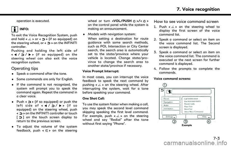
How to see voice command screen
1. Push <>on the steering wheel to
display the first screen of the voice
command list.
2. Speak a command or select an item on the voice command list. The Second
screen is displayed.
3. Speak a command or select an item on the voice command list. The command is
executed or the next screen for further
command is displayed.
4. Follow the prompts to complete the commands.
Voice command screens:
Example
7. Voice recognition
7-3