MERCEDES-BENZ SL-CLASS ROADSTER 2013 Owners Manual
Manufacturer: MERCEDES-BENZ, Model Year: 2013, Model line: SL-CLASS ROADSTER, Model: MERCEDES-BENZ SL-CLASS ROADSTER 2013Pages: 572, PDF Size: 9.23 MB
Page 391 of 572
Popular searches
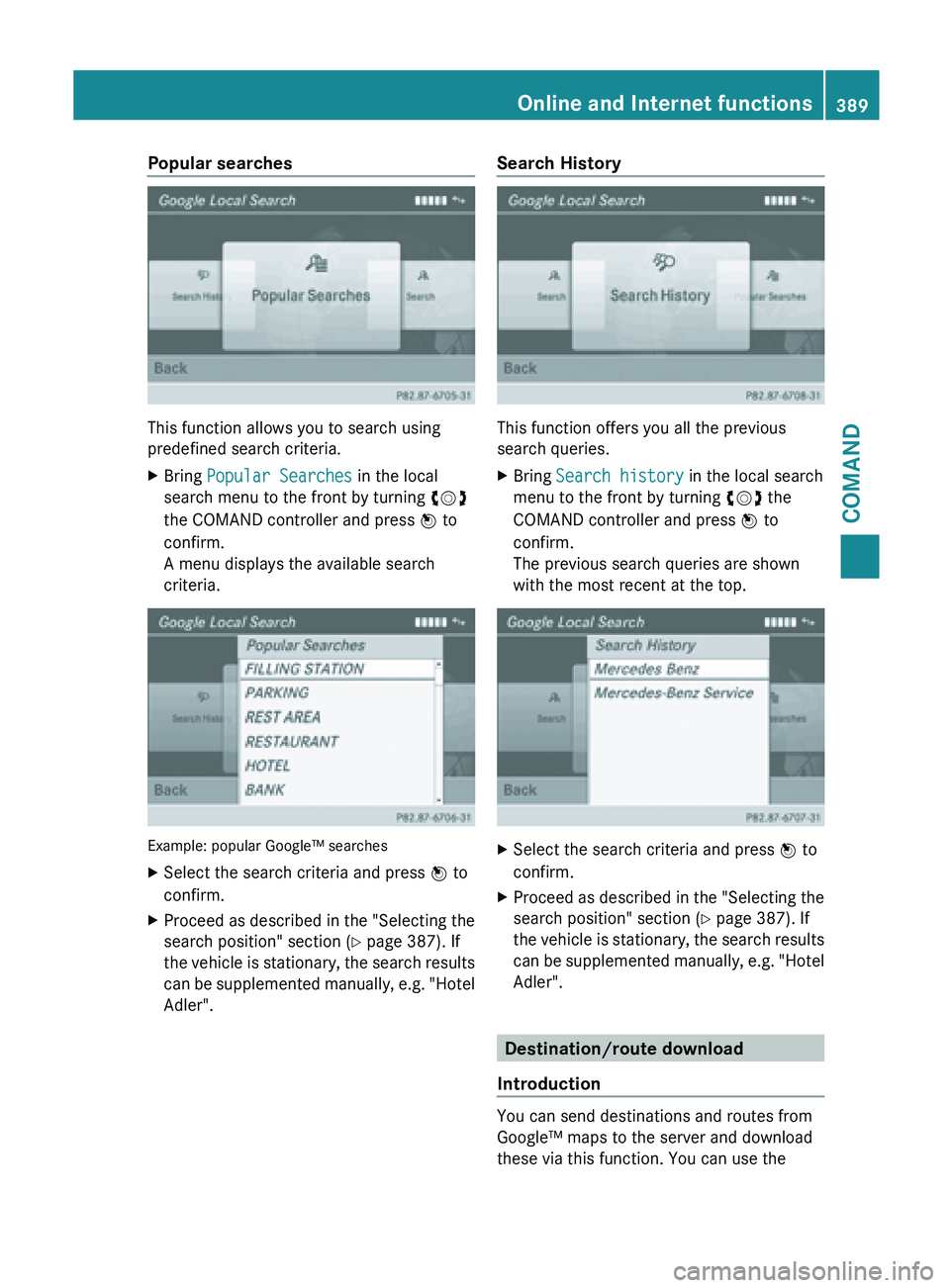
This function allows you to search using
predefined search criteria.
X
Bring Popular Searches in the local
search menu to the front by turning cVd
the COMAND controller and press W to
confirm.
A menu displays the available search
criteria. Example: popular Google™ searches
X
Select the search criteria and press W to
confirm.
X Proceed as described in the "Selecting the
search position" section (Y page 387). If
the vehicle
is stationary, the search results
can be supplemented manually, e.g. "Hotel
Adler". Search History
This function offers you all the previous
search queries.
X
Bring Search history in the local search
menu to the front by turning cVd the
COMAND controller and press W to
confirm.
The previous search queries are shown
with the most recent at the top. X
Select the search criteria and press W to
confirm.
X Proceed as described in the "Selecting the
search position" section (Y page 387). If
the vehicle
is stationary, the search results
can be supplemented manually, e.g. "Hotel
Adler". Destination/route download
Introduction You can send destinations and routes from
Google™ maps to the server and download
these via this function. You can use the Online and Internet functions
389
COMAND Z
Page 392 of 572
destinations and routes for route guidance
and save them for further use.
In order to use the download destination/
route function, the mbrace system must be:
R
activated
R set up
R and activated for COMAND and Internet
access services.
Step 1: sending destinations/routes to
the server X
Call up the website for Google™ maps on
the Internet.
X Select the destination.
X Select "Mercedes-Benz" as the company
entry.
X Confirm "Send" on the Google™ maps
website.
The destinations/routes are sent to the
server.
i The availability of the Google™ maps
function is country-dependent.
Step 2: downloading destinations/
routes from the server Proceed as follows to use destinations/
routes that have been sent to the server:
X
Select the ® symbol in the main function
bar by sliding ZV and turning cVd the
COMAND controller and press W to
confirm.
The carousel view appears.
X Bring the COMAND panel to the front by
turning cVd the COMAND controller and
press W to confirm.
The COMAND menu appears. X
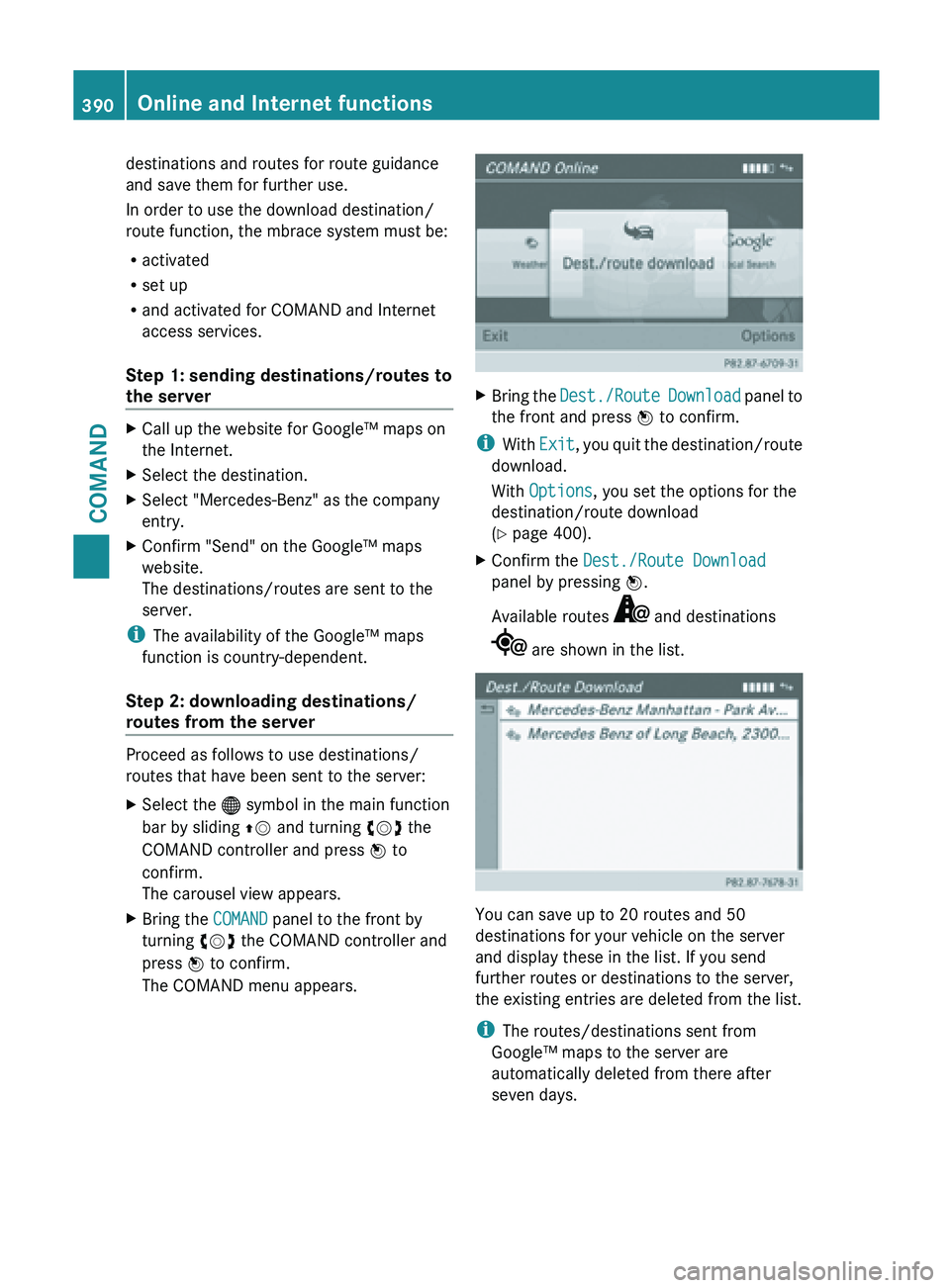
Bring the Dest./Route Download panel to
the front and press W to confirm.
i With Exit, you
quit the destination/route
download.
With Options, you set the options for the
destination/route download
(Y page 400).
X Confirm the Dest./Route Download
panel by pressing W.
Available routes and destinations
are shown in the list.
You can save up to 20 routes and 50
destinations for your vehicle on the server
and display these in the list. If you send
further routes or destinations to the server,
the existing entries are deleted from the list.
i
The routes/destinations sent from
Google™ maps to the server are
automatically deleted from there after
seven days. 390
Online and Internet functions
COMAND
Page 393 of 572
Step 3: using destinations/routes
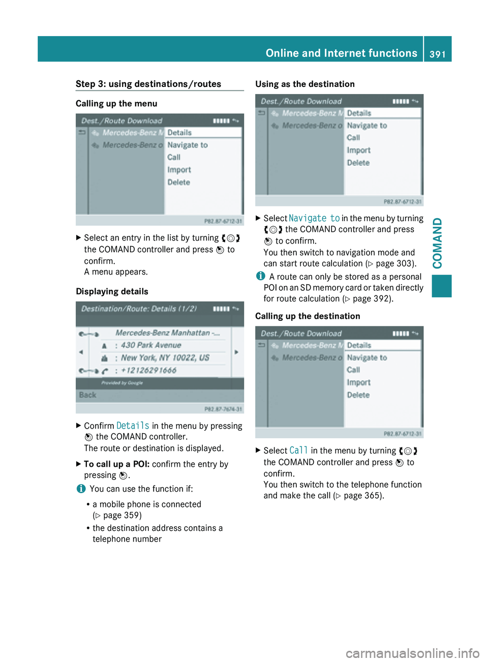
Calling up the menu
X
Select an entry in the list by turning cVd
the COMAND controller and press W to
confirm.
A menu appears.
Displaying details X
Confirm Details in the menu by pressing
W the COMAND controller.
The route or destination is displayed.
X To call up a POI: confirm the entry by
pressing W.
i You can use the function if:
R a mobile phone is connected
(Y page 359)
R the destination address contains a
telephone number Using as the destination
X
Select Navigate to in the menu by turning
cVd the COMAND controller and press
W to confirm.
You then switch to navigation mode and
can start route calculation (Y page 303).
i A route can only be stored as a personal
POI on
an SD memory card or taken directly
for route calculation ( Y page 392).
Calling up the destination X
Select Call in the menu by turning cVd
the COMAND controller and press W to
confirm.
You then switch to the telephone function
and make the call ( Y page 365). Online and Internet functions
391COMAND Z
Page 394 of 572
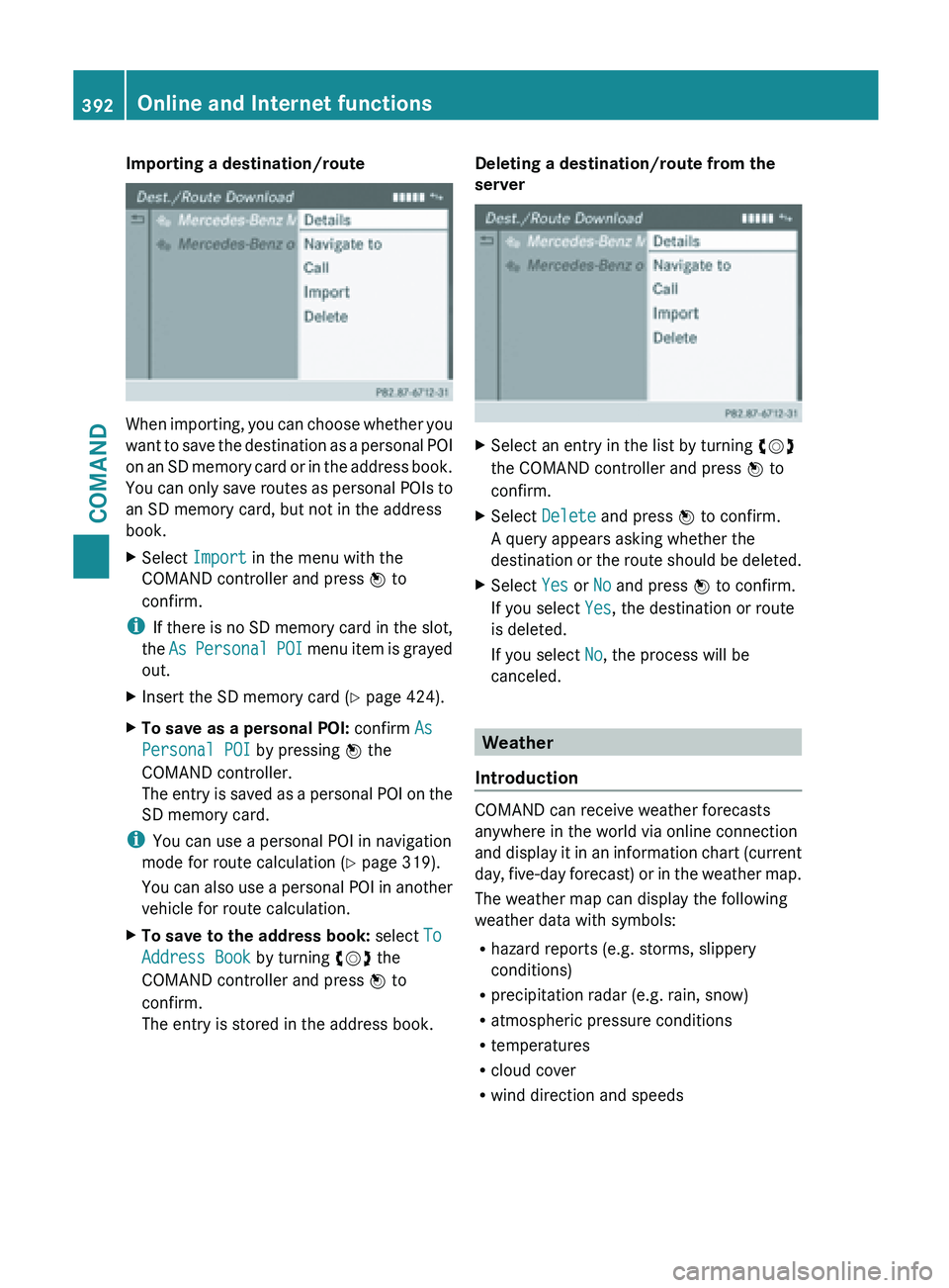
Importing a destination/route
When importing, you can choose whether you
want
to
save the destination as a personal POI
on an SD memory card or in the address book.
You can only save routes as personal POIs to
an SD memory card, but not in the address
book.
X Select Import in the menu with the
COMAND controller and press W to
confirm.
i If there
is no SD memory card in the slot,
the As Personal POI menu item is grayed
out.
X Insert the SD memory card (Y page 424).
X To save as a personal POI: confirm As
Personal POI by pressing W the
COMAND controller.
The entry
is saved as a personal POI on the
SD memory card.
i You can use a personal POI in navigation
mode for route calculation ( Y page 319).
You can
also use a personal POI in another
vehicle for route calculation.
X To save to the address book: select To
Address Book by turning cVd the
COMAND controller and press W to
confirm.
The entry is stored in the address book. Deleting a destination/route from the
server
X
Select an entry in the list by turning cVd
the COMAND controller and press W to
confirm.
X Select Delete and press W to confirm.
A query appears asking whether the
destination or
the route should be deleted.
X Select Yes or No and press W to confirm.
If you select Yes, the destination or route
is deleted.
If you select No, the process will be
canceled. Weather
Introduction COMAND can receive weather forecasts
anywhere in the world via online connection
and display
it in an information chart (current
day, five-day forecast) or in the weather map.
The weather map can display the following
weather data with symbols:
R hazard reports (e.g. storms, slippery
conditions)
R precipitation radar (e.g. rain, snow)
R atmospheric pressure conditions
R temperatures
R cloud cover
R wind direction and speeds392
Online and Internet functions
COMAND
Page 395 of 572
Activating/deactivating the weather
display
Activating
X
Select the ® icon in the main function bar
by sliding ZV and turning cVd the
COMAND controller and press W to
confirm.
The carousel view appears.
X Turn cVd the COMAND controller until
COMAND is brought to the front and press
W to confirm.
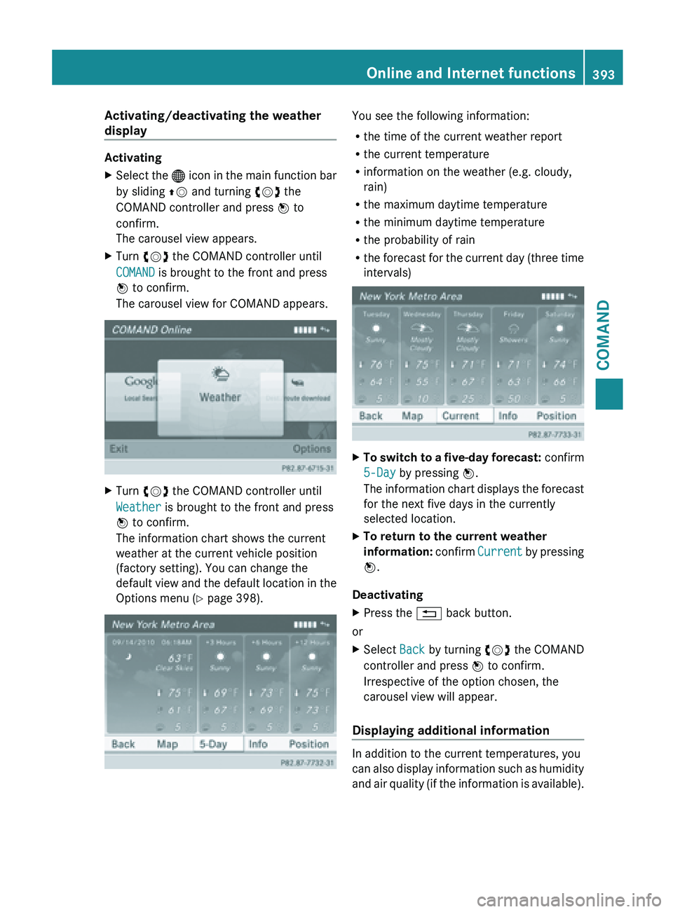
The carousel view for COMAND appears. X
Turn cVd the COMAND controller until
Weather is brought to the front and press
W to confirm.
The information chart shows the current
weather at the current vehicle position
(factory setting). You can change the
default view
and the default location in the
Options menu (Y page 398). You see the following information:
R
the time of the current weather report
R the current temperature
R information on the weather (e.g. cloudy,
rain)
R the maximum daytime temperature
R the minimum daytime temperature
R the probability of rain
R the forecast
for the current day (three time
intervals) X
To switch to a five-day forecast: confirm
5-Day by pressing W.
The information
chart displays the forecast
for the next five days in the currently
selected location.
X To return to the current weather
information: confirm
Current
by pressing
W.
Deactivating
X Press the % back button.
or
X Select Back by turning cVd the COMAND
controller and press W to confirm.
Irrespective of the option chosen, the
carousel view will appear.
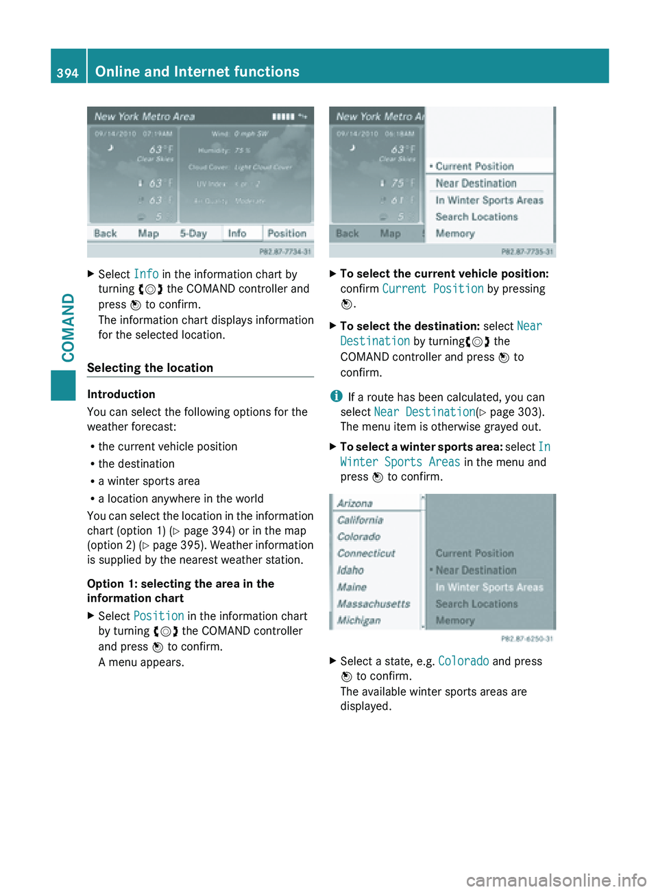
Displaying additional information In addition to the current temperatures, you
can
also
display information such as humidity
and air quality (if the information is available). Online and Internet functions
393
COMAND Z
Page 396 of 572
X
Select Info in the information chart by
turning cVd the COMAND controller and
press W to confirm.
The information chart displays information
for the selected location.
Selecting the location Introduction
You can select the following options for the
weather forecast:
R
the current vehicle position
R the destination
R a winter sports area
R a location anywhere in the world
You can
select the location in the information
chart (option 1) (Y page 394) or in the map
(option 2) (Y page 395). Weather information
is supplied by the nearest weather station.
Option 1: selecting the area in the
information chart
X Select Position in the information chart
by turning cVd the COMAND controller
and press W to confirm.
A menu appears. X
To select the current vehicle position:
confirm Current Position by pressing
W.
X To select the destination: select Near
Destination by turningcVd the
COMAND controller and press W to
confirm.
i If a route has been calculated, you can
select Near Destination(Y page 303).
The menu item is otherwise grayed out.
X To select a winter sports area: select
In
Winter Sports Areas
in the menu and
press W to confirm. X
Select a state, e.g. Colorado and press
W to confirm.
The available winter sports areas are
displayed. 394
Online and Internet functions
COMAND
Page 397 of 572
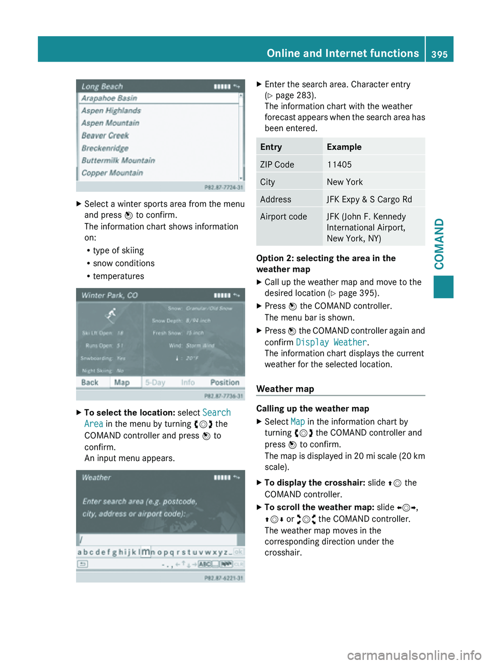
X
Select a winter sports area from the menu
and press W to confirm.
The information chart shows information
on:
R
type of skiing
R snow conditions
R temperatures X
To select the location: select Search
Area in the menu by turning cVd the
COMAND controller and press W to
confirm.
An input menu appears. X
Enter the search area. Character entry
(Y page 283).
The information chart with the weather
forecast appears
when the search area has
been entered. Entry Example
ZIP Code 11405
City New York
Address JFK Expy & S Cargo Rd
Airport code JFK (John F. Kennedy
International Airport,
New York, NY)
Option 2: selecting the area in the
weather map
X
Call up the weather map and move to the
desired location ( Y page 395).
X Press W the COMAND controller.
The menu bar is shown.
X Press W the COMAND controller again and
confirm Display Weather
.
The information chart displays the current
weather for the selected location.
Weather map Calling up the weather map
X
Select Map in the information chart by
turning cVd the COMAND controller and
press W to confirm.
The map
is displayed in 20 mi scale (20 km
scale).
X To display the crosshair: slide ZV the
COMAND controller.
X To scroll the weather map: slide XVY,
ZVÆ or aVb the COMAND controller.
The weather map moves in the
corresponding direction under the
crosshair. Online and Internet functions
395
COMAND Z
Page 398 of 572
X
To change the map scale: as soon as you
turn cVd the COMAND controller, the
scale bar appears.
X Turn cVd until the desired scale is set.
i The data is downloaded again from the
server for these functions. This can delay
the display of the weather map.
Showing/hiding the
menu in the weather
map
X To show: press W
the COMAND controller
in the weather map.
X To hide: slide up ZV the COMAND
controller.
Switching to the weather information
display in the map
X Display the menu on the weather map
(Y page 396).
X Select View by turning cVd the COMAND
controller and press W to confirm. Weather
characteristic Display on the map
Hazard Icons Displays warnings,
calling up legend
(Y page 396)
Radar Map Displays the rain radar as
a colored area on the
map, calling up legend
(Y page 396)
Atmospheric
Pressure Displays air pressure
with isobars and as a
colored area on the map
Temperatures Displays the
temperatures
Cloud Cover Displays the clouds
Winds Displays wind direction
with an arrow and wind
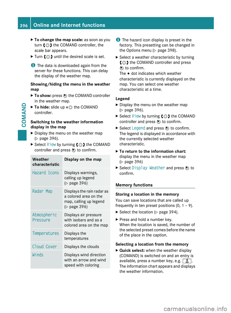
speed with coloring i
The hazard icon display is preset in the
factory. This presetting can be changed in
the Options menu (Y page 398).
X Select a weather characteristic by turning
cVd the COMAND controller and press
W to confirm.
The # dot indicates which weather
characteristic is
currently displayed on the
map. You can select one weather
characteristic at a time.
Legend
X Display the menu on the weather map
(Y page 396).
X Select View by turning cVd the COMAND
controller and press W to confirm.
X Select Legend and press W to confirm.
The legend
is displayed in accordance with
the currently selected weather
characteristic.
X To return to the information chart:
display the menu in the weather map
(Y page 396)
X Select Display Weather and press W to
confirm.
Memory functions Storing a location in the memory
You can save locations that are called up
frequently in ten preset positions (0, 1 – 9).
X
Select the location ( Y page 394).
X Press and hold a number key.
When the location is saved, the number of
the selected
preset comes before the name
of the place in the caption.
Selecting a location from the memory
X Quick select: when the weather display
(COMAND) is switched on and an entry is
available, press a number key, e.g. l.
The information
chart appears and displays
the weather information. 396
Online and Internet functions
COMAND
Page 399 of 572
X
From the weather memory: select
Position in the information chart by
turning cVd the COMAND controller and
press W to confirm.
X Select Presets and press W to confirm.
X Select a preset position that has an entry
by turning cVd the COMAND controller
and press W to confirm.
The information
chart appears and displays
the weather information. Options
Introduction You can select options for the following
COMAND Mercedes-Benz Apps:
R
local search ( Y page 397)
R weather display (Y
page 398)
R destination/route download
(Y page 400)
You can reset the selected options to the
default settings (Y page 401).
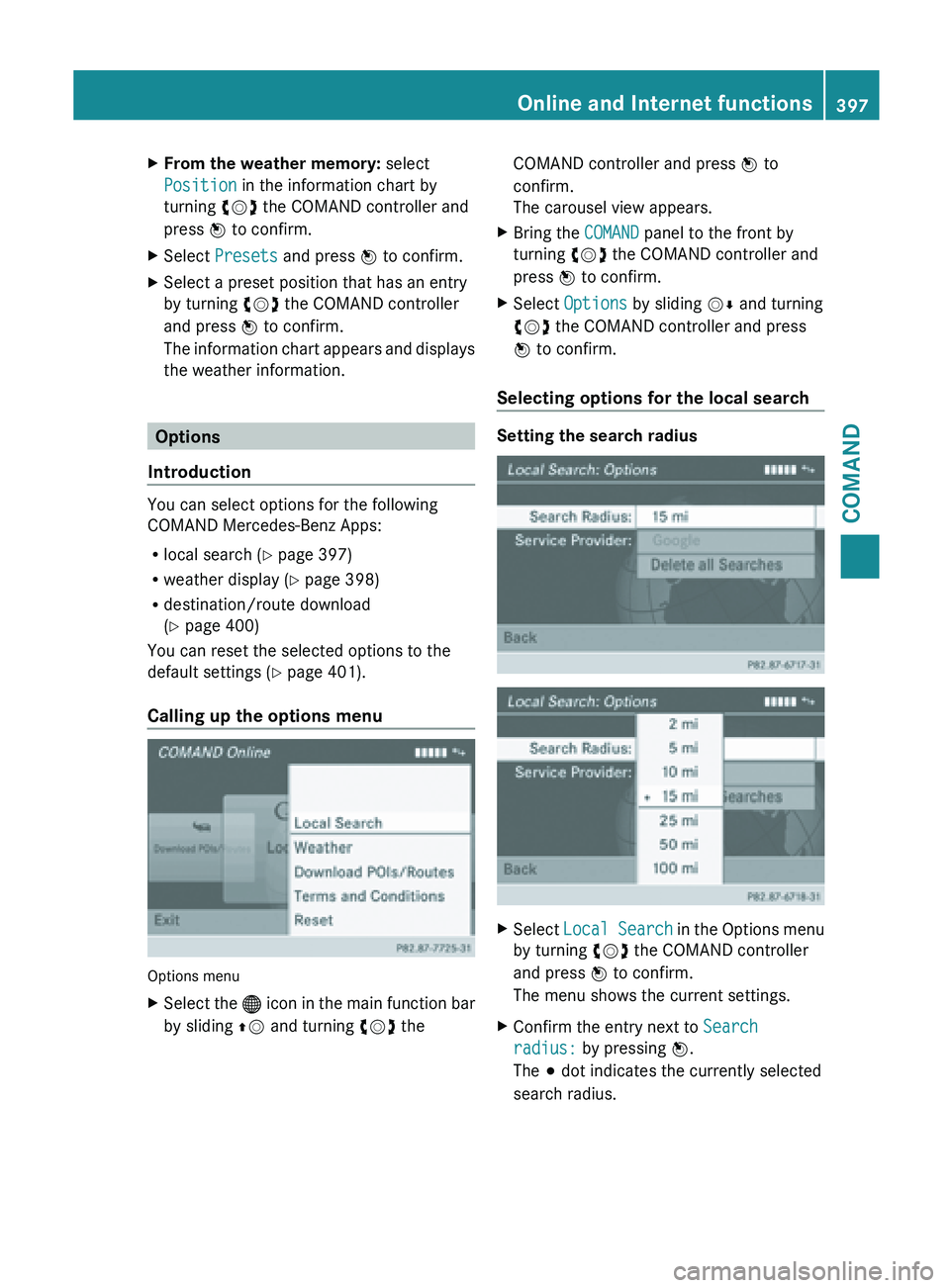
Calling up the options menu Options menu
X
Select the ® icon
in the main function bar
by sliding ZV and turning cVd the COMAND controller and press
W to
confirm.
The carousel view appears.
X Bring the COMAND panel to the front by
turning cVd the COMAND controller and
press W to confirm.
X Select Options by sliding VÆ and turning
cVd the COMAND controller and press
W to confirm.
Selecting options for the local search Setting the search radius
X
Select Local Search in
the Options menu
by turning cVd the COMAND controller
and press W to confirm.
The menu shows the current settings.
X Confirm the entry next to Search
radius: by pressing W.
The # dot indicates the currently selected
search radius. Online and Internet functions
397
COMAND Z
Page 400 of 572
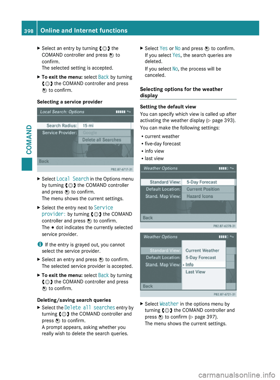
X
Select an entry by turning cVd the
COMAND controller and press W to
confirm.
The selected setting is accepted.
X To exit the menu: select Back by turning
cVd the COMAND controller and press
W to confirm.
Selecting a service provider X
Select Local Search in the Options menu
by turning cVd the COMAND controller
and press W to confirm.
The menu shows the current settings.
X Select the entry next to Service
provider: by turning cVd the COMAND
controller and press W to confirm.
The # dot indicates the currently selected
service provider.
i If the entry is grayed out, you cannot
select the service provider.
X Select an entry and press W to confirm.
The selected service provider is accepted.
X To exit the menu: select Back by turning
cVd the COMAND controller and press
W to confirm.
Deleting/saving search queries
X Select the Delete all
searches entry by
turning cVd the COMAND controller and
press W to confirm.
A prompt appears, asking whether you
really wish to delete the search queries. X
Select Yes or No and press W to confirm.
If you select Yes, the search queries are
deleted.
If you select No, the process will be
canceled.
Selecting options for the weather
display Setting the default view
You can specify which view is called up after
activating the weather display
(Y
page 393).
You can make the following settings:
R current weather
R five-day forecast
R info view
R last view X
Select Weather in the options menu by
turning cVd the COMAND controller and
press W to confirm (
Y page 397).
The menu shows the current settings. 398
Online and Internet functions
COMAND