MERCEDES-BENZ E-Class 2016 W213 Comand Manual
Manufacturer: MERCEDES-BENZ, Model Year: 2016, Model line: E-Class, Model: MERCEDES-BENZ E-Class 2016 W213Pages: 246, PDF Size: 6.7 MB
Page 81 of 246

XTo select a destination:press the con-
troller.
The list contains the Menu
menu item. If
several destinations are available in the
area around the crosshair, these are also
displayed.
XTo show the menu: press the controller.
XTo select a destination from the selection
list: turn and press the controller.
If the digital map provides navigable
address data, you will see the destination
address in the address entry menu.
XTo start route calculation: selectStart.
Entering intermediate destinations
Introduction
You can also map the route to the destination yourself by entering up to four intermediate
destinations. The sequence of the intermedi-
ate destinations can be changed at any time.
COMAND provides a selection of predefined
POIs in eight categories, e.g. Restaurants
for a quick selection. You can also use the
destination entry options to enter intermedi-
ate destinations.
Creating intermediate destinations
XTo switch to navigation mode: press the
Ø button.
XTo show the menu: slide6the control-
ler.
XTo select Destination: turn and press the
controller.
XSelect Intermediate Destinations.
The destination is entered in the intermedi-
ate destinations menu.
XTo select Add New:: press the controller.
XTo select a POI category or Other: turn and
press the controller.
After selecting one of the eight POI cate-
gories, available POIs are displayed:
Ralong the route
Rin the vicinity
COMAND first searches for destinations on
the route. The search for destinations is
then initiated in the area around the current
vehicle position.
XAfter selecting Other, select one of the
destination entry options.
Destination entry79
Navigation
Z
Page 82 of 246
SelectionStep
Address
Entry
XEnter a destination by
address (
Ypage 70).
Keyword
Search
XSelect a destination by
means of a keyword
search (
Ypage 72).
From Last
Destinations
XSelect a destination
from the list of last des-
tinations (
Ypage 74).
From Con‐
tacts
XSelect a contact from
the address book as
the destination
(
Ypage 74).
From POIsXSelect a point of inter-
est (
Ypage 74).
Using MapXEnter a destination
using the map
(
Ypage 78).
From Memory
Card
XSelect a personal POI
(
Ypage 85).
From
Mercedes-
Benz Apps
XEnter a destination
from Mercedes-Benz
Apps (
Ypage 82).
Using Geo-
Coordinates
XEnter a destination
using the geo-coordi-
nates (
Ypage 82).
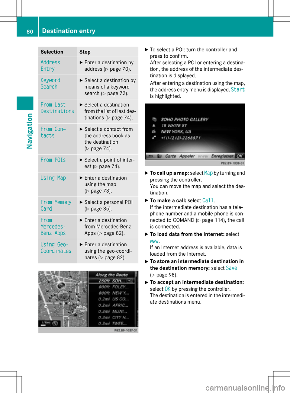
XTo select a POI: turn the controller and
press to confirm.
After selecting a POI or entering a destina-
tion, the address of the intermediate des-
tination is displayed.
After entering a destination using the map,
the address entry menu is displayed.Start
is highlighted.
XTo call up a map:selectMapby turning and
pressing the controller.
You can move the map and select the des-
tination.
XTo make a call: selectCall.
If the intermediate destination has a tele-
phone number and a mobile phone is con-
nected to COMAND (
Ypage 114), the call
is connected.
XTo load data from the Internet: select
www
.
If an Internet address is available, data is
loaded from the Internet.
XTo store an intermediate destination in
the destination memory: selectSave
(Ypage 98).
XTo accept an intermediate destination:
selectOK
by pressing the controller.
The destination is entered in the intermedi-
ate destinations menu.
80Destination entry
Navigation
Page 83 of 246
Editing intermediate destinations
You can perform the following functions:
Rchange intermediate destinations
Rswitch the sequence of the intermediate
destinations in the intermediate destina-
tions menu
Rdelete intermediate destinations
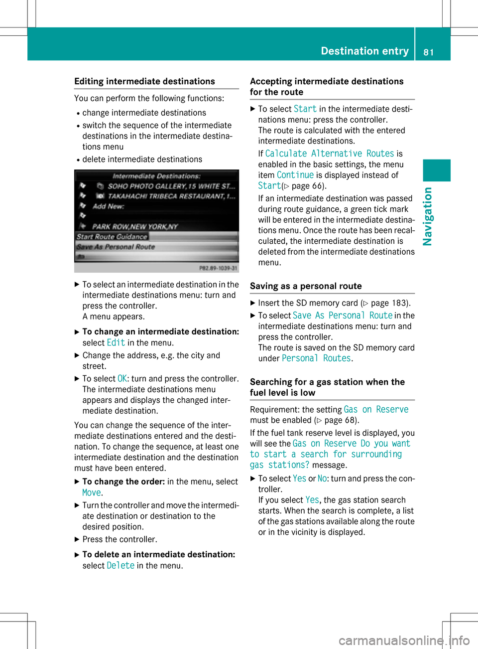
XTo select an intermediate destination in the
intermediate destinations menu: turn and
press the controller.
A menu appears.
XTo change an intermediate destination:
selectEdit
in the menu.
XChange the address, e.g. the city and
street.
XTo select OK: turn and press the controller.
The intermediate destinations menu
appears and displays the changed inter-
mediate destination.
You can change the sequence of the inter-
mediate destinations entered and the desti-
nation. To change the sequence, at least one
intermediate destination and the destination
must have been entered.
XTo change the order: in the menu, select
Move
.
XTurn the controller and move the intermedi-
ate destination or destination to the
desired position.
XPress the controller.
XTo delete an intermediate destination:
select Delete
in the menu.
Accepting intermediate destinations
for the route
XTo select Startin the intermediate desti-
nations menu: press the controller.
The route is calculated with the entered
intermediate destinations.
If Calculate Alternative Routes
is
enabled in the basic settings, the menu
item Continue
is displayed instead of
Start
(Ypage 66).
If an intermediate destination was passed
during route guidance, a green tick mark
will be entered in the intermediate destina-
tions menu. Once the route has been recal-
culated, the intermediate destination is
deleted from the intermediate destinations menu.
Saving as a personal route
XInsert the SD memory card (Ypage 183).
XTo select SaveAsPersonalRoutein the
intermediate destinations menu: turn and
press the controller.
The route is saved on the SD memory card
under Personal Routes
.
Searching for a gas station when the
fuel level is low
Requirement: the setting Gas on Reserve
must be enabled (Ypage 68).
If the fuel tank reserve level is displayed, you
will see the Gas
onReserveDoyouwant
to start a search for surrounding
gas stations?message.
XTo selectYesorNo: turn and press the con-
troller.
If you select Yes
, the gas station search
starts. When the search is complete, a list
of the gas stations available along the route
or in the vicinity is displayed.
Destination entry81
Navigation
Z
Page 84 of 246
If you selectNo, the search is canceled.
XSelect the gas station.
The address of the gas station is displayed.
XTo selectStart: press the controller.
The gas station selected is set in the inter-
mediate destinations menu as the next
intermediate destination not yet reached.
Route guidance begins.
Entering a destination from
Mercedes-Benz Apps
Requirement (USA): mbrace is activated for
the Mercedes-Benz Apps (
Ypage 149).
Requirement (Canada): a mobile phone is
connected via Bluetooth
®(Ypage 114) or
USB (
Ypage 196) with COMAND.
XTo switch to navigation mode: press the
Ø button.
XTo show the menu: slide6the control-
ler.
XTo select Destination: turn and press the
controller.
XSelect From Mercedes-Benz Apps.
The list of Mercedes-Benz Apps appears.
Using geo-coordinates
XTo switch to navigation mode: press the
ß button.
XTo show the menu: slide6the control-
ler.
XTo select Destination: turn and press the
controller.
XSelect Using Geo-Coordinates.
Geo-coordinates are entered in degrees,
minutes and seconds.
Entering the latitude and longitude coor-
dinates
XTo change the value: turn the controller.
XTo move the selection within the line: slide
1 the controller.
XTo move the selection between lines: slide
4the controller.
XTo confirm the value: press the controller.
Saving a destination
XTo select Save: turn and press the control-
ler.
The destination can be stored as:
Rhome address in the address book
Ra navigable address book contact
For further information on the address
book, see (
Ypage 128)
Ra personal destination on the SD memory
card (
Ypage 99)
Starting route calculation
XTo select Start Route Guidance: turn
and press the controller.
Personal POIs and routes
General notes
The use of personal POIs for displaying traffic surveillance equipment is not permitted in
every country. Please observe the country-
specific regulations and always drive at a suit-
able speed.
Personal POIs are filed in categories:
RNot Classified
Standard entry for personal POIs
RMercedes-Benz Apps
Personal POIs (destinations, routes) that
you have imported via the online functions
RCategories which you have created your-
self, e.g. on your PC
Personal routes are not categorized.
82Personal POIs and routes
Navigation
Page 85 of 246

Settings for personal POIs
Displaying on the map
Requirement: an SD memory card with per-
sonal POIs is inserted (
Ypage 183).
All personal POIs of the selected category are
displayed on the map with a corresponding
symbol.
If the "Alert when approaching" (
Ypage 83)
function is activated, the symbols are dis-
played up to a map scale of 2 km.
XTo switch to navigation mode: press the
ß button.
XTo show the menu: slide6the control-
ler.
XTo select Options: turn and press the con-
troller.
XSelect Personal POIs.
XSelectDisplay on the Map.
The menu displays the categories available
on the SD memory card.
XTo select a category: turn the controller and
press to confirm.
All personal POIs in the selected category
are displayed Oor not displayed ª,
depending on the previous status.
Alert when approaching
Requirement: an SD memory card with per-
sonal POIs is inserted (
Ypage 183).
If the vehicle is approaching a personal POI,
this is highlighted on the map and/or an audi- ble signal sounds.
For this purpose, both the corresponding
function Alert When Approaching
and the
category containing the personal POI must be
activated.
XTo switch to navigation mode: press the
ß button.
XTo show the menu: slide6the control-
ler.
XTo select Options: turn and press the con-
troller.
XSelect Personal POIs.
XSelectAlert When Approaching.
The menu displays the categories available
on the SD memory card.
XSelect AudibleorOptical.
The function is switched on Oor off ª,
depending on the previous status.
XTo select a category: turn the controller and
press to confirm.
The function is switched on Oor off ª, for
all personal POIs of this category, depend-
ing on the previous setting.
Personal POIs and routes83
Navigation
Z
Page 86 of 246
Saving personal POIs and routes
General notes
Personal POIs and routes are geodata which
are saved in the open GPX (GPS Exchange)
format on the SD memory card.
Personal POI from current vehicle posi-
tion or crosshair position
XInsert the SD memory card (Ypage 183).
XTo switch to navigation mode: press the
ß button.
XWhen the map is displayed, press the con-
troller until a message appears.
The current vehicle position is saved to the
Not
Classifiedcategory on the SD mem-
ory card and also stored in the "Last desti-
nations" memory (
Ypage 99).
If the "Move map" function is selected
(
Ypage 66), the crosshair position is saved.
iIf no SD memory card is inserted, the per-
sonal POI will only be stored in the "Last
destinations" memory.
Personal POI from destination address
XInsert the SD memory card (Ypage 183).
XTo switch to navigation mode: press the
ß button.
XCall up the address entry menu and enter
the destination address (
Ypage 69).
XTo select Save: slide6the controller.
XTurn and press the controller.
XTo select ToMemoryCard: turn and press
the controller.
XEnter the name.
XSelect a category.
The current address is saved as a personal
point of interest on the SD memory card.
iYou can select a destination from the
From Last Destinations
or From Con‐
tactsmemories and save it on the SD
memory card.
RFrom Last Destinations
(Ypage 74)
RFrom Contacts(Ypage 74)
Personal route from a tour including
intermediate destinations
XInsert the SD memory card (Ypage 183).
XTo switch to navigation mode: press the
ß button.
XEnter a destination, e.g. by address
(
Ypage 69).
XStart route calculation (Ypage 71).
XTo create intermediate destinations
(
Ypage 79).
XTo select SaveAsPersonalRoutein the
intermediate destinations menu: turn and
press the controller.
The route is saved in the Personal
Routes
folder on the SD memory card.
Importing personal POIs and routes
via Mercedes-Benz Apps
You can use Mercedes-Benz Apps (e.g. Down-
load POI, Local Search) to import destinations
to the navigation system. These have their
own symbol and are filed in the Mercedes-
Benz Appscategory.
You can save the imported destinations and
routes as personal POIs and routes
(
Ypage 84).
When importing routes, please note:
RThe Mercedes-Benz Apps may generate a
route based on a different map from the
one used by COMAND. Points on the route
may therefore be situated off the digital
roads. For this reason an imported route
commenced in COMAND may deviate from the original route from the Mercedes-Benz
Apps.
RThe Mercedes-Benz Apps minimize the
number of route points offered. For this
reason an imported route commenced in
84Personal POIs and routes
Navigation
Page 87 of 246
COMAND may deviate from the original
route from the Mercedes-Benz Apps.
Selecting and editing personal POIs
and routes
Selecting
XIn sert the SDmemory card (Ypage 183).
XTo switch to navigation mode:press the
ß button.
XTo show the menu: slide6the control-
ler.
XTo select Destination: turn and press the
controller.
XSe lect From Memory Card.
The menu displays the categories availab le
on the SDmemory car d.
XTo select a category or Personal Routes:
turn and press the controller.
The available personal POIs or route entries
are disp layed.
XSelect personal POI or personal route.
The addr ess of the personal POI appears or
the personal route is displayed in the map.
If a large number of entries are stored, a reg-
ister for quick selection appears. Personal
POIs and routes can besaved and sorted with
diff erent character sets (e. g. Latin, Cyrillic,
Ar abic ).
XTo select a register: slide9 the con-
troller.
XTo select a character: turn and press the
controller.
XTo select a cha racter set for sorting:
slide 9 the controller to select B.
XPress the controller.
The available character sets are displayed.
The#dot indicates the current setting.
XTurn and press the controller.
Editing
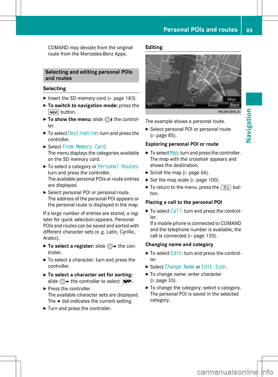
The example shows a personal route.
XSelect personal POI or personal route
(
Ypage 85).
Exploring personal POI or route
XTo selectMap: turn and press the controller.
The map with the crosshair appears and
shows the destination.
XScroll the map (Ypage 66).
XSe t the map scale (Ypage 100).
XTo return to the menu: press the %but-
ton.
Placing a call to the personal POI
XTo select Call: turn and press the control-
ler.
If a mobile phone isconnected to COMAND
and the telephone number isavailable, the
call isconnected (
Ypage 120).
Changing name and category
XTo select Edit: turn and press the control-
ler.
XSe lect Change NameorEdit Icon.
XTo change name: enter character
(
Ypage 33).
XTo change the category: select a category.
The personal POI issaved inthe selected
category.
Personal POIs and routes85
Navigation
Z
Page 88 of 246
Deleting personalPOI or rout e
XTo selectDelete:tur nand press th econ-
troller.
A prompt will appear.
XSelec tYesor No.
If you select Yes
,th epersonal destination
or personal route is deleted.
Selecting outwar dand return rout e
XTo selectSwap:tur nand press th econtrol -
ler .
The startin gand destination position sof
your personal route ,and thus th edirection
fo rroute guidance ,are switched round .
One-way streets or restricted intersection s
are taken into consideration .Therefore ,th e
outward and return route smay differ from
eac hother .
Saving persona lPOI
XTo select Save:tur nand press th econtrol -
ler .
XTo continue savin g (Ypage 98).
Starting rout eguidance
XTo select Start:tur nand press th econ-
troller.
Recording th erout e
General notes
Whe nrecordin gth eroute ,bear in min dth e
following :
Rif theSD memory car dis inserted, it mus t
no tbe remove dduring recording.
Rif route recordin gis started manually, it
mus tbe finished manually before COMAND
is switched of f(e. g. when th eengin eis
switched off).
RCOMAND minimizes th enumber of route
points recorded. Therefore when th erecor-
ded route is subsequentl ycommenced, it
may differ from th eroute that was originally
recorded.
Starting/finishin grout erecording
XInser tth eSD memory car d (Ypage 183).
XTo switch to navigation mode: press the
ß button.
XTo sho wthemenu: slide6 thecontrol -
ler .
XTo select Destination:tur nand press th e
controller .
XSelectFro mMemory Car d.
XSelectStart Route Recording.
The route is recorded and REC appears at
th ebotto medge of th escreen.
XTo stop recording, select End Route
Recordingfrom themenu.
The route is store dunder Personal
Routes.
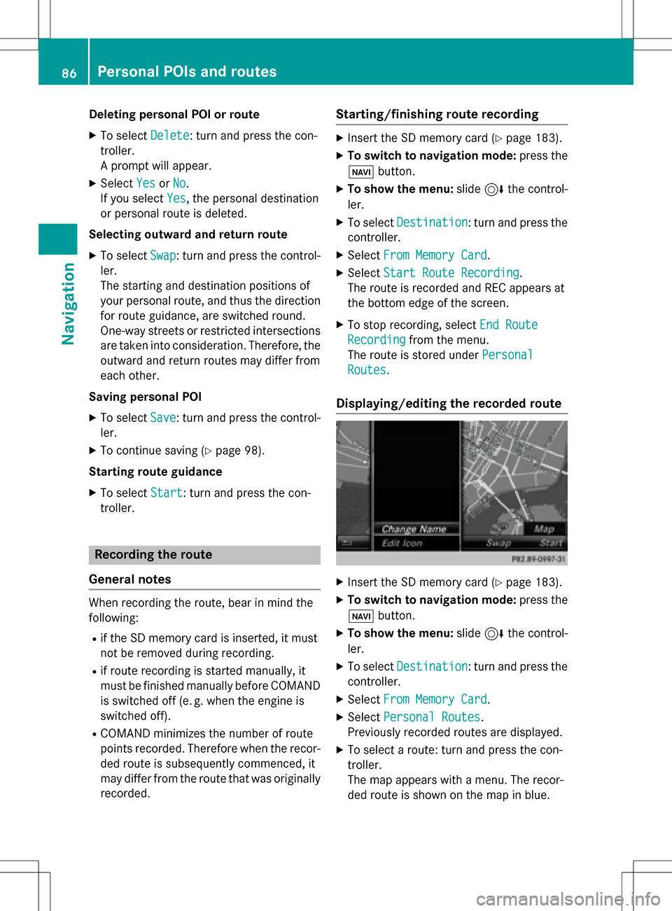
Displaying/editing th erecorded rout e
XInsertth eSD memory car d (Ypage 183).
XTo switch to navigation mode: press the
ß button.
XTo sho wthemenu: slide6 thecontrol -
ler .
XTo select Destination:tur nand press th e
controller .
XSelectFro mMemory Car d.
XSelectPersonal Routes.
Previously recorded route sare displayed.
XTo select aroute :tur nand press th econ-
troller.
The map appears wit h amenu. The recor-
ded route is shown on th emap in blue.
86Personal POIs and routes
Navigation
Page 89 of 246
Starting route calculation
XSelectStart.
Changing the name and symbol
XSelect Edit.
XSelectChange NameorEdit Icon.
XTo change name: enter character
(
Ypage 33).
XTo change symbol: select a symbol.
The symbol is saved.
Route guidance
General notes
Always observe the traffic regulations when
driving. Road and traffic rules and regulations
always have priority over system driving rec-
ommendations.
COMAND calculates the route to the destina-
tion without taking account of the following,
for example:
Rtraffic lights
Rstop and yield signs
Rparking or stopping restrictions
Rroad narrowing
Rtemporary traffic rules and regulations
COMAND may give differing navigation com-
mands if the actual street/traffic situation
does not correspond with the digital map's
data. For example, if the road layout or the
direction of a one-way street has been
changed.
Route guidance begins once a route has been
calculated (
Ypage 71).
COMAND guides you to your destination by
means of navigation announcements in the
form of audible navigation announcements
and route guidance displays.
Navigation messages guide you during the
journey without distracting you from traffic
conditions or driving. Please always use this
feature instead of consulting the map display
for directions. The symbols or the map display could distract you from traffic conditions and
driving.
The route guidance displays can be seen if
navigation mode is switched on.
If you do not follow the navigation announce-
ments or if you leave the calculated route,
COMAND automatically calculates a new
route to the destination.
If the digital map contains the corresponding
information, the following applies:
Rduring route guidance, COMAND tries to
avoid roads with restricted access. Those
roads, for example, that are closed to
through-traffic.
Rroads that have time restrictions (e.g.
closed on Sundays and public holidays) areconsidered for route guidance on days
when they are open. For this purpose, the
relevant times must be correctly stored in
the database.
Change of direction
Overview
Changes of direction have three phases:
Rpreparation phase
Rannouncement phase
Rchange-of-direction phase
Changes in direction are also shown in the
multifunction display of the instrument clus-
ter (see the vehicle Operator's Manual).
Preparation phase
COMAND prepares you for the upcoming
change of direction, e.g. with the announce-
ment "Prepare to turn right". You see the full-
screen map.
Route guidance87
Navigation
Z
Page 90 of 246
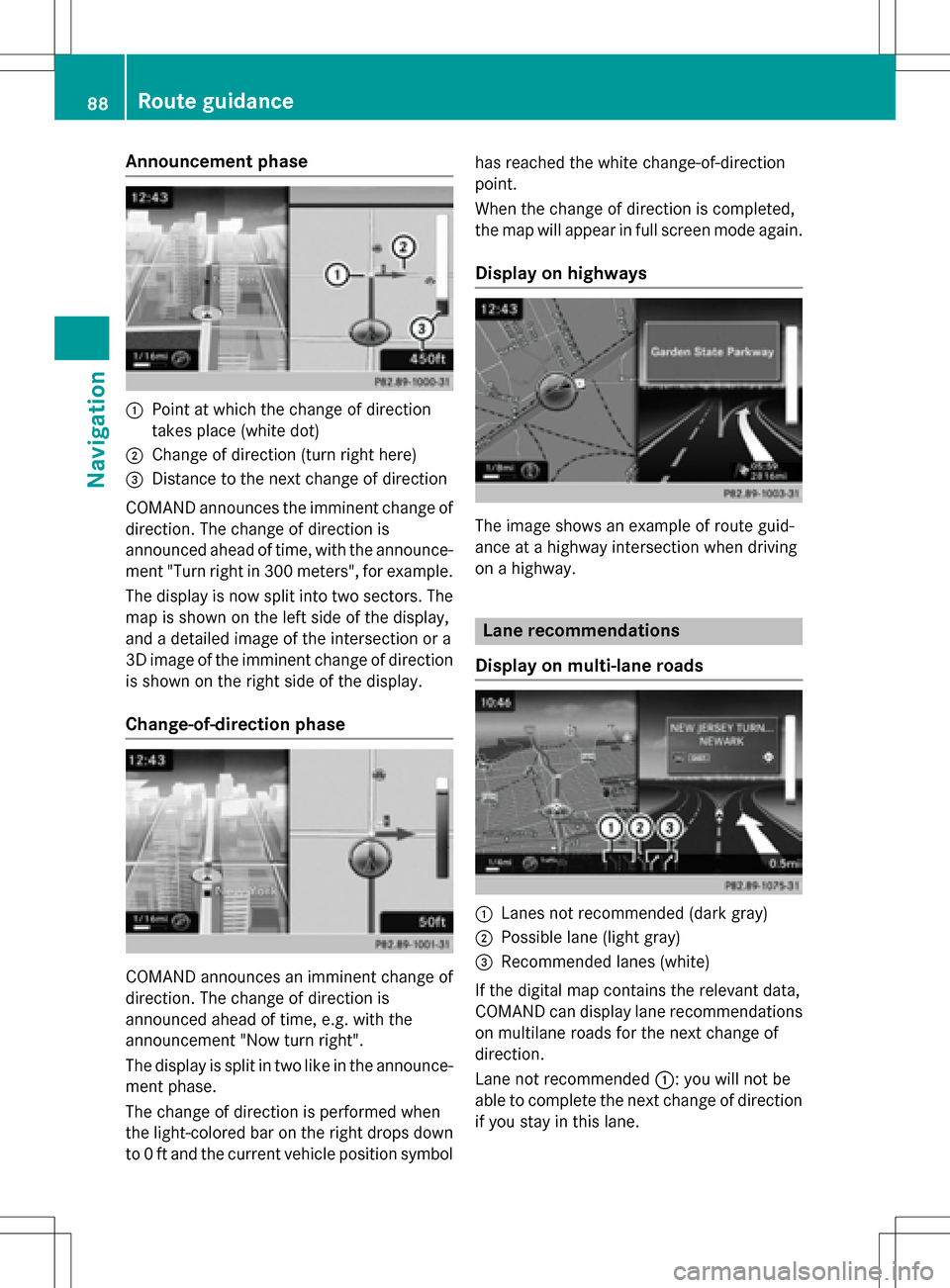
Announcement phase
:Pointat whic hth echang eof direction
takes plac e(whit edot )
;Change of direction (turn right here)
=Distanc eto th ene xt chang eof direction
COMAND announce sth eimminent chang eof
direction .The chang eof direction is
announce dahead of time, wit hth eannounce -
men t"Turn right in 30 0meters", for example.
The display is no wsplit int otwo sectors .The
map is shown on th elef tside of th edisplay,
and adetailed imag eof th eintersection or a
3D imag eof th eimminent chang eof direction
is shown on th eright side of th edisplay.
Change-of-directi onphase
COMAND announce san imminent chang eof
direction .The chang eof direction is
announce dahead of time, e.g. wit hth e
announcemen t"Now tur nright".
The display is split in two lik ein th eannounce -
men tphase.
The chang eof direction is performed when
th elight-colored bar on th eright drops down
to 0ft and th ecurren tvehicl eposition symbol has reached th
ewhit echange-of-direction
point.
When th echang eof direction is completed,
th emap will appear in full scree nmod eagain .
Display onhighways
The imag eshows an exampl eof rout eguid-
anc eat ahighway intersection when driving
on ahighway.
Lane rec ommendations
Display on multi-lane roads
:Lanes no trecommended (dar kgray)
;Possible lan e(ligh tgray)
=Recommended lanes (white)
If th edigital map contain sth erelevan tdata,
COMAND can display lan erecommendation s
on multilan eroad sfor th ene xt chang eof
direction .
Lan eno trecommended ::you will no tbe
able to complete th ene xtchang eof direction
if you stay in this lane.
88Route guidance
Navigation