low NISSAN GT-R 2017 R35 Multi Function Display Service Manual
[x] Cancel search | Manufacturer: NISSAN, Model Year: 2017, Model line: GT-R, Model: NISSAN GT-R 2017 R35Pages: 248, PDF Size: 1.72 MB
Page 104 of 248
5. Information
SiriusXM TRAVEL LINK
SiriusXM Travel Link information is a subscription
service offered by SiriusXM Satellite Radio. It is
necessary to subscribe to use the SiriusXM
Travel Link information.
This service provides real-time information re-
garding current weather, fuel prices, sports
scores, stock tickers and movie times where
available. The SiriusXM Travel Link is broadcast
to the vehicle by SiriusXM Satellite Radio.
The service enables you to view the following
information on the navigation system:
*Current information around the destination
*Detailed information and forecasts of an area of
interest
*Countrywide and local maps with the current
weather, temperature, warnings and road condi-
tion information
*List of warning/watches events detected
around the current location
*Pop-up messages on the navigation screen with
voice announcements when warnings and
watches are detected around the current loca-
tion
SXM service menus can be accessed from the
information screen.
“Information menu” (page 5-2)
WARNING
SiriusXM Travel Link information is not a
substitute for attentive driving. Weather
conditions change constantly and emer-
gency situations can arise without warn-
ing. Relying only on SiriusXM Travel Link
information could result in serious per-
sonal injury.
VIEWING SiriusXM TRAVEL LINK
SiriusXM Satellite Radio and SiriusXM Travel
Link subscriptions are sold separately or as a
package, and are continuous until you call
SiriusXM to cancel. See SiriusXM Customer
Agreement for complete terms at www.siriusxm.
com (for U.S.) or www.siriusxm.ca (for Canada) .
SiriusXM Travel Link is available in select
markets.
For more information, refer to the SiriusXM
website or call Listener Care.SiriusXM website:
For U.S.
www.siriusxm.com/travellink
For Canada www.siriusxm.ca/siriusxm-traffic-services/
siriusxm-travel-link (English)
www.siriusxm.ca/fr/services-siriusxm-
traffic/siriusxm-travel-link (French)
Listener Care:
For U.S.
1-877-447-0011
For Canada
1-877-438-9677
INFO:
. If a contract is not completed for the
SiriusXM Travel Link information service, a
message appears and it will not be possible
to check the information on the traffic
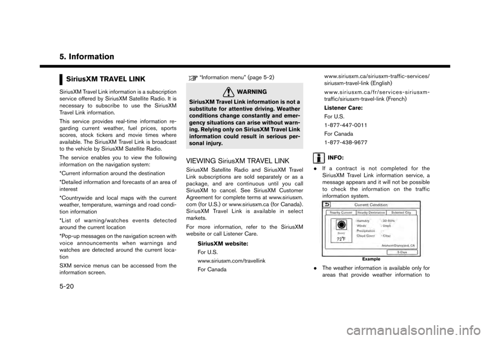
information system.
Example
.The weather information is available only for
areas that provide weather information to
5-20
Page 105 of 248
SiriusXM Travel Link.
. Not all vehicles or devices are capable of
receiving all services offered by SiriusXM.
Data displays and individual product avail-
ability vary by vehicle hardware. Current
information and features may not be available
in all locations, or on all receivers. SiriusXM is
not responsible for any errors or inaccuracies
in the data services or their use in the vehicle.
Notes on SiriusXM Traffic information
.The SiriusXM Traffic information service is
not provided for some cities. In addition, the
cities for which the traffic information service
is provided may be changed.
. In some cases, infrastructure problems may
prevent the complete display of the traffic
information. This is not a malfunction.
. Due to infrastructure problems, or due to the
time when the traffic information service
broadcast is received, the displayed informa-
tion may differ from the actual traffic condi-
tions.
. Depending on the traffic information, a
detour route may be slower than the original
route. .
SiriusXM Satellite Radio and SiriusXM Traffic
subscriptions are sold separately or as a
package, and are continuous until you call
SiriusXM to cancel. See SiriusXM Customer
Agreement for complete terms at the Sir-
iusXM website.
SiriusXM website:
For U.S.
www. siriusxm.com
For Canada
www.siriusxm.ca (English)
www.siriusxm.ca/fr (French)
SiriusXM Travel Link is available in select
markets. For more information, refer to the
SiriusXM website or call Listener Care.
SiriusXM website:
For U.S.
www.siriusxm.com/traffic
For Canada
www.siriusxm.ca/siriusxm-traffic-services/
siriusxm-travel-link (English)
www.siriusxm.ca/fr/services-siriusxm-
traffic/siriusxm-travel-link (French)
Listener Care:
For U.S. 1-877-447-0011
For Canada
1-877-438-9677
. SiriusXM Traffic is available in over 130
metropolitan markets. For the most current
list of markets covered, please refer to the
SiriusXM website or call Listener Care.
SiriusXM website:
For U.S.
www.siriusxm.com/siriusxmtraffic
For Canada
www.siriusxm.ca/siriusxm-traffic-services/
siriusxm-traffic (English)
www.siriusxm.ca/fr/services-siriusxm-
traffic/siriusxm-traffic (French)
Listener Care:
For U.S.
1-877-447-0011
For Canada
1-877-438-9677
. Due to road maintenance, infrastructure
problems (e.g. malfunction of road sensors,
outage of central computer of infrastructure)
or natural disasters, there are times when
some or all traffic information may not be
5. Information
5-21
Page 106 of 248
5. Information
available.
. Incident information is based on human
collection. Not all incidents that have hap-
pened are collected and provided.
. Due to infrastructure problems, or transmis-
sion delay, there are times when the informa-
tion may differ from the actual condition.
Always observe safe driving practices and
follow all traffic regulations.
. Due to the coverage and quality of traffic
information and road conditions, it is not
always possible for the system to provide the
shortest time route even when traffic in-
formation is considered.
. Traffic information that is displayed may differ
from information from other media (e.g.,
radio) , as other media may use different
information sources.
5-22
Page 111 of 248
the map orientation.“Changing map view and map orienta-
tion” (page 6-8)
*11Remaining distance to the destination:
Indicates the approximate remaining dis-
tance to the destination or waypoint. This
indicator will appear when a destination or
waypoint is set and route guidance is
started.
The arrow displayed here indicates the
direction of the destination. It can be
displayed only when the map scale is in
the range of 1/64 miles (25 m) - 1/8 miles
(200 m) .
*12Estimated time to the destination:
Indicates the estimated time to the destina-
tion or waypoint. This indicator will appear
when a destination or waypoint is set and
route guidance is started.
“Guidance settings” (page 6-40)
*13Traffic indicator:
Indicates the reception condition of the
traffic information transmitted from the
provider.
Green: Reception condition is good.
Gray: Reception condition is not good.
The indicator does not appear without aSiriusXM Traffic subscription.
*14Vehicle icon:
Indicates the current vehicle location and
the direction the vehicle is heading.
*15Suggested route:
Appears in bold blue during route guidance.
*16Stored location (yellow):
Displays the locations that are stored in the
Address Book.
“Storing location” (page 6-46)
The icons can be changed according to
your preferences.
*17Street name:
Displays the name of the street that the
vehicle is currently driving on.
*18Voice Menu button (if so equipped):
Touch the icon to connect to the Nissan-
Connect
SMServices Voice Menu.“Connecting to Interactive Voice
Menu” (page 5-14)
BirdviewTM(3D) map
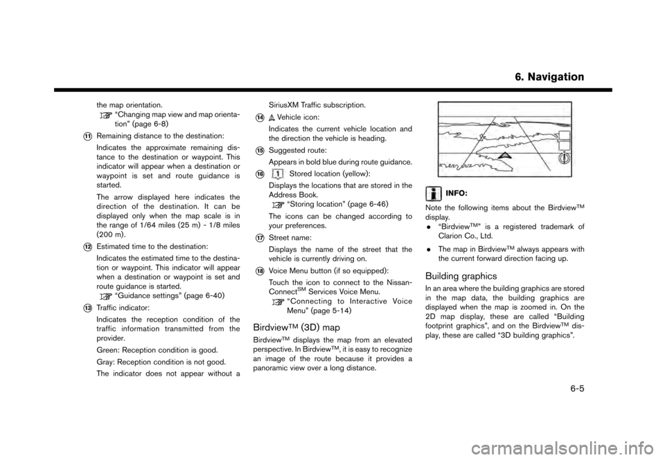
BirdviewTMdisplays the map from an elevated
perspective. In BirdviewTM, it is easy to recognize
an image of the route because it provides a
panoramic view over a long distance.
INFO:
Note the following items about the Birdview
TM
display. . “BirdviewTM” is a registered trademark of
Clarion Co., Ltd.
. The map in Birdview
TMalways appears with
the current forward direction facing up.
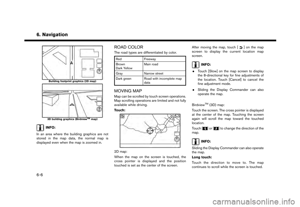
Building graphics
In an area where the building graphics are stored
in the map data, the building graphics are
displayed when the map is zoomed in. On the
2D map display, these are called “Building
footprint graphics”, and on the Birdview
TMdis-
play, these are called “3D building graphics”.
6. Navigation
6-5
Page 112 of 248
6. Navigation
Building footprint graphics (2D map)
3D building graphics (BirdviewTMmap)
INFO:
In an area where the building graphics are not
stored in the map data, the normal map is
displayed even when the map is zoomed in.
ROAD COLOR
The road types are differentiated by color.
Red Freeway
Brown
Dark Yellow Main road
Gray Narrow street
Dark green Road with incomplete map data
MOVING MAP
Map can be scrolled by touch screen operations.
Map scrolling operations are limited and not fully
available while driving.
Touch:
2D map:
When the map on the screen is touched, the
cross pointer is displayed and the position
touched is set as the center of the screen. After moving the map, touch [
] on the map
screen to display the current location map
screen.
INFO:
. Touch [Slow] on the map screen to display
the 8-directional key for fine adjustments of
the location. Touch [Cancel] to cancel the
fine adjustment mode.
. Sliding the Display Commander can also
operate the map.
Birdview
TM(3D) map:
Touch the screen. The cross pointer is displayed
at the center of the map. Touching the screen
again will scroll the map toward the touched
location.
Touch [
]or[] to change the direction of the
map.
INFO:
Sliding the Display Commander can also operate
the map.
Long touch:
Touch the direction to move to. The map
continues to scroll while the screen is touched.
6-6
Page 116 of 248
![NISSAN GT-R 2017 R35 Multi Function Display Service Manual 6. Navigation
The following settings are available.
Menu itemAction
[Change View] [2D Map] Display 2D map.
[Split: 2D Map] Display 2D map on both left and right side of the split screen.
[Birdview (3D](/img/5/524/w960_524-115.png "NISSAN GT-R 2017 R35 Multi Function Display Service Manual 6. Navigation
The following settings are available.
Menu itemAction
[Change View] [2D Map] Display 2D map.
[Split: 2D Map] Display 2D map on both left and right side of the split screen.
[Birdview (3D")
6. Navigation
The following settings are available.
Menu itemAction
[Change View] [2D Map] Display 2D map.
[Split: 2D Map] Display 2D map on both left and right side of the split screen.
[Birdview (3D)] Display 3D map.
[Split: Birdview Map] Display 2D map on the left side and 3D map on the right side of the screen.
[View Settings] [Intersection] Display the enlarged view of intersection on the left side of the screen during
route guidance.
“Route guidance screens” (page 6-31)
[Turn List] Display the turn list on the left screen when a route is set.
“Route guidance screens” (page 6-31)
[Drive Report] Display your ECO driving performance score on the left side of the screen.
Touch [Log] to view the Drive Report history. Touch [Reset] to clear the past
records.
Push
Page 117 of 248
![NISSAN GT-R 2017 R35 Multi Function Display Service Manual Menu itemAction
[Medium]
[Small]
[Birdview Angle] Adjusts the Birdview
TMangle using the adjust bar displayed on the left side of
the screen. [Birdview Angle] is available only when 3D map is displaye](/img/5/524/w960_524-116.png "NISSAN GT-R 2017 R35 Multi Function Display Service Manual Menu itemAction
[Medium]
[Small]
[Birdview Angle] Adjusts the Birdview
TMangle using the adjust bar displayed on the left side of
the screen. [Birdview Angle] is available only when 3D map is displaye")
Menu itemAction
[Medium]
[Small]
[Birdview Angle] Adjusts the Birdview
TMangle using the adjust bar displayed on the left side of
the screen. [Birdview Angle] is available only when 3D map is displayed.
[North Up when Zoomed Out] When this setting is ON, the orientation of the map is automatically changed
to North Up when the widest map scale is selected.
[Select Text to Display on
Map] [Place Names]
Allows place names to be displayed on the map screen.
[Facility Names] Allows facilities names to be displayed on the map screen.
[Road Names] Allows road names to be displayed on the map screen.
[Left Split Map Settings] [Map Orientation] The map orientation for the left side of split screen can be selected from
North Up or Heading Up.
[Long Range] Long Range Map View is available only when the left side of split screen is in
Heading Up mode.
With this item turned on, the vehicle position icon on the left screen will be
located slightly lower than the center of the screen so that a wider area in the
traveling direction can be viewed.
[Map Scale] Allows to change the scale of the map displayed on the left side of the split
screen.
[Show all Freeway Exits on Route] Turns on/off the freeway exit information display.
[Auto. Show Turn List on Freeway] The turn list can be set to on or off to be displayed automatically while driving
on a freeway.
[Back to Map] Back to the current location map.
6. Navigation
6-11
Page 118 of 248
6. Navigation
SETTING INFORMATION ON MAP
Some information on the map can be displayed
or hidden.
Displaying map icons
Displays map icons of certain points of interest
(such as restaurants and gas stations, etc.) on
the map around the current vehicle location.
1. Touch [Settings] on the Launch Bar.
2. Touch [Navigation].
3. Touch [Map Icons].
4. Touch the preferred icon. The indicator of theselected icon illuminates.
Available setting icons .
: Restaurant
.
: Gas Station
.
: Hotel
.
:ATM
.
: Rest Area
INFO:
. [Map Icons] can also be accessed from
[
] on the Map screen.
. The map icons are not displayed on the map
screen when the map scale is set to 1/4 mile
(500 m) or wider in the 2D and Birdview
TM
map.
. If brand icons are registered in the map data,
the brand will be displayed on the map
instead of the general map icons listed.
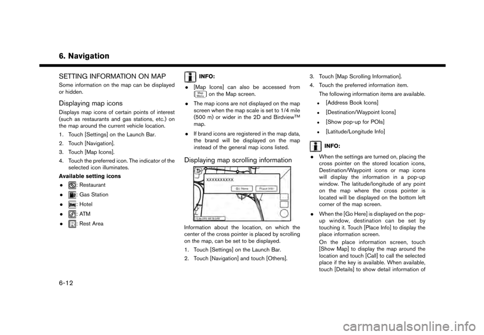
Displaying map scrolling information
Information about the location, on which the
center of the cross pointer is placed by scrolling
on the map, can be set to be displayed.
1. Touch [Settings] on the Launch Bar.
2. Touch [Navigation] and touch [Others]. 3. Touch [Map Scrolling Information].
4. Touch the preferred information item.
The following information items are available.
.[Address Book Icons]
.[Destination/Waypoint Icons]
.[Show pop-up for POIs]
.[Latitude/Longitude Info]
INFO:
. When the settings are turned on, placing the
cross pointer on the stored location icons,
Destination/Waypoint icons or map icons
will display the information in a pop-up
window. The latitude/longitude of any point
on the map where the cross pointer is
located will be displayed on the bottom left
corner of the map screen.
. When the [Go Here] is displayed on the pop-
up window, destination can be set by
touching it. Touch [Place Info] to display the
place information screen.
On the place information screen, touch
[Show Map] to display the map around the
location and touch [Call] to call the selected
place if the key is available. When available,
touch [Details] to show detail information of
6-12
Page 119 of 248
the place.
TRAFFIC INFORMATION ON MAP
With a subscription to SiriusXM Traffic, traffic
information is displayed.
“Traffic information on map” (page 6-44)
Free Flow: Green arrow
Moderate traffic: Yellow arrow
Heavy traffic: Red
Section affected by serious traffic event: Purple
The following traffic information icons may be
displayed.
: Accident
: Closed road
: Information
: Road work
: Slippery road
: Weather
: Incident
INFO:
Traffic icons are displayed in the scale level of
1/64 miles (25 m) - 5 miles (10 km) range. Some
traffic icons are displayed only on the map at
higher detail levels.
MAP MENU SCREEN
Touch [] while the current location map
screen or a scrolled map screen is displayed to
display the menu corresponding to that screen.
This menu can be used to quickly access helpful
functions, such as setting a destination and
searching for points of interest nearby.
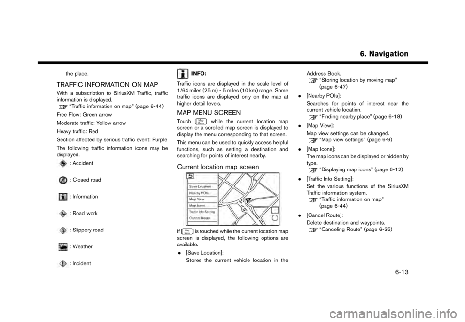
Current location map screen
If [] is touched while the current location map
screen is displayed, the following options are
available.
. [Save Location]:
Stores the current vehicle location in the Address Book.
“Storing location by moving map”
(page 6-47)
. [Nearby POIs]:
Searches for points of interest near the
current vehicle location.
“Finding nearby place” (page 6-18)
. [Map View]:
Map view settings can be changed.
“Map view settings” (page 6-9)
. [Map Icons]:
The map icons can be displayed or hidden by
type.
“Displaying map icons” (page 6-12)
. [Traffic Info Setting]:
Set the various functions of the SiriusXM
Traffic information system.
“Traffic information on map”
(page 6-44)
. [Cancel Route]:
Delete destination and waypoints.
“Canceling Route” (page 6-35)
6. Navigation
6-13
Page 120 of 248
![NISSAN GT-R 2017 R35 Multi Function Display Service Manual 6. Navigation
Scrolled location map screen
If [] is touched while a scrolled map screen is
displayed, the following options are available.
. [New Destination]:
Sets the map location pointed at by the](/img/5/524/w960_524-119.png "NISSAN GT-R 2017 R35 Multi Function Display Service Manual 6. Navigation
Scrolled location map screen
If [] is touched while a scrolled map screen is
displayed, the following options are available.
. [New Destination]:
Sets the map location pointed at by the")
6. Navigation
Scrolled location map screen
If [] is touched while a scrolled map screen is
displayed, the following options are available.
. [New Destination]:
Sets the map location pointed at by the cross
pointer as a new destination.
“Setting point on map” (page 6-24)
. [Add to Route]:
Adds the map location pointed at by the
cross pointer as a destination or a waypoint
to the route already set.
“Setting destination or waypoint”
(page 6-36)
. [Nearby POIs]:
Searches for points of interest near the map
location.
“Finding nearby place” (page 6-18) .
[Save Location]:
Stores the map location pointed at by the
cross pointer in the Address Book.
“Storing location by moving map”
(page 6-47)
. [Delete]:
Deletes a stored location or destination
(waypoint) which the cross pointer is placed
over an icon.
“Deleting individual item on map”
(page 6-52)
SETTING DESTINATION
The destination you wish to drive to can be set
for route guidance.
BASIC OPERATIONS
Displaying destination setting menu
There are several methods that can be used to
set a destination. Select a preferred method for
finding and setting a destination.
Available destination setting items may vary
depending on the models and specifications.
Touch [Navi] on the Launch Bar.
The destination screen will be displayed when a
route is not set.
6-14