Acura ILX 2014 Navigation Manual
Manufacturer: ACURA, Model Year: 2014, Model line: ILX, Model: Acura ILX 2014Pages: 234, PDF Size: 8.8 MB
Page 81 of 234
80
Entering a DestinationPlace Phone Number
Navigation
Place Phone Number
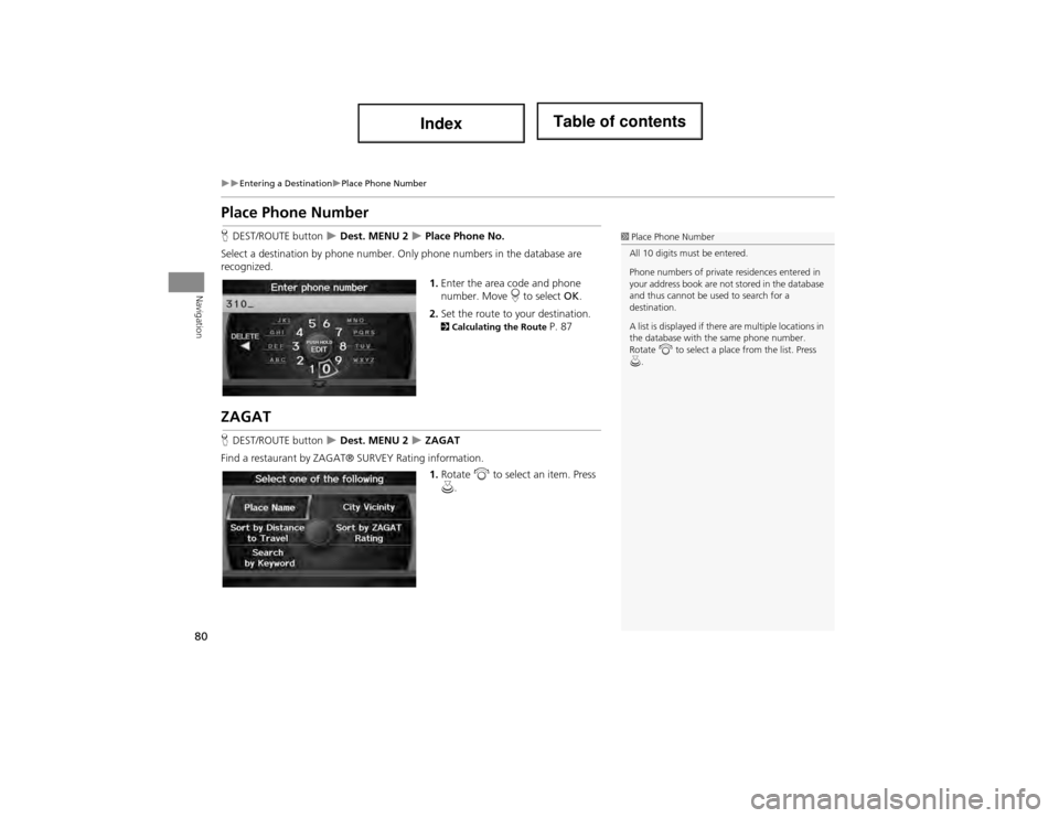
HDEST/ROUTE button Dest. MENU 2 Place Phone No.
Select a destination by phone number. On ly phone numbers in the database are
recognized.
1.Enter the area code and phone
number. Move r to select OK.
2. Set the route to your destination.
2 Calculating the Route P. 87
ZAGAT
HDEST/ROUTE button Dest. MENU 2 ZAGAT
Find a restaurant by ZAGAT® SURVEY Rating information.
1.Rotate i to select an item. Press
u .
1Place Phone Number
All 10 digits must be entered.
Phone numbers of private residences entered in
your address book are not stored in the database
and thus cannot be used to search for a
destination.
A list is displayed if there are multiple locations in
the database with th e same phone number.
Rotate i to select a place from the list. Press
u.
Page 82 of 234
81
Entering a DestinationZAGAT
Navigation
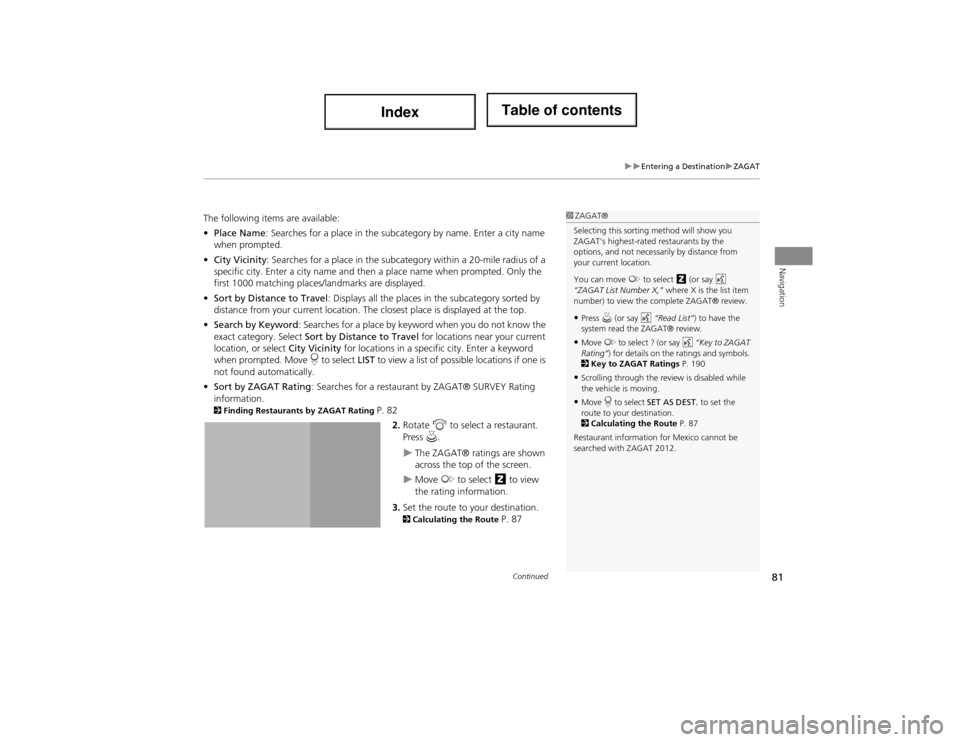
The following items are available:
•Place Name : Searches for a place in the subcategory by name. Enter a city name
when prompted.
• City Vicinity : Searches for a place in the subcate gory within a 20-mile radius of a
specific city. Enter a city name and then a place name when prompted. Only the
first 1000 matching places /landmarks are displayed.
• Sort by Distance to Travel : Displays all the places in the subcategory sorted by
distance from your curren t location. The closest plac e is displayed at the top.
• Search by Keyword : Searches for a place by keyword when y ou do not know the
exact category. Select Sort by Distance to Travel for locations near your current
location, or select City Vicinity for locations in a specif ic city. Enter a keyword
when prompted. Move r to select LIST to view a list of possible locations if one is
not found automatically.
• Sort by ZAGAT Rating : Searches for a restaurant by ZAGAT® SURVEY Rating
information.
2 Finding Restaurants by ZAGAT Rating P. 82
2.Rotate i to select a restaurant.
Press u.
The ZAGAT® ratings are shown
across the top of the screen.
Move y to select z to view
the rating information.
3. Set the route to your destination.
2 Calculating the Route P. 87
1ZAGAT®
Selecting this sorting method will show you
ZAGAT's highest-rated restaurants by the
options, and not necessarily by distance from
your current location.
You can move y to select z (or say d
“ZAGAT List Number X,” where X is the list item
number) to view the complete ZAGAT® review.
•Press u (or say d “Read List”) to have the
system read the ZAGAT® review.
•Move y to select ? (or say d “Key to ZAGAT
Rating” ) for details on the ratings and symbols.
2 Key to ZAGAT Ratings P. 190
•Scrolling through the review is disabled while
the vehicle is moving.
•Move r to select SET AS DEST. to set the
route to your destination.
2 Calculating the Route P. 87
Restaurant information for Mexico cannot be
searched with ZAGAT 2012.
Continued
Page 83 of 234
82
Entering a DestinationZAGAT
Navigation
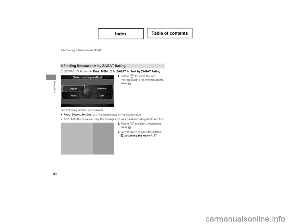
HDEST/ROUTE button Dest. MENU 2 ZAGAT Sort by ZAGAT Rating
1. Rotate i to select the sort
method used to list the restaurants.
Press u.
The following options are available:
• Food, Décor, Service : Lists the restaurants by the rating value.
• Cost : Lists the restaurants by the average cost of a meal (including drink and tip).
2. Rotate i to select a restaurant.
Press u.
3. Set the route to your destination.
2 Calculating the Route P. 87
■Finding Restaurants by ZAGAT Rating
Page 84 of 234
83
Entering a DestinationCoordinate
Navigation
Coordinate
HDEST/ROUTE button Dest. MENU 2 Coordinate
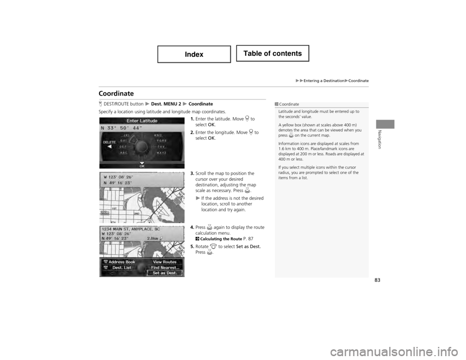
Specify a location using latitude and longitude map coordinates. 1.Enter the latitude. Move r to
select OK.
2. Enter the longitude. Move r to
select OK.
3. Scroll the map to position the
cursor over your desired
destination, adjusting the map
scale as necessary. Press u.
If the address is not the desired
location, scroll to another
location and try again.
4. Press u again to display the route
calculation menu.
2 Calculating the Route P. 87
5. Rotate i to select Set as Dest.
Press u.
1Coordinate
Latitude and longitude must be entered up to
the seconds’ value.
A yellow box (shown at scales above 400 m)
denotes the area that can be viewed when you
press u on the current map.
Information icons are displayed at scales from
1.6 km to 400 m. Place/landmark icons are
displayed at 200 m or less. Roads are displayed at
400 m or less.
If you select multiple icons within the cursor
radius, you are prompted to select one of the
items from a list.
Page 85 of 234
84
Entering a DestinationIntersection
Navigation
Intersection
HDEST/ROUTE button Dest. MENU 2 Intersection
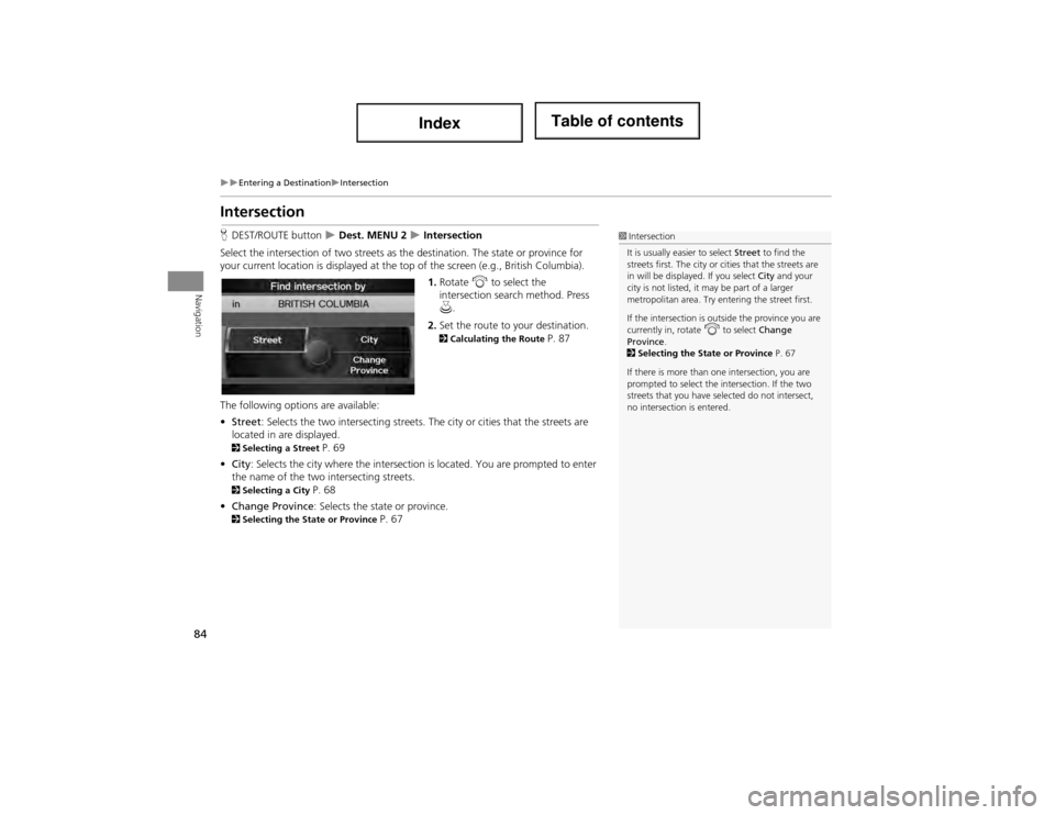
Select the intersection of two streets as th e destination. The state or province for
your current location is displayed at the top of the screen (e.g., British Columbia).
1.Rotate i to select the
intersection search method. Press
u .
2. Set the route to your destination.
2 Calculating the Route P. 87
The following options are available:
• Street : Selects the two intersecting streets. Th e city or cities that the streets are
located in are displayed.
2 Selecting a Street P. 69
• City : Selects the city where the intersection is located. You are prompted to enter
the name of the two in tersecting streets.
2Selecting a City P. 68
• Change Province : Selects the state or province.
2Selecting the State or Province P. 67
1Intersection
It is usually easier to select Street to find the
streets first. The city or cities that the streets are
in will be displayed. If you select City and your
city is not listed, it may be part of a larger
metropolitan area. Try entering the street first.
If the intersection is outside the province you are
currently in, rotate
i to select Change
Province .
2 Selecting the State or Province P. 67
If there is more than one intersection, you are
prompted to select the intersection. If the two
streets that you have selected do not intersect,
no intersection is entered.
Page 86 of 234
85
Entering a DestinationMap Input
Navigation
Map Input
HDEST/ROUTE button Dest. MENU 2 Map Input
Use the Interface Dial to manually select an icon or a location on the map screen as
the destination.
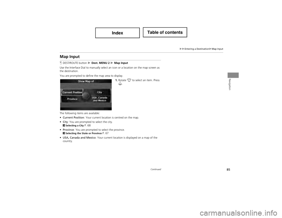
You are prompted to define the map area to display.
1.Rotate i to select an item. Press
u .
The following items are available:
• Current Position : Your current location is centred on the map.
• City : You are prompted to select the city.
2Selecting a City P. 68
• Province : You are prompted to select the province.
2Selecting the State or Province P. 67
• USA, Canada and Mexico : Your current location is displayed on a map of the
country.
Continued
Page 87 of 234
86
Entering a DestinationMap Input
Navigation
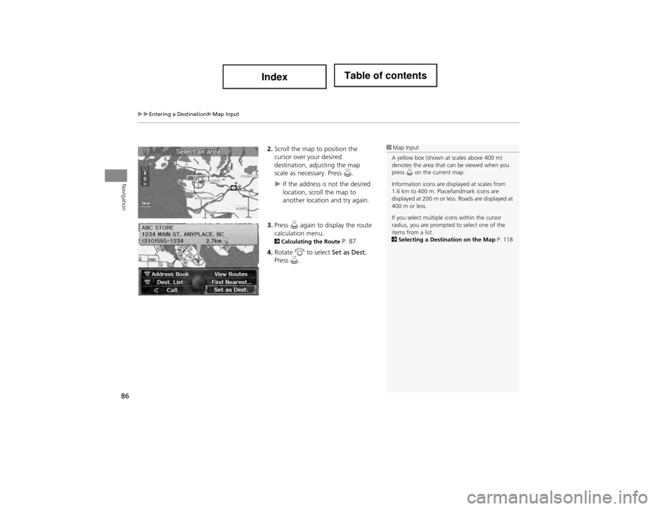
2.Scroll the map to position the
cursor over your desired
destination, adjusting the map
scale as necessary. Press u.
If the address is not the desired
location, scroll the map to
another location and try again.
3. Press u again to display the route
calculation menu.
2 Calculating the Route P. 87
4. Rotate i to select Set as Dest.
Press u.
1Map Input
A yellow box (shown at scales above 400 m)
denotes the area that can be viewed when you
press u on the current map.
Information icons are displayed at scales from
1.6 km to 400 m. Place/landmark icons are
displayed at 200 m or less. Roads are displayed at
400 m or less.
If you select multiple icons within the cursor
radius, you are prompted to select one of the
items from a list.
2 Selecting a Destination on the Map P. 118
Page 88 of 234
87
Navigation
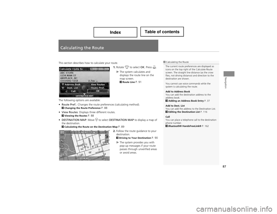
Calculating the Route
This section describes how to calculate your route.1.Rotate i to select OK. Press u.
The system calculates and
displays the route line on the
map screen.
2Route Line P. 91
The following options are available:
• Route Pref. : Changes the route prefer ences (calculating method).
2Changing the R oute Preference P. 88
• View Routes : Displays three different routes.
2Viewing the Routes P. 88
• DESTINATION MAP : Move r to select DESTINATION MAP to display a map of
the destination.
2 Calculating the Route on the Destination Map P. 89
2. Follow the route guidance to your
destination.
2 Driving to Your Destination P. 90
The system provides you with
pop-up messages if your route
passes through unverified areas
or avoid areas.
1Calculating the Route
The current route preferences are displayed as
icons on the top right of the Calculate Route
screen. The straight line distance (as the crow
flies, not driving distance) and direction to the
destination are shown.
You cannot use voice commands while the
system is calculating the route.
Add to Address Book
You can add the destination address to the
address book.
2 Adding an Address Book Entry P. 37
Add to Dest. List
You can add the address to the Destination List.
2 Editing the Destination List P. 116
Call
You can place a telephone call to the destination
phone number.
2 Bluetooth ® HandsFreeLink® P. 162
Page 89 of 234
88
Calculating the RouteChanging the Route Preference
Navigation
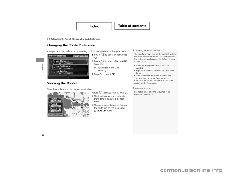
Changing the Route Preference
Change the route preference by selecting minimum or maximum driving methods.1.Rotate i to select an item. Press
u .
2. Rotate i to select MIN or MAX .
Press u.
Repeat step 1 and 2 as
necessary.
3. Move r to select OK.
Viewing the Routes
View three different routes to your destination.
Rotate i to select a route. Press u.
The travel distance and estimated
travel time is displayed for each
route.
The system calculates and displays
the route line on the map screen.
2Route Line P. 91
1Changing the Route Preference
The calculated route may be the shortest route or
the route you would choose. For safety reasons,
the system generally ap plies the following rules
to your route:
•Shortcuts through residential areas are
avoided.
•Right turns are favoured over left turns or U-
turns.
•Time-restricted turns (turns prohibited at
certain times of the day) are not used.
Check the ferry schedule when the calculated
route includes ferry route.
1 Viewing the Routes
It is not unusual for some calculated route
options to be identical.
Page 90 of 234
89
Calculating the RouteCalculating the Route on the Destination Map
Navigation
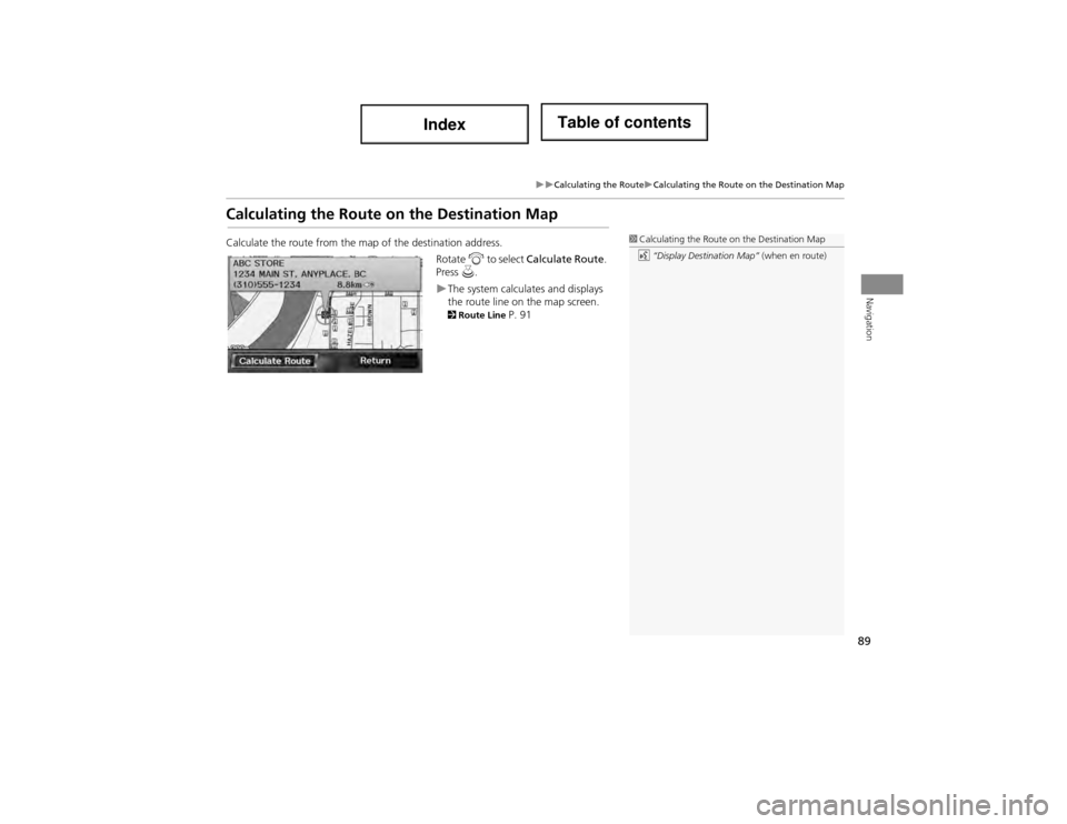
Calculating the Route on the Destination Map
Calculate the route from the map of the destination address.
Rotate i to select Calculate Route .
Press u.
The system calculates and displays
the route line on the map screen.
2Route Line P. 91
1Calculating the Route on the Destination Map
d “Display Destination Map” (when en route)