AUDI TT COUPE 2016 Owners Manual
Manufacturer: AUDI, Model Year: 2016, Model line: TT COUPE, Model: AUDI TT COUPE 2016Pages: 322, PDF Size: 52.86 MB
Page 141 of 322
Downloaded from www.Manualslib.com manuals search engine ..... N
G: CX)
.....
"' U"I
.....
"' .....
Additional information about individual route
criteria can be found in¢ page 137.
Using the control knob , you can select the possi
b le routing for t
he alternative routes and show
Map
Operating the map
Appl ies to: vehicles with navigation system
•
Wild Acres R d
•
Escondido Fwy
Escondido
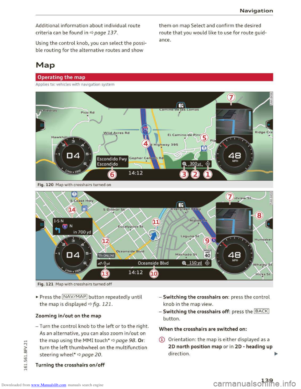
Fig. 120 Map wit h crosshairs turned on
F i
g. 121 Map wit h crosshai rs turned off
~ Press th e I NAV/MAPI button repeatedly un til
the map is displayed~ fig. 121.
Zooming in /out on the map
-Turn the control knob to the left or to the right.
As a n alternative, you can also zoom in/out on
the map using the MMI touch* ¢ page 98. Or:
turn the left thumbwheel on the m ultifun ction
steering wheel*~ page 20 .
Turning the crosshairs on/off
Nav igation
them on map Se lect and confirm the desired
route that yo u wou ld like to use for route guid
ance.
-
Switching the crosshairs on: press the co ntrol
knob
in the map view.
- Switching
the crosshairs off: press the IBACKI
button.
When the crosshairs are switched on:
(D Orientation: the map is either displayed as a
20 north position map or i n 20 -heading up
direction . ..,.
139
Page 142 of 322
Downloaded from www.Manualslib.com manuals search engine Navigation
@ Scale: turn the control knob to the left or
right to decrease or increase the scale.
@ When the Auto zoom function is switched
on, an "A" for "Automatic" is displayed .
@ Crosshairs: move the crosshairs in the de
sired direction using the MMI touch control
pad and set a point on the map as the desti
nation or have information about the focal
point displayed.
® Map content (points of interest, favorites): if
there are multiple POis in the immediate vi
cinity, they will be shown stacked on the
map.
@ Addit ional information on the crosshairs po
sition: if you move the crosshairs to a loca
tion on the map, ava ilable information for
the current crosshairs position is displayed.
Press the control knob to open destination
details o r to start ro ute guidance. When the
crosshairs are turned off, the road being cur
rently driven on is shown.
(j) Disp lay of an upcoming maneuver. If there is
no upcoming maneuver, the distance and cal
culated arrival time to the destination/stop
over is displayed in this location.
® If a turn arrow is displayed, a bar graph turns
on. The fewer bars are shown, the shorter the
d istance is unti l the turn.
When the crosshairs are s witch ed off:
® Speed limit displayll: display of the maxi
mum permitted speed on the exp ressways
and highways.
@ Road currently being driven on. When the ve
h i
cle is stationary, "offroad" is displayed
here.
@ Vehicle location
@ Disp lay of active traffic information (online
or TMC)
@ Altitude display
@ Route information: different information will
be displayed during active route guidance
(for example, the upcoming maneuver in
cluding
calculated d istance and street
l) O nly app lies to veh icles without camer a-based speed limit
di splay .
140
names). The display also provides traffic in
formation or points of interest on the current
route.
(!) Tips
Depending on the rerouting that is selected
¢page 137, the traffic congestion along the
route may already be included in the route
calculation.
Map functions
Applies to: vehicles with navigat ion system
... Press the I NAV/MAPI button repeatedly until
the map is displayed .
... Select: left control button> desired function .
Switch to destination input
The Enter de stin ation menu is displ ayed
¢ page 131 , fig. 114.
Traffic messages
Current traffic information is displayed in the In
fotainment system display. ¢page 143.
Route list
The route list can only be displ ayed when rou te
guidance is active and contains informatio n re
garding the ro ute, the names of th e s treets and
th e length of the route sections. When traveling
on highways, possible parking lots and rest areas
are shown, w hich you can select as a stopover.
Points of interest (POis) along the route
Requirement: rou te guidance must be active.
Searching for poi nts of interest along your cur
r
ent route ¢ page 134.
Additional options on the map
Applies to: vehicles with navigation syste m
... Press the I NAV/MAPI b utton repeatedly unti l
t
he map is displayed.
... Press the right control button.
Page 143 of 322
Downloaded from www.Manualslib.com manuals search engine ...... N
> u. CX> ...... u:>
"' ...... u:> ......
Depending on the function selec ted, the follow
i ng
options can also be selected under th e Map
menu:
Cancel route guidance: ¢ page 136.
Map settings: ¢page 141 .
Route criteria :¢ page 137.
Voice guidance:¢ page 138.
Navigation settings: ¢page 137.
Online traffic data*: ¢page 142.
Block route:¢ page 138.
Show alternative routes:¢ page 1 3 8 .
Parking along the route: parki ng option s near
the veh icle are disp layed.
POis along the route: points of interest nea r the
vehicle are displayed .
Save current position: you can save your current
vehicle position as a favor ite q page 13 7 or save
it
as a contact in the directory ¢ page 13 7.
Audi
connect for this location* : allows you to
search for City events or Weather at the entered
location.
Country information: you can display the appli
cable urban
and rural speed limits for any coun
try/state. This information will be automatically
shown
to you in the route information @
q page 139, fig. 120 when the speed limit is e x
ceed ed, if this function is activated ¢page 141.
Map settings
A pp lies to: vehi cles with navigation system
... Press the I NAV/MAPI button repeatedly un til
the map is displayed .
... Select: right control button> Map settings.
Depending on
the selected function, the follow
ing
settings can be selected :
Day/night map
Day/Night : the map is displayed with a light/
dark background .
Automatic: when the lights switch on, the map
colors switch from day to night.
Map view
Standard ¢page 139, fig . 120.
Google Earth ¢ page 142, fig. 122
Traffic ¢ page 142
Map orientation
Navigation
Destination: the map ind icates the destina tion
and is or iented to the north.
2D -heading up/2D north position map: the
curre nt vehicle position is displayed. The map is
oriented in the direction of travel or to the north.
3D
position map: when this functio n is sw itch ed
on, the cur rent vehicle position is show n on a
three-dim ensiona l map and oriente d in the d ir e c
tion of travel. At a sca le of 62 m iles (100 km ) and
larger, t he map is or iented to the north.
Overview : the entire route from the vehicle posi
ti on to the destination or the nex t stopover is dis
played on
the map. The map scale depends on
the length of the route and adapts automatically.
The
map i s oriented to the north.
Route information
The display of route information such as the cur
rent road being driven on, upcoming maneuvers,
traffic information
or points of interest along the
r
oute can be switched on/off.
Auto zoom
On: the map scale is adapted automatically de
p endi ng o n th e type of road being traveled (ex
pr essway,
highway, other roads) so th a t you al
way s have an opti
mal o ve rview of the roa d ah ead.
The scale is also automatically adapted w he n
t h
ere are upcom ing maneu vers to provi de a bet
ter detailed view.
Off: the map scale you have chosen is kept.
Map content
Map content, such as traffic information, favor
i t es
or restaurants, can be displayed or hidden
(g).
141
Page 144 of 322
Downloaded from www.Manualslib.com manuals search engine Navigation
Online map view
Applies to: vehicles with navigation system and Audi connect
With the online map view, you can display the
map with satellite images.
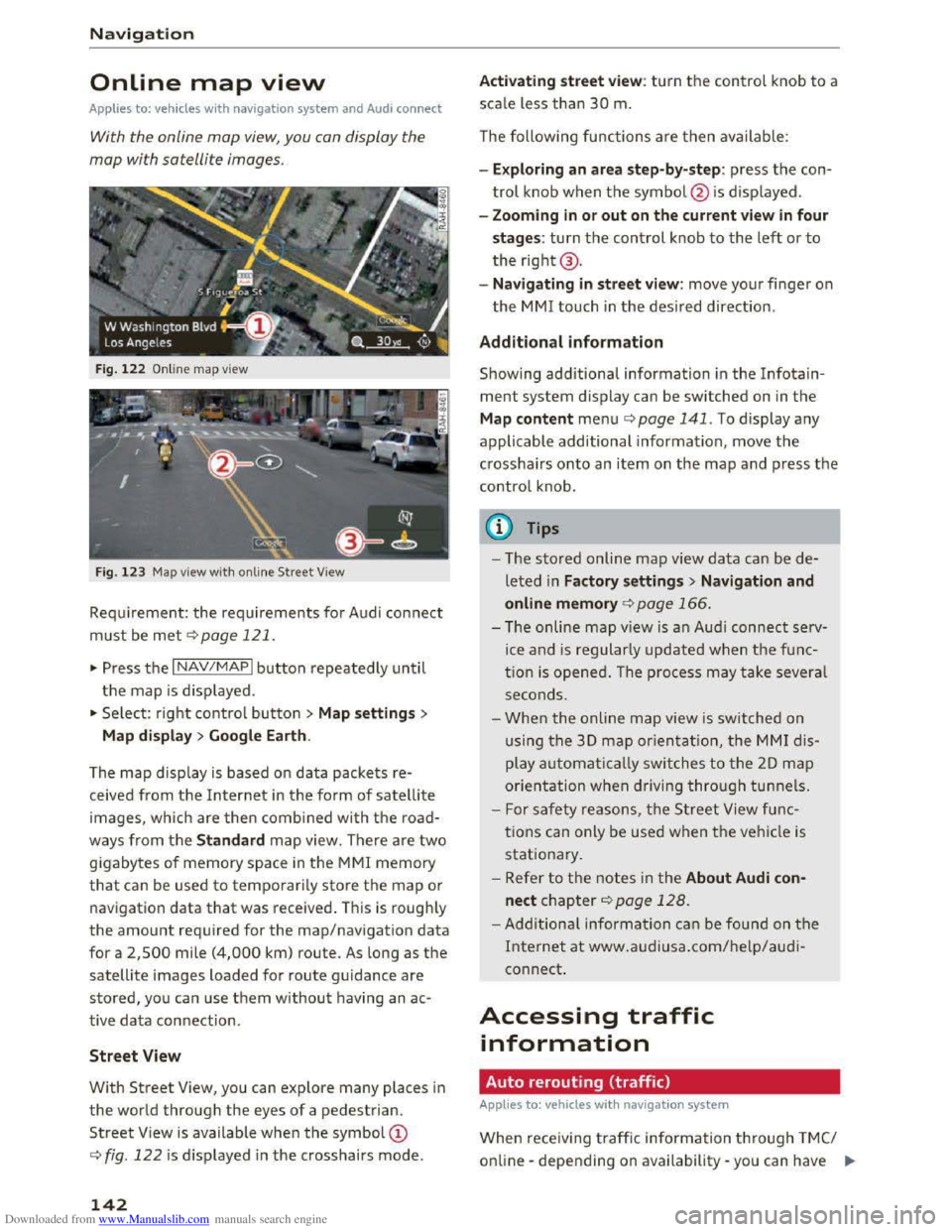
Fig. 122 Online map view
Fig.
123 Map view with on line Street View
Requirement: the requirements for Audi connect
must be met c::> page 121.
... Press the I NAV/MAPI button repeatedly until
the map is displayed .
... Select: right control button > Map settings>
Map
display> Google Earth.
The
map display is based on data packets re
ceived from the Internet in the form of satellite
images, which are then combined with the road
ways from the Standard map view. There are two
gigabytes of memory space in the MMI memory
that can be used to temporarily store the map or
navigation
data that was received . This is roughly
the amount required for the map/navigation data
for a 2,500 mile (4,000 km) route. As long as the
satellite images loaded for route guidance are
stored, you can use them without having an ac
tive data connection .
Street View
With Street View, you can explore many places in
the world through the eyes of a pedestrian.
Street View is available when the symbol©
c::> fig. 122 is displayed in the crosshairs mode.
142
Activating street view: turn the control knob to a
scale less than 30 m.
The following functions
are then available:
- Exploring
an area step-by-step: press the con
trol knob when the symbol @ is displayed .
-
Zooming in or out on the current view in four
stages: turn the control knob to the left or to
the right@.
-
Navigating in street view: move your finger on
the MM! touch in the desired direction .
Additional information
Showing additional information in the Info tain
ment system display can be switched on in the
Map content menu c::;.page 141. To display any
applicable additional information , move
the
crosshairs onto an item on the map and press the
control knob .
(D Tips
-The stored on line map view data can be de
leted in Factory settings> Navigation and
online memory c::;. page 166.
-The on line map view is an Audi connect serv
ice and is regularly updated when the func
tion is opened. The process may take several
seconds .
-
When the online map view is switched on
using
the 30 map orientation, the MMI dis
play automatically switches to the 20 map
orientation when driving through tunnels.
- For safety reasons, the Street View func
tions can only be used when the vehicle is
stationary.
-Refer to the notes in the About Audi con·
nect chapter c::> page 128.
-Additional information can be found on the
Internet at www.audiusa.com/help/audi
connect.
Accessing traffic
information
Auto rerouting (traffic)
Applies to: vehicles with navigat ion system
When receiving traffic inform ation through TMC/
online -depending on availability -you can have II>
Page 145 of 322
Downloaded from www.Manualslib.com manuals search engine the MMI navigate you around traffic incidents, if
possib l
e. Rerouting must be switched on for this
¢page 137.
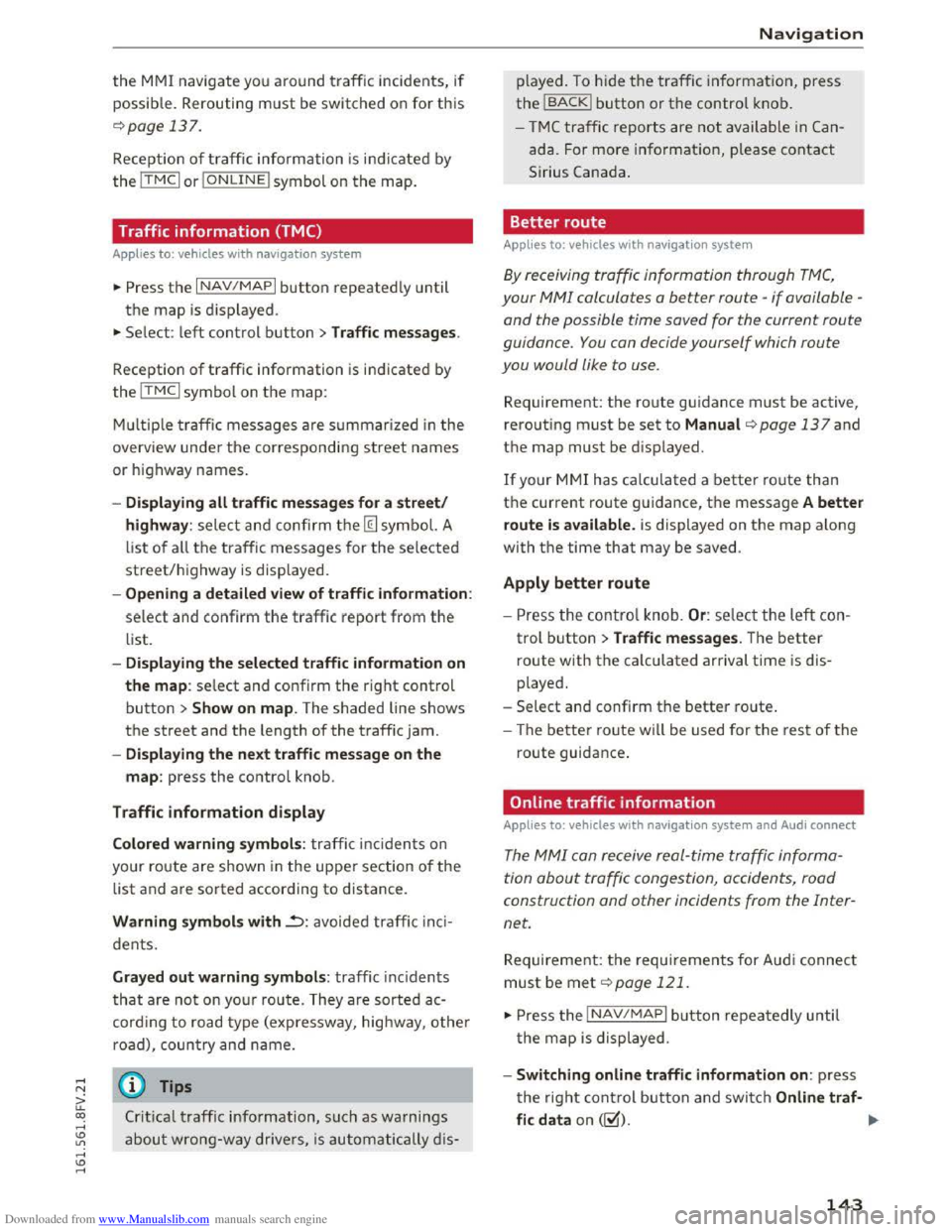
Reception of traffic information is indicated by
the ITMCI or IONLINEI symbol on the map.
Traffic information (TMC)
Applies to: vehicles with nav igation system
~Press the I NAV/MAPI button repeatedly until
the map is displ ayed .
~ Select: left control button > Traffic messages.
Reception of traffic information is indicated by
the ITMCI symbol on the map:
M ul
tiple traffi c messages are summarized in the
overview under the corresponding street names
or highway names.
-Dis playing all traffi c messages for a street/
highway :
select and confirm the [ill symbol. A
list
of all the traffic messages for the selected
street/highway is displayed.
-Openin g a detailed view of traffic information :
select and confirm the traffic report from the
list.
-Displa ying the selected traffi c information on
the map : select and confirm the right control
button > Show on map. The shaded line shows
the street and the length of the traffic jam.
-Dis pla ying the ne xt traffic message on the
map : press the control knob .
Traffic information display
Colored warning symbo ls : traffi c inc idents on
your route are shown in the upper section of the
list and are sorted according to distance.
Warning symbols with..=>: avoided traffic inc i
dents.
Gray ed out warning symbols: traffic inc idents
that are not on yo ur route. They are sorted ac
cord ing
to road type (exp ressway, highway, other
road),
country and name.
(D Tips
Crit ical traffic information, such as warnings
about wrong-way drivers, is automatically d is-
Navigation
played. To h ide the traffic in formation, press
the IBACKI button or the control knob .
-
T M C traffic reports are not available in Can
ada. For more information, please contact
Sirius Canada .
Better route
Applies to: vehicles with nav igation system
By receiving traffic information through TMC,
your MMI calculates a better route -if available -
and the possible time saved for the current route
guidance.
You can decide yourself which route
you would like
to use.
Requirement: the route guidance must be active,
rero u
ting must be set to Manual q page 13 7 and
the map must be displayed.
If your MMI has calculated a better route than
the current route guidance, the message A better
route is av ailable .
is displayed on the map along
with the time that may be saved.
Apply better route
-Press the contro l knob. Or: select the left con
trol button > Traffic messages. The better
route with the calculated arrival time is dis
played.
-
Select and confirm the better route.
- The
better route wi ll be used for the rest of the
route guidance.
Online traffic information
Applies to: vehicles with nav igation system and Audi connect
The MMI can receive real-time traffic informa
tion
about traffic congestion, accidents, road
construction
and other incidents from the Inter
net.
Requirement: the requirements for Aud i connect
must be met ¢page 121.
~Press the INAV/MAPI button repeatedly until
t he
map is displayed.
-Switching online traffic information on: press
the right control button and switch Onlin e traf·
fic data on (~). IJll-
143
Page 146 of 322
Downloaded from www.Manualslib.com manuals search engine Navigation
-Switching traffic map view on: for an optimal
view of traffic information, select: I NAV/MAPI
button > right control button > Map settings >
Map display >Traffic .
You can also display the online traffic informa
tion in the on line map view ¢ page 142 or the
standard map view ¢ page 139, fig. 120.
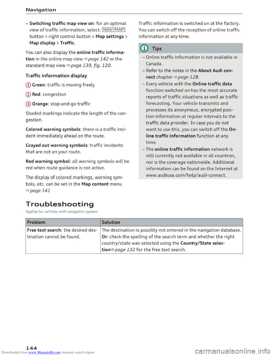
Traffic information display
@Green : traffi c is movi ng freely
@Red: congestion
® Orange : stop-and-go traffic
Shaded markings indicate the leng th of the con
gestion.
Colored warning symbols: there is a t raffic inci
dent immedia te ly ahead on the route.
Grayed out warning symbols: traffic inc idents
t
hat a re not on your rou te.
Red warning symbol: all warning symbols will be
red
when route guidance i s no t ac tive.
The display of colored markings, warning sym·
bols, etc. can be set in the Map content menu
¢ page 141
Troubleshooting
Applies to: vehi cles with navigation system
Problem Solution
Traffic in formation is switched on at the fa ctory.
You can switch off the rece ption of online traffic
i
nformation at any time.
@ Tips
-O nline traffic information is not available in
Cana da.
- Refer to th e notes in the About Audi con
nect chapter¢ page 128.
- Every vehicle with t he Online traffic data
func tion switched on has the most ac cu rate
re po rts of traffic situations as well as traffic
f o
recasting. Your vehicle transmits and
processes its anonymous, encrypted p osi
tion info rmation at regular intervals to the
t raffic data provider . In case you do not
want to use t h is, you can switch off the On
line traffic information function at any
t i
me.
- T he online traffic information network is
still cur re ntly not available in all countries,
nor is the cover age nationwi de. Additional
inf ormation can be found on the Intern et at
www .audiusa.c om/help /a udi -connect.
Free text search : the desired des-The destinatio n i s possibly not entered in the navigation database.
ti
nati o n ca nnot be found . Or: check the spelling of th e search ter m a nd w hether the right
co un
try/state w as selected usi ng the Country/State selec-
tion¢ page 132 for the free text searc h.
144
Page 147 of 322
Downloaded from www.Manualslib.com manuals search engine ..... N
G: CX)
.....
"' U"I
.....
"' .....
Radio
Accessing the radio
The radio supports the FM, AM and SiriusXM*
(satellite radio) bands. Using
the HO Radio re
ceiver also
allows you to receive radio stations
on the FM and AM bond in digital format.
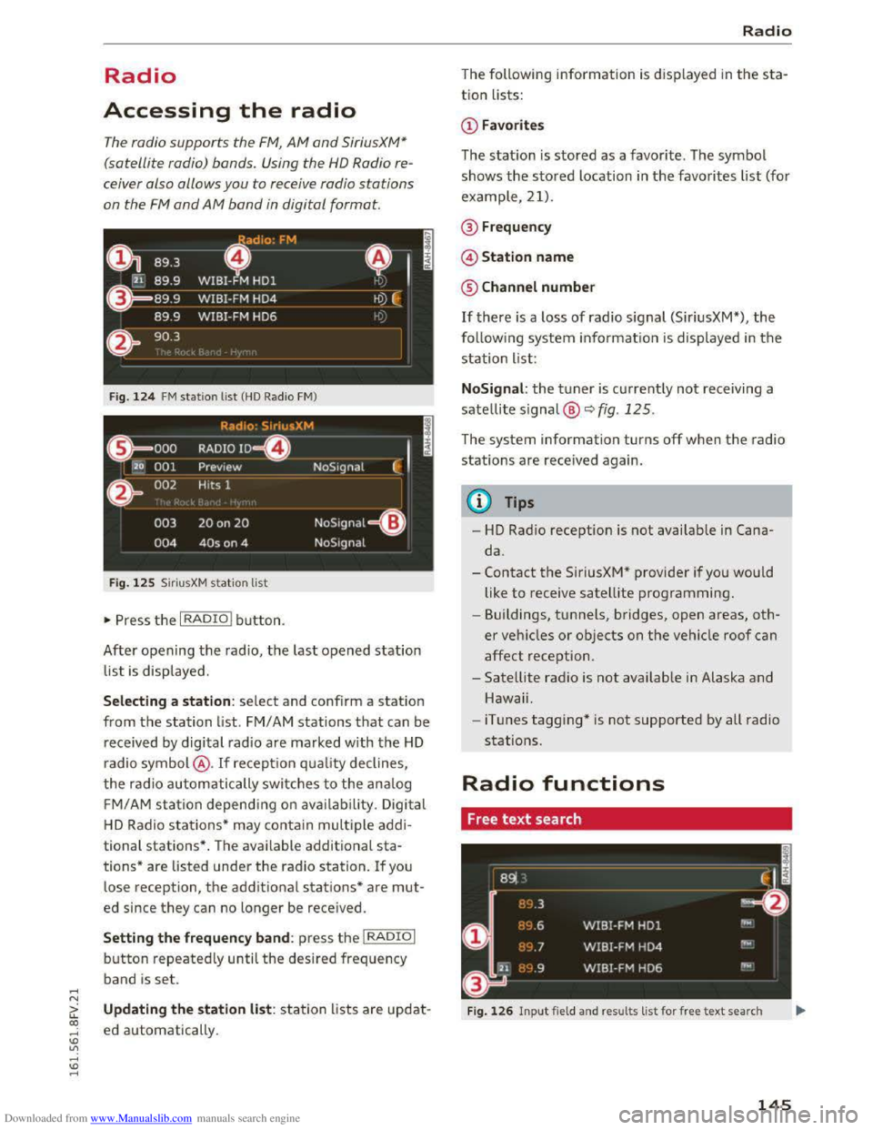
Fig. 124 FM station list (HO Radio FM)
Radio: SiriusXM
~'
.000 RADIO 10 D
120 001 Preview NoSignal
&
002 Hits 1
003 20 on 20 NoSignal =
Fig. 125 Siri usXM station list
"Press the I RADIO I button.
After opening the radio, the last opened station
list is displayed.
.
I
Selecting a station : select and confirm a station
from the station list. FM/ AM stations that can be
received by
digital radio are marked with the HD
radio symbol @. If recept ion quality declines,
the radio automatically switches to the analog
FM/AM station depending on availability . Digital
HD Radio stations * may contain multiple addi
tional stations* . The available additional sta
tions* are listed under
the radio station. If you
lose recept ion,
the additional stations* are mut
ed since they can no Longer be received.
Setting the frequency band: press the I RADIO I
button repeatedly until the desired frequency
band
is set.
Updating the station list: station lists are updat
ed automatically .
Radio
The following information is d isplayed in the sta
tion Lists:
The statio n is stored as a favor ite. The symbol
shows
the stored Location in the favorites list (fo r
example, 21).
@Frequency
©Station name
® Channel number
If there is a loss of radio signal (SiriusXM*), the
following system information is displayed in the
station List:
NoSignal: the tuner is currently not receiving a
satellite signal @
c::> fig. 125.
The system information turns off when the radio
stations are received again.
{!) Tips
-HD Radio reception is not availab le in Cana
da.
-
Contact the SiriusXM* provider if you would
like
to receive satellite programming.
- Buildings, tunnels, bridges, open areas,
oth
er veh icles or objects on the vehicle roof can
affect reception.
- Satellite radio is
not availab le in Alaska and
Hawaii.
- iTunes
tagging* is not supported by all radio
stations.
Radio functions
Free text search
Fig. 126 Input field and results list for free text search
145
Page 148 of 322
Downloaded from www.Manualslib.com manuals search engine Radio
-Opening the free text search: when in a station
list, keep turning the control knob to the left
until the free text search inp ut fie ld is dis
played.
-Using the free text search : ¢page 102, Free
text search.
Stations from the favorites list@ are dis played
in the results list CD¢ fig. 126. The symbol@ in
dicates which station list you switched to based
on the station selection.
Additional options
•Se lect: IRADIOI button> right control button.
The following options are avai lable depending on
the frequency band:
-Sound settings : q page 169.
-Store as favorite : ¢page 147, Favorites .
-Delete all entries: all entries are deleted in the
Last stations view.
-Tag this song for iTunes* : connect your Apple
device with
the Audi music interface* on your
MMI. Select and confirm Tag this song for
iTunes .
The track that is currently p la ying is
stored on your Apple device. Synchronize your
Apple device with iTunes. The tagged track will
display
the next time you open yo ur iTunes me
dia center. If there is no Apple device connect
ed, the tagged track are stored temporarily in
the MMI (maximum of SO tracks). Once you
connect your Apple device to the Audi music in
terface, the tags are stored on the device.
-Manual station tuning: the frequency bars are
displayed. Select and confirm the desired fre
quency .
-Seek: the radio tunes to the previous or next re
ceivable
station.
-Scan: a ll stations are played for several seconds
each.
- Radio settings : ¢page 147.
Radio text
• Se lect: I RADIO I button > left control button > a
frequency band (for example, FM) >a station.
• Select: right control button > Radio text.
146
Information that accompanies the program (such
as artist, composer, track) is displayed .
-Browsing through radio text entries: turn the
control knob to the left or right.
View: additional station information
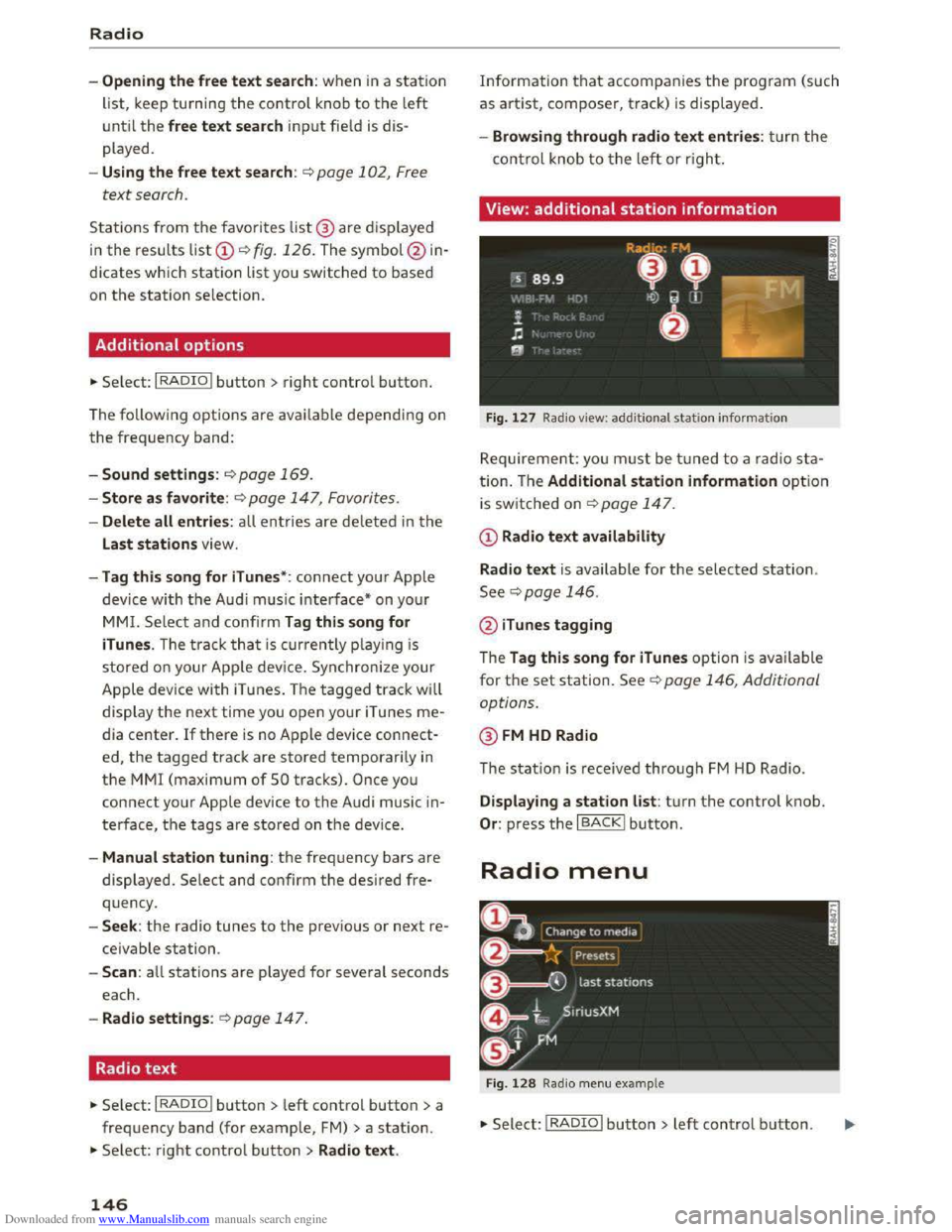
Fig. 127 Radio view: additional statio n informa tio n
Requirement: you must be tuned to a radio sta
tion. Th e Additional station information option
is switched on ~page 147.
CD Radio text availability
Radio
text is available for the selected station.
See¢ page 146.
@ iTunes tagging
The Tag this song for iTunes option is available
for the set station. See ¢ page 146, Additional
options.
@FM HD Radio
The station is received through FM HD Radio.
Displaying a station list: tur n the control knob.
Or : press the I BACK! button.
Radio menu
Fig . 128 Radio menu example
•Select: I RADIO I button> left control button.
Page 149 of 322
Downloaded from www.Manualslib.com manuals search engine Setting the frequency band: select and confirm
the desired frequency band in the radio menu
c::> fig . 128. Or: press the I RADIO I button repeat
edly until the desired frequency band is set. The
station list is displ ayed.
The Media menu is displayed. See c::> page 159,
Playing
media.
@ Favorites
The favorites list is displayed . See c::>page 147,
Favorites.
@ Last stations
The last stations listened to from all frequency
bands are shown in the list. Select and confirm a
station for immediate playback.
© SiriusXM*
The SiriusXM " station list is displ ayed.
@ FM
The FM station list is displayed.
Additional frequency bands
Depending on availability, you can select addi
tional frequency bands in the selection menu.
Favorites
You can store your favorite stations from every
frequency
band in the favorites list.
" Se lect: the I RADIO I button > Favorites .
Storing favorites:
press the I RADIO I button.
-Select: an entry from the list> right control
button > Store as favorite. Or: hold down the
control knob for several seconds.
-Or: select: left control button > Presets > a free
memory space> a frequency band >an entry
from
the lis t.
Requirement: the favorites list must be dis
p layed.
- Listening to a favorite : select and confirm a fa
vorite from
the list.
-Move favorite : select a favorite from the list>
right control button > Move favorite . Or: hold
Radio
down the control knob for several seconds. Se
lect and confirm the location of the selected fa
vorite.
-Deleting a favorite : select a favorite from the
list> right control button> Delete favorite >
Delete this favorite
or Delete all favorites .
Additional settings
Radio settings
" Select: I RADIO I button > rig ht control button >
Radio settings.
The following settings can be selected, depend
ing on the ba nd that is selected:
FM/AM HD Radio*
You can switch HD Radio reception on or off.
Station sorting (SiriusXM*)
You can set the station sorting for SiriusXM sta
tion lists* by:
-Channel number : the stations are sorted in as
cending order according to their station num
ber.
-Channel name: the stations are listed in alpha
betical order.
-First category , then channel number: the sta
tions are sorted by their category and then by
their channel numbers.
-First the category, then the channel name: the
stations are sorted by their category and then
by their channel names.
Category filter (SiriusXM*)
The stations shown in the station list can be fil
tered by your personal preferences and by pro
gram type. The program categories that you can
select depend on what is offered by your provid
er.
Se lect the All categories option to deactivate
all filter options and display all available stations
in the satellite station list.
Additional station information
When the function is~ switched on and statio n
or favorites lists are open, the display will switch
after approximately five seconds to the Addition-
al station information view c::> page 146. ""
147
Page 150 of 322
Downloaded from www.Manualslib.com manuals search engine Radio
Depending on availability, in formation about the
set station (such as station name, artist, slide
show,
station logo) is displayed in this view.
Preferred picture view
You can set your preferred picture view for the
Additional station information display
c::>poge 146 .
-Station logo : th e station logo is d is played, d e
pending on ava ilability.
-Cover art : th e a lbum cover or genre cover is dis-
p layed,
dependi ng on ava ila bil ity.
Gracenote online database*
Req uirement: the MMI must be connected to the
Internet. T he Cover art option must be selected
c::> page 148, Preferred picture view.
Troubleshooting
Problem Solution
When the~ function is switched on, the albu m
cover
or genre cover for the song being played is
l
oaded from the G racenote on line database, de
pending on availability.
Subscription status (SiriusXM)*
This optio n is available whe n your subscrip tion is
abou t to expire or has already expired. The expi
ration date of your license is displ ayed .
Call to SiriusXM *: the contact information for
yo ur satellite radio provi der is d isplaye d. To ca ll
you r
satellite radio provi der using the MMI, p ress
Call to SiriusXM*.
A station with poor reception is no longer Store the statio n as a favo rite in advance. Access the fa-
displ ayed in t he
station list onc e you vorite throug h t he favorites list c::> page 147.
switch to a different station.
148