CADILLAC ESCALADE 2010 3.G Owners Manual
Manufacturer: CADILLAC, Model Year: 2010, Model line: ESCALADE, Model: CADILLAC ESCALADE 2010 3.GPages: 616, PDF Size: 39.41 MB
Page 311 of 616
Using Your Stored Preset Destinations
These destinations are available for selection whiledriving.
1. If the radio is already on with a map disc inserted,skip to Step 5.
2. PressOto turn the system on.
3. Insert the DVD map disc. See“Installing the MapDVD”underMapson page 5!14for moreinformation.
4. A caution may appear. Touch the OK screen buttonto proceed.
5. Press the DEST hard key.
6. Select one of the available preset destinationscreen buttons. A map screen, with the destinationmarked appears.
7. Select the route preference (Fastest, Shortest,or Other). The system calculates and highlights theroute.
8. Select the Start Guidance screen button. The routeis now ready to be started.
See“Preset Destination”underDestinationonpage 5!24for more information.
Canceling Guidance
Guidance is canceled once the final destination isreached. To cancel guidance prior to arrival at the finaldestination:
1. Press the DEST hard key.
2. Press the Cancel Guidance screen button.
3. Press OK to confirm.
Guidance Volume
Adjust the volume of voice guidance prompts:
1. Press the CONFIG hard key to enter the menuoptions, then press the CONFIG key repeatedlyuntil Nav is selected or touch the Nav screenbutton.
2. Press the Voice Prompt screen button.
3. Press the + (plus) or–(minus) screen buttons toincrease or to decrease the volume of the voiceprompts. The system responds with the adjustedvoice level.
See“Voice Prompt”underConfigure Menuonpage 5!42for more information.
Cleaning the Display
Use a soft clean cotton cloth dampened withclean water.
5-11
Page 312 of 616
Features and Controls
Using the Navigation System
This section presents basic information needed tooperate the navigation system.
Use the hard keys located on the navigation systemalong with the available touch-sensitive screen buttonson the navigation screen to operate the system. SeeNavigation System Overviewo n p a g e 5!2for moreinformation.
Once the vehicle is moving, various functions aredisabled to reduce driver distractions.
Hard Keys
The following hard keys are located on the navigationsystem:
O/n(Power/Volume):Press to turn the systemon and off. Turn to increase or decrease the volume tothe audio system.
Press and hold for more than two seconds to turn offthe navigation system, the Rear Seat Entertainment(RSE), and Rear Seat Audio (RSA). If the vehicle hasnot been tuned off, the RSE and the RSA can be turnedback on by pressing this knob and continues play of thelast active source.
w(Tune):Turn to go to the next or previous radiostation or disc track or chapter. SeeNavigation AudioSystemon page 5!60,CD Playeron page 5!68,orDVD Playeron page 5!75for more information.
Z(DVD Map Disc Eject):Press to eject the DVDmap disc. This button is located next to the upper discslot. SeeMapson page 5!14for more information.
M(Load):Press to load CDs or audio/video DVDs. SeeCD Playeron page 5!68orDVD Playeron page 5!75for more information.
Z(CD/DVD Eject):Press to eject CDs or audio/videoDVDs. This button is located under the load button. SeeCD Playeron page 5!68orDVD Playeron page 5!75for more information.
M(Disc Up/Down):Press the up or down arrows to goto the next or previous disc.
AUDIO :Press access the full Audio screen to changeAM, FM, XM™Satellite Radio Service (if equipped),CD/DVD, and auxiliary input. See“Audio”underNavigation Audio Systemon page 5!60for moreinformation.
FAV (Favorite) :Press to access the preset stations.See“Storing Radio Station Presets”underNavigationAudio Systemon page 5!60for more information.
5-12
Page 313 of 616
5(Phone):Press to access calling through OnStar®.See the OnStar®owner guide andBluetooth®onpage 4!67for more information.
e(Sound):Press to access the Sound screen toadjust bass, midrange, treble, and Digital SignalProcessing (DSP). See“Sound Menu”underNavigationAudio Systemon page 5!60for more information.
DEST (Destination) :Press to access the DestinationEntry screen to plan a destination. SeeDestinationonpage 5!24for more information.
CONFIG (Configure Menu) :Press to adjust featuresfor sound, radio, navigation, and the display. SeeConfigure Menuon page 5!42for more information.
NAV (Navigation) :Press to view your vehicle's currentposition on the map screen. Each press of this keycycles through Full Map and the tab that displays thecurrent audio source (AM, FM, CD, etc.). Full Mapdisplays the screen in full map view. Selecting the audiotab splits the screen between the map screen and thecurrent audio source screen menu. See“Audio”underNavigation Audio Systemon page 5!60for moreinformation.
RPT (Navigation Repeat) :Press to repeat the lastvoice guidance prompt.
y © ¨ z(Seek):Press the seek arrows to seekand scan radio stations, to seek tracks on a CD, and toseek chapters on a DVD. SeeNavigation Audio Systemon page 5!60,CD Playeron page 5!68, orDVDPlayeron page 5!75for more information.
Touch-Sensitive Screen Buttons
Touch-sensitive screen buttons are located on thescreen. When a screen button has been selected, abeep sounds. Screen buttons are highlighted when afeature is available.
Alpha-Numeric Keyboard
Letters of the alphabet, symbols, punctuation, andnumbers, when available, displays on the navigationscreen as an alpha or numeric keyboard. The alphakeyboard displays when the system requires entry of acity or street name.
All characters are touch-sensitive screen buttons.Touch a character to select it.
A-Y (Accent Alphabet) :Select to enter letters withaccent symbols. This button may toggle to A-Z.
A-Z (Alphabet) :Select to enter letters from thealphabet. This button may toggle to A-Y.
0-9 (Numbers) :Select to enter numbers.
5-13
Page 314 of 616
U(Space):Select to enter a space betweencharacters or the words of a name.
Backspace :Select if an incorrect character hasbeen entered.
To make name entries easier, the system only highlightsthe characters that can follow the last one entered. Forexample, if a Z is entered, a T may not be available forselection.
If a name does not display after entry, it may need to beentered differently or the map DVD disc may not containthat information. SeeDatabase Coverage Explanationson page 5!59for more information.
Maps
This section includes basic information that you need toknow about the map database.
The maps are stored on a DVD. The United States,Canada, and Puerto Rico are contained on one disc.
Detailed Areas
Road network attributes are contained in the mapdatabase for detailed areas. Attributes includeinformation such as street names, street address, turnrestrictions, etc. A detailed area includes all majorhighways, service roads, and residential roads. Thedetailed areas include points of interest (POI) such as:restaurants, airports, banks, hospitals, police stations,gas stations, tourist attractions, historical monuments,etc. The map database may not include data for newlyconstructed areas or map database corrections thatare completed after the production of the disc. Thenavigation system provides full route guidance in thedetailed map areas.
Limited Guidance Areas
Any area that is not classified as detailed, is a limitedguidance area. Limited guidance streets are displayedon the map but route guidance may not be given onthese streets. Some POI categories, such as the citycenter POI category, and some street addresses areincluded in the limited guidance areas.
The navigation system informs through voice promptswhen you are traveling into a limited guidance areawhere route guidance is not available. The street mapsand the directional arrow displayed on the navigationsystem can then be used to determine the remainingroute to your destination.
5-14
Page 315 of 616
Installing the DVD Map Disc
When a DVD Map Disc is installed, noise from the discmay occur, this is normal system operation.
The navigation system in this vehicle uses a DVD tostore map information. When the system loads datafrom the disc, you may hear a very slight buzz soundfrom the navigation system. The sound is similar to thatof a CD player seeking through different tracks. This isnormal operation and may occur more frequently withthe use of XM NavTraffic.
Your dealer/retailer may have installed the map DVD.If the map DVD was not installed, do the following toload it:
1. Turn the ignition on.
2. Press theO(power) knob to turn the navigation
system on or press the NAV, DEST, or MENU hardkeys. If the MENU hard key is selected, press andhold until the NAV screen is active, or select theNAV tab manually.
3. Load the map DVD partway into the slot locatedjust below the screen. The system will pull it in.
4. Touch the OK screen button to agree to theCaution screen, if it appears. If the map is in splitscreen mode, you must push the NAV tab button toget the full map screen.
DVD Map Disc Messages
If Disc Read Error appears on the display and/orthe map disc comes out, it could be for one of thefollowing reasons:
.If the map disc was installed into the CD slot.See“Installing the DVD Map Disc”previously.
.It is very hot, when the temperature returns tonormal, the map disc should play.
.You are driving on a very rough road. When theroad becomes smoother, the map disc should play.
.The map disc is dirty, scratched, wet,or upside down.
If any error occurs repeatedly or if an error cannot becorrected, contact your dealer/retailer.
Ejecting the DVD Map Disc
Z(DVD Map Disc Eject):Press twice to eject theDVD map disc. This button is located next to theupper disc slot.
5-15
Page 316 of 616
Handling the DVD Map Disc
When handling the DVD map disc, be careful of thefollowing:
.Handle the disc very carefully to avoidcontamination or flaws. Signals may not read outproperly if the disc gets contaminated or flawed.
.If the disc gets soiled, use a soft cloth to gentlywipe it out from the center of the disc to theoutside. Do not use photographic record cleaner,solvents, or other cleaners.
.Do not use the disc to rest on while writing ordrawing using any writing utensil or attach a seal toany of the sides or the disc.
.Do not keep the disc in direct sunlight, hightemperatures, or humidity.
.After using the disc, place it back into theoriginal case.
Map Adjustments
The system lets you adjust the scale of view on themap. Also, as you drive, the map scrolls automaticallybased on the direction of travel.
Map Scales
+/!(Zoom In/Zoom Out) :Touch the zoom in or outscreen buttons or the scale on the bar to change thelevel of map detail. The scale appears on the screenonce the zoom in or zoom out screen buttons areselected. The system adjusts the map accordingly.The scale of a map can range from 1/32 mi. (50 m)to 256 mi. (400 km). To change English or metric, seeDIC Operation and Displayson page 4!41for moreinformation.
5-16
Page 317 of 616
Scrolling the Map
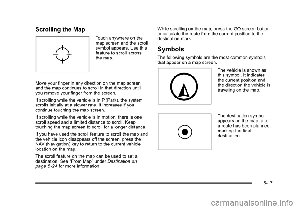
Touch anywhere on themap screen and the scrollsymbol appears. Use thisfeature to scroll acrossthe map.
Move your finger in any direction on the map screenand the map continues to scroll in that direction untilyou remove your finger from the screen.
If scrolling while the vehicle is in P (Park), the systemscrolls initially at a slower rate. It increases if youcontinue touching the map screen.
If scrolling while the vehicle is in motion, there is onescroll speed and a limited distance to scroll. Keeptouching the map screen to scroll for a longer distance.
If you have used the scroll feature to scroll the map andthe vehicle icon disappears off the screen, press theNAV (Navigation) key to return to the current vehiclelocation on the map.
The scroll feature on the map can be used to set adestination. See“From Map”underDestinationonpage 5!24for more information.
While scrolling on the map, press the GO screen buttonto calculate the route from the current position to thedestination mark.
Symbols
The following symbols are the most common symbolsthat appear on a map screen.
The vehicle is shown asthis symbol. It indicatesthe current position andthe direction the vehicle istraveling on the map.
The destination symbolappears on the map, aftera route has been planned,marking the finaldestination.
5-17
Page 318 of 616
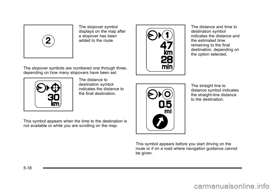
The stopover symboldisplays on the map aftera stopover has beenadded to the route.
The stopover symbols are numbered one through three,depending on how many stopovers have been set.
The distance todestination symbolindicates the distance tothe final destination.
This symbol appears when the time to the destination isnot available or while you are scrolling on the map.
The distance and time todestination symbolindicates the distance andthe estimated timeremaining to the finaldestination, depending onthe option selected.
The straight line todistance symbol indicatesthe straight-line distanceto the destination.
This symbol appears before you start driving on theroute or if on a road where navigation guidance cannotbe given.
5-18
Page 319 of 616
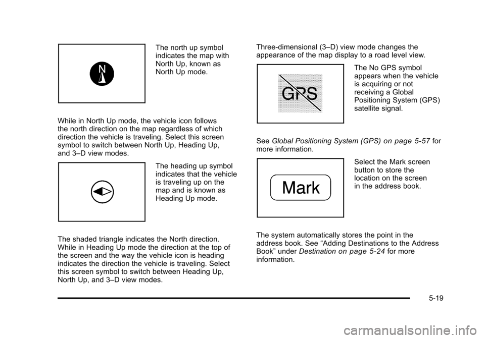
The north up symbolindicates the map withNorth Up, known asNorth Up mode.
While in North Up mode, the vehicle icon followsthe north direction on the map regardless of whichdirection the vehicle is traveling. Select this screensymbol to switch between North Up, Heading Up,and 3–D view modes.
The heading up symbolindicates that the vehicleis traveling up on themap and is known asHeading Up mode.
The shaded triangle indicates the North direction.While in Heading Up mode the direction at the top ofthe screen and the way the vehicle icon is headingindicates the direction the vehicle is traveling. Selectthis screen symbol to switch between Heading Up,North Up, and 3–D view modes.
Three-dimensional (3–D) view mode changes theappearance of the map display to a road level view.
The No GPS symbolappears when the vehicleis acquiring or notreceiving a GlobalPositioning System (GPS)satellite signal.
SeeGlobal Positioning System (GPS)on page 5!57formore information.
Select the Mark screenbutton to store thelocation on the screenin the address book.
The system automatically stores the point in theaddress book. See“Adding Destinations to the AddressBook”underDestinationon page 5!24for moreinformation.
5-19
Page 320 of 616
Displaying Points of Interest (POI) on the
Map Screen
Select the POI screenbutton to display or deletePOI icons from the map.
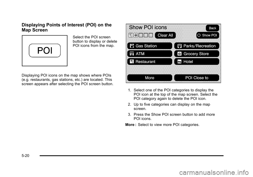
Displaying POI icons on the map shows where POIs(e.g. restaurants, gas stations, etc.) are located. Thisscreen appears after selecting the POI screen button.
1. Select one of the POI categories to display thePOI icon at the top of the map screen. Select thePOI category again to delete the POI icon.
2. Up to five categories can display on the mapscreen.
3. Press the Show POI screen button to add morePOI icons.
More :Select to view more POI categories.
5-20