NAVIGATION SYSTEM OWNER’S MANUAL - 5
Warnings
LIMITATIONS OF THE NAVIGATION SYSTEM
This navigation system calculates the current vehicle position using satellite signals,
various vehicle signals, map data, etc.
However, the accurate position may not be shown depending on the satellite condition,
road configuration, vehicle condition or other circumstances.NOTICE
Once turned on, the system requires
some time to find satellite signals and
navigation data so it can calculate
a solution for the position of your
vehicle.
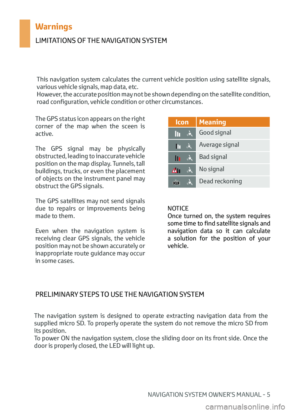
IconMeaning
Good signal
Average signal
Bad signal
No signal
Dead reckoning
The GPS status icon appears on the right
corner of the map when the sceen is
active.
The GPS signal may be physically
obstructed, leading to inaccurate vehicle
position on the map display. Tunnels, tall
buildings, trucks, or even the placement
of objects on the instrument panel may
obstruct the GPS signals.
The GPS satellites may not send signals
due to repairs or improvements being
made to them.
Even when the navigation system is
receiving clear GPS signals, the vehicle
position may not be shown accurately or
inappropriate route guidance may occur
in some cases.
PRELIMINARY STEPS TO USE THE NAVIGATION SYSTEM
The navigation system is designed to operate extracting navigation data from the
supplied micro SD. To properly operate the system do not remove the micro SD from
its position.
To power ON the navigation system, close the sliding door on its front side. Once the
door is properly closed, the LED will light up.
NAVIGATION SYSTEM OWNER’S MANUAL - 15
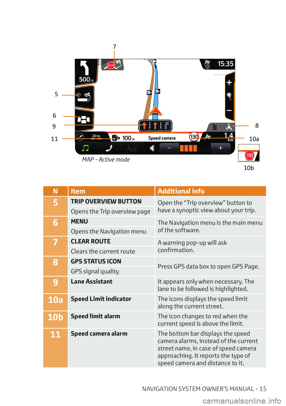
NItem Additional info
5TRIP OVERVIEW BUTTON
Open the “Trip overview” button to
have a synoptic view about your trip.
Opens the Trip overview page
6MENU The Navigation menu is the main menu
of the software.
Opens the Navigation menu
7CLEAR ROUTE A warning pop-up will ask
confirmation.
Clears the current route
8GPS STATUS ICON
Press GPS data box to open GPS Page.
GPS signal quality
9Lane Assistant It appears only when necessary. The
lane to be followed is highlighted.
10aSpeed Limit indicatorThe icons displays the speed limit
along the current street.
10bSpeed limit alarmThe icon changes to red when the
current speed is above the limit.
11Speed camera alarmThe bottom bar displays the speed
camera alarms, instead of the current
street name, in case of speed camera
approaching. It reports the type of
speed camera and distance to it.
10a
9
5
6
7
8
11
10b
MAP - Active mode


