CADILLAC XLR 2005 1.G Owners Manual
Manufacturer: CADILLAC, Model Year: 2005, Model line: XLR, Model: CADILLAC XLR 2005 1.GPages: 438, PDF Size: 3.69 MB
Page 231 of 438
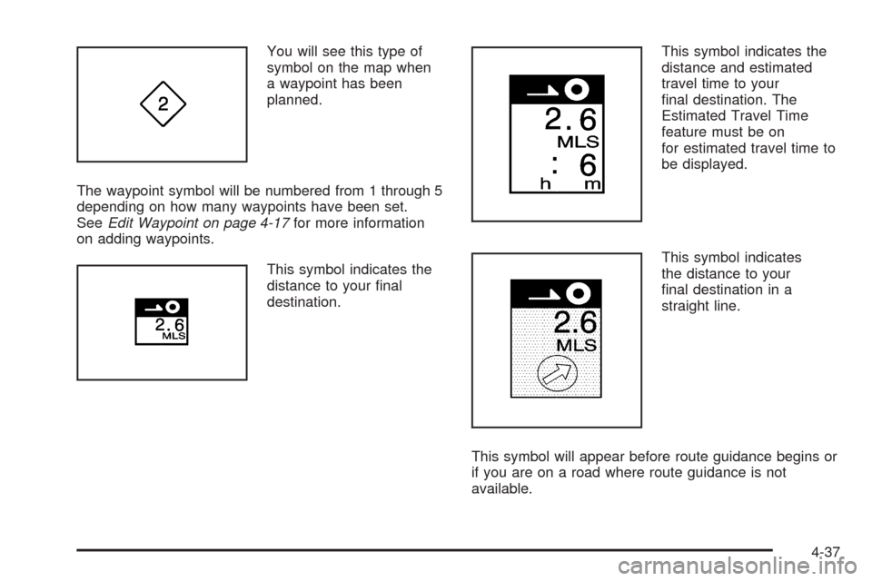
You will see this type of
symbol on the map when
a waypoint has been
planned.
The waypoint symbol will be numbered from 1 through 5
depending on how many waypoints have been set.
SeeEdit Waypoint on page 4-17for more information
on adding waypoints.
This symbol indicates the
distance to your �nal
destination.This symbol indicates the
distance and estimated
travel time to your
�nal destination. The
Estimated Travel Time
feature must be on
for estimated travel time to
be displayed.
This symbol indicates
the distance to your
�nal destination in a
straight line.
This symbol will appear before route guidance begins or
if you are on a road where route guidance is not
available.
4-37
Page 232 of 438

This symbol indicates the
map with North up.
While in North up mode, North will always be at the top
of the map screen regardless of which direction the
vehicle is traveling.
This symbol indicates the
map with the vehicle travel
direction up, or Heading up.
The shaded triangle indicates North. While in Heading
up mode, the direction your vehicle is traveling will
always be at the top of the map screen.
Touch either the North Up heading symbol or the vehicle
Heading Up symbol to alternate between settings.This symbol will appear
when the navigation
system is unable to receive
the GPS signal.
SeeGlobal Positioning System (GPS) on page 4-42for
more information.
When a point of interest
(POI) or street address
name is too long to
be displayed, an arrow
will appear.
Touch the right or left arrow to scroll through the
entire name.
4-38
Page 233 of 438
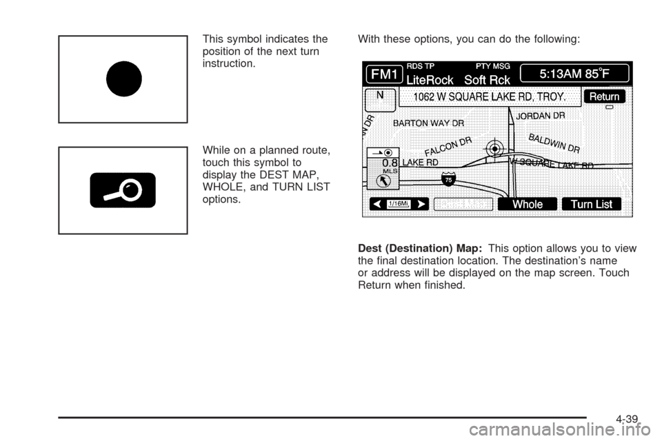
This symbol indicates the
position of the next turn
instruction.
While on a planned route,
touch this symbol to
display the DEST MAP,
WHOLE, and TURN LIST
options.With these options, you can do the following:
Dest (Destination) Map:This option allows you to view
the �nal destination location. The destination’s name
or address will be displayed on the map screen. Touch
Return when �nished.
4-39
Page 234 of 438
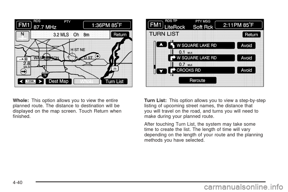
Whole:This option allows you to view the entire
planned route. The distance to destination will be
displayed on the map screen. Touch Return when
�nished.Turn List:This option allows you to view a step-by-step
listing of upcoming street names, the distance that
you will travel on the road, and turns you will need to
make during your planned route.
After touching Turn List, the system may take some
time to create the list. The length of time will vary
depending on the length of your route and the planning
methods you have selected.
4-40
Page 235 of 438
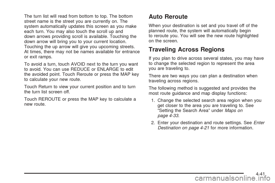
The turn list will read from bottom to top. The bottom
street name is the street you are currently on. The
system automatically updates this screen as you make
each turn. You may also touch the scroll up and
down arrows providing scroll is available. Touching the
down arrow will bring you to your current location.
Touching the up arrow will give you upcoming streets.
At times, there may not be names available for entrance
or exit ramps.
To avoid a turn, touch AVOID next to the turn you want
to avoid. You can use REDUCE or ENLARGE to edit
the avoided point. Touch Reroute or press the MAP key
to calculate your new route.
Touch Return to view your current position and to turn
the turn list screen off.
Touch REROUTE or press the MAP key to calculate a
new route.Auto Reroute
When your destination is set and you travel off of the
planned route, the system will automatically begin
to reroute you. You will see the new route highlighted
on the screen.
Traveling Across Regions
If you plan to drive across several states, you may have
to change the selected region to represent the area
you are traveling to.
There are two ways you can plan a destination when
traveling across regions.
The following method is suggested and provides the
most route guidance and map display functions:
1. Change the selected search area region when you
get closer to the area you are traveling to. See
“Setting the Search Area” underMaps on
page 4-33.
2. Enter your destination and route settings. SeeEnter
Destination on page 4-21for more information.
4-41
Page 236 of 438
If you do not want to use the �rst method, keep your
currently selected search area region and enter your
destination. This method allows you only to select a
destination from the easy planning route method or from
the All Points of Interest (POI) categories with the “All
Search Areas” comment for US Only. For example,
Tourist is a category that features this comment. See
Enter Destination on page 4-21for more information.
If you are traveling in or to Canada and you cross the
regional border, the only map scale views available
are 4 mi, 8 mi, 31 mi, and 128 mi (8 km, 16 km,
64 km and 256 km). Change the selected search area
region when you get closer to the area you are traveling
to. See “Setting the Search Area” underMaps on
page 4-33for more information.
Remote Keyless Entry System
When you insert the key in the ignition, Driver 1 or
Driver 2 will be displayed on the screen. A message will
not appear on the screen if the driver is unknown. The
number on the back of the RKE transmitter corresponds
to driver 1 or driver 2. The navigation system can store
memory points for drivers 1 and 2 individually. See
Keyless Access System on page 2-4for more
information.
OnStar®System
When using the OnStar®system, the audio system will
be muted and the navigation voice prompts will be
disabled during the call. The volume of the OnStar
®call
can be adjusted by using the steering wheel volume
controls. SeeOnStar
®System on page 2-36for
more information.
Global Positioning System (GPS)
The navigation system determines the position of your
vehicle by using satellite signals, various vehicle signals,
and map data.
The Global Positioning System (GPS) locates the
current position of your vehicle using signals sent by the
United States Department of Defense GPS satellites.
While your vehicle is receiving signals from these
satellites, the GPS symbol will not appear on the map
screen. SeeSymbols on page 4-36for more information
on the GPS symbol.
However, at times, other interferences such as the
satellite condition, road con�guration, the condition of
the vehicle, and/or other circumstances can interfere
with the system’s ability to determine the accurate
position of the vehicle. This is when the GPS symbol
will appear on the map screen.
4-42
Page 237 of 438
This system may not be available/or interferences may
occur if any of the following are true:
Signal are obstructed by tall buildings, large trucks,
or a tunnels.
Satellites are being repaired or improved.
Objects are located on the rear shelf.
After-market glass tinting has been applied to the
vehicle’s windows.
Notice:Do not apply after-market glass tinting to
the vehicle’s windows. Glass tinting will interfere
with the system’s ability to receive GPS signals and
cause the system to malfunction. You might have
to replace the window to correct the problem.
This would not be covered by your warranty.
If you are experiencing a problem, seeVehicle
Positioning on page 4-43orProblems with Route
Guidance on page 4-44for more information.
Vehicle Positioning
At times, the position of the vehicle on the map may be
inaccurate due to one or more of the following reasons:
The road system has changed.
The vehicle is traveling on slippery road surfaces
such as sand, gravel, and/or snow.
The vehicle is being driven on winding roads.
The vehicle is being driven on a long straight road.
The vehicle is approaching a tall building or a large
vehicle.
The surface streets run parallel to a freeway.
The vehicle has just been transferred by a vehicle
carrier or a ferry.
The current position calibration is set incorrectly.
The vehicle is being driven at high speeds.
4-43
Page 238 of 438
The vehicle is repeating a change of direction by
going forward and backward, or turning on a turn
table in a parking lot.
The vehicle is entering and/or exiting a parking lot or
garage with a roof.
The vehicle has a roof carrier, ski, or bike rack
installed on it.
The vehicle has tire chains on it.
The tires have been replaced.
The tire pressure is incorrect.
The tires are worn.
The battery is disconnected.
The vehicle is driven in heavy traffic where driving is
at low speeds and the vehicle is stopped and started
repeatedly.
Problems with Route Guidance
Inappropriate route guidance may occur under any of
the following conditions:
You have not turned onto the road indicated by
the system.
Route guidance is not available for the next turn.
The route is not changed during automatic rerouting.
Plural names of places are displayed.
You are driving at high speeds, which may cause
the automatic rerouting to operate more slowly.
The route prohibits the entry of a vehicle due to a
regulation by time or season or any other regulation
which may be given.
A route cannot be found.
A road is new, was recently changed or is not listed
on the DVD. The route to the destination may not
be shown. SeeOrdering Map DVDs on page 4-45.
4-44
Page 239 of 438
If the System Needs Service
If you are still experiencing difficulty with your navigation
system after reading this information, see your dealer
for assistance.
Ordering Map DVDs
The map DVD in your vehicle is the most up-to-date
information available when your vehicle was purchased.
The map DVD is updated periodically, provided that
the map information has changed. To order a new map
DVD, contact your dealer.
Database Coverage Explanations
Coverage areas vary with respect to the level of map
detail available for any given area. Some areas will
feature greater levels of detail than others. If this
happens, it does not mean there is a problem with the
system. As the map DVD is updated, more detail
may become available for areas which previously had
limited detail. SeeOrdering Map DVDs on page 4-45.
Navigation Audio System
Notice:Before adding any sound equipment to
your vehicle, like a tape player, CB radio, mobile
telephone, or two-way radio, make sure that it can
be added by checking with your dealer. Also,
check federal rules covering mobile radio and
telephone units. If sound equipment can be added,
it is very important to do it properly. Added
sound equipment may interfere with the operation
of your vehicle’s engine, radio, or other systems,
and even damage them. Your vehicle’s systems may
interfere with the operation of sound equipment
that has been added improperly.
Your vehicle has a feature called Retained Accessory
Power (RAP). With RAP, the audio system can be
played even after the ignition is turned off. SeeRetained
Accessory Power (RAP) on page 2-22for more
information.
The audio system is operated using navigation system
menus. The audio menus are explained in this section.
4-45
Page 240 of 438
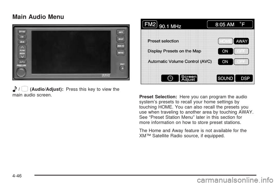
Main Audio Menu
e
/z(Audio/Adjust):Press this key to view the
main audio screen.
Preset Selection:Here you can program the audio
system’s presets to recall your home settings by
touching HOME. You can also recall the presets you
use when traveling to another area by touching AWAY.
See “Preset Station Menu” later in this section for
more information on how to store preset stations.
The Home and Away feature is not available for the
XM™ Satellite Radio source, if equipped.
4-46